Hurricanes and tropical storms can produce tornadoes. These tornadoes most often occur in thunderstorms embedded in rain bands well away from the center of the hurricane; however, they can also occur near the eyewall. The majority of tornadoes associated with tropical systems occur in the right front quadrant of the storm. This area typically has the best wind shear and instability. Most of the tropical tornadoes that affect central South Carolina and eastern Georgia are from tropical systems that make landfall in the Gulf of America and continue on a path toward the north/northeast. Usually, tornadoes produced by tropical cyclones are relatively weak and short-lived, but they still pose a significant threat.
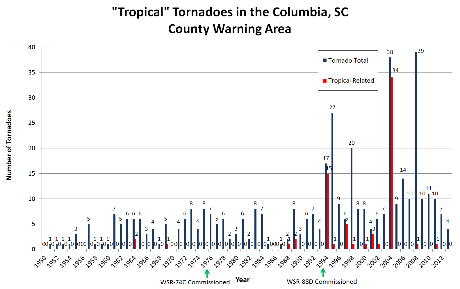
Tropical Tornadoes (1950-2013)
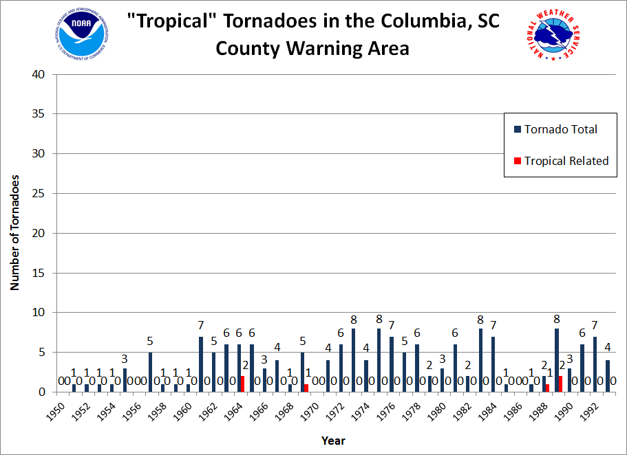
Pre-Doppler Tornadoes (1950-1993)
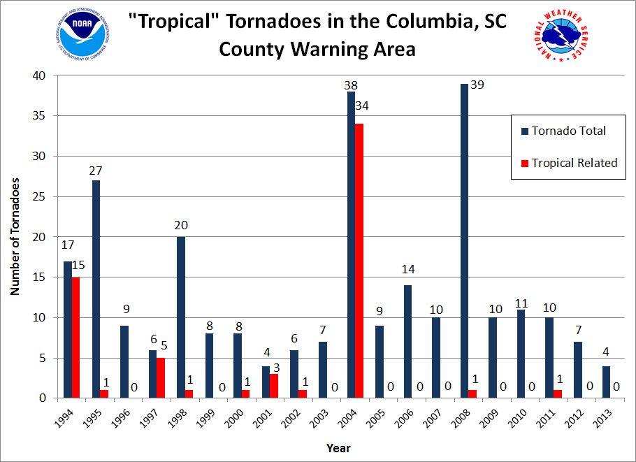
Post-Doppler Tornadoes (1994-2013)
Tropical systems that produced tornadoes in the Columbia, SC county warning area (1950-2013):
1964: Hurricane Cleo
1969: Tropical Depression/Subtropical Storm #12
1988: Tropical Storm Chris
1989: Hurricane Hugo
1994: Tropical Storm Beryl
1995: Hurricane Opal
1997: Hurricane Danny
1998: Hurricane Earl
2000: Tropical Storm Helene
2001: Tropical Storm Allison
2002: Tropical Storm Hanna
2004: Tropical Storm Bonnie, Hurricane Frances, Hurricane Ivan, Hurricane Jeanne
2008: Tropical Storm Fay
2011: Tropical Storm Lee
The post-doppler period chart (1994 to present) shows an increase in both the total number of tornadoes and the number of tropical tornadoes on record as compared to the pre-doppler chart. However, this doesn’t necessarily mean that there have been more storms and more tornadoes. The addition of the WSR-88D radar to the Columbia, SC weather forecast office in 1994 provided doppler velocity, which greatly improved tornado detection. Other factors have also played a role including more public outreach and education efforts, more aggressive storm verification, and the growth of social media.

