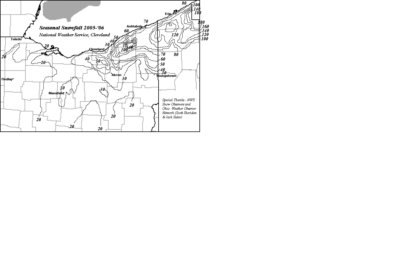
The snow season 2005-’06 was one of contrast for northern Ohio and northwest Pennsylvania. The season started late with little snow until late November. From Thanksgiving week through the week before Christmas, it was cold and snowy much of the time. While there were no widespread heavy snows, localized lake effect snow was quite heavy across parts of the snowbelt of extreme northeast Ohio and northwest Pennsylvania. By late December the weather had turned mild and January was one of the warmest on record. Winter returned in February and early March although snow was generally light with the exception of some locally heavy lake effect snow.
The final seasonal snow tally showed above normal snow across the snowbelt where amounts ranged from 70 to 90 inches near the Lake Erie lake shore to over 120 inches inland with peak totals of 160 inches or more across northern Geauga County, Ohio and inland Erie County, Pennsylvania. Outside the snowbelt, seasonal snowfall was a little below normal ranging from 40 to 50 inches across northeast Ohio to generally 20 to 30 inches across northwest Ohio.
| 2005-06 | Oct 05 | Nov 05 | Dec 05 | Jan 06 | Feb 06 | Mar 06 | Apr 06 | May 06 | Total 2005-06 |
| Toledo | 0.0 | 5.0 | 21.5 | 1.9 | 1.5 | 1.6 | 0.0 | 0.0 | 31.5 |
| Mansfield | 0.0 | 2.0 | 11.1 | 2.7 | 11.5 | 4.1 | T | 0.0 | 31.4 |
| Cleveland | 0.0 | 5.5 | 21.0 | 4.6 | 16.9 | 2.2 | 0.4 | 0.0 | 50.6 |
| Akron-Canton | 0.3 | 4.2 | 11.9 | 3.8 | 12.1 | 2.9 | 0.6 | 0.0 | 35.8 |
| Youngstown | 0.0 | 8.0 | 17.1 | 10.0 | 14.8 | 2.3 | 1.0 | 0.0 | 53.2 |
| Erie PA | 0.0 | 11.3 | 32.4 | 9.0 | 20.1 | 4.4 | 5.7 | 0.0 | 82.9 |

