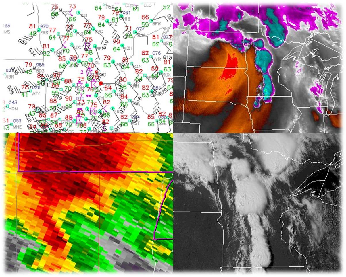
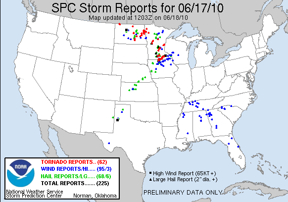
On Thursday June 17, 2010, an outbreak of severe thunderstorms occurred across parts of the Upper Midwest, particularly across North Dakota and Minnesota. This outbreak featured many reports of tornadoes, and many of those reports have been confirmed as tornado tracks by National Weather Service offices across the region. This outbreak affected a portion of the NWS Duluth, MN county warning area (CWA), particularly parts of northeast Minnesota. An image of the national storm reports from June 17th is available to the right. If you would like a listing of local storm reports from the event, click here (PDF of Local Storm Reports). Four tornadoes were confirmed in the NWS Duluth CWA:
Page Navigation Jump quickly to pre-defined sections of the web page by clicking on the links below: Fast Facts | Summary | St. Croix River Tornado | Other Tornadoes | Other Severe | Storm Pictures
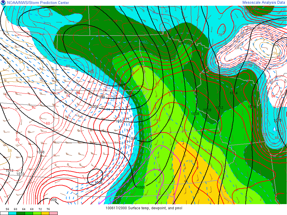
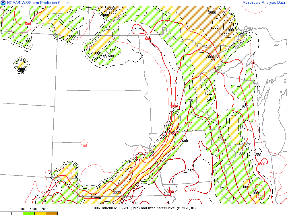
Thunderstorms from overnight gradually weakened around dawn as they moved from eastern North Dakota into western Minnesota. A few thunderstorms developed along a warm front in central Minnesota late in the morning and then tracked into northern Minnesota in the early afternoon. Some of these storms were severe, particularly from Cass County into Itasca County - in the Backus to Squaw Lake corridor. As a cold front surged east during the day into the humid air mass, thunderstorms began firing along the advancing front in the afternoon. This was the main round of severe weather, and the combination of strong instability and wind shear helped provide the necessary ingredients for supercell thunderstorms. These severe storms spread east across much of the state of Minnesota during the afternoon and early evening hours, spawning tornadoes, large hail, and damaging straight-line winds.
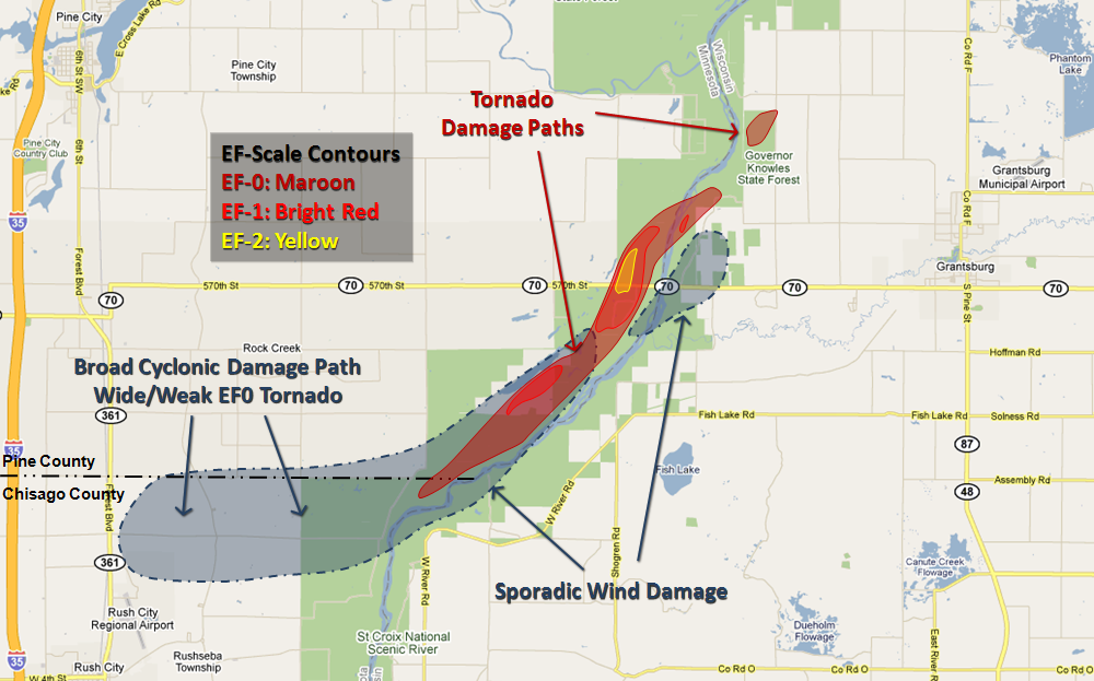
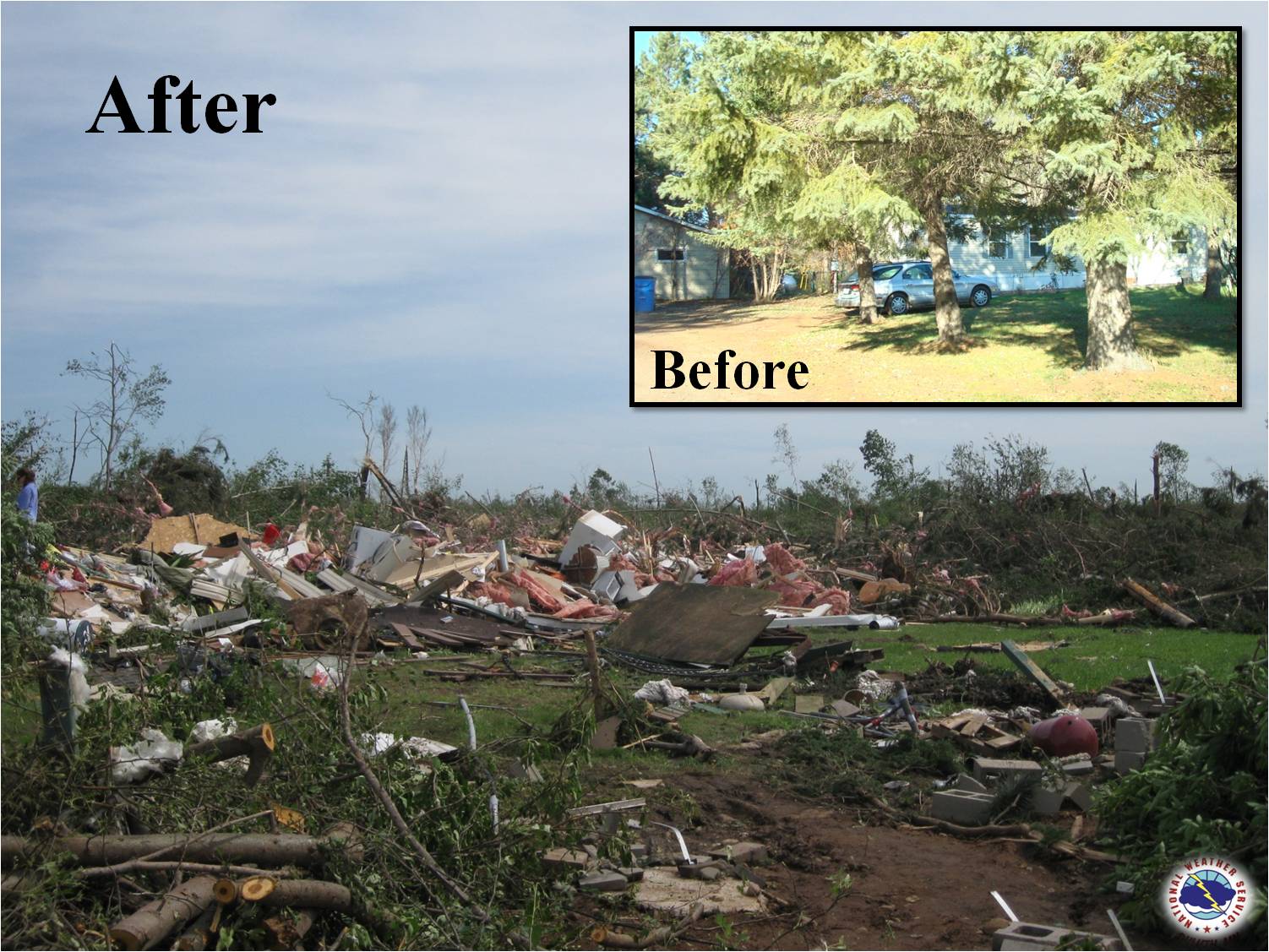
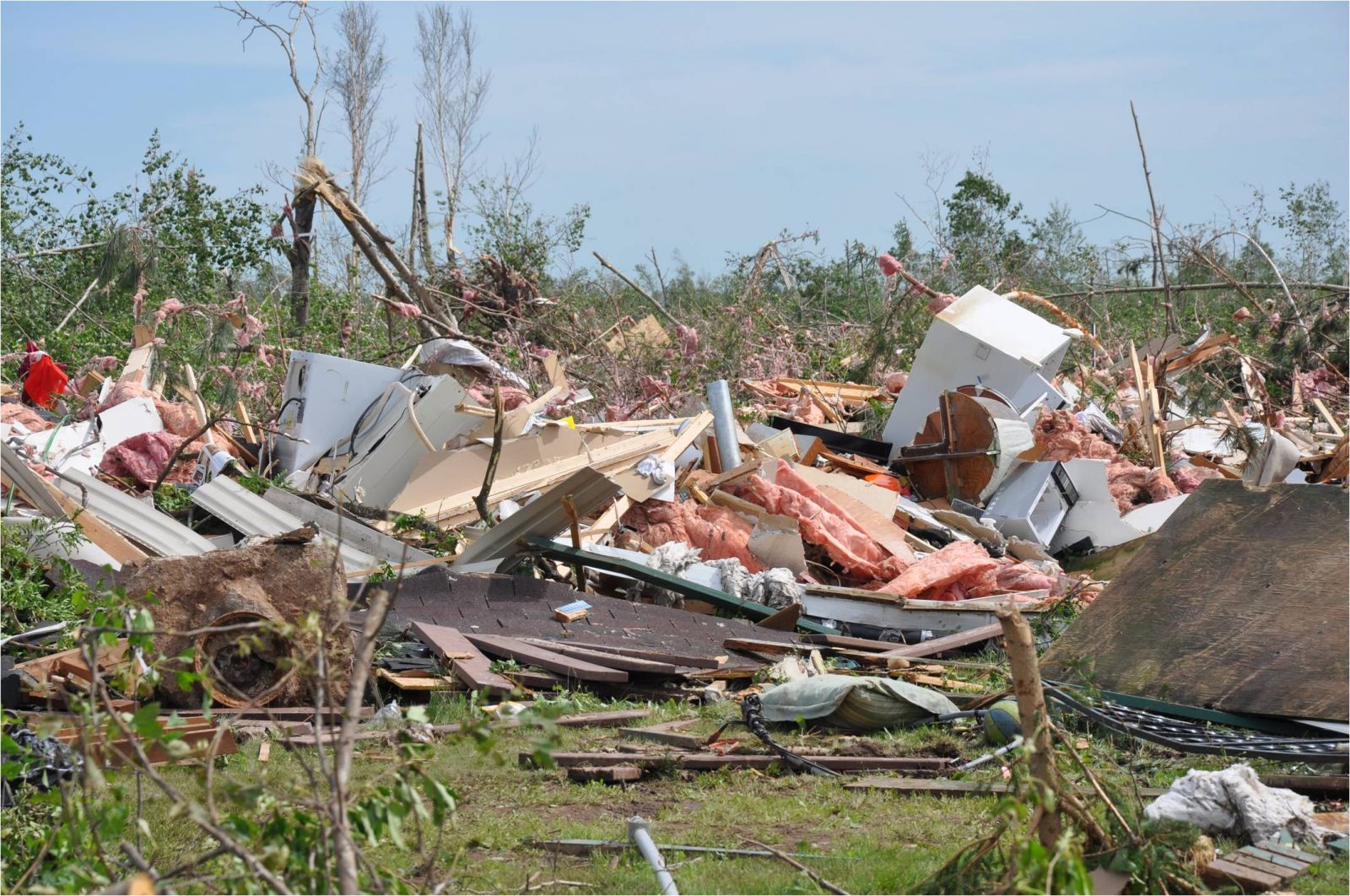
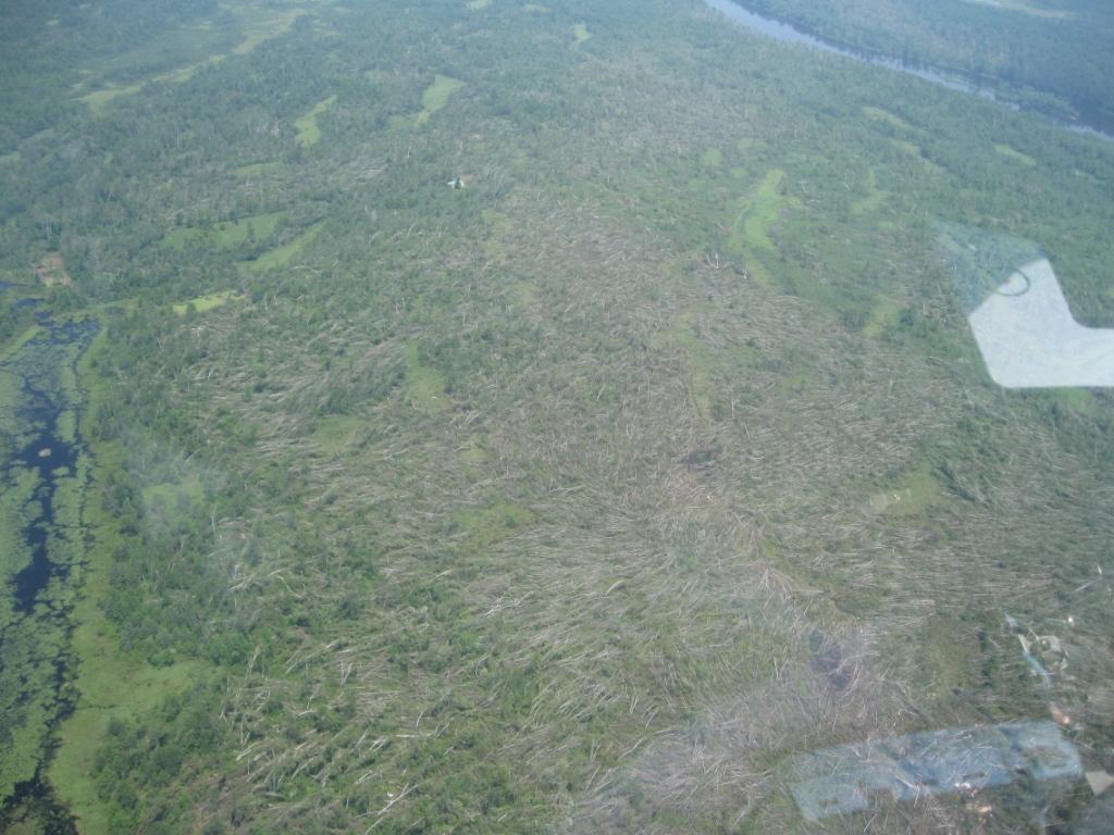
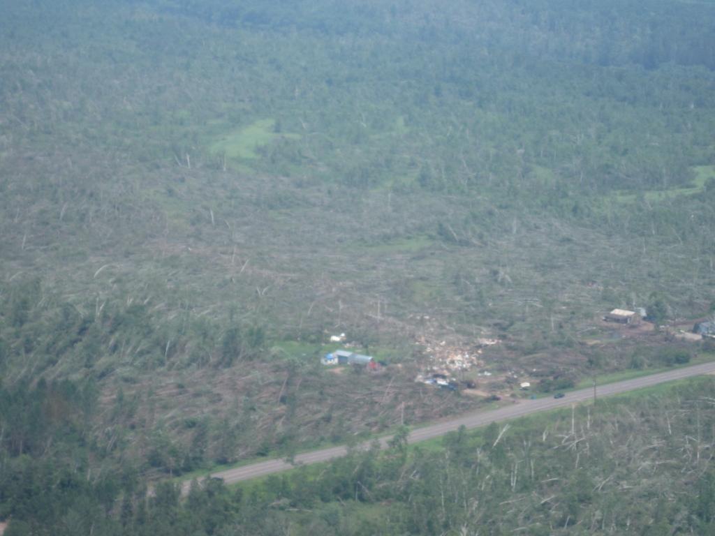
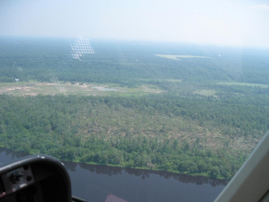
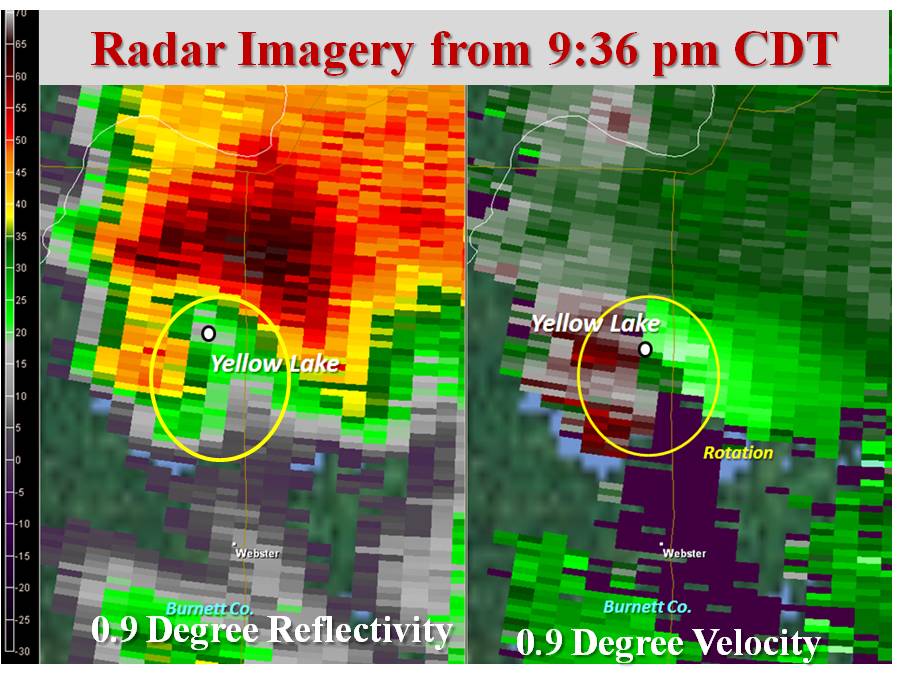
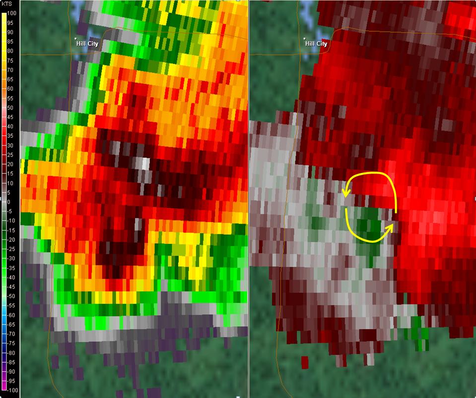
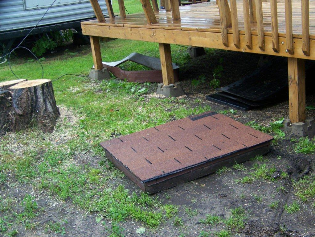
A National Weather Service damage survey team confirmed an EF-2 (what is the Enhanced Fujita Scale?) tornado path stretching from extreme northeast Chisago County, through southeast Pine County, and into far western Burnett County. This tornado began about 5 miles east-northeast of Rush City. The tornado moved northeast, roughly parallel to, and about 1/4 to 1/2 mile northwest of, the St. Croix River. The tornado crossed the St. Croix River into Wisconsin about 1.5 miles north of Highway 70, and dissipated about 3.5 miles northwest of Grantsburg. The most severe damage was found where the tornado crossed Highway 70 about 1/2 mile west of the St. Croix River in Pine County. At this locations, a strapped down mobile home was completely destroyed - resulting in two injuries. Minor structural damage was also noted to several surrounding homes and buildings, including two garages that were destroyed. A couple of structures had their roofs removed. Tree damage at this location was also substantial, with almost all trees either snapped off or uprooted. An EF-2 rating is being assigned for about a 1 mile length of the tornado damage path where it crossed Highway 70, but most of the tornado damage was EF-0 or EF-1 intensity. EF-2 damage corresponds to estimated 3-second wind gusts of 111-135 miles per hour. A map of the damage path is available above. Click here to view a slideshow of damage photos
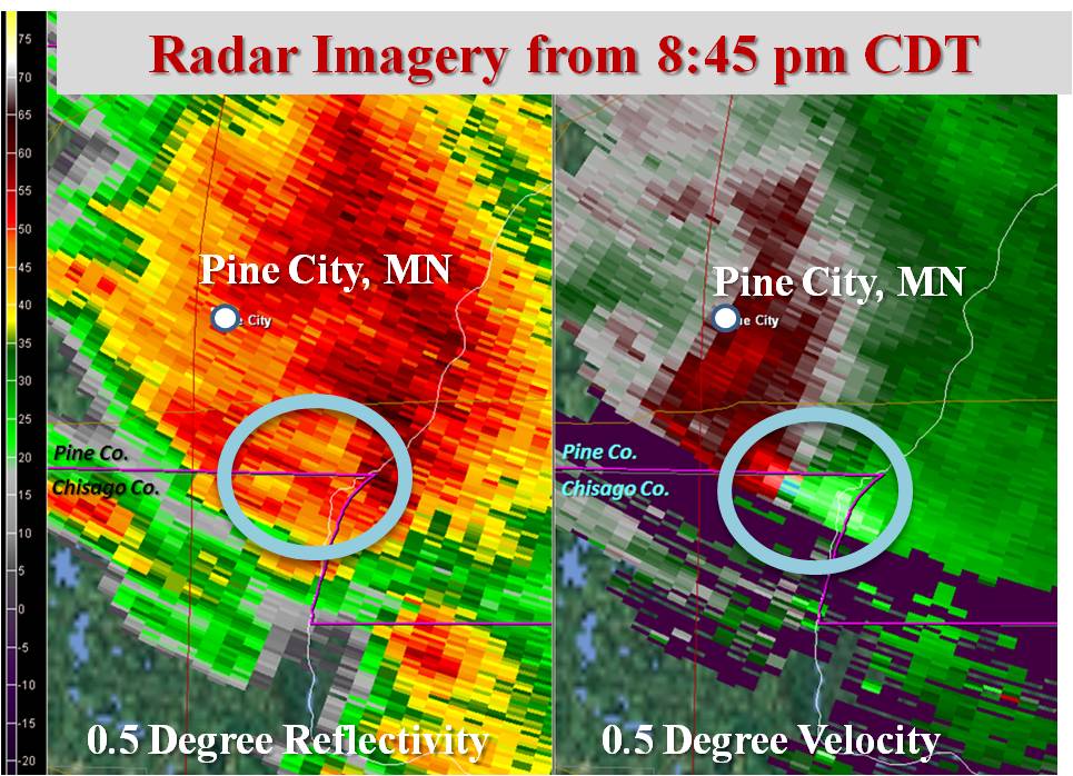
All aerial photos were taken on a survey with the Pine County Sheriff and Minnesota State Patrol, unless otherwise noted on the photograph. Below are two radar images. The first was taken just after the tornado had crossed Highway 70 and was very close to the St. Croix River. The second was later on when the circulation was near Yellow Lake, WI - with no tornado on the ground at that point.
EF-0 Tornado in Burnett County, Wisconsin There was also a brief EF-0 tornado in Burnett County, Wisconsin, immediately following the longer tracked, stronger tornado. This tornado location is indicated on the damage path map for the other tornado (click here). This tornado was about 4 miles northwest of Grantsburg, and occurred around 9:05 PM CDT. Some tree damage was noted with this tornado. EF-0 Tornado in Cass County, Minnesota This was actually the first tornado of the event in the NWS Duluth county warning area. The tornado crossed from Wadena County, and tracked in Cass County from about 6.0 miles northwest of Poplar, to the west side of Deer Lake. The path in Cass County was 9.76 miles long and about 200 yards wide, and involved mainly tree damage. The tornado affected Cass County between 537pm and 548pm. This tornado was produced by the same parent thunderstorm that produced the EF-4 tornado in Wadena, Minnesota.
Midday Storms in Cass and Itasca Counties
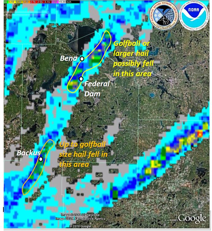
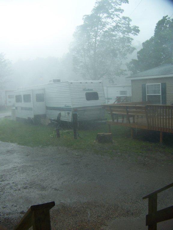
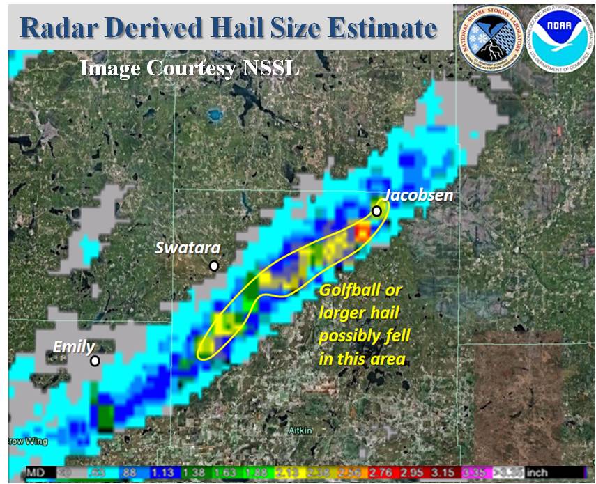
However, between Noon and 1 PM, a persistent severe thunderstorm developed and tracked through Cass County, eventually tracking to near Lake Winnibigoshish. This storm produced golfball size hail in Backus in central Cass County. It was probably at its most intense over northeastern parts of Leech Lake where up to baseball size hail and destructive straight-line winds were reported. The large hail caused damage to some buildings and vehicles in and around Bena. The image to the left is a radar derived hail size, courtesy of the National Severe Storms Laboratory. You can see that a substantial hail swath extended through much of Cass County. Below are a few pictures (used with permission) from Holly Ash at the New Leech Lake Campground. On the left is a picture taken during the storm, and the right is an access cover that was ripped off the roof of the lodge.
Evening Storms in Aitkin County A swath of large hail also developed across northern Aitkin County during the evening hours. You can see the radar derived hail size map by clicking here. Once again, that image is courtesy of the National Severe Storms Laboratory. Up to golfball size hail was reported in Aitkin County.
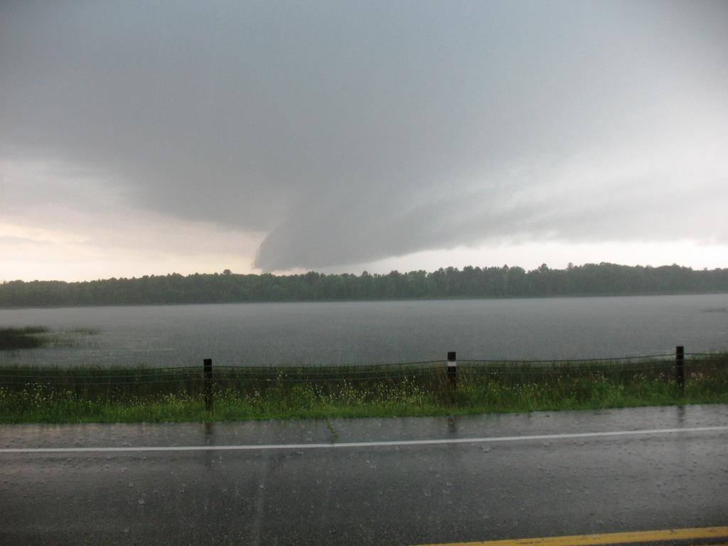
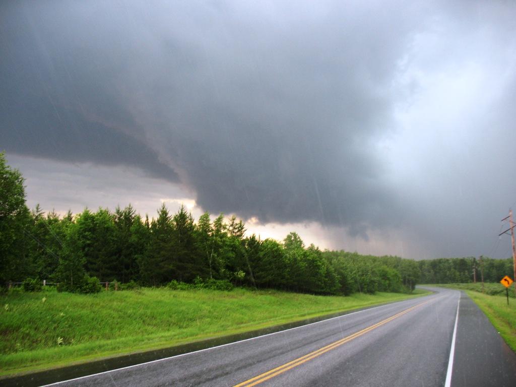
Pictures of a wall cloud in northern Crow Wing County
|


 Follow us on YouTube