
Jump back to DLH Science main page
Welcome to the National Weather Service Duluth, MN Significant Events Database. On this web page, we will collect write-ups for a variety of weather phenomena including winter storms and severe weather outbreaks. To explore the information that we have, simply choose one of the options we have below, or scroll down the page to find the event that you are interested in.
View Events In Chronological Order Instead
Tornadoes: Any severe weather event in the area that produced significant tornadoes.
Winter Weather: Any major winter storm, including both snow storms and ice storms.
Heavy Rain: Any weather event marked by either substantial or record-setting rainfall, or flooding.
Winds/Blowdown: Includes both straight-line winds from thunderstorms, and strong and damaging winds not associated with precipitation.
Other Events: Any weather event of notoriety that does not fit into other classifications.
Before we list all of our event summaries, here are some featured events that are especially notable, either because they occurred very recently, or they had a very significant impact on the Northland:
- March 13, 2017: A rare Lake Effect Snow for the Twin Ports area. A narrow band of snow affected Superior, southern portions of Duluth, and areas farther inland.
- June 19, 2016: Severe thunderstorms produced several tornadoes, damaging winds, and large hail. The strongest tornado was an EF-2 in Crow Wing County and 4-inch diameter hail was reported.
- August 29, 2013: An EF1 Tornado moved from near Remer, MN to near Hill City
- July 1, 2011: An EF2 tornado, embedded in a swath of extensive straight line wind damage, touched town near the town of Solon Springs, WI.
- July 27, 2010: Three tornadoes and up to baseball size hail in northwest Wisconsin. Includes the Turtle Flambeau Flowage tornado.
- June 17, 2010: Severe weather outbreak including St. Croix River EF-2 tornado
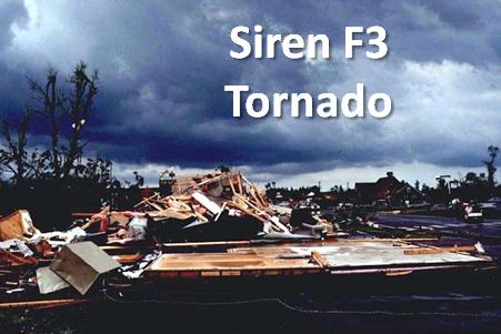
- June 18, 2001: Siren F3 Tornado
- March 13, 2017: A rare Lake Effect Snow for the Twin Ports area. A narrow band of snow affected Superior, southern portions of Duluth, and areas farther inland.
- January 20-24th, 2013: Arctic Cold Outbreak. Temperatures of -30 to -40 F across northern Minnesota.
- December 31-January 1, 2012: Mix of 3-6 inches of snow followed by 40 mph winds bring in the New Year.
- April 16, 2011: Late winter storm produces over 6 inches of snow near the Iron Range, and wind gusts over 50mph in the Twin Ports.
- March 22-23, 2011: Winter storm brings heavy snow to areas from near Brainerd to Hinckley, and into northwest Wisconsin.
- January 21, 2011: Frigid cold temperatures, lows down to -46F at International Falls and Babbitt
- January 14-15, 2011: Snow with up to 7 inches in Douglas County.
- December 20-21, 2010: Snowstorm with general 4-8 inches, up to a foot around Duluth.
- December 11-12, 2010: Snowstorm with over a foot in parts of NW Wisconsin and blowing snow.
- November 29-December 1, 2010: Heavy snow with 10 or more inches in parts of northeast Minnesota.
- November 24-25, 2010: Snow storm with 6-12 inches in far northern Minnesota.
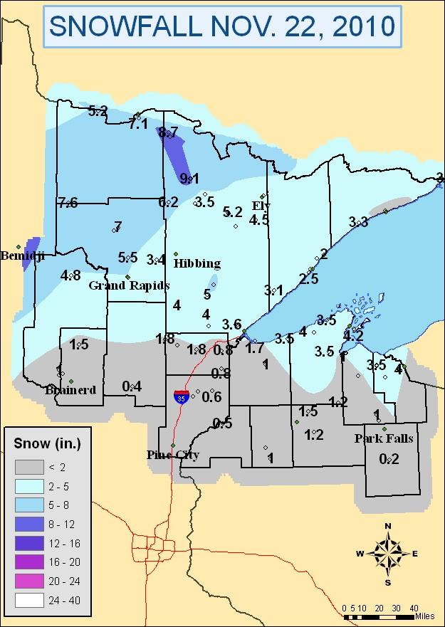
- November 22, 2010: Snow with up to 9 inches in northwest St. Louis County.
- November 13-14, 2010: Heavy snow with up to 11 inches of snow in Duluth.
- December 24-26, 2009: Winter storm/blizzard with up to 26 inches of snow
- March 31 - April 1, 2009: Winter storm with up to 16 inches of snow
- March 29, 2009: Ice storm on the North Shore with up to 1-2" of ice accumulation
- March 9-11, 2009: Winter storm and subsequent arctic outbreak
- December 19-21, 2008: Winter storm with lake effect enhancement of snow totals
- December 13-15, 2008: Winter storm and blizzard conditions in the Twin Ports
- April 10-12, 2008: Winter storm and blizzard conditions (gusts up to 62 mph)
- April 5-7, 2008: Heavy snow event with up to 32 inches of snow
- March 1-2, 2007: Snowstorm and blizzard for much of the Northland with wind gusts over 50 mph and snow totals greater than 2 feet in some areas.
- December 14-15, 2005: Heavy snow event with up to 16 inches of snow (UNAVAILABLE)
- January 21, 2005: Snowstorm hits the Midwest, up to 13 inches of snow in this area (UNAVAILABLE)
- January 1, 2005: New Years Day snowstorm deposits up to a foot of snow (UNAVAILABLE)
- March 27-28, 2003: Lake effect snowstorm (up to 22 inches) (UNAVAILABLE)
- October 31 - November 3, 1991: The famous "Halloween" Blizzard which deposited 36.9" of snow in Duluth.
Also check out the list of memorable winter weather events in the Northland.
- July 11, 2016: High winds and flooding in the Northland
- June 19, 2012: Widespread Flooding in Duluth and across much of the Northland.
- May to Sep 2010: Unusually wet summer months; parts of NW WI see more rain in 5 months than they do in an entire year on average.
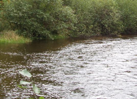
- 1972 Floods: A look back at the 1972 Duluth floods as well as other significant floods of the region.
- July 20-21, 2016: Major downbursts in the Northland. Duluth area hit hard.
- June 19, 2016: Severe thunderstorms produced several tornadoes, damaging winds, and large hail. The strongest tornado was an EF-2 in Crow Wing County and 4-inch diameter hail was reported.
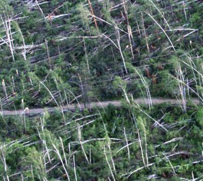
- July 1, 2011: Winds in excess of 100 mph devastated much of the Saint Croix State Park and the forested areas across Burnett County WI.
- September 2, 2010: Wake low with up to 58 mph gusts in Duluth
- July 14, 2010: Several rounds of severe weather including bow echo with high winds in Hayward
- January 31, 2009: Non-convective wind gusts up to 62 mph
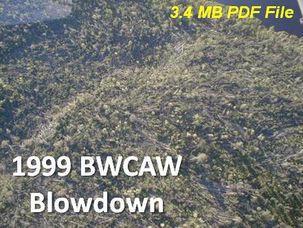
- July 4, 1999: Boundary Waters Derecho & Blowdown (3.4 MB PDF File)
- May 10-11, 2011: Scattered severe thunderstorms, hail up to baseball size. (UNAVAILABLE)
- October 26-27, 2010: Strong extratropical low with snow, rain, wind, and low pressure records.
- June 22, 2010: Severe weather hits Northwest Wisconsin (UNAVAILABLE)
- January 16, 2009: Arctic outbreak with up to 97 hours below zero and lows down to -47 (UNAVAILABLE)
- January 13-18, 2005: Arctic outbreak with lows as low as -54 at the height of event
Select From A Listing In Chronological Order
2017
- March 13, 2017: A rare Lake Effect Snow for the Twin Ports area. A narrow band of snow affected Superior, southern portions of Duluth, and areas farther inland.
2016
- July 20-21, 2016: Major downbursts in the Northland. Duluth area hit hard.
- July 11, 2016: High winds and flooding in the Northland
- June 19, 2016: Severe thunderstorms produced several tornadoes, damaging winds, and large hail. The strongest tornado was an EF-2 in Crow Wing County and 4-inch diameter hail was reported.
2013
2012
2011
- December 31-January 1, 2012: Mix of 3-6 inches of snow followed by 40 mph winds bring in the New Year.
- July 1, 2011: An EF2 tornado, embedded in a swath of extensive straight line wind damage, touched town near the town of Solon Springs, WI.
- May 10-11, 2011: Scattered severe thunderstorms, hail up to baseball size. (UNAVAILABLE)
- April 16, 2011: Late winter storm produces over 6 inches of snow near the Iron Range, and wind gusts over 50mph in the Twin Ports.
- March 22-23, 2011: Winter storm brings heavy snow to areas from near Brainerd to Hinckley, and into northwest Wisconsin.
- January 21, 2011: Frigid cold temperatures, lows down to -46F at International Falls and Babbitt
- January 14-15, 2011: Snow with up to 7 inches in Douglas County.
2010
- December 20-21, 2010: Snowstorm with general 4-8 inches, up to a foot around Duluth.
- December 11-12, 2010: Snowstorm with over a foot in parts of NW Wisconsin and blowing snow.
- November 29-December 1, 2010: Heavy snow with 10 or more inches in parts of northeast Minnesota.
- November 24-25, 2010: Snow storm with 6-12 inches in far northern Minnesota.
- November 22, 2010: Snow with up to 9 inches in northwest St. Louis County.
- November 13-14, 2010: Heavy snow with up to 11 inches of snow in Duluth.
- October 26-27, 2010: Strong extratropical low with snow, rain, wind, and low pressure records.
- May to Sep 2010: Unusually wet summer months; parts of NW WI see more rain in 5 months than they do in an entire year on average.
- September 2, 2010: Wake low with up to 58 mph gusts in Duluth
- July 27, 2010: Three tornadoes and up to baseball size hail in northwest Wisconsin. Includes the Turtle Flambeau Flowage tornado.
- July 14, 2010: Several rounds of severe weather including bow echo with high winds in Hayward
- June 22, 2010: Severe weather hits Northwest Wisconsin (UNAVAILABLE)
- June 17, 2010: Severe weather outbreak including St. Croix River EF-2 tornado
- May 7-8, 2010: May snowstorm that dropped the 3rd heaviest May snowfall at Duluth (UNAVAILABLE)
2009
2008
2005-2007
2000-2004
1990s
Pre-1990
- 1972 Floods: A look back at the 1972 Dluuth floods as well as other significant floods of the region.

