Christmas Storm Summary
2009 December 24th-26th
|
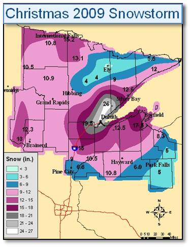
A very strong low pressure system lifted north over the Central Plains from Texas over the Christmas holiday from Thursday, December 24th, through Saturday the 26th. The storm brought a surge of moisture from the Gulf which helped to produce the high snowfall totals that were seen across the Northland. Most locations in northeast Minnesota and northwest Wisconsin saw upwards of 8- 10 inches. The greatest snowfall of around 2 feet was recorded in the Duluth, Esko, Proctor, Hermantown and Brimson areas. The storm also packed a punch with wind gusts of 55 mph recorded near downtown Duluth, and 53 mph at the Duluth airport. New daily snowfall records were set at Duluth on Christmas Eve and Christmas Day, with International Falls setting a snowfall record on Christmas Day. The 24-hour snowfall amounts for Christmas Day were 5.2 inches at International Falls and 12.4 inches at Duluth. This is also the 5th biggest 3-day snowstorm for Duluth, coming in with a total of 24.5 inches, recorded from December 24th through the 26th. However, this amount was nowhere near the 36.1 inches of snow that fell during the famed Halloween storm of 1991.
Storm Summary from Sioux Falls, SD NWS Office |
 |
Snowfall Reports
000
NOUS43 KDLH 261834
PNSDLH

PUBLIC INFORMATION STATEMENT
NATIONAL WEATHER SERVICE DULUTH MN
1234 PM CST SAT DEC 26 2009


THE TOTALS BELOW ARE SNOW AMOUNTS FROM DECEMBER 24TH THROUGH 26TH.
THESE AMOUNTS ARE NOT NECESSARILY THE FINAL AMOUNT FOR EACH
LOCATION. THE REPORTS ARE FROM NATIONAL WEATHER SERVICE SNOW
SPOTTERS AND COOPERATIVE OBSERVERS. THANK YOU FOR YOUR REPORTS.


SNOW REPORTS LISTED BY AMOUNT

 INCHES  LOCATION                 ST  COUNTY           TIME
 ------  -----------------------  --  --------------   -------
 26.00   25 NNE DULUTH            MN  ST. LOUIS        1022 AM
                 PEQUAYWAN LAKE
 24.40   DULUTH                   MN  ST. LOUIS        1150 AM
                 NATIONAL WEATHER SERVICE OFFICE...MAX WIND
                 GUST 53 MPH ON 12/25
 24.00   5 NW TWO HARBORS         MN  LAKE             0847 AM
 19.50   CLOQUET                  MN  CARLTON          1100 AM
 14.50   4 S BRUNO                MN  PINE             0800 AM
 14.50   ASHLAND                  WI  ASHLAND          0710 AM
 14.00   SILVER BAY               MN  LAKE             0830 AM
 14.00   INTERNATIONAL FALLS      MN  KOOCHICHING      0600 AM
 13.00   5 N PILLAGER             MN  CASS             0905 AM
 12.60   ENE FINLAND              MN  LAKE             0945 AM
                 WOLF RIDGE ELC
 12.40   KABETOGAMA               MN  ST. LOUIS        0650 AM
 12.30   MAPLE                    WI  DOUGLAS          0825 AM
 12.00   5 NW GRAND MARAIS        MN  COOK             1151 AM
                 6 INCHES FELL OVERNIGHT THROUGH CURRENT
                 TIME...SNOWING MODERATELY NOW
 10.80   SARONA                   WI  WASHBURN         0612 AM
 10.50   BRAINERD                 MN  CROW WING        0800 AM
 10.30   HAYWARD                  WI  SAWYER           0745 AM
 10.00   3 SW LITTLEFORK          MN  KOOCHICHING      1000 AM
  9.30   3 N BRAINERD             MN  CROW WING        0850 AM
  9.30   GRAND RAPIDS             MN  ITASCA           0640 AM
  9.30   3 E ORR                  MN  ST. LOUIS        1220 PM
  9.00   14 W ISABELLA            MN  LAKE             0907 AM
  9.00   GRAND PORTAGE            MN  COOK             0700 AM
  9.00   NORTHOME                 MN  KOOCHICHING      0700 AM
  8.50   3 NE NISSWA              MN  CROW WING        0815 AM
  7.50   FORT RIPLEY              MN  CROW WING        1000 AM
  7.20   7 S BIGFORK              MN  ITASCA           0830 AM
  7.00   GILE                     WI  IRON             1000 AM
  6.30   WINTER                   WI  SAWYER           0900 AM
  5.50   20 NNW GRAND MARAIS      MN  COOK             0850 AM
                 ROCKWOOD LODGE...MID GUNFLINT TRAIL
  4.00   5 N VIRGINIA             MN  ST. LOUIS        1020 AM
  2.00   ELY                      MN  ST. LOUIS        0845 AM
  2.00   EMBARRASS                MN  ST. LOUIS        0608 AM

$$
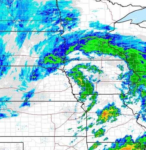
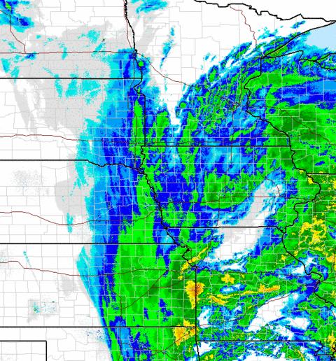
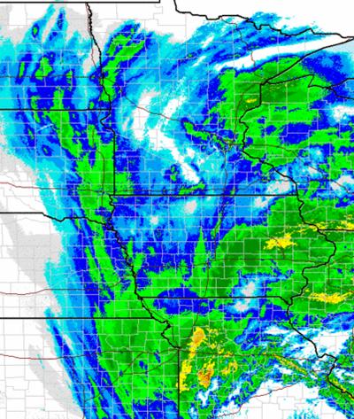
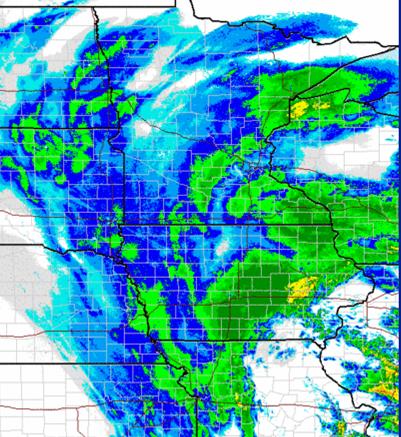
Radar & Satellite
 |
 |
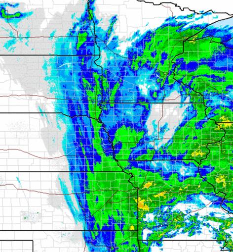 |
| 8PM Dec 23rd | 9PM Dec 24th | 10PM Dec 24th |
 |
 |
 |
| 12AM Dec 25th | 4AM Dec 25th | 6AM Dec 26th |
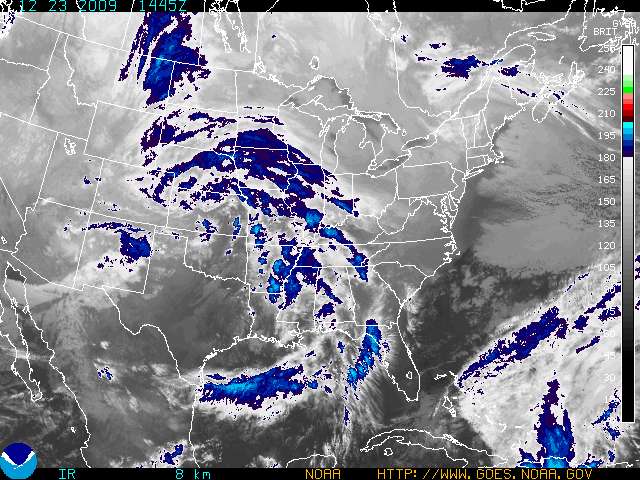
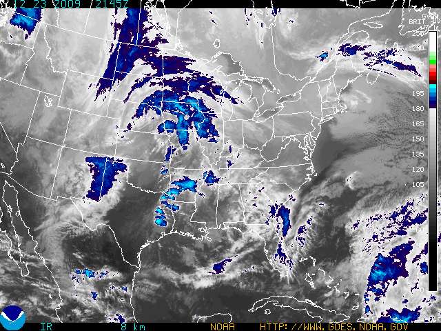
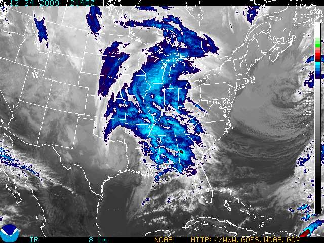
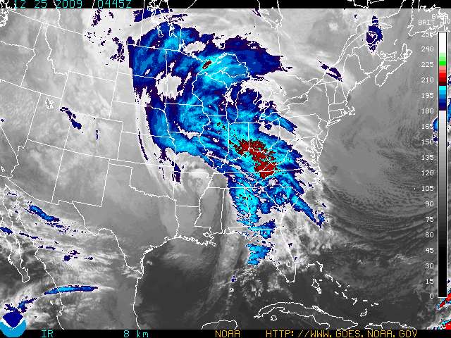
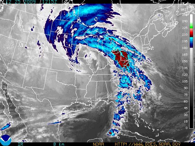
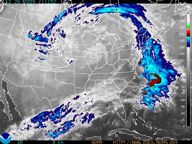
IR Satellite Imagery
 |
 |
 |
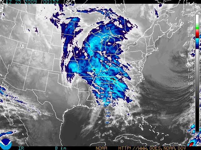 |
| 8AM Dec 23rd | 4PM Dec 23rd | 3PM Dec 24th | 6PM Dec 24th |
 |
 |
 |
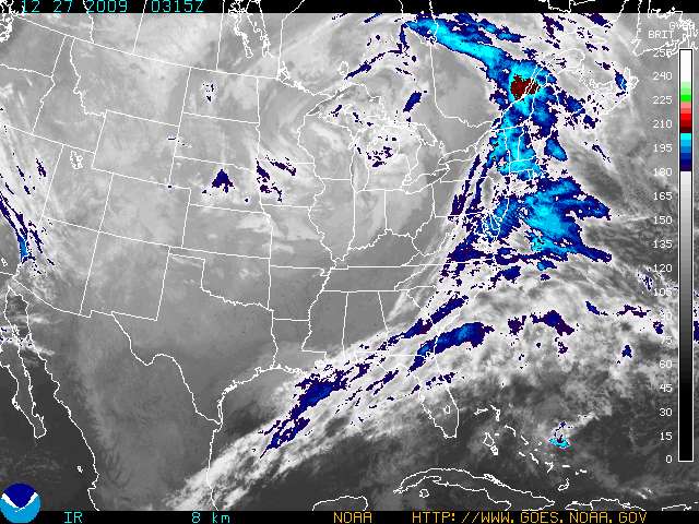 |
| 10PM Dec 24th | 6AM Dec 25th | 6AM Dec 26th | 9PM Dec 26th |
Environment
Surface Plots
 |
 |
 |
 |
| 6PM Dec 23rd | 12AM Dec 24th | 6AM Dec 24th | 9AM Dec 24th |
 |
 |
 |
 |
| 12PM Dec 24th | 3PM Dec 24th | 6PM Dec 24th | 10PM Dec 24th |
 |
 |
 |
 |
| 6AM Dec 25th | 9AM Dec 25th | 6PM Dec 25th | 6AM Dec 26th |
Surface Analysis
 |
 |
 |
| 6PM Dec 23rd | 6AM Dec 24th | 12PM Dec 24th |
 |
 |
 |
| 3PM Dec 24th | 9PM Dec 24th | 6AM Dec 25th |
 |
 |
 |
| 12PM Dec 25th | 6PM Dec 25th | 12AM Dec 26th |
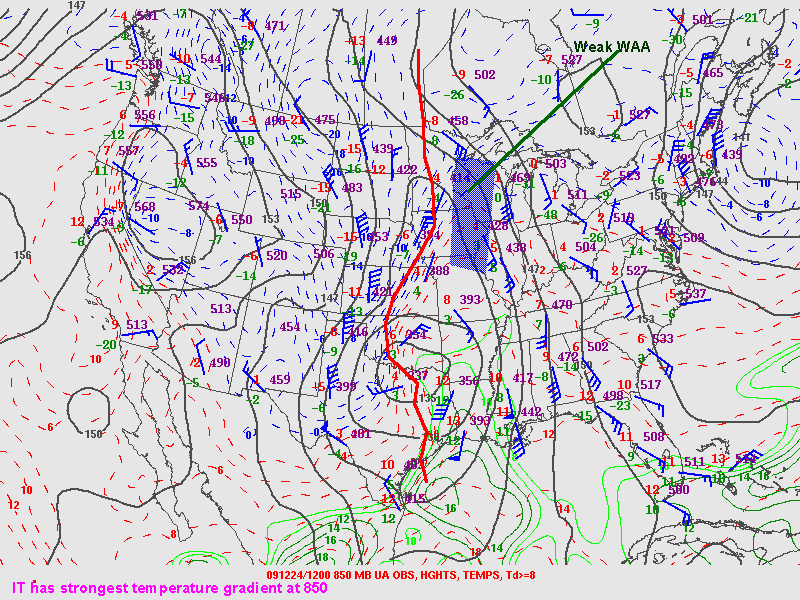
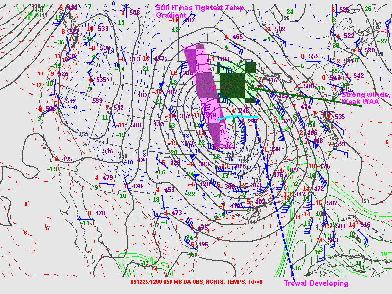
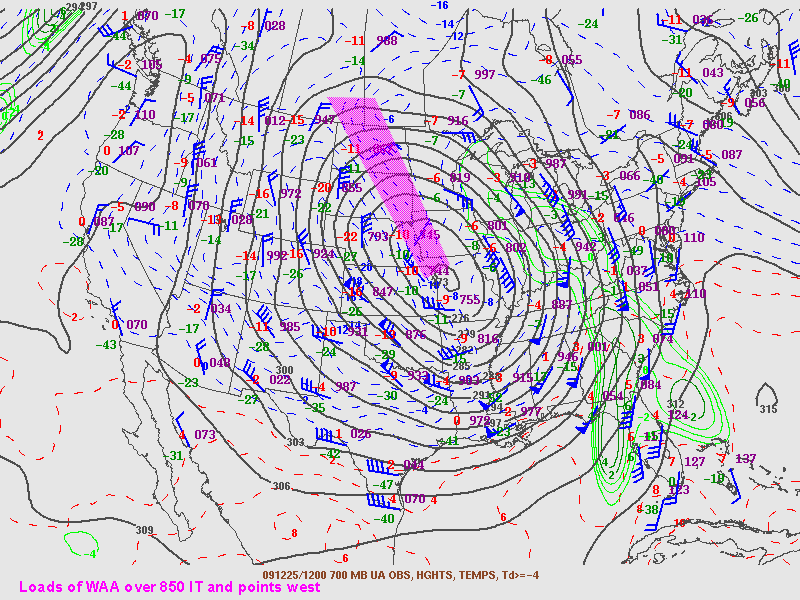
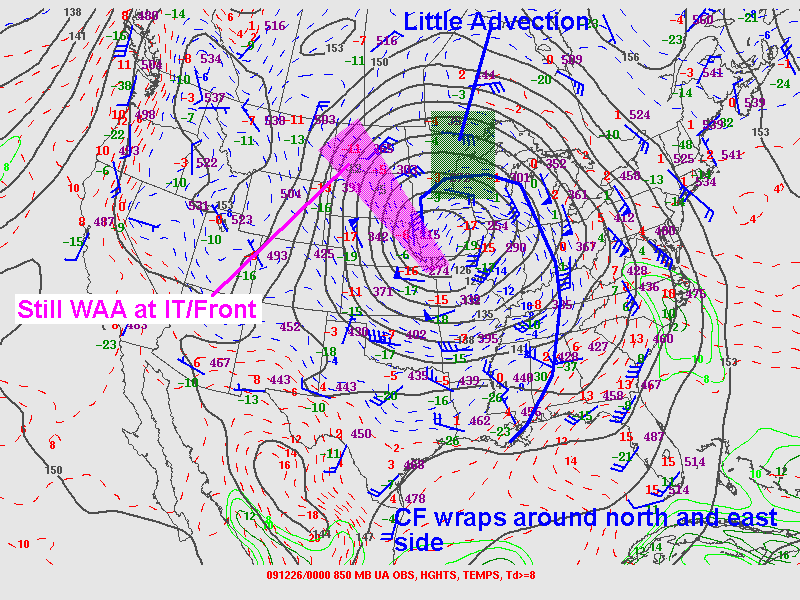
Upper Air Maps
 |
 |
 |
 |
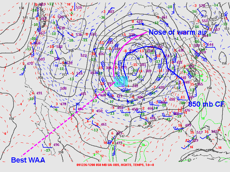
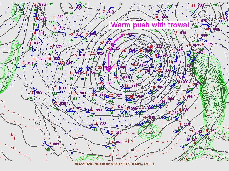
| 850mb 6AM Dec 24th | 850mb 6PM Dec 24th | 850mb 6AM Dec 24th | 700mb 6AM Dec 24th |
 |
 |
 |
|
| 850mb 6PM Dec 24th | 850mb 6AM Dec 25th | 700mb 6AM Dec 25th |
Photos
 |
 |
 |
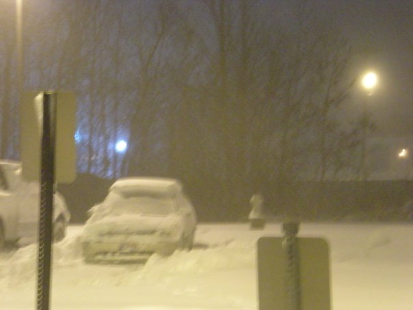 |
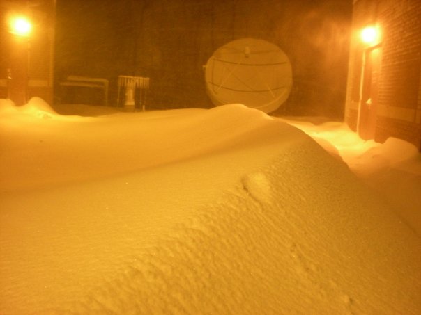
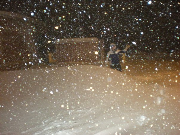
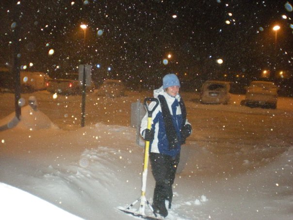
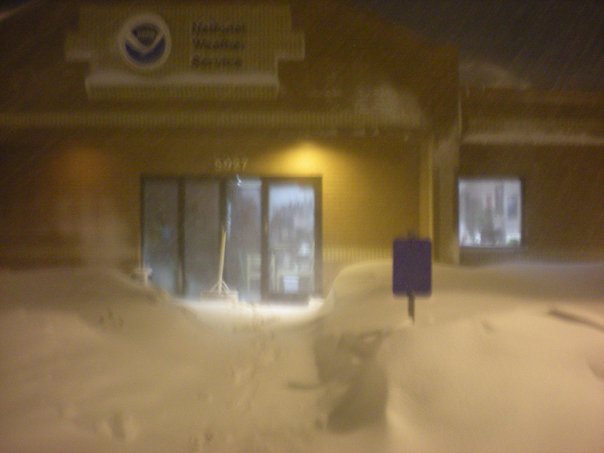
| 20" of snow at the office by 6AM Christmas morning! | Forecaster Amanda is out there somewhere. | Forecaster Amanda pauses while shoveling a path to the parking lot. | Cars in the lot buried in the snow. |
 |
 |
 |
|
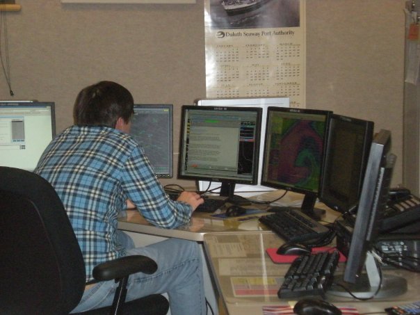
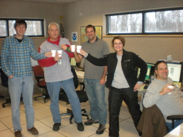
| Looking from the parking lot to the entrance. | Forecaster Dean hard at work on the forecast. | Celebrating making it through the night with a celebratory cup of coffee once the day shift arrived Christmas morning. |
 |
Media use of NWS Web News Stories is encouraged! Please acknowledge the NWS as the source of any news information accessed from this site. |
|

