A storm and trailing cold front will continue to slowly move through the Gulf Coast and Southeast U.S. through this weekend with widespread rain showers and isolated thunderstorms. A fast-moving clipper storm may bring several inches of snow to the north-central Plains, Midwest, eastern Great Lakes, and Northeast regions this weekend. Read More >
Overview
|
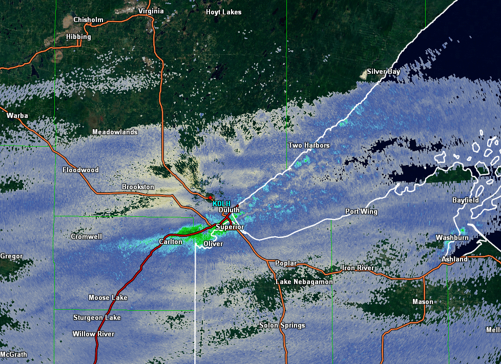
Some folks in the Twin Ports of the Duluth/Superior area woke up to piles of snow while others had a dusting. The piles of snow was caused by a narrow band of lake effect snow that developed quickly overnight over western sections of Duluth. This band of snow was about 5 miles wide, with snow rates of about 2 to 3 inches per hour. As the night wore on, the snow band drifted southeast over Superior. The snow band diminished as it moved across far northern Wisconsin after daybreak.
At left is a radar loop of the lake effect snow band. The loop is one frame about every 20 minutes from about 1 am until 6:30 am.
|
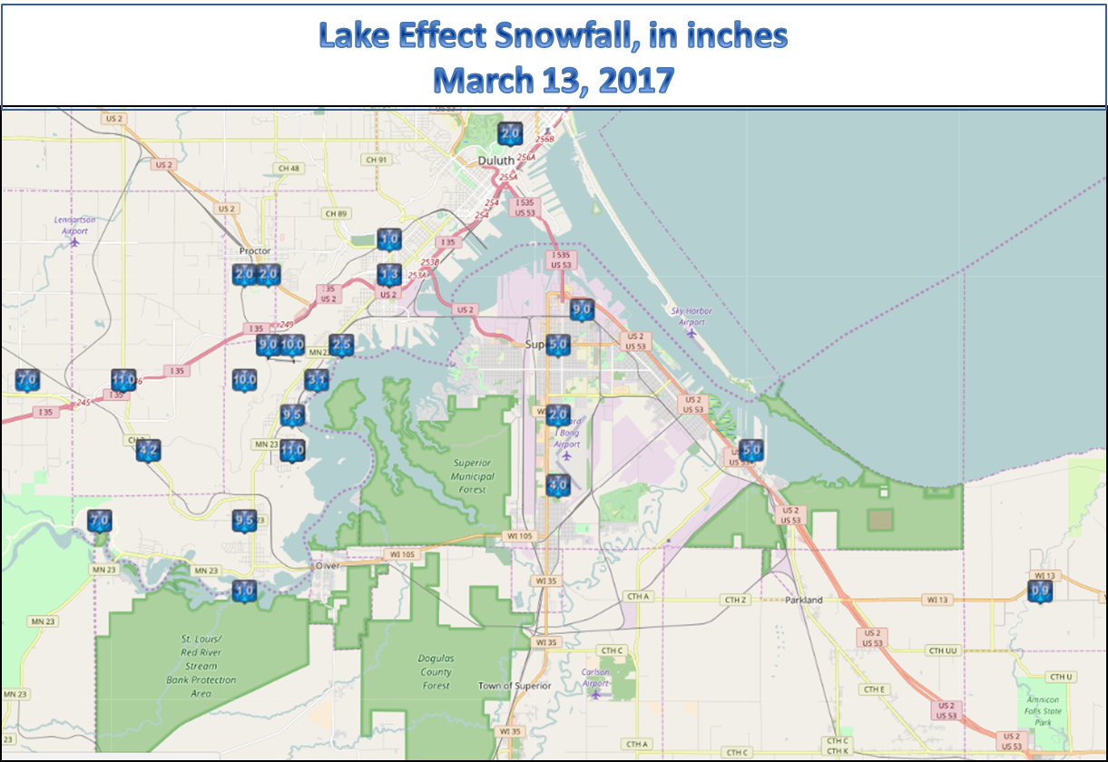 Map of Plotted Snow amounts. Click for larger view. |
Photos
 |
 |
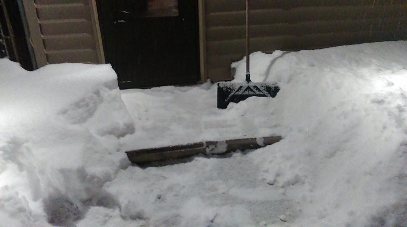 |
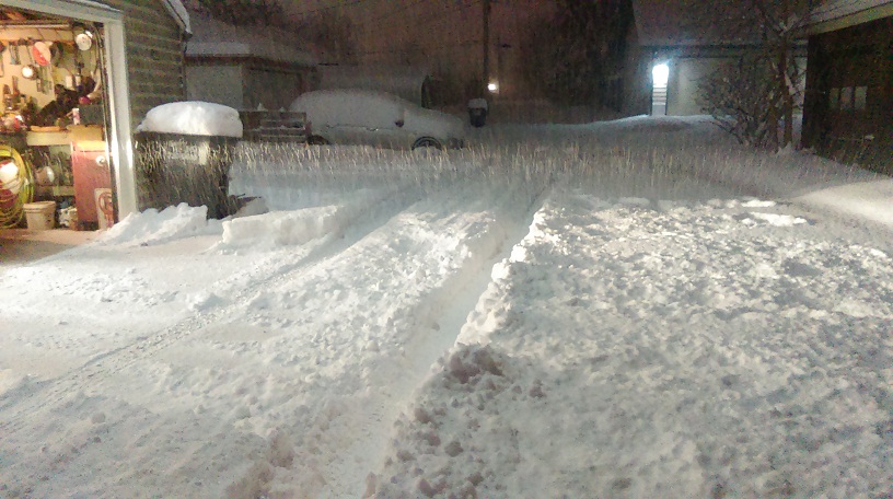
| Alley in west Duluth Doug Nelson photo |
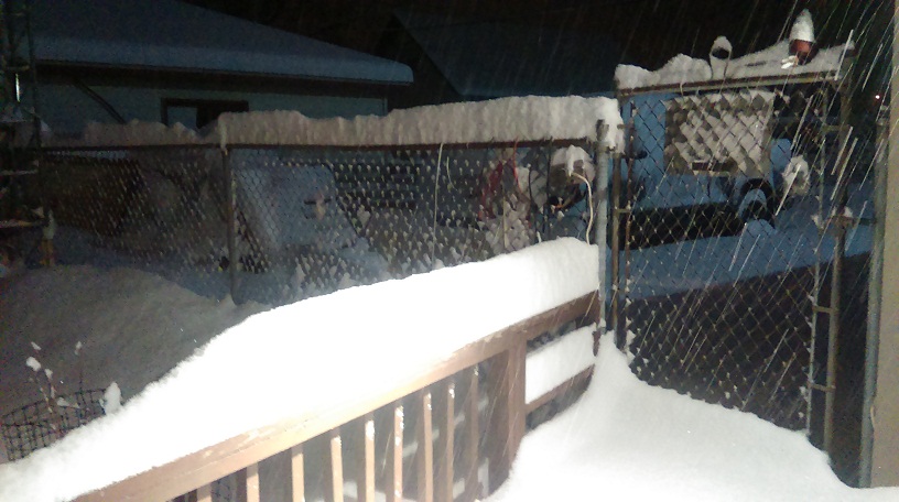
Snow on fence Doug Nelson photo |
Done shoveling! Doug Nelson photo |
 |
 |
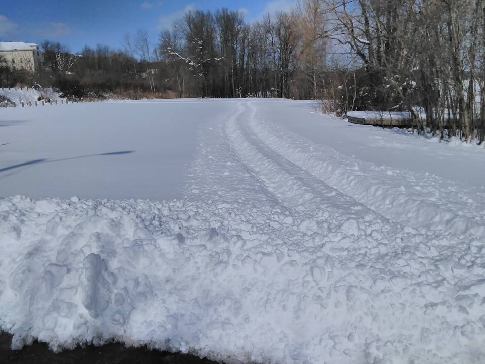 |
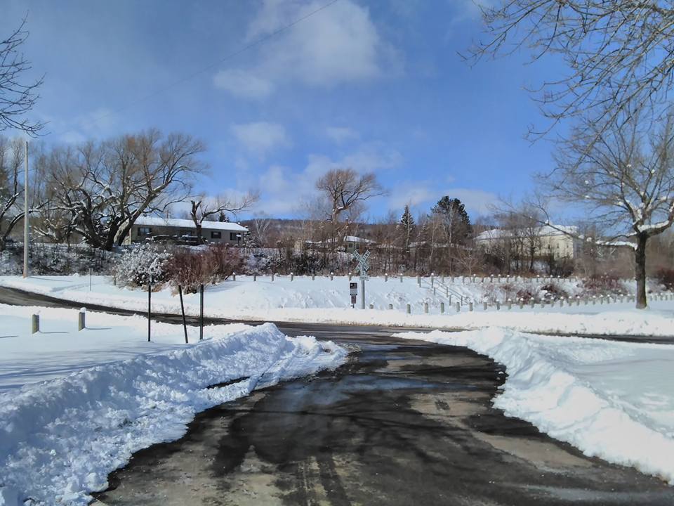
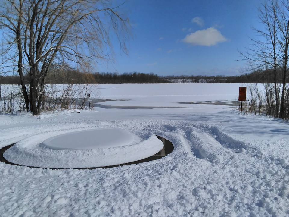
| Far west Duluth Tim Burr photo |
Snow in Riverside neighborhood of Duluth Tim Burr photo |
Snow in Riverside neighborhood of Duluth Tim Burr photo |
Snowfall Reports
The list below contains the snow reports from March 13th, 2017.
Location                     Amount    Time/Date
1 N Gary New Duluth          13.0 in   0523 AM 03/13
1 NNW Gary New Duluth        13.0 in   0712 AM 03/13
3 N Fond Du Lac              11.0 in   1130 AM 03/13
1 NNW Gary New Duluth        11.0 in   0800 AM 03/13
2 NW Gary New Duluth         10.5 in   0900 AM 03/14
2 SSE Proctor                10.0 in   1038 AM 03/13
2 NNW Gary New Duluth        10.0 in   0818 AM 03/13
2 N Gary New Duluth          9.5 in    0740 AM 03/13
1 WSW Gary New Duluth        9.5 in    0500 AM 03/13
Duluth                       9.0 in    0400 AM 03/13
3 NNW Superior               9.0 in    0245 PM 03/13
2 SSE Proctor                9.0 in    1159 PM 03/13
3 N Fond Du Lac              7.0 in    0217 AM 03/13
1 W Fond Du Lac              7.0 in    0555 AM 03/13
2 E Esko                     7.0 in    0307 AM 03/13
5 SE Superior                6.5 in    0700 AM 03/14
1 E Esko                     6.1 in    0900 AM 03/14
2 ESE Superior               5.0 in    0739 AM 03/13
2 WNW Superior               5.0 in    0154 PM 03/13
1 N Fond Du Lac              4.2 in    0215 AM 03/13
2 WSW Superior               4.0 in    0138 PM 03/13
Bayfield 9N                  3.7 in    0700 AM 03/14
2 SSW West Duluth            3.1 in    0205 AM 03/13
Madeline Island              2.5 in    0752 AM 03/14
1 S West Duluth              2.5 in    0205 AM 03/13
Wrenshall                    2.5 in    0800 AM 03/14
2 W Superior                 2.0 in    0823 AM 03/13
Proctor                      2.0 in    0634 AM 03/13
Duluth                       2.0 in    0445 AM 03/13
Proctor                      2.0 in    0315 AM 03/13
3 S Ashland                  1.6 in    0800 AM 03/14
Moquah 2n                    1.6 in    0700 AM 03/14
3 N Mahtowa                  1.5 in    0801 AM 03/13
Duluth Airport               1.3 in    0655 AM 03/14
1 NE West Duluth             1.3 in    0704 AM 03/13
1 NE West Duluth             1.3 in    0838 AM 03/13
Ashland                      1.1 in    0700 AM 03/14
1 NE West Duluth             1.0 in    0820 AM 03/13
1 N Duluth                   1.0 in    0805 PM 03/12
Ashland                      1.0 in    0656 AM 03/13
Gile                         1.0 in    1115 PM 03/13
1 SW Brainerd                1.0 in    0700 AM 03/13
Esko                         1.0 in    0814 PM 03/12
Brainerd                     1.0 in    0700 AM 03/14
2 WNW Cloquet                1.0 in    0555 AM 03/13
2 ENE Glidden                1.0 in    0700 AM 03/13
3 WSW Lakeside               0.9 in    1230 PM 03/13
1 SE Malmo                   0.8 in    0803 AM 03/13
3 N Brainerd                 0.8 in    0628 AM 03/13
12 N Isle                    0.8 in    0800 AM 03/14
3 SSW Bruno                  0.8 in    0824 AM 03/13
9 SE Webster                 0.7 in    0700 AM 03/14
4 ESE Casino                 0.7 in    0700 AM 03/14
1 WNW Brainerd               0.6 in    0715 PM 03/12
Park Falls                   0.5 in    0800 AM 03/14
Herbster                     0.5 in    0752 AM 03/13
Fort Ripley                  0.5 in    0746 PM 03/12
3 N Butternut                0.5 in    0600 AM 03/14
Holyoke                      0.5 in    1045 AM 03/13
3 W Clam Lake                0.4 in    0700 AM 03/14
4 W Clam Lake                0.4 in    0700 AM 03/14
2 WNW Seeley                 0.4 in    0600 AM 03/14
7 WSW Pine River             0.4 in    0815 PM 03/12
11 W Drummond                0.4 in    0700 AM 03/14
3 WSW Mission                0.3 in    0800 AM 03/14
East Gull Lake               0.3 in    0800 AM 03/14
Bayfield 9N                  0.1 in    0700 AM 03/14


Observations are collected from a variety of sources with varying
equipment and exposures. Not all data listed are considered official.
 |
Media use of NWS Web News Stories is encouraged! Please acknowledge the NWS as the source of any news information accessed from this site. |
|