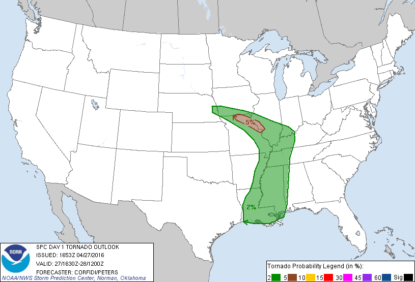
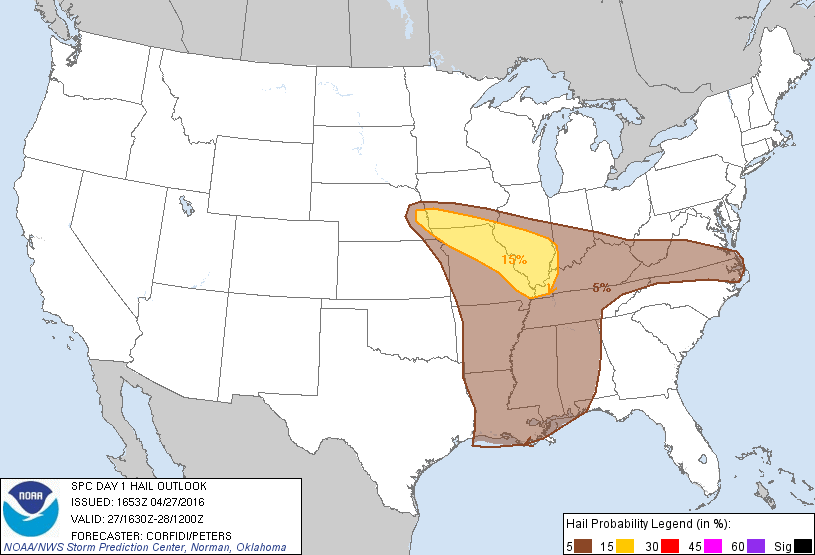
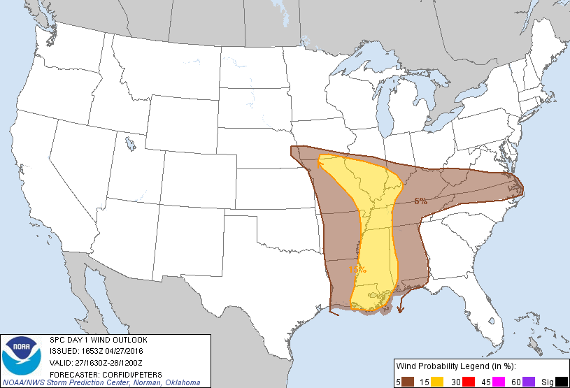
Overview
|
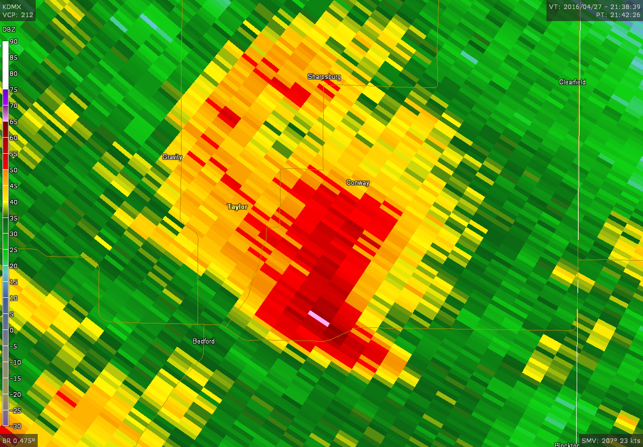
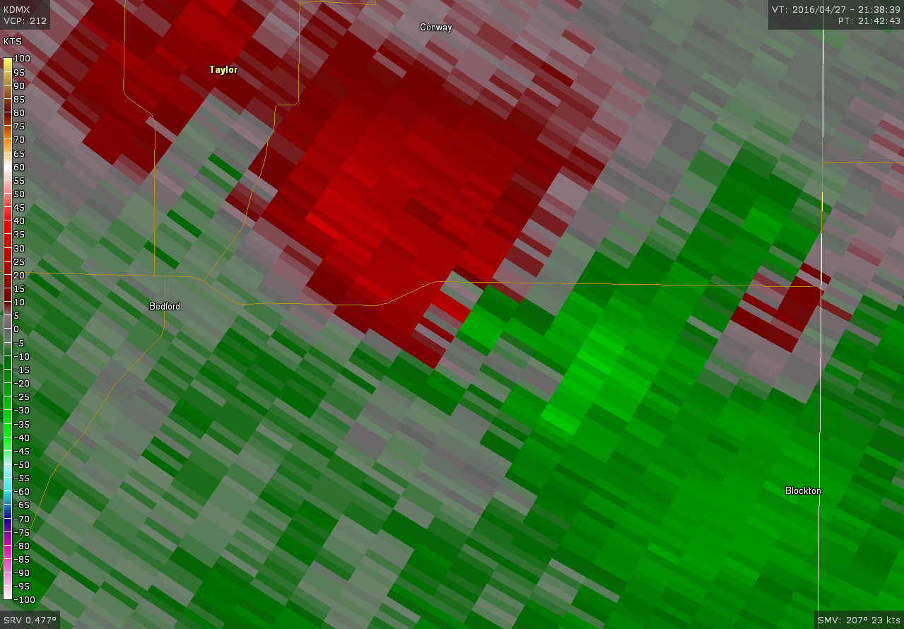
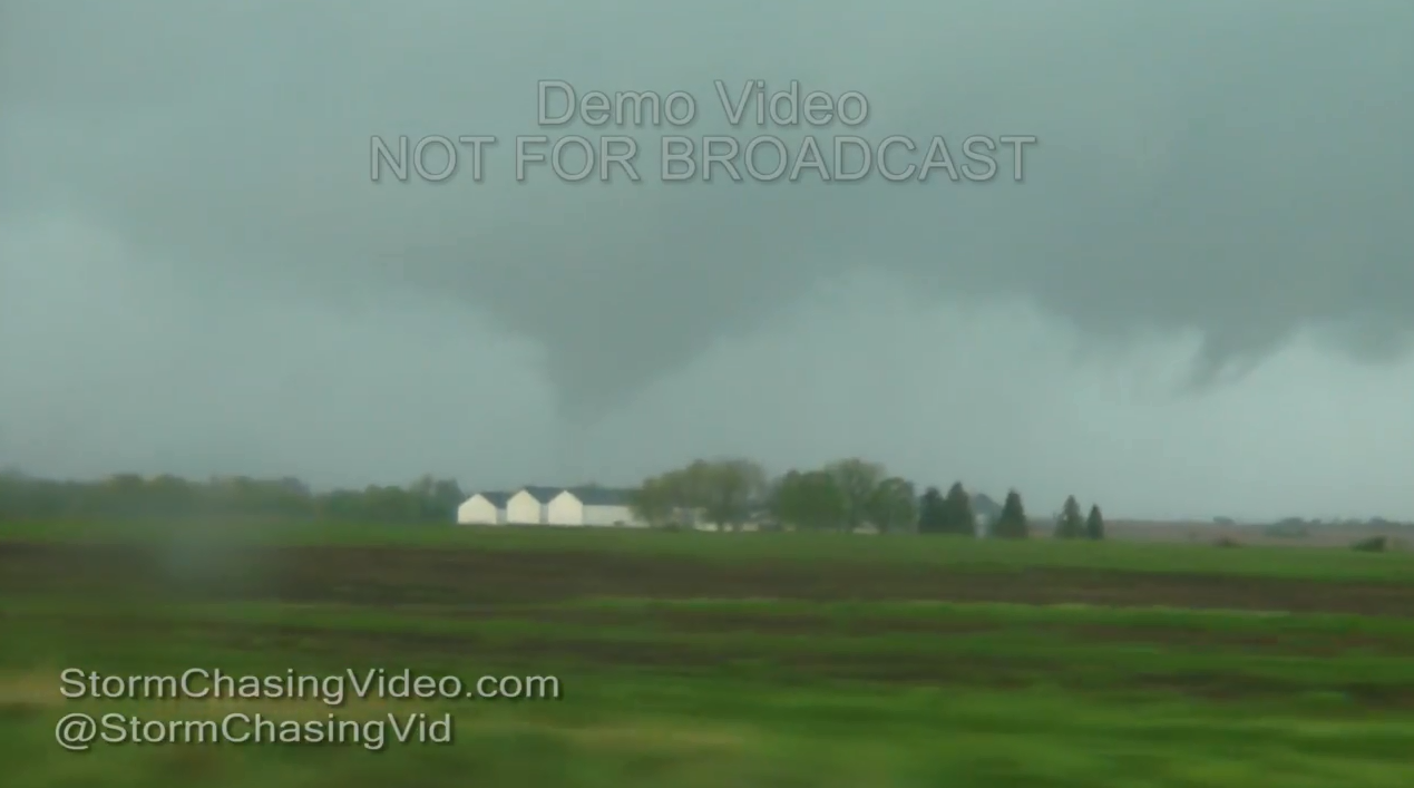
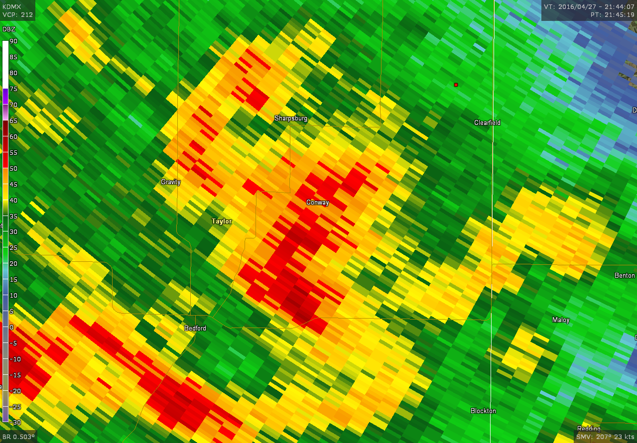
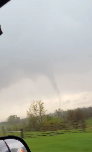
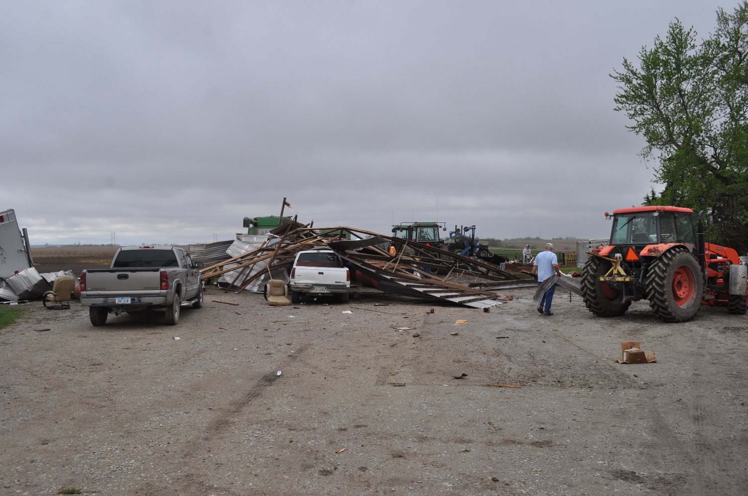
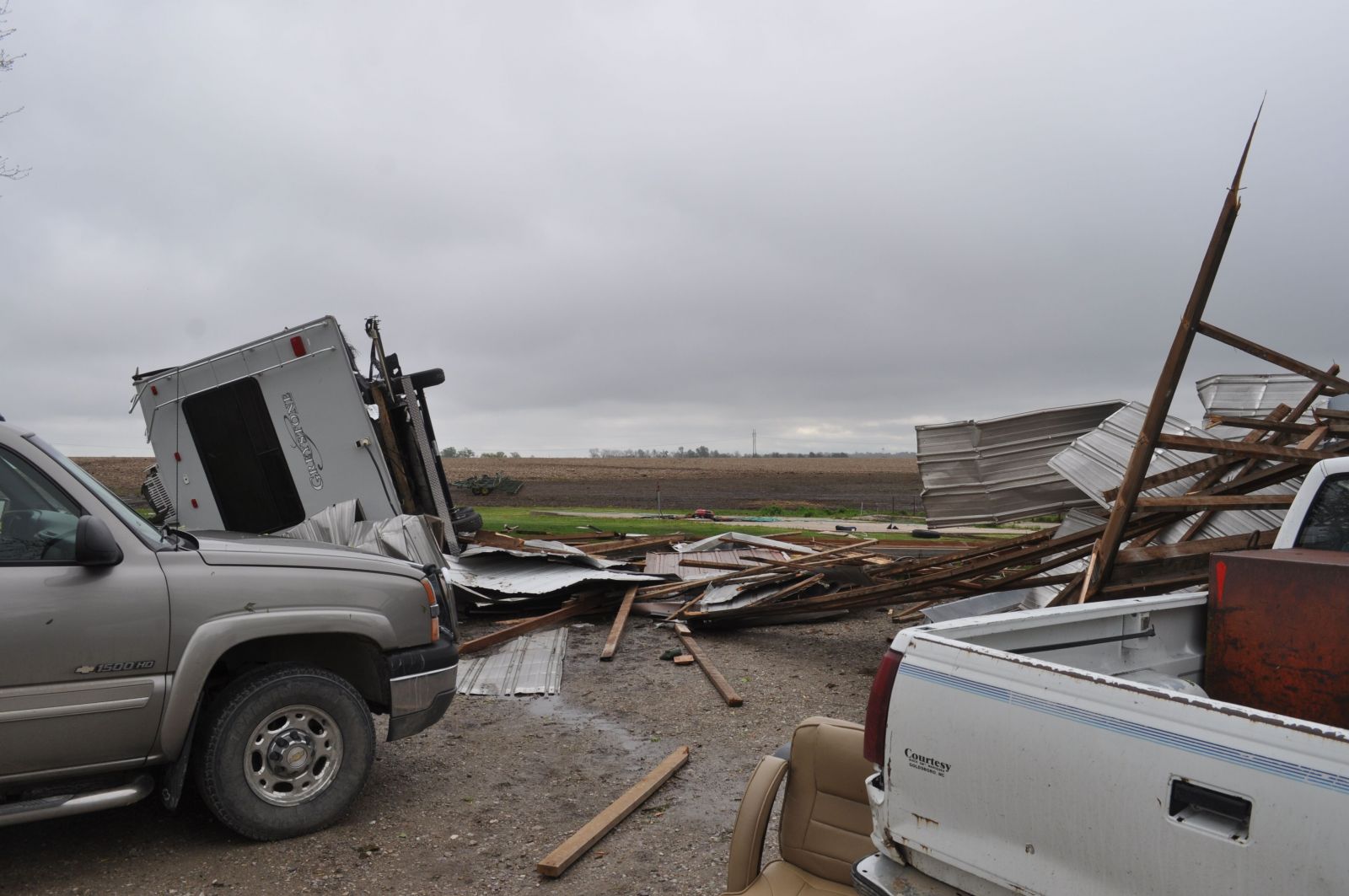
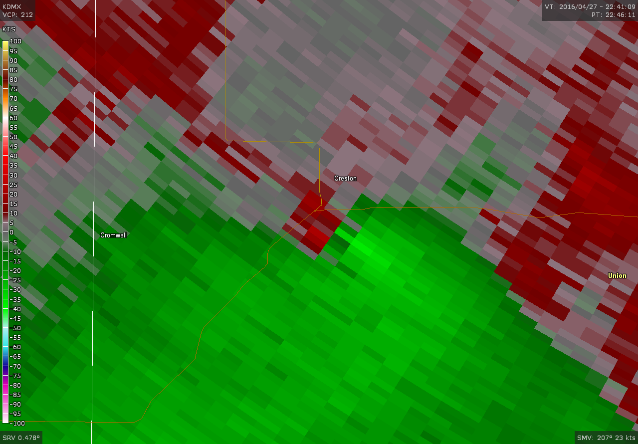
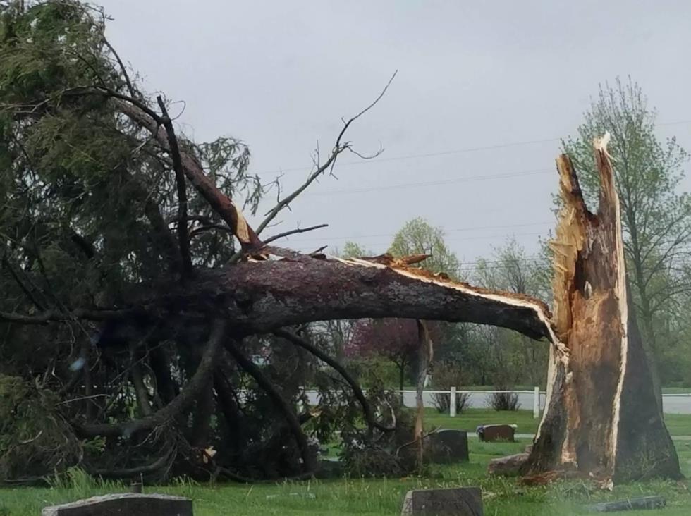
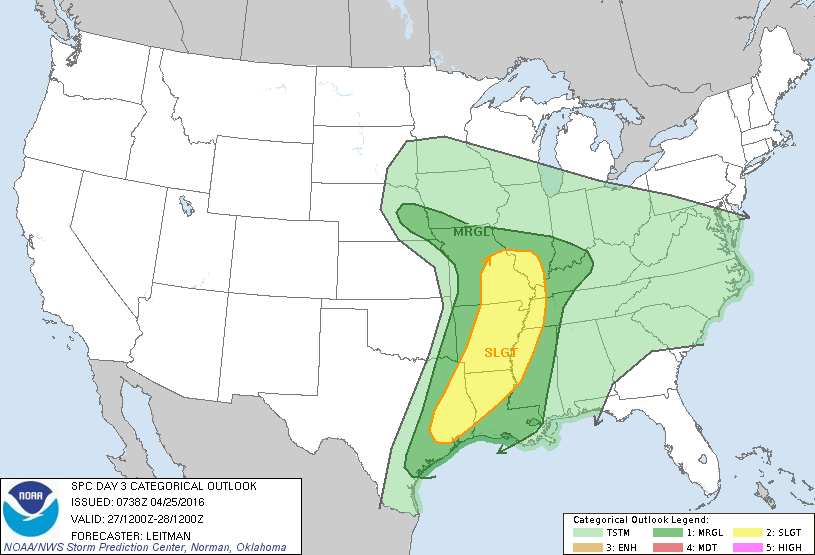
On the afternoon of April 27, an upper level low pressure system spawned a line of thunderstorms that lifted north and east across southern Iowa. A warm front situated over southwest Iowa interacting with these storms led to the development of at least five weak tornadoes in Iowa. EF0 to EF1 damage was found with mostly trees and outbuildings impacted. One tornado developed just south of Creston and moved into the southeast portion of town, causing very light damage to a few trees. Thunderstorms also produced very heavy rainfall over the southern half of Iowa with amounts of one to two inches common and localized areas of flooding. |
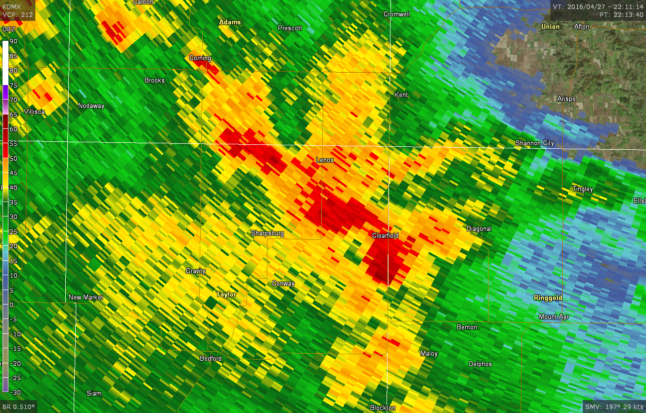
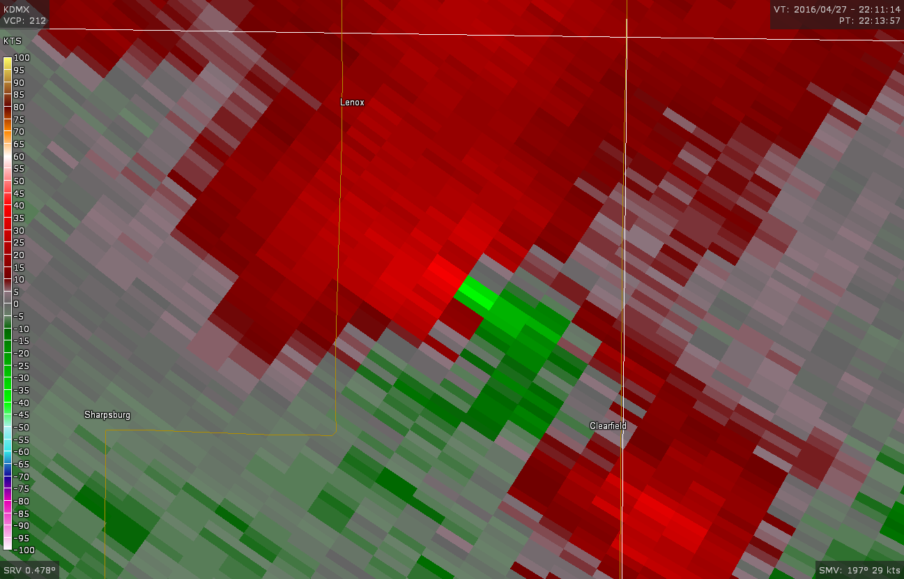
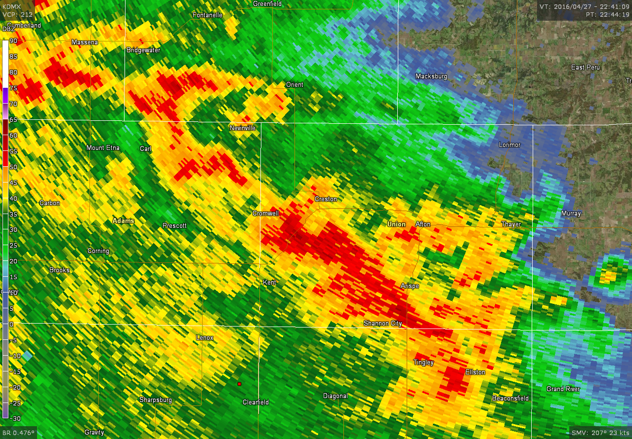
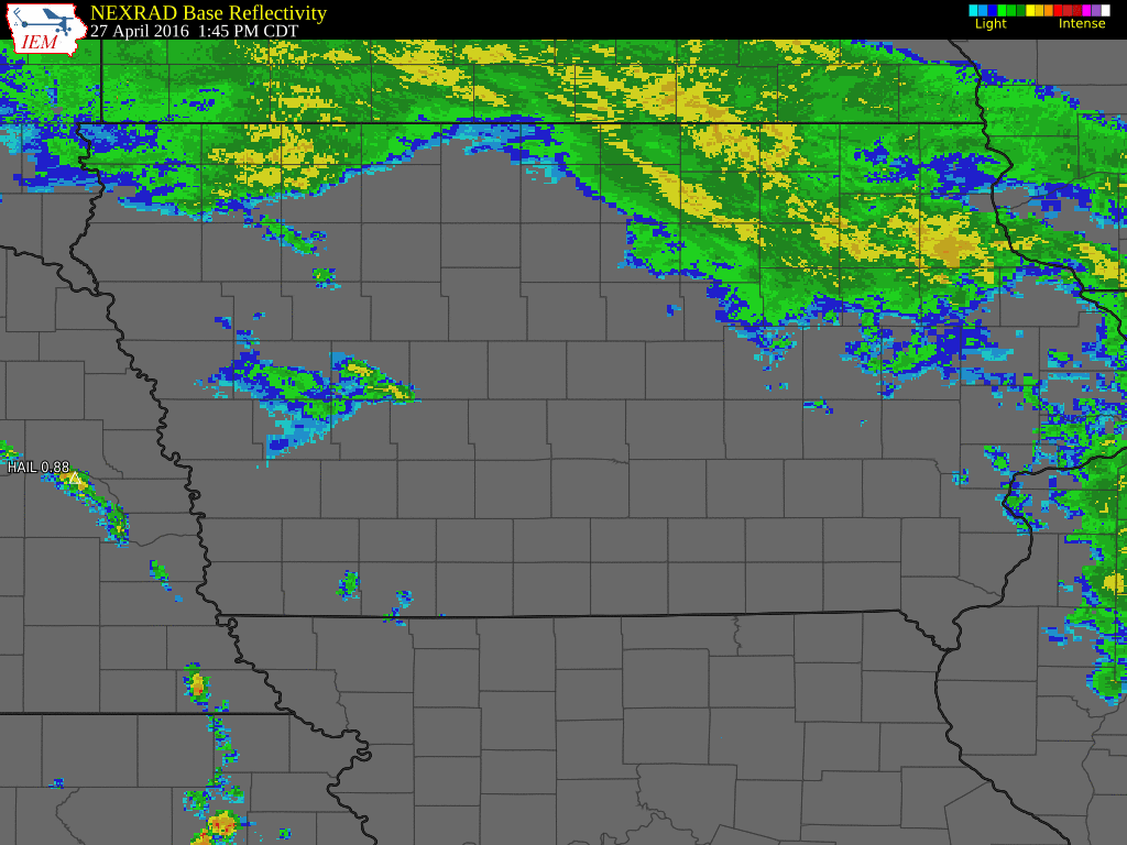 Radar Loop across Iowa on the Afternoon of April 27, 2016 |
Tornadoes:
|
Tornado #1 - 6.0 mi ESE of Bedford
Track Map 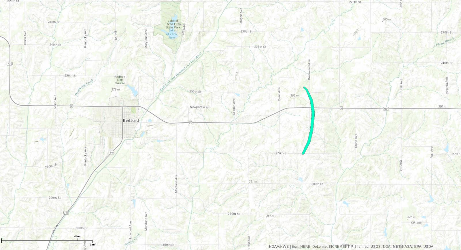 
|
||||||||||||||||
|
||||||||||||||||
|
Tornado #2 - 6.1 mi E of Bedford
Track Map 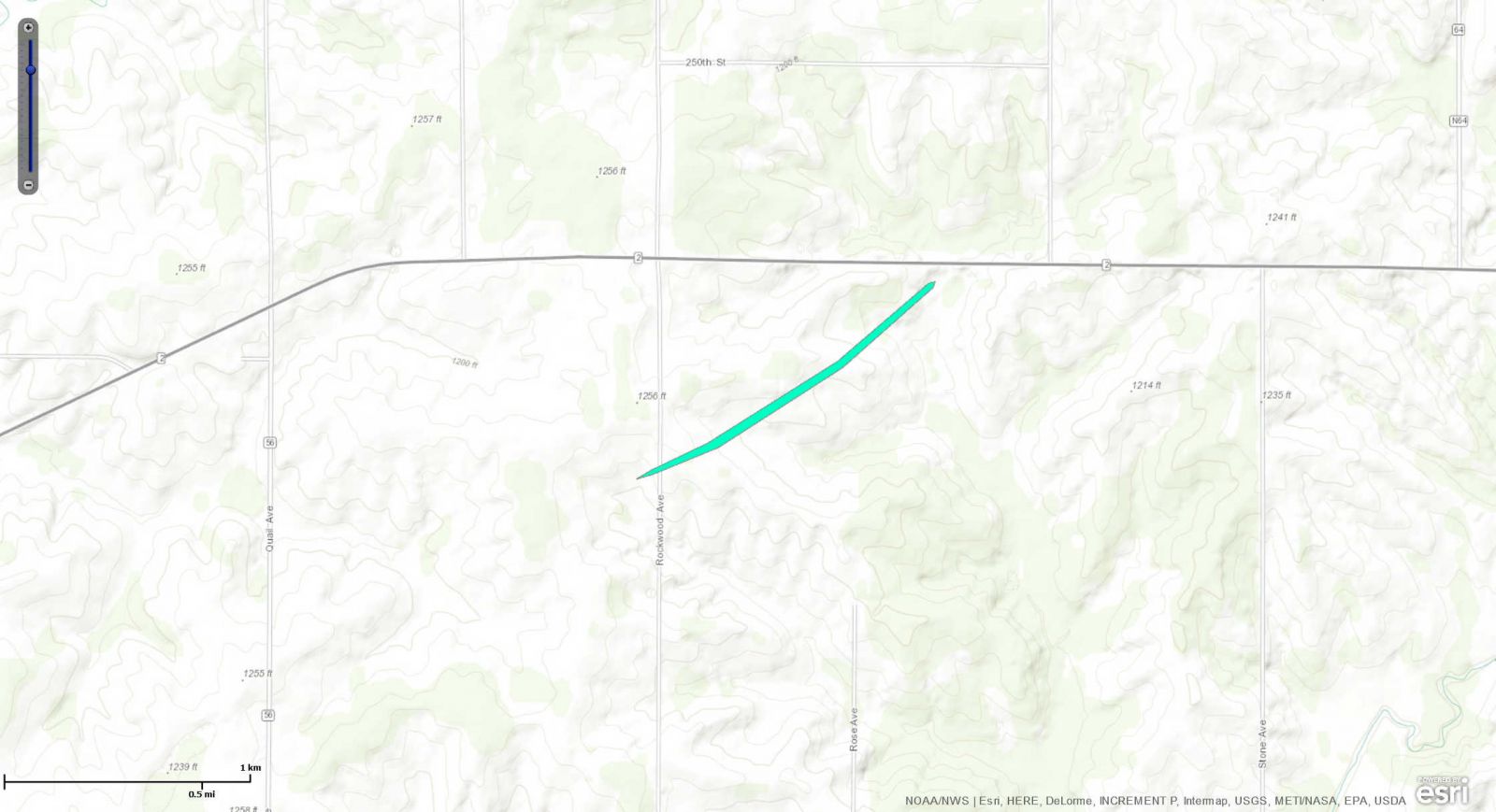
|
||||||||||||||||
|
||||||||||||||||
|
Tornado #3 - 2.1 mi NW of Clearfield
Track Map 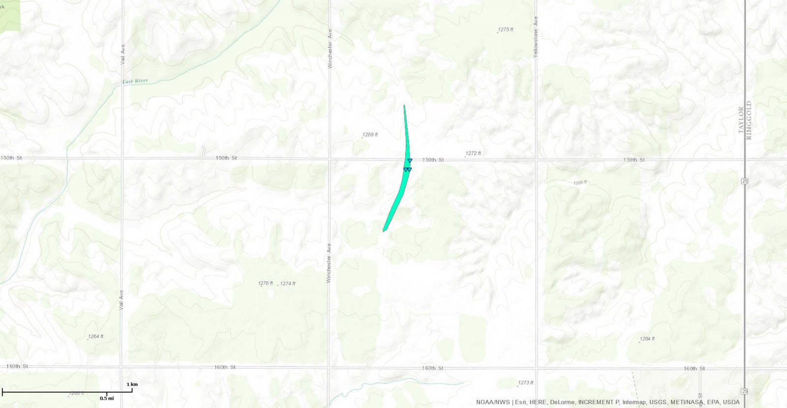
|
||||||||||||||||
|
||||||||||||||||
|
Tornado #4 - 4.6 mi S of Creston
Track Map 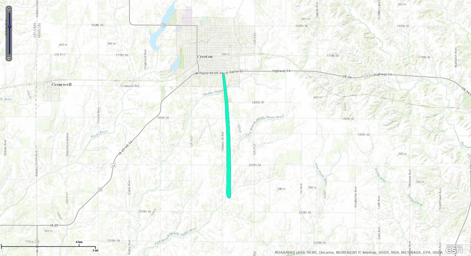
|
||||||||||||||||
|
||||||||||||||||
The Enhanced Fujita (EF) Scale classifies tornadoes into the following categories:
| EF0 Weak 65-85 mph |
EF1 Moderate 86-110 mph |
EF2 Significant 111-135 mph |
EF3 Severe 136-165 mph |
EF4 Extreme 166-200 mph |
EF5 Catastrophic 200+ mph |
 |
|||||
Storm Reports
..TIME...   ...EVENT...      ...CITY LOCATION...     ...LAT.LON...
..DATE...   ....MAG....      ..COUNTY LOCATION..ST.. ...SOURCE....
            ..REMARKS..

0434 PM     HAIL             5 SE BEDFORD            40.63N 94.64W
04/27/2016  E0.88 INCH       TAYLOR             IA   TRAINED SPOTTER


0435 PM     HAIL             5 SE BEDFORD            40.62N 94.66W
04/27/2016  E1.00 INCH       TAYLOR             IA   TRAINED SPOTTER
0452 PM     TORNADO          3 SE CONWAY             40.71N 94.58W
04/27/2016                   TAYLOR             IA   PUBLIC

            VIDEO EVIDENCE OF A BRIEF TORNADO TOUCHDOWN
            NEAR THE INTERSECTION OF HIGHWAY 2 AND
            ROCKWOOD ROAD. NO DAMAGE REPORTED AT THIS
            TIME.
0500 PM     FUNNEL CLOUD     4 E CONWAY              40.75N 94.55W
04/27/2016                   TAYLOR             IA   TRAINED SPOTTER

            SPOTTER ON HW25 OBSERVING A WEAK ROPE FUNNEL
            CLOUD AND RAPID ROTATION TO THE WEST.

0514 PM     TSTM WND DMG     2 NNW CLEARFIELD        40.83N 94.50W
04/27/2016                   TAYLOR             IA   EMERGENCY MNGR

            DAMAGE TO A BARN. TIME ESTIMATED FROM RADAR.

0543 PM     TORNADO          3 SSW CRESTON           41.02N 94.38W
04/27/2016                   UNION              IA   TRAINED SPOTTER

            TORNADO 1 MILE WEST OF THE CRESTON AIRPORT
            HEADING TOWARDS CRESTON.

0547 PM     TORNADO          1 SSW CRESTON           41.04N 94.37W
04/27/2016                   UNION              IA   PUBLIC

            TORNADO JUST SOUTH OF CRESTON BUT HAS BECOME
            RAIN WRAPPED.

0551 PM     TORNADO          3 NNE CRESTON           41.09N 94.35W
04/27/2016                   UNION              IA   LAW ENFORCEMENT

            RELAYED REPORT OF A TORNADO NORTH OF CRESTON

0618 PM     HAIL             LEON                    40.74N 93.75W
04/27/2016  E0.88 INCH       DECATUR            IA   EMERGENCY MNGR
Environment
After sparking widespread severe thunderstorms across the central and southern U.S. on April 26, a seasonably strong vertically-stacked low pressure system and upper level shortwave trough pivoted up across eastern Nebraska during the afternoon of April 27. This 300mb wave provided the focus for thunderstorm development during the early afternoon hours near the Missouri River between Kansas City and Omaha. A warm front branching southeastward from the surface cyclone lifted northward into southwest Iowa during this timeframe.
 |
 |
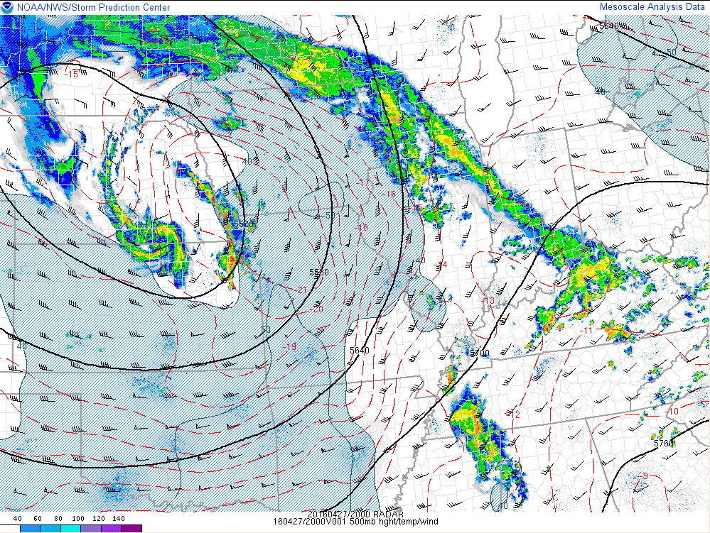 |
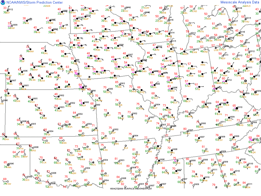
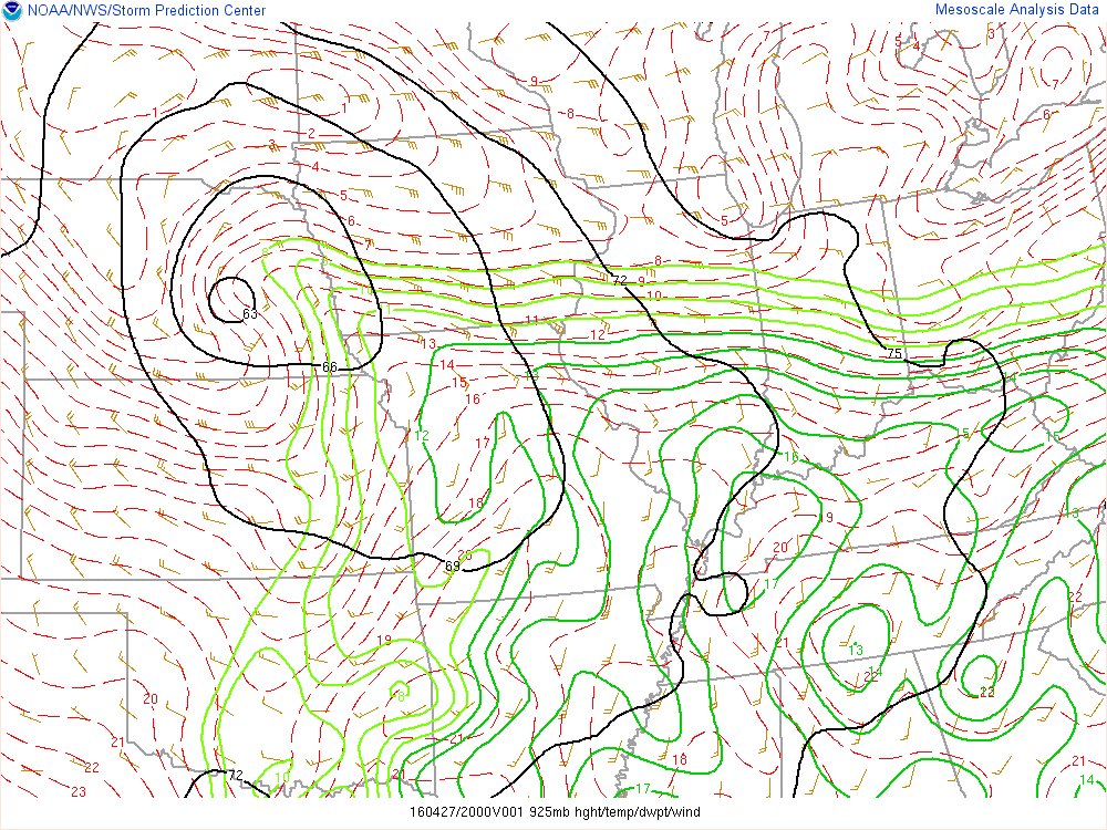
| Figure 1: Surface observations at 3:00pm CDT showing the warm front lifting into SW Iowa. | Figure 2: 925mb analysis at 3:00pm CDT depicting good moisture transport into SW Iowa. | Figure 3: 500mb analysis at 3:00pm showing how the developing storms align with the upper trough. |
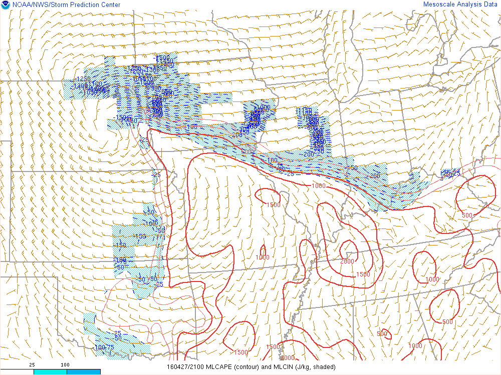
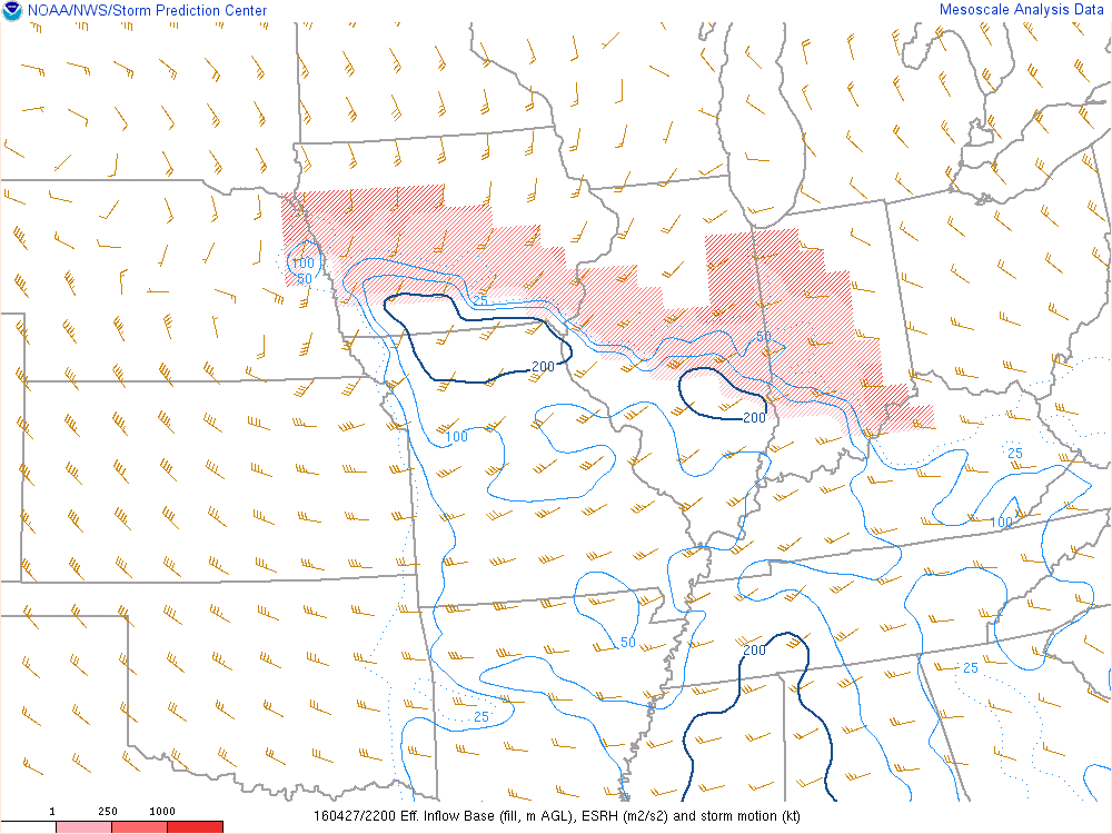
A narrow ribbon of surface-based instability developed along and south of the warm front with MLCAPE values of 500 to 1000 J/kg being reached by 2:00-3:00pm. Strong easterly flow to the immediate north of the warm front combined with southerly flow south of the boundary led to a favorable low-level shear environment for tornadoes. The lifted condensation levels (LCLs) were also very low, meaning that the base of the storms would be very low and tornadogenesis was more likely, but the tornadoes could be harder to spot.
 |
 |
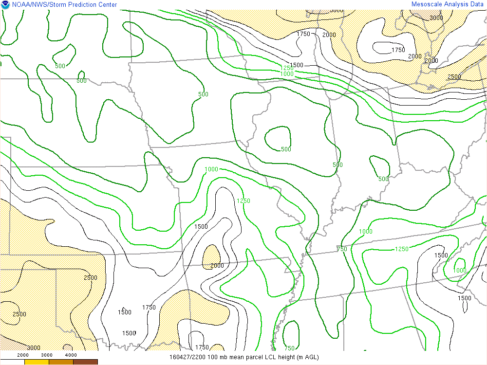 |
| Figure 4: MLCAPE plot at 4:00pm showing the region of surface instability with no inhibition. | Figure 5: Effective SRH plot showing values of over 200 m2/s2 over southern Iowa. | Figure 6: LCL plot showing values well below 1000m over Iowa. |
Additional Information
The Forecast
Warning Lead Time
| Counties & Issuance Time | Report Lead Time |
| Severe Thunderstorn Warning - Taylor - 3:57pm CDT | 38 minutes |
| Severe Thunderstorn Warning - Cass - 3:59pm CDT | No Reports |
| Tornado Warning - Taylor - 4:38pm CDT | 2 minutes |
| Tornado Warning - Ringgold, Taylor,Union,Adams - 5:14pm CDT | 29 minutes |
| Severe Thunderstorn Warning - Adair, Ringgold, Union, Madison, Clarke - 5:42pm CDT | No Reports |
| Tornado Warning - Union, Madison, Adair - 5:45pm CDT | Tornado in Progress |
Summaries from other NWS Offices
 |
Media use of NWS Web News Stories is encouraged! Please acknowledge the NWS as the source of any news information accessed from this site. |
|