Overview
|
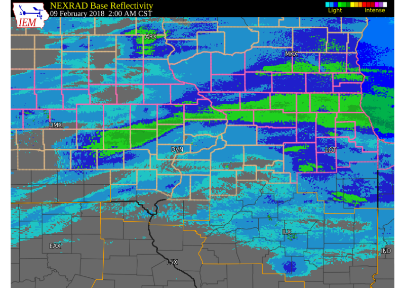
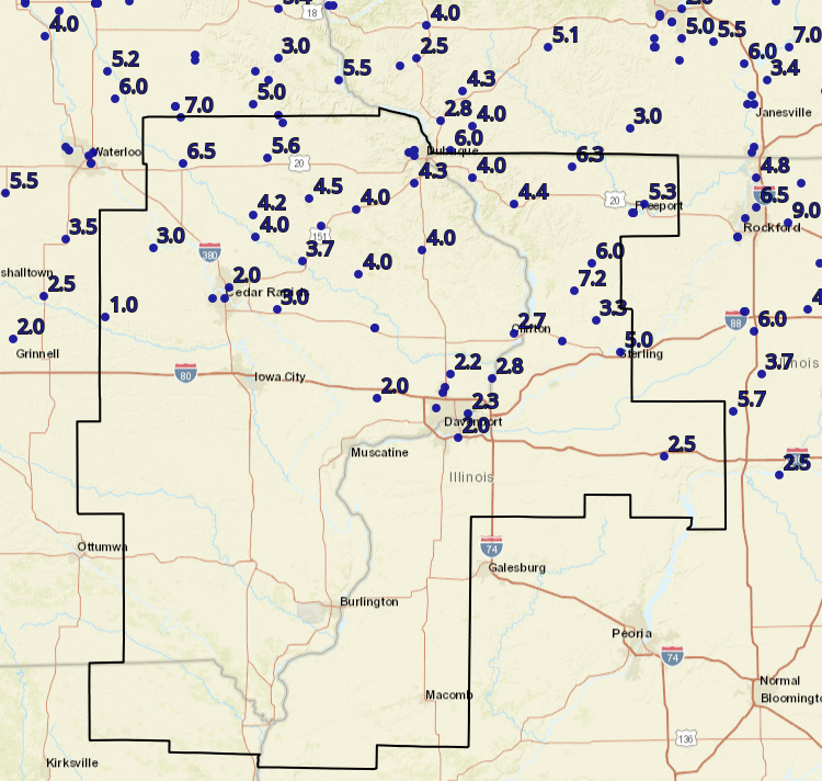
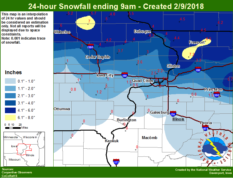
An upper level storm system tracked east across the eastern Great Plains into northern Missouri and Illinois on from Feb. 8-9, 2018, bringing widespread snow to portions of eastern Iowa and northwest Illinois. The heaviest snowfall fell along the Highway 20 corridor, where amounts of 6 to 8 inches were reported in Independence, Dubuque, and Freeport. To the south, around 2 to 5 inches fell from the Interstate 80 corridor to Highway 30. This page will update as more information becomes available. |
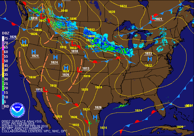 Surface Map |
Storm Reports
 |
.png) |
 |
| Interactive Map Link | Iowa Snow Analysis Courtesy Iowa Environmental Mesonet |
Local Snowfall |
THE REPORTS BELOW ARE NOT NECESSARILY THE FINAL AMOUNT FOR EACH LOCATION.
Public Information Statement
National Weather Service Quad Cities IA IL
1055 AM CST Fri Feb 9 2018

...Snowfall Totals from February 8-9, 2018...

Location                     Amount    Time/Date       Lat/Lon
1 E Freeport                 8.0 in    0500 AM 02/09   42.29N/89.62W
2 WSW Chadwick               7.2 in    0836 AM 02/09   42.00N/89.92W
2 NNE Hazleton               7.0 in    0600 AM 02/09   42.64N/91.89W
Freeport                     6.5 in    0700 AM 02/09   42.29N/89.63W
1 ENE Independence           6.5 in    0539 AM 02/09   42.47N/91.88W
1 ENE Nora                   6.3 in    0916 AM 02/09   42.46N/89.93W
Lanark                       6.0 in    0500 AM 02/09   42.10N/89.83W
1 SE Asbury                  6.0 in    0803 AM 02/09   42.51N/90.75W
Manchester                   5.6 in    0700 AM 02/09   42.49N/91.46W
3 SW Winneshiek              5.3 in    0700 AM 02/09   42.32N/89.57W
Rock Falls                   5.0 in    0500 AM 02/09   41.77N/89.69W
3 NW Greeley                 5.0 in    0657 AM 02/09   42.62N/91.38W
Hopkinton                    4.5 in    1012 AM 02/09   42.34N/91.25W
Elizabeth                    4.4 in    0630 AM 02/09   42.32N/90.22W
Dubuque Regional Arpt        4.3 in    0600 AM 02/09   42.40N/90.72W
Coggon                       4.2 in    0630 AM 02/09   42.28N/91.53W
Unionville                   4.0 in    0759 AM 02/09   41.81N/89.98W
Central City                 4.0 in    0837 AM 02/09   42.20N/91.52W
Cascade                      4.0 in    0757 AM 02/09   42.30N/91.01W
Fulton                       4.0 in    1027 AM 02/09   42.15N/90.68W
Monticello                   4.0 in    0800 AM 02/09   42.24N/91.19W
Galena                       4.0 in    0700 AM 02/09   42.42N/90.43W
Wyoming                      4.0 in    0900 AM 02/09   42.06N/91.00W
Anamosa                      3.7 in    0630 AM 02/09   42.11N/91.28W
1 SSW Coleta                 3.3 in    0837 AM 02/09   41.89N/89.81W
3 W Cedar Rapids             3.2 in    0843 AM 02/09   41.97N/91.73W
1 NE Mount Vernon            3.0 in    0759 AM 02/09   41.93N/91.41W
Vinton                       3.0 in    0700 AM 02/09   42.16N/92.03W
1 SW Cordova                 2.8 in    0833 AM 02/09   41.67N/90.33W
1 ESE Clinton                2.7 in    0823 AM 02/09   41.84N/90.22W
Lowden                       2.6 in    0730 AM 02/09   41.86N/90.92W
Davenport Municipality       2.6 in    0600 AM 02/09   41.62N/90.58W
Eldridge                     2.5 in    0834 AM 02/09   41.64N/90.57W
Princeton                    2.5 in    0700 AM 02/09   41.38N/89.47W
1 ENE Riverdale              2.3 in    0837 AM 02/09   41.54N/90.45W
Park View                    2.2 in    0633 AM 02/09   41.69N/90.54W
Davenport                    2.0 in    0754 AM 02/09   41.56N/90.61W
Moline Quad-City Airport     2.0 in    0600 AM 02/09   41.45N/90.50W
Durant                       2.0 in    0813 AM 02/09   41.60N/90.91W
3 NNE Cedar Rapids           2.0 in    0523 AM 02/09   42.01N/91.65W
Belle Plaine                 1.0 in    0800 AM 02/09   41.90N/92.27W

Observations are collected from a variety of sources with varying
equipment and exposures. We thank all volunteer weather observers
for their dedication. Not all data listed are considered official.

$$
Highlighted locations are official NWS observations.
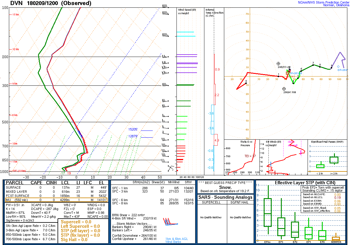
Environment
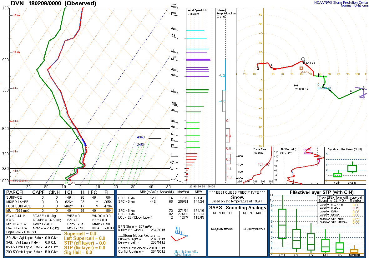 |
 |
|
| Figure 1: 00Z 2/9 DVN Sounding | Figure 2: 12Z 2/9 DVN Sounding |
 |
Media use of NWS Web News Stories is encouraged! Please acknowledge the NWS as the source of any news information accessed from this site. |