Quad Cities, IA/IL
Weather Forecast Office
Overview
|
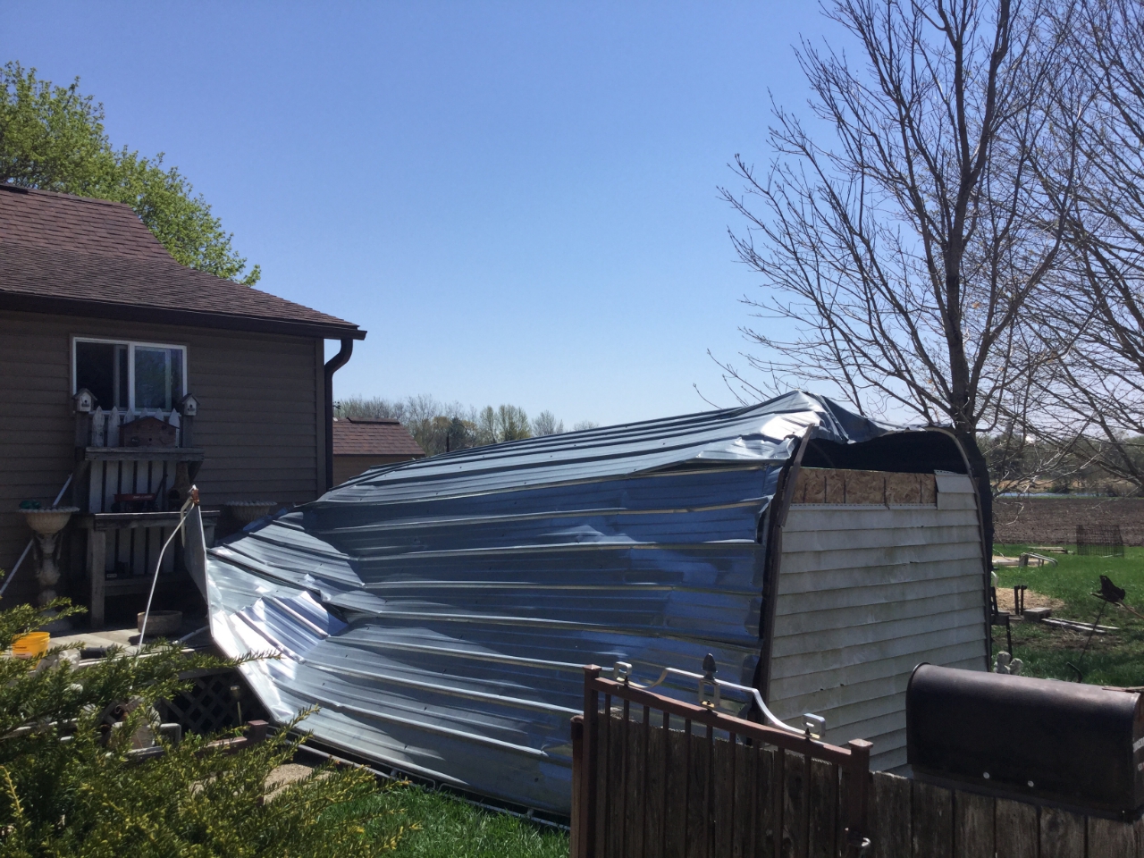
A fast moving line of showers and thunderstorms tracked east over eastern Iowa late Thursday evening. A brief, weak tornado touched down just northwest of Olin, IA damaging a metal shed and displacing a fire hydrant.
|
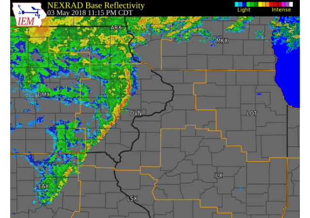 Radar Image (11:15 P.M.) (IEM) (Click to zoom) (Click here for Animation) |
Tornadoes:
|
Tornado - Olin, IA
Track Map 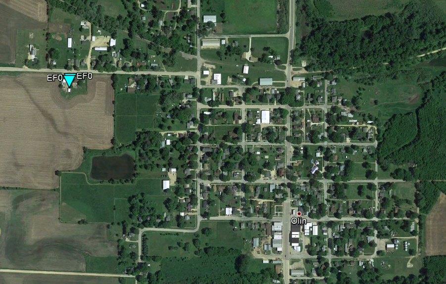 
Downloadable KMZ File |
||||||||||||||||
The Enhanced Fujita (EF) Scale classifies tornadoes into the following categories:
| EF0 Weak 65-85 mph |
EF1 Moderate 86-110 mph |
EF2 Significant 111-135 mph |
EF3 Severe 136-165 mph |
EF4 Extreme 166-200 mph |
EF5 Catastrophic 200+ mph |
 |
|||||
Photos & Video:
 |
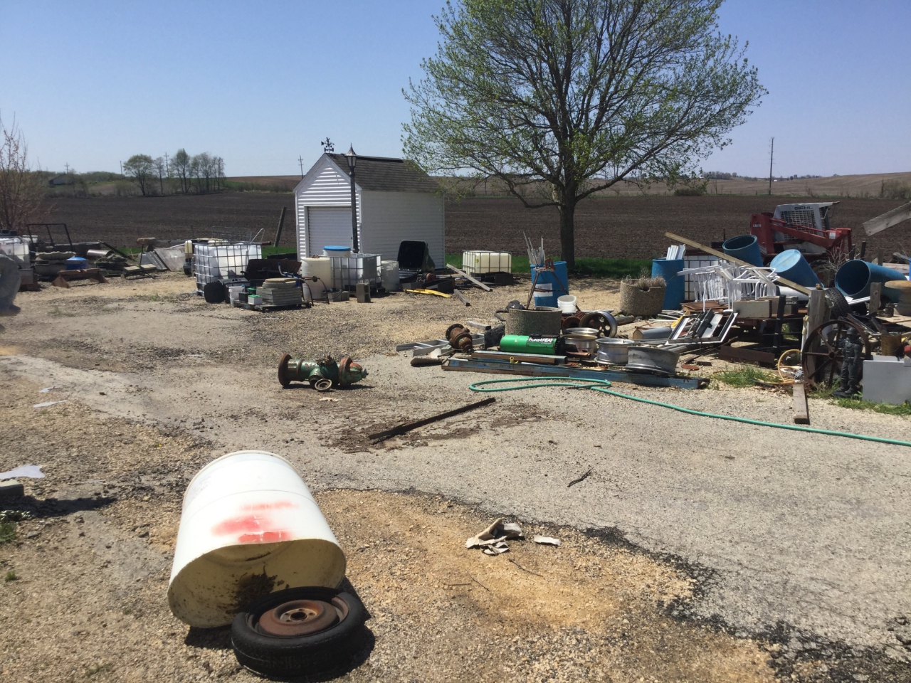 |
| Olin, IA (NWS Survey) |
Olin, IA (NWS Survey) |
Environment
 |
 |
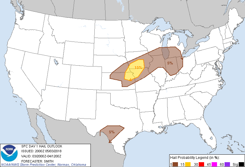 |
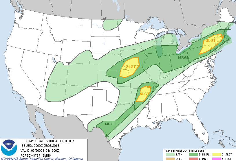
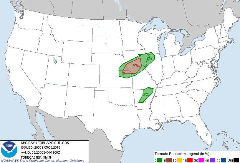
| Figure 1: SPC Day 1 Outlook (20:00 UTC) | Figure 2: SPC Day 1 Tornado Outlook (20:00 UTC) | Figure 3: SPC Day 1 Hail Outlook (20:00 UTC) |
 |
 |
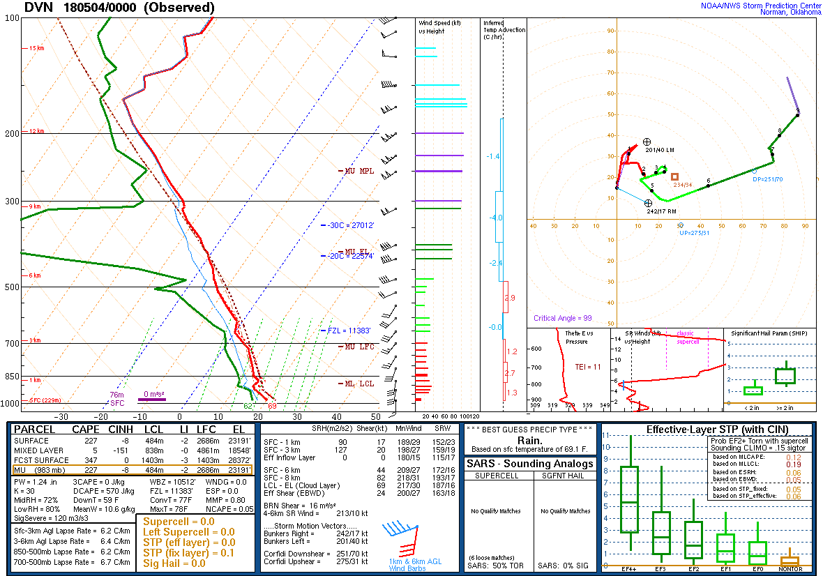 |
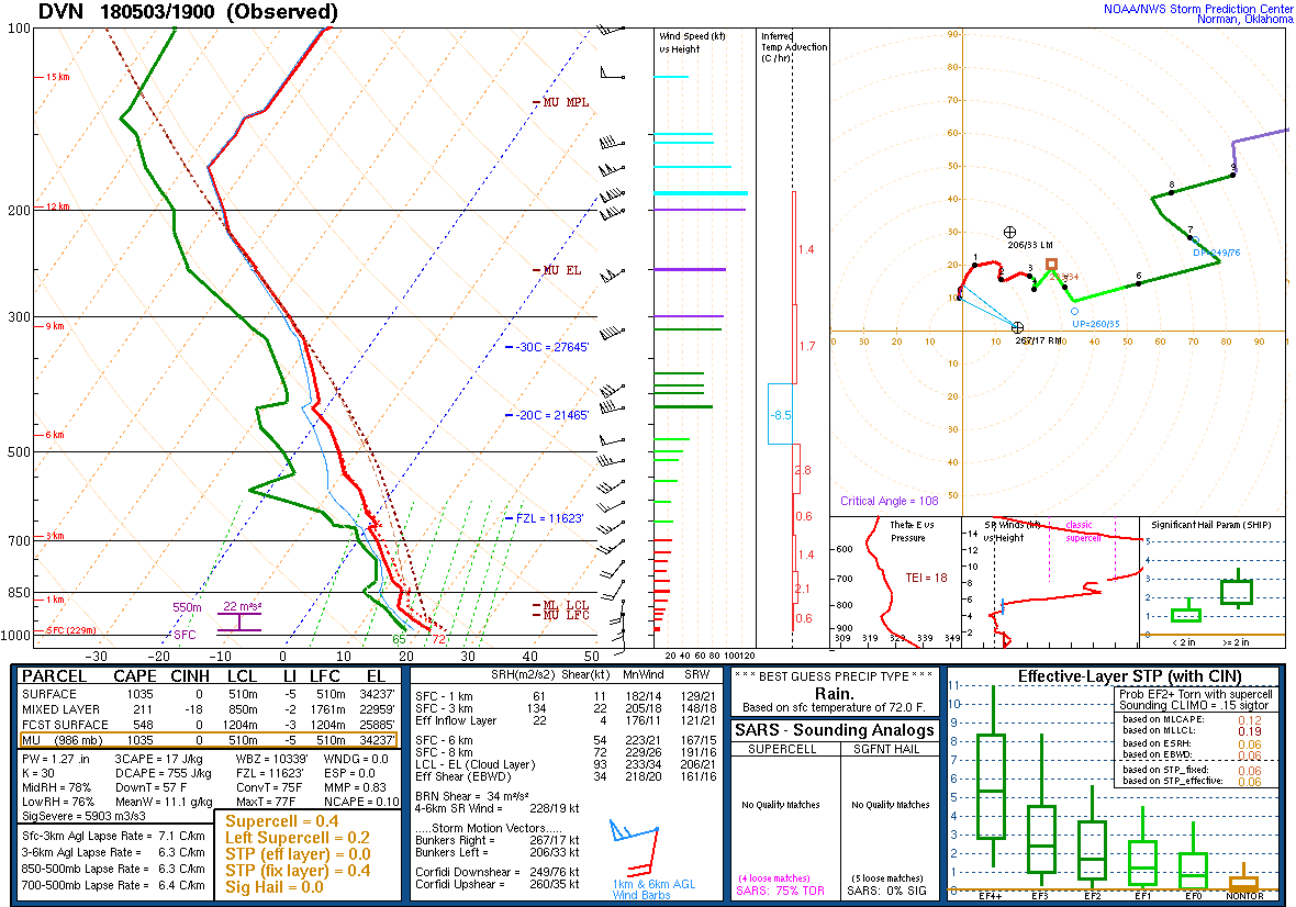
| Figure 4: SPC Day 1 Wind Outlook (20:00 UTC) | Figure 5: DVN Sounding: 5/3/18 19z | Figure 6: DVN Sounding: 5/4/18 00z |
 |
Media use of NWS Web News Stories is encouraged! Please acknowledge the NWS as the source of any news information accessed from this site. |
|
Hazardous Weather
Watches, Warnings, & Advisories
Briefing
Hazards Page
View Local Storm Reports
Submit Report
Road Reports
Text Products
Forecasts
Fire Weather
Briefing
Hourly Forecast Graphs
Forecast Discussion
User-Defined Area
Activity Planner
Local Forecasts
Space Weather
Text Products
River Graphs
Airport Forecasts
Snow and Ice Probabilities
Winter Storm Severity Index (WSSI)
Current Conditions
Observations
Drought Monitor
Radar
Satellite
Text Products
Rivers and Lakes
River Graphs
Sunrise/Sunset Tables
Seasons (Equinoxes/Solstices)
Road Reports
Past Weather
Recent Observation History
Climate Summaries
Past Events
Climate Normals/Averages
Climate Records
Climate/Almanac Data
Holiday Climatology
Climate Maps
Climate Graphs
Observation Site History
Sunrise/Sunset Tables
US Dept of Commerce
National Oceanic and Atmospheric Administration
National Weather Service
Quad Cities, IA/IL
9040 N Harrison Street
Davenport Municipal Airport
Davenport, IA 52806-7326
563-386-3976
Comments? Questions? Please Contact Us.

