Overview
|
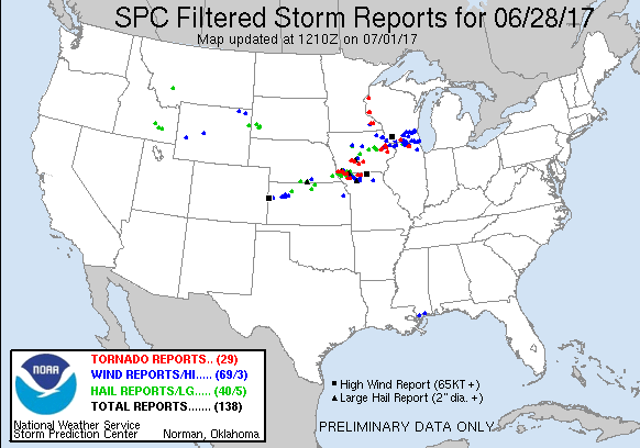
Here is a preliminary summary of the tornadoes that occurred on June 28, 2017. |
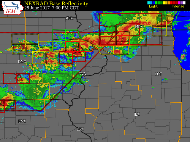
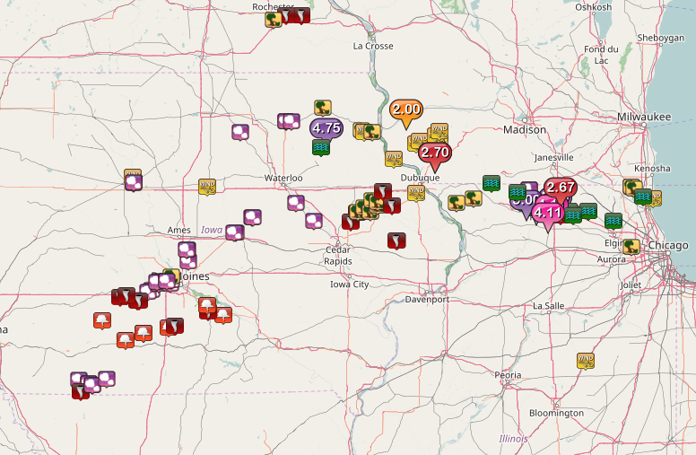 Regional Storm Reports |
Tornadoes:
|
Tornado 1 - Central City/Prairieburg
Track Map 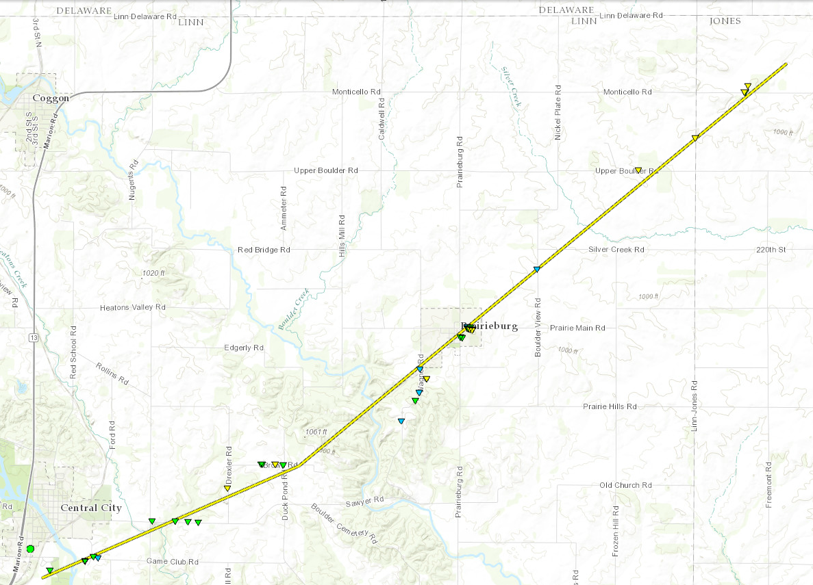 
|
||||||||||||||||
|
Tornado 2 - N Monticello
Track Map 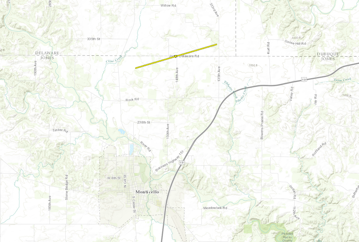
|
||||||||||||||||
|
Tornado - Oxford Junction
Track Map 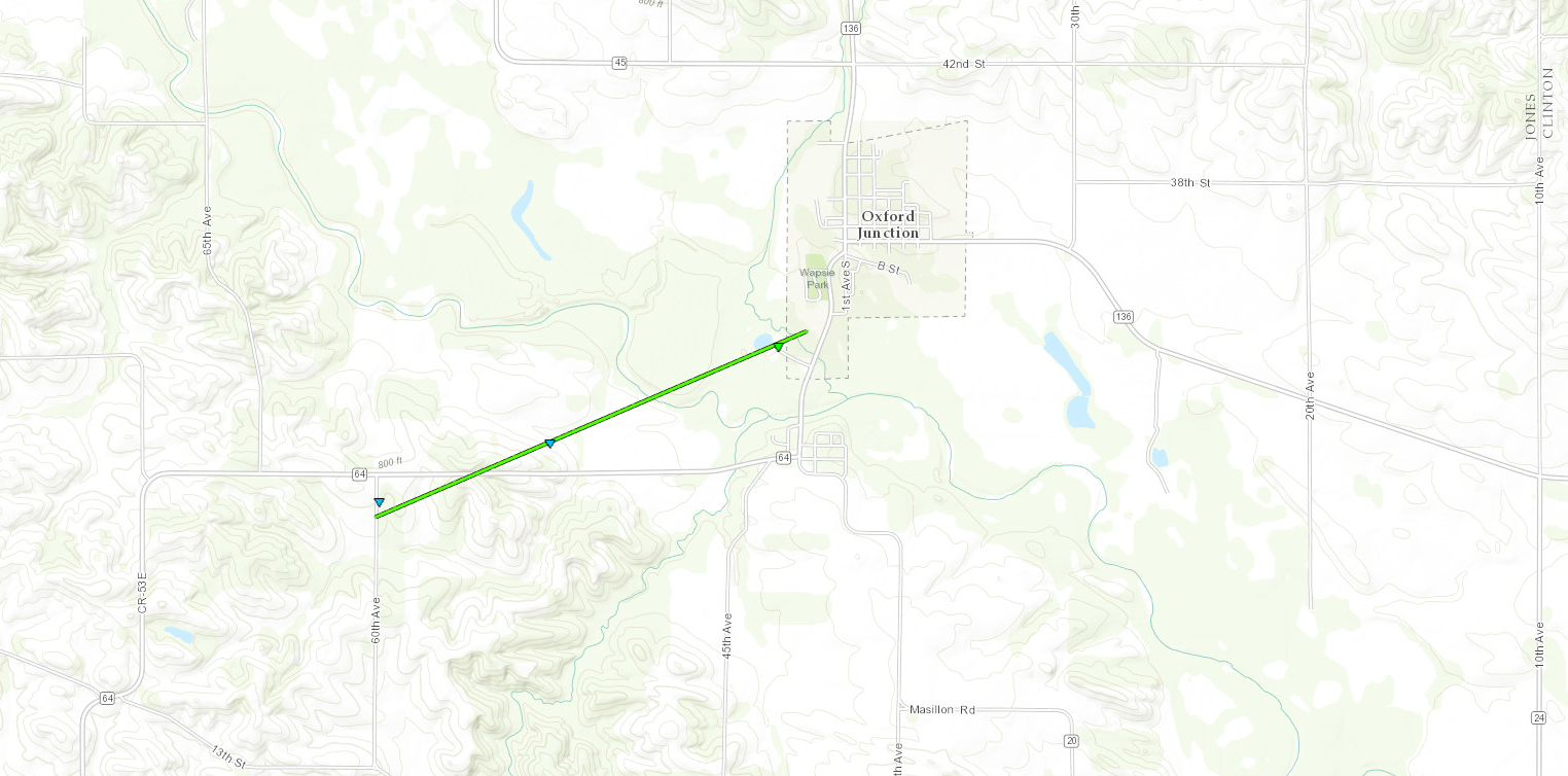
|
||||||||||||||||
|
Tornado - 2 SE Vinton, IA
Track Map 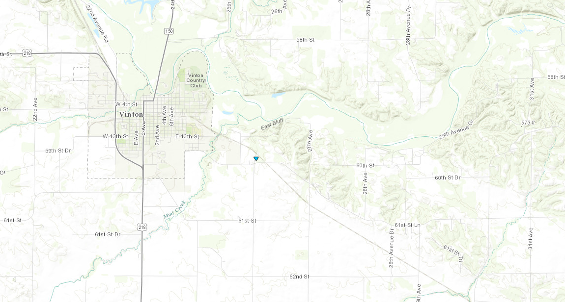
Downloadable KMZ File |
||||||||||||||||||
The Enhanced Fujita (EF) Scale classifies tornadoes into the following categories:
| EF0 Weak 65-85 mph |
EF1 Moderate 86-110 mph |
EF2 Significant 111-135 mph |
EF3 Severe 136-165 mph |
EF4 Extreme 166-200 mph |
EF5 Catastrophic 200+ mph |
 |
|||||
 |
Media use of NWS Web News Stories is encouraged! Please acknowledge the NWS as the source of any news information accessed from this site. |
|