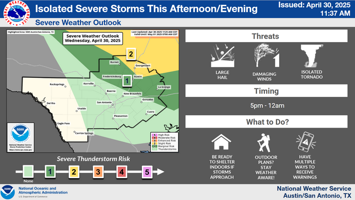
Continued Flood and Rip Current Risk from Chantal; Lingering Flood Watches in Central Texas
Chantal now a Tropical Depression. Flash flood concerns continue across portions of central North Carolina into Monday. Life-threatening surf and rip currents conditions are expected to continue at beaches along the U.S. east coast from northeastern Florida to the Mid-Atlantic states during the next day or so. Flood Watches and recovery continue across central Texas.
Read More >
A Flood Watch has been extended through 7 PM Sunday. Additional rainfall amounts of 2-4 inches are possible with isolated pockets of 10 inches somewhere in the watch area. It is very difficult to pinpoint where exactly the isolated heavy amounts will occur in this pattern. Stay Weather Aware!
During a flood, water levels and the rate at which the water is flowing can quickly change. Get to higher ground. Do not drive or walk into water. It only takes 6 inches of water to knock you off your feet. Stay informed by monitoring local radio and television for updates. weather.gov/safety/flood
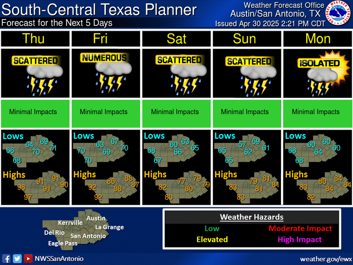
Chances of rain with locally heavy rains possible today and Monday, decrease on Tuesday, then end for the remainder of this coming week. Relatively "cooler" temperatures continue today into Monday, then warm the remainder of this coming week.


 Austin/San Antonio Radar
 Weather Map
 Satellite Imagery
 Del Rio Radar
 Digital Forecast Map
 Tropical Outlook
 Drought Status
 Air Quality
 Fire Weather Forecasts
 Observed Rainfall
 Observed Temperatures
 Daily Climate Graphs