For an explanation on how to use this page click here
880
SXUS43 KFGF 282240
RECFGF
Recreation Forecast
National Weather Service Grand Forks ND
440 PM CST Fri Nov 28 2025
Here are the Recreation Area Forecasts...
Wave height forecasts represent the average of the highest 33% of
waves that occur in a given period. Since the significant wave
height is an average of the largest waves, mariners should be
aware that many individual waves will be higher.
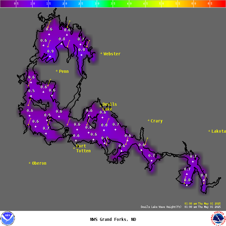
For Devils Lake...
.TONIGHT...Northeast winds around 10 mph. Waves 1 foot or less.
Scattered flurries early in the evening, then chance of snow in
the late evening and overnight. Cloudy. Lows around 16.
.SATURDAY...Northwest winds 10 to 15 mph. Waves 1 foot or less.
Scattered flurries in the morning. Mostly cloudy. Highs 15 to 25.
.SATURDAY NIGHT...Northwest winds 10 to 20 mph. Waves 1 foot or
less building to 1 to 2 feet after midnight. Mostly cloudy in the
evening then clearing. Lows around 5.
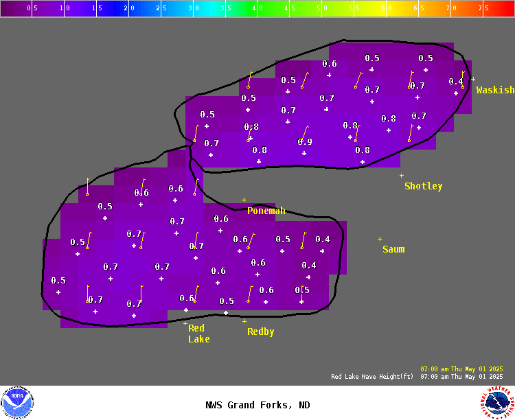
For the Upper and Lower Red Lakes...
.TONIGHT...Light winds. Waves less than 1 foot. Cloudy. Lows
around 18.
.SATURDAY...Light winds becoming northwest around 10 mph late in
the afternoon. Waves 1 foot or less. Scattered flurries in the
morning. Mostly cloudy. Highs in the 20s.
.SATURDAY NIGHT...Northwest winds 10 to 20 mph. Waves 1 foot or
less. Mostly cloudy. Lows around 13.
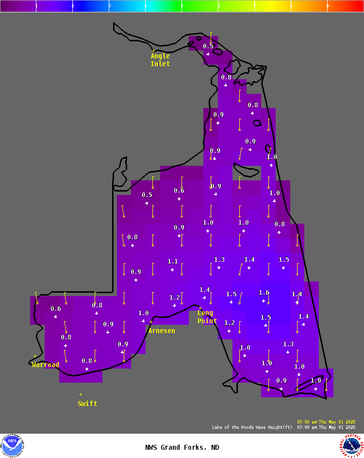
For Lake of the Woods...
.TONIGHT...Light winds. Waves 1 foot or less. Cloudy. Lows around
19.
.SATURDAY...Light winds becoming northwest around 10 mph in the
afternoon. Waves 1 foot or less. Scattered flurries early in the
morning. Mostly cloudy. Highs in the 20s.
.SATURDAY NIGHT...Breezy. Northwest winds 15 to 25 mph. Waves
1 to 3 feet. Mostly cloudy. Lows around 15.
$$
| Lake Wind/Wave Forecasts | ||
| Devils Lake | Red Lake | Lake of the Woods |
 Click on image for 2 day forecast |
 Click on image for 2 day forecast |
 Click on image for 2 day forecast |
| Lake of the Woods Buoy | ||
Notice: Wave height forecasts represent the average of the highest one-third (33%) of waves (measured from trough to crest) that occur in a given period. Since the Significant Wave Height is an average of the largest waves, mariners should be aware that many individual waves will probably be higher.

