Sunday, July 11, 2010, brought isolated severe thunderstorms to a small part of south central Nebraska for
the second consecutive evening, as a weak upper level disturbance interacted with an unstable airmass. Western Dawson County again took the brunt of this activity, as an isolated supercell storm moved in from Lincoln and Custer Counties.
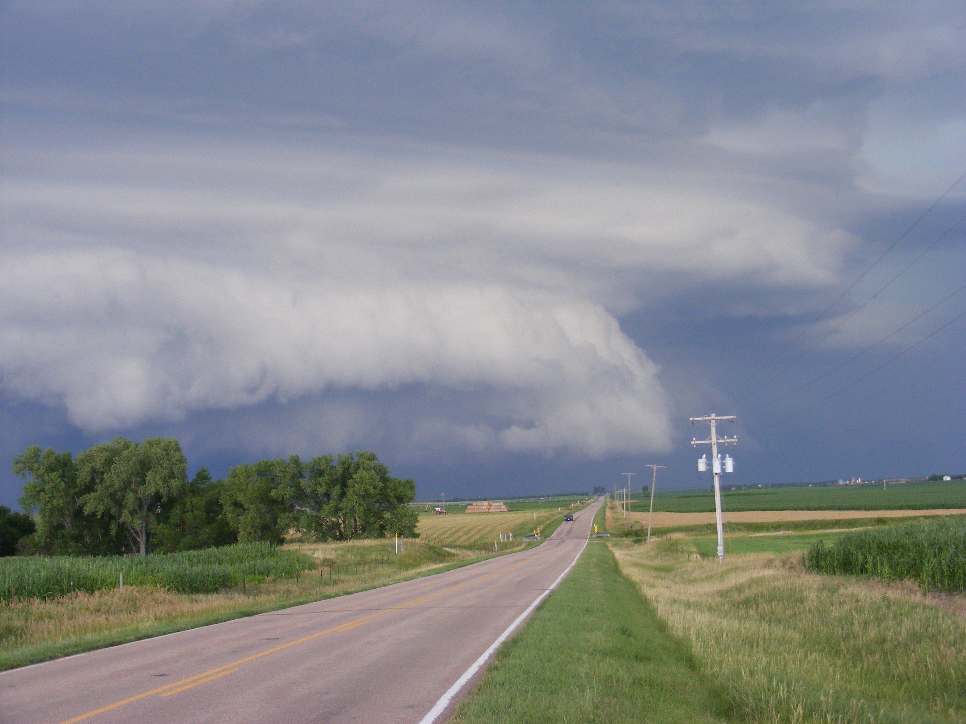
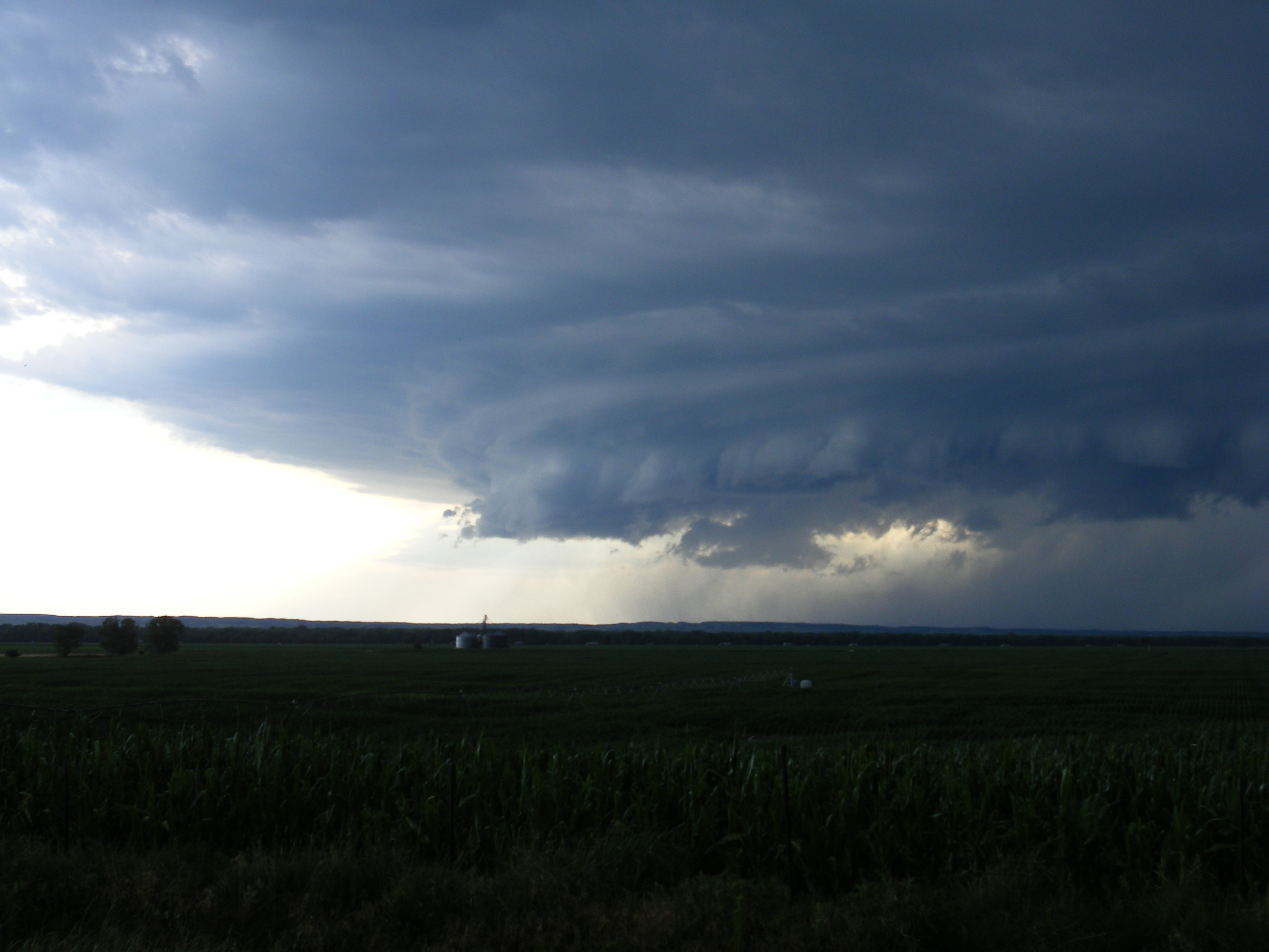
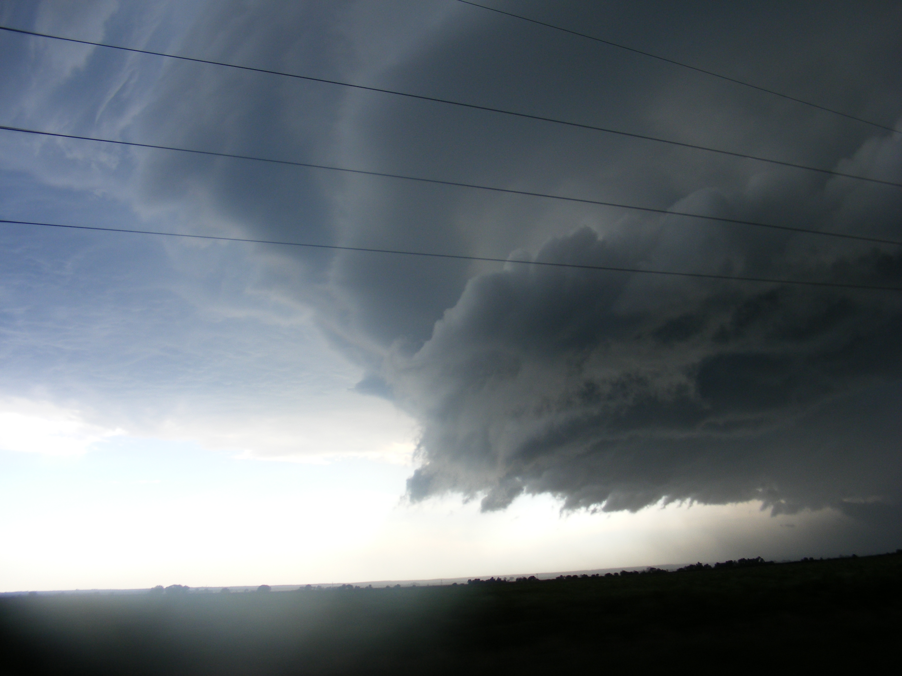
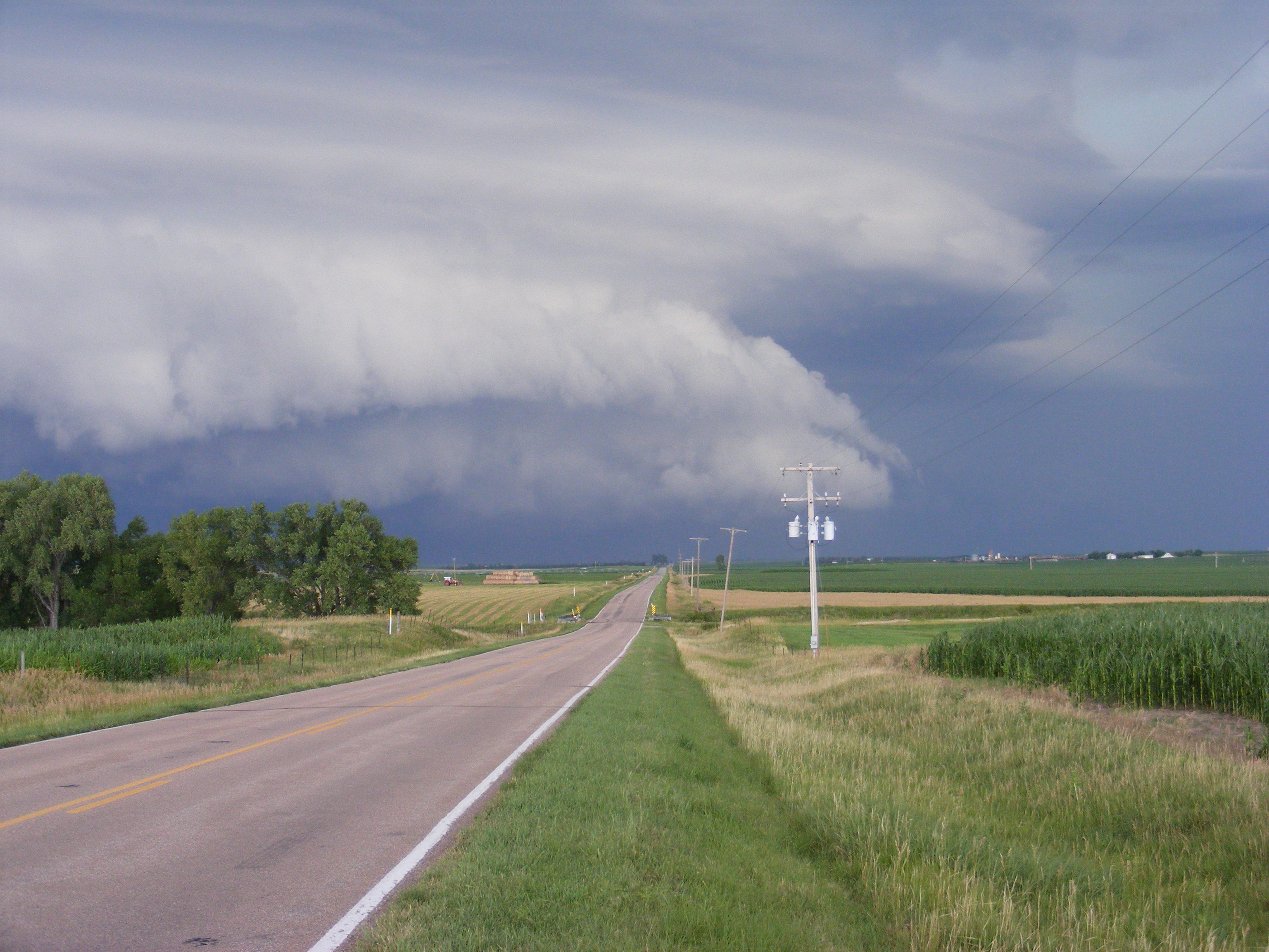
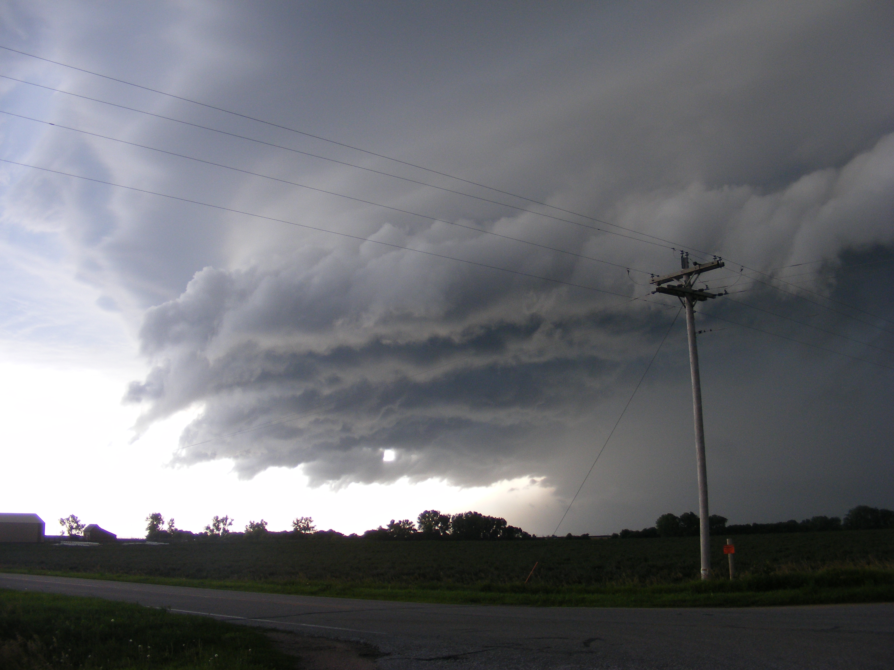
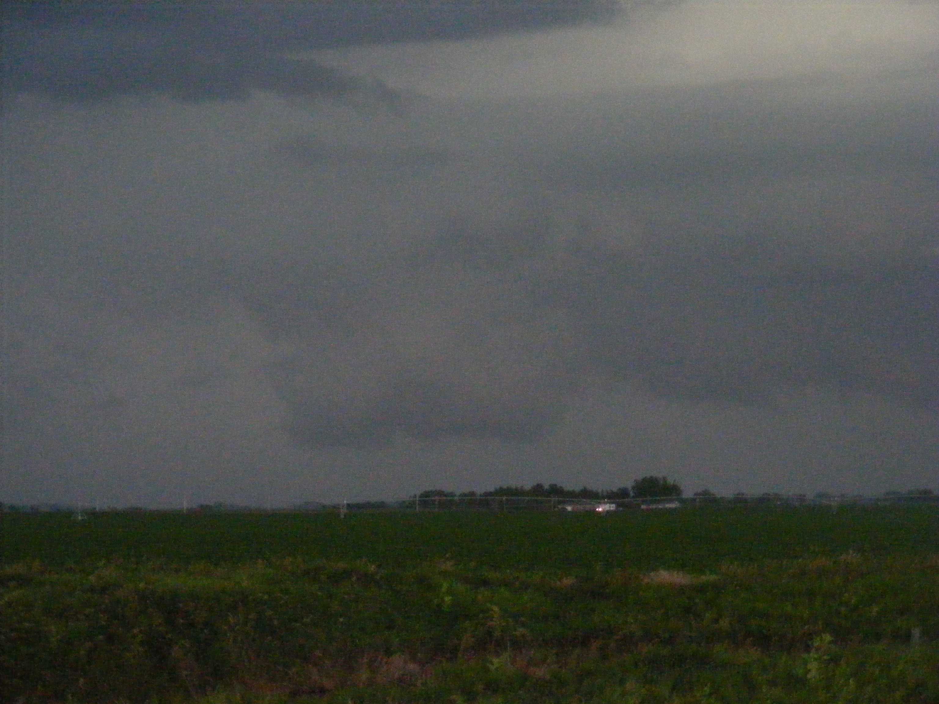
The following photographs of the storm were taken by Trevor Tetley. The first five pictures depict a shelf cloud, which is associated with the storm's gust front. The presence of a shelf cloud is indicative of strong straight line winds within a storm. A small wall cloud is shown in the lower right image.
 |
 |
 |
 |
 |
 |
Severe Weather:
Here are a few "highlights" of the event, based on reports received from storm spotters and local law enforcement/emergency management:
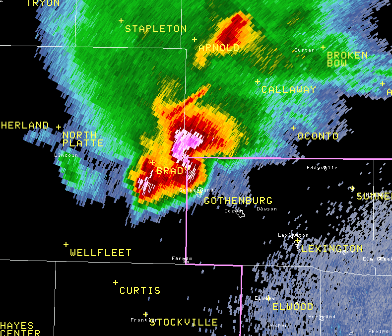
The radar image below depicts reflectivity from the NWS Hastings WSR-88D radar at 731 PM, just as the supercell storm was entering far northwestern Dawson County. The "curled out" shape just north of Gothenburg is an indicator of the very strong wind that accompanied this storm.
PRELIMINARY LOCAL STORM REPORT...SUMMARY
NATIONAL WEATHER SERVICE HASTINGS NE
904 PM CDT SUN JUL 11 2010
..TIME... ...EVENT... ...CITY LOCATION... ...LAT.LON...
..DATE... ....MAG.... ..COUNTY LOCATION..ST.. ...SOURCE....
..REMARKS..
0729 PM TSTM WND GST 7 NNW GOTHENBURG 41.02N 100.21W
07/11/2010 M94.00 MPH DAWSON NE TRAINED SPOTTER
94MPH WIND GUSTS MEASURED BY 2 ANEMOMETERS. TREE LIMBS
DOWN, POWER OUT, CORN FLATTENED.
0730 PM TSTM WND GST 1 N GOTHENBURG 40.94N 100.16W
07/11/2010 E50.00 MPH DAWSON NE TRAINED SPOTTER
ESTIMATED 50 MPH WINDS
0734 PM TSTM WND GST 4 NW GOTHENBURG 40.97N 100.22W
07/11/2010 M60.00 MPH DAWSON NE TRAINED SPOTTER
MEASURED 60 MPH GUST FROM HOME WEATHER STATION
0735 PM TSTM WND GST 7 NNW GOTHENBURG 41.02N 100.21W
07/11/2010 E70.00 MPH DAWSON NE PUBLIC
ESTIMATED 70 MPH WINDS AND NICKEL SIZED HAIL. BRANCHES
DOWN.
0755 PM TSTM WND DMG GOTHENBURG 40.93N 100.16W
07/11/2010 DAWSON NE TRAINED SPOTTER
6 INCH DIAMETER TREE BRANCHES DOWN. WINDS ESTIMATED AT 50
MPH. DIME SIZE HAIL.
0801 PM TSTM WND GST COZAD 40.86N 99.99W
07/11/2010 E50.00 MPH DAWSON NE CO-OP OBSERVER
ESTIMATED 50 MPH WINDS AND DIME SIZED HAIL
0811 PM HAIL 6 WSW LEXINGTON 40.75N 99.85W
07/11/2010 E1.00 INCH DAWSON NE STORM CHASER
QUARTER SIZED HAIL


 Follow us on YouTube