May 12, 2011 Severe Weather Event 3 Confirmed Brief Tornadoes Large Hail National Weather Service Radar (KUEX) loop |
 |
|
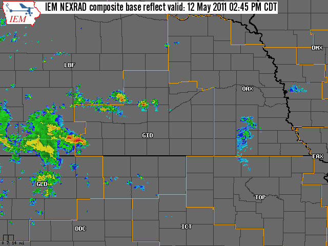
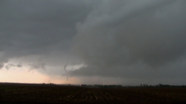
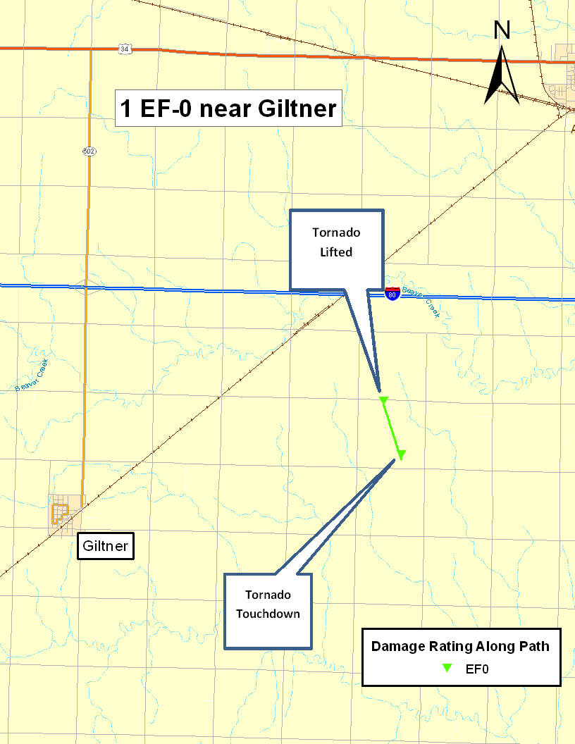
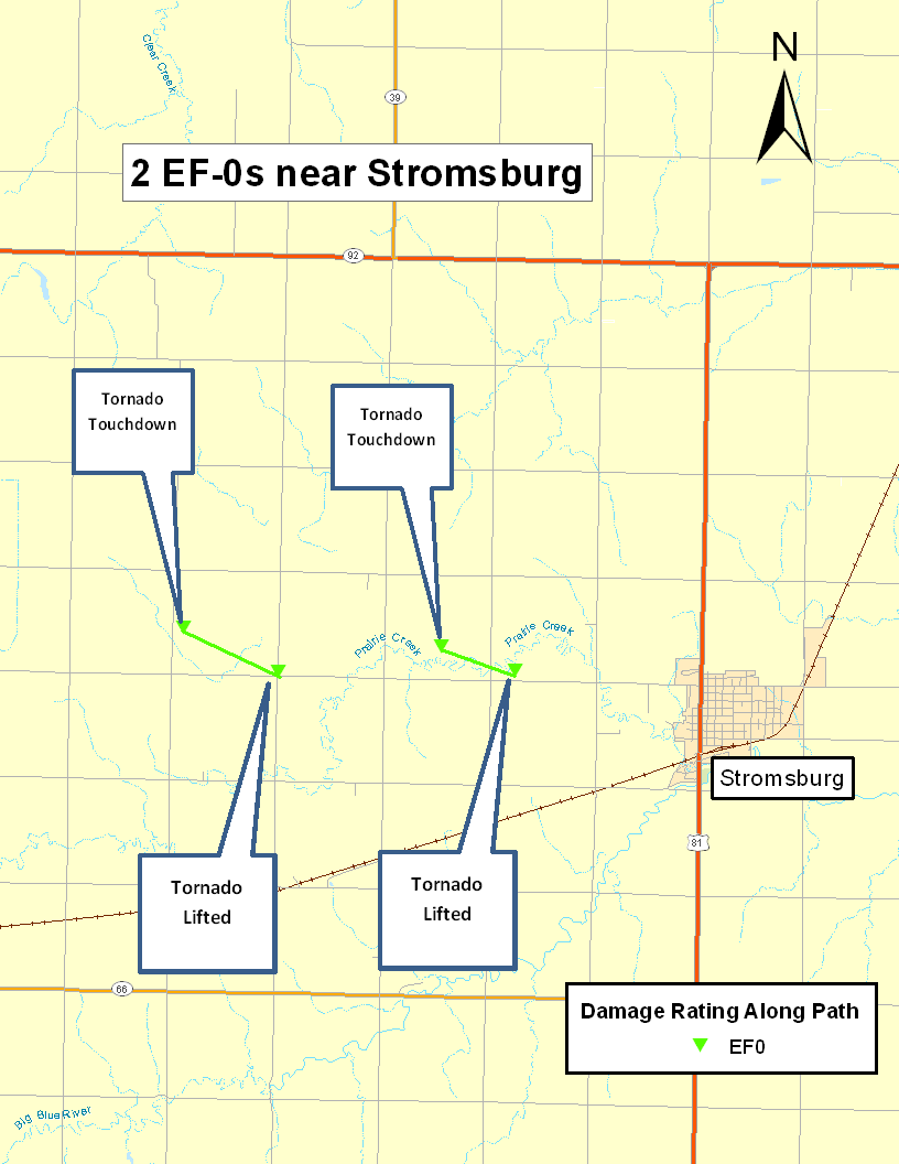
For the second day in a row, severe thunderstorms pounded portions of South Central Nebraska on Thursday, May 12, 2011, resulting in numerous reports of large hail, funnel clouds, torrential rainfall and even a few brief tornadoes. The vast majority of severe weather affected locations north of Interstate 80, and also near the Highway 81 corridor. This day featured a fairly "classic" meteorological setup for severe weather, with a low pressure system slowly lumbering east along the Nebraska/Kansas state line both at the surface and aloft, and a nearly stationary surface front arcing northeast and east from the low along the Interstate 80 corridor. The combination of these features, along with ample instability and low level wind shear resulted in this very active weather afternoon. There were numerous reports of large hail between 1-2 inches in diameter, with the first reports rolling in around 330 pm from southern Sherman County. The largest reported hail of 3 inches in diameter fell near Exeter in Fillmore County. Numerous funnel clouds were sighted in parts of Polk, Hamilton, York and Hall Counties, with at least a few of these funnels touching down as brief tornadoes. Please scroll down the page for more details on heavy rainfall and lowland flooding. Tornado Details: 3 brief tornadoes were confirmed from this event based on a variety of sources, including NWS surveys, storm chaser/spotter video and pictures, emergency management reports and WSR-88D radar data. Although there were numerous reports of funnels and brief tornadoes, these 3 tornado locations were considered the most reliable and consistent based on the overall collection of evidence. NWS Hastings extends a big "Thank You" to all individuals who provided storm reports, including photos and video. Hamilton County: 1 confirmed EF0 tornado Location: ABOUT 6 MILES SOUTH SOUTHWEST OF AURORA (BETWEEN AURORA AND GILTNER) Rating: EF0
- Tornado 1: Rating: EF0 - Tornado 2: Rating: EF0
|
 |
 |
||||||||||||||||||||||||||||||
|
Funnel cloud 2 miles west of Aurora, NE (Hamilton County). |
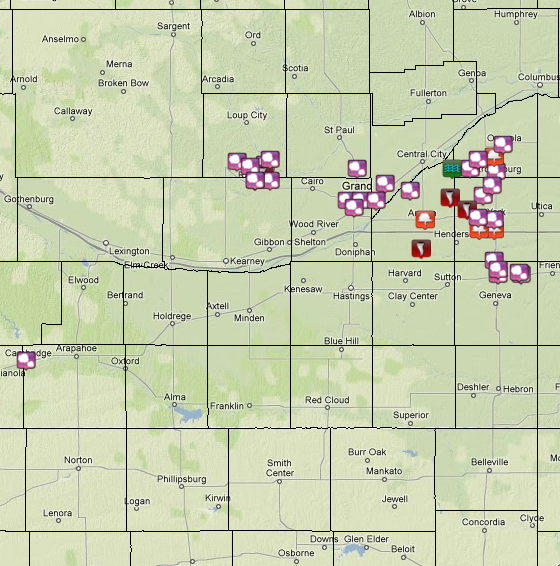
The Preliminary Storm Reports are shown on the Graphic Above (Click on image for a list of reports and to enlarge.) |
||||||||||||||||||||||||||||||
 |
 |
||||||||||||||||||||||||||||||
| Tornado 2 miles west of Stromsburg, NE (Polk County). Photograph courtesy of Dustin Wilcox. |
Funnel cloud 2 miles west of Stromsburg, NE (Polk County). Photograph courtesy of Dustin Wilcox. |
||||||||||||||||||||||||||||||
|
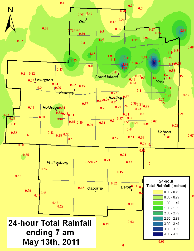
Heavy Rainfall: While the majority of the NWS Hastings 30-county coverage area received well under 1 inch of rain during the 24-hour period ending at 7am May 13th, a major exception occurred across a narrow east-west corridor north of Interstate 80. As can be seen in the radar loop above, persistent thunderstorms with heavy rain moved, or "trained" across areas extending through southern Sherman County, southern Howard County, far northern Hall County, Merrick County, northern Hamilton County, southwest Polk County, and northwest York County. Within this narrow zone, 24-hour rainfall totals of 1.5 to over 4 inches were reported. Some of these areas had just received 1-2 inches of rain in severe storms the day before on May 11th, thus pushing 48-hour rainfall totals into the 4-6 inch range. This resulted in extensive lowland flooding of fields and small creeks, with water also covering some roadways. While the table below focuses on 24-hour totals ending at 7am on May 13, one of the highest 48-hour totals during this time was measured by the NWS Cooperative Observer in Polk, with 6.12 inches. The table below lists some of the higher 24-hour rainfall amounts from Automated Weather Stations, National Weather Service Cooperative Observers, and NeRAIN Observers, and the image illustrates where the heavier rainfall occurred.
|
|||||||||||||||||||||||||||||||


 Follow us on YouTube