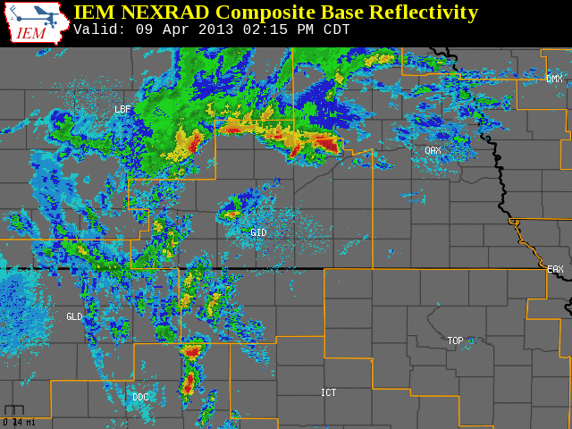
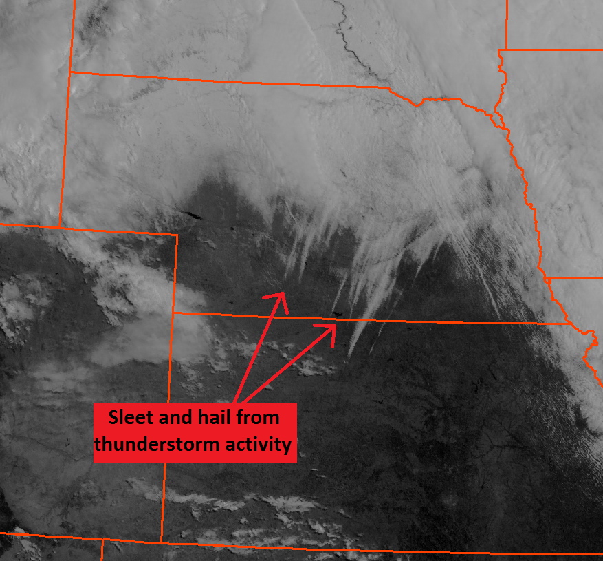
During the afternoon and evening hours of Tuesday, April 9, several thunderstorms developed and moved across portions of south central Nebraska and north central Kansas. Anybody across the area who observed these storms noticed a significant difference between these storms most other thunderstorms...instead of rainfall most locations observed an extended period sleet! Periods of hail were also observed with these thunderstorms, but sleet was the primary precipitation type with some locations reporting around a half inch of sleet accumulation. The first image below shows thunderstorm activity across the area Tuesday afternoon and evening on April 9. The second image below shows visible satellite imagery from the morning of Friday, April 12. Look closely at the satellite imagery...do you see the white streaks extending from southwest to northeast across south central Nebraska and north central Kansas? Those streaks are the sleet and hail which fell from the thunderstorm activity on Tuesday!


 Follow us on YouTube