
A cold front will cross the Great Lakes and Northeast U.S. through Monday with gusty winds and areas of rain showers. A strong atmospheric river is expected to move into the Pacific Northwest by midweek bringing a threat for moderate to heavy rainfall, gusty winds, and mountain snows for parts of Washington, Oregon, northern California, and the Sierra Nevada. Read More >
Event Summary |
||||||||||||||||||||||||||||||||||||||||||||||||||||||||||||||||||||||||||
|
||||||||||||||||||||||||||||||||||||||||||||||||||||||||||||||||||||||||||
|
||||||||||||||||||||||||||||||||||||||||||||||||||||||||||||||||||||||||||
|
|
||||||||||||||||||||||||||||||||||||||||||||||||||||||||||||||||||||||||||
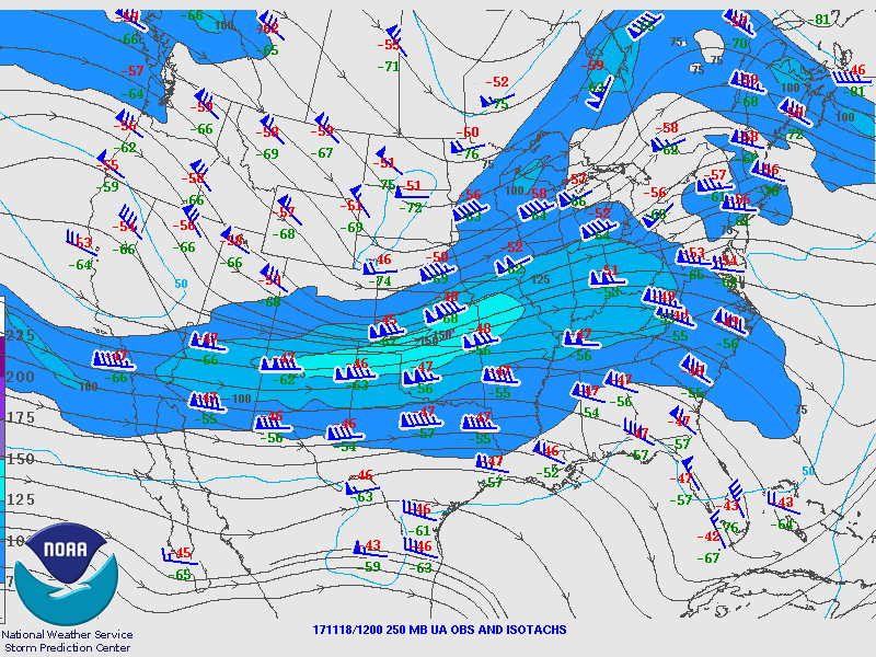
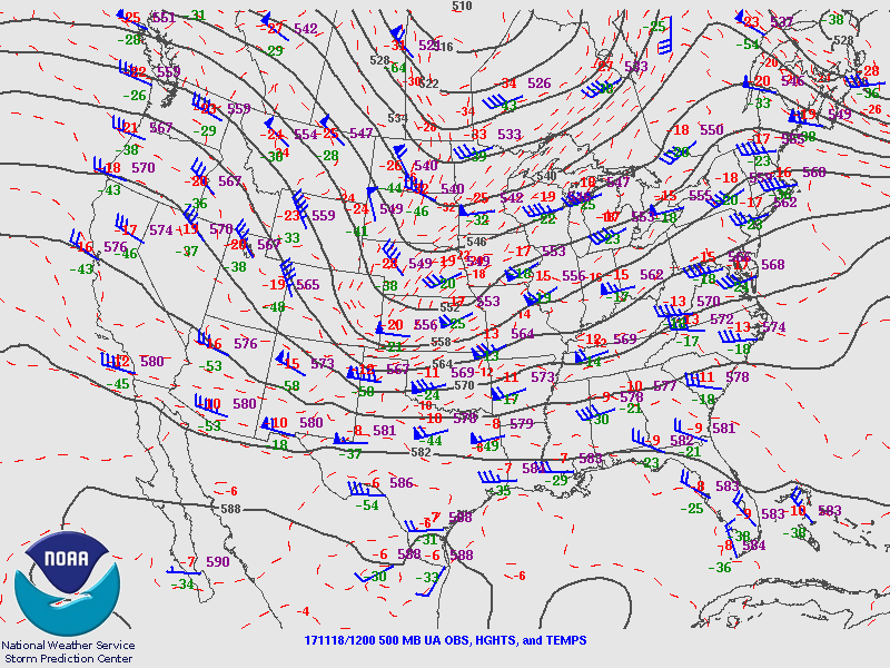
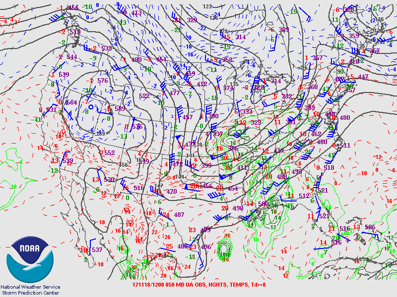
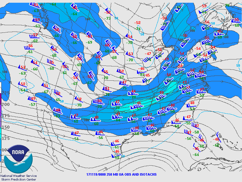
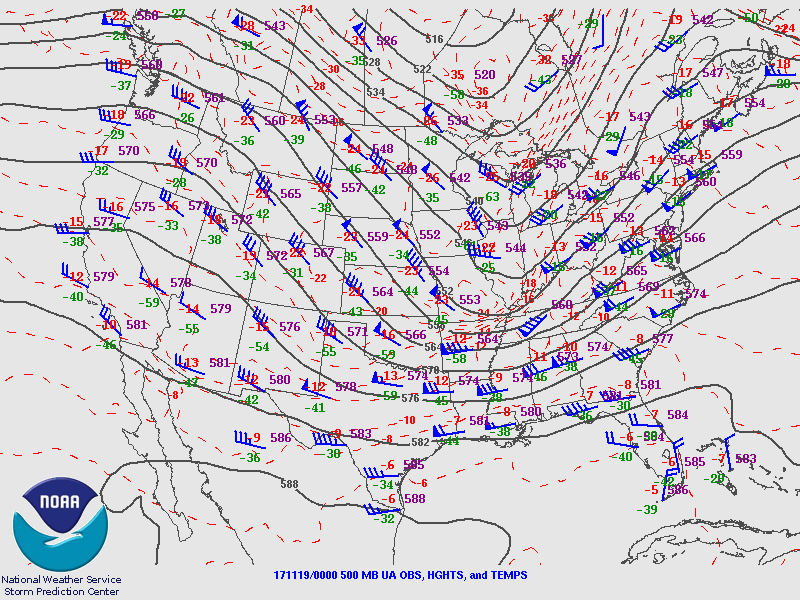
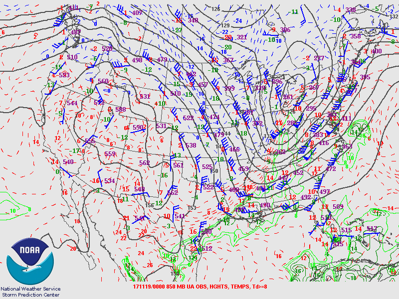
Upper Air Charts
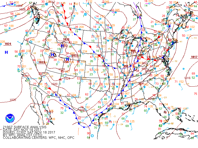
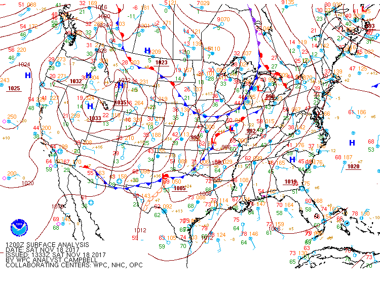
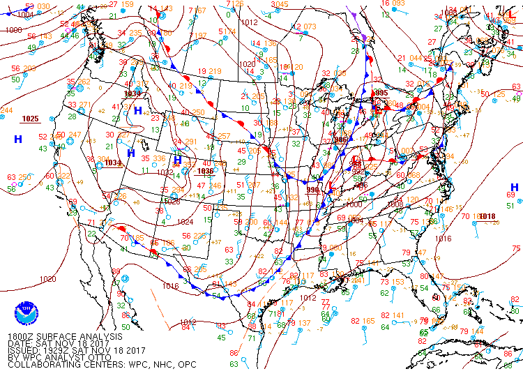
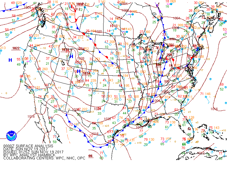
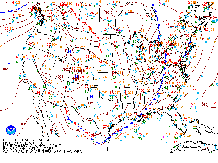
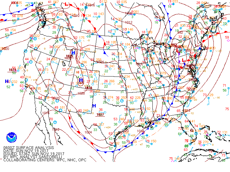
Surface Charts
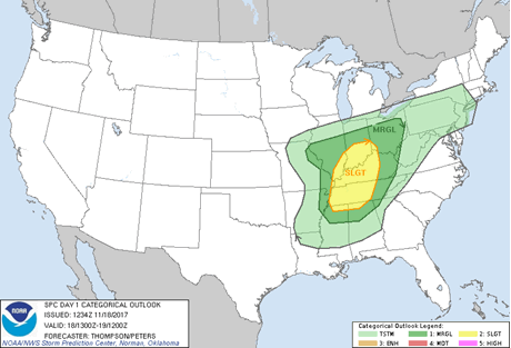
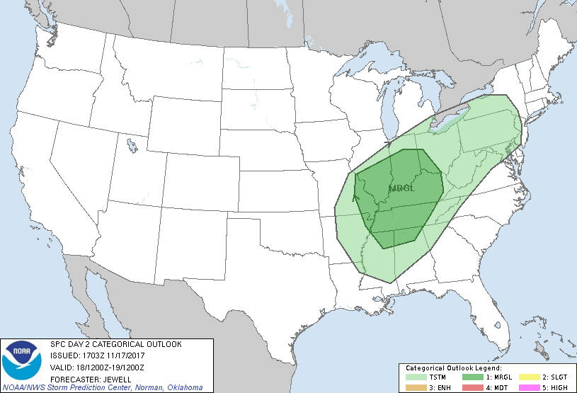
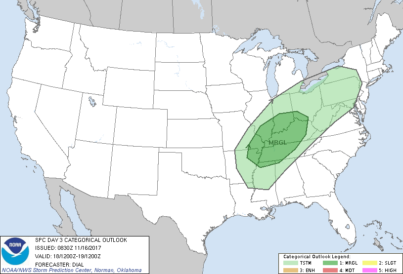
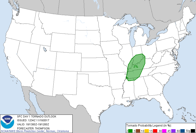
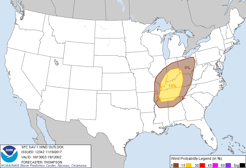
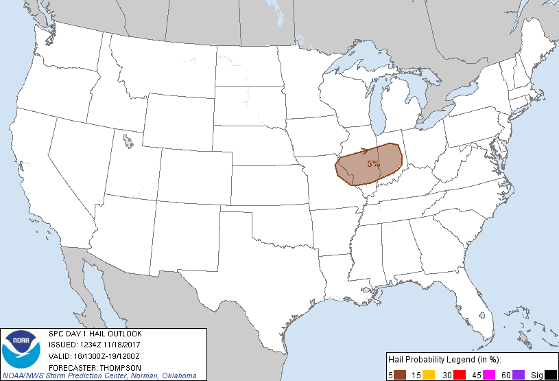
SPC Outlooks
|
||||||||||||||||||||||||||||||||||||||||||||||||||||||||||||||||||||||||||


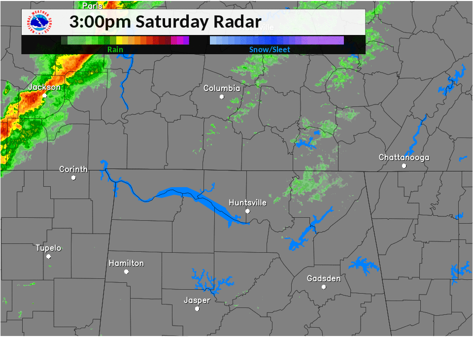
 Local Radar
 Weather Map