Overview
|
An upper level disturbance and associated strong Arctic cold front moving south across Mid-America supported areas of light to moderate snow spreading south across the region during the pre-dawn and morning hours of January 15th. Accumulations of around a dusting to one-half inch were common, although portions of central and southeast Kansas received 1 to 3 inches. Numerous traffic accidents no doubt occurred. The 0.3 inches measured at Wichita Eisenhower National Airport broke a record 393-day measurable snow drought in Wichita. Furthermore, breezy north winds and falling temperatures in wake of the Arctic cold front supported bitter cold wind chills. |
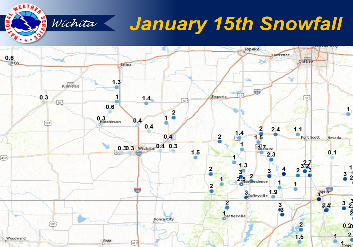 View entire accumulation map and list HERE |
Photos:
|
|
|
 |
|
|
|
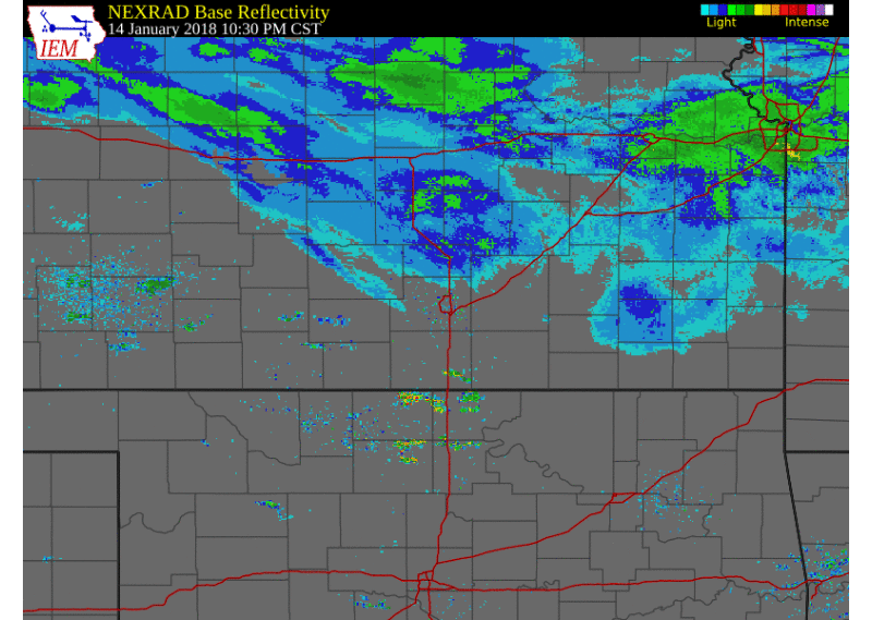 |
| Radar Animation from 1030pm Jan 14th through 12pm Jan 15th |
 |
Media use of NWS Web News Stories is encouraged! Please acknowledge the NWS as the source of any news information accessed from this site. |
|

