Overview: July 7th, 2016 Tornadoes
|
The combination of weak surface low pressure in south central Kansas and an outflow boundary oriented from west to east across central and eastern Kansas led to the development of thunderstorms on the evening of July 7th, 2016. Given recent heavy rains, ample daytime heating allowed dew point temperatures to reach the mid to upper 70s. These very moist low levels worked in concert with modestly steep mid-level lapse rates to allow an extremely unstable atmosphere, characterized by 6000+ J/kg of surface based CAPE, to develop. The extreme instability was also met with 40-50 knots of effective bulk shear and decent directional shear with height, as shortwave energy gradually clipped the region from the north. With all of the ingredients necessary for severe storms, by the late afternoon and early evening hours a cumulus field had developed and was oriented from west to east across the state along the residual outflow boundary. As convergence continued to increase along this boundary, multiple thunderstorms began to erupt around the Chase, Lyon, Greenwood county borders. One dominant right moving supercell began to take over as it dropped southeast across Greenwood county producing multiple tornadoes. The strongest tornado developed northwest of Eureka, where high-end EF-3 damage was found. As the storm cycled and continued to move towards Eureka, an EF-2 tornado developed on the northwest side of the city and moved southeast across the city before dissipating. There were also brief touchdowns in far southeast Chase county and northwest Wilson county.
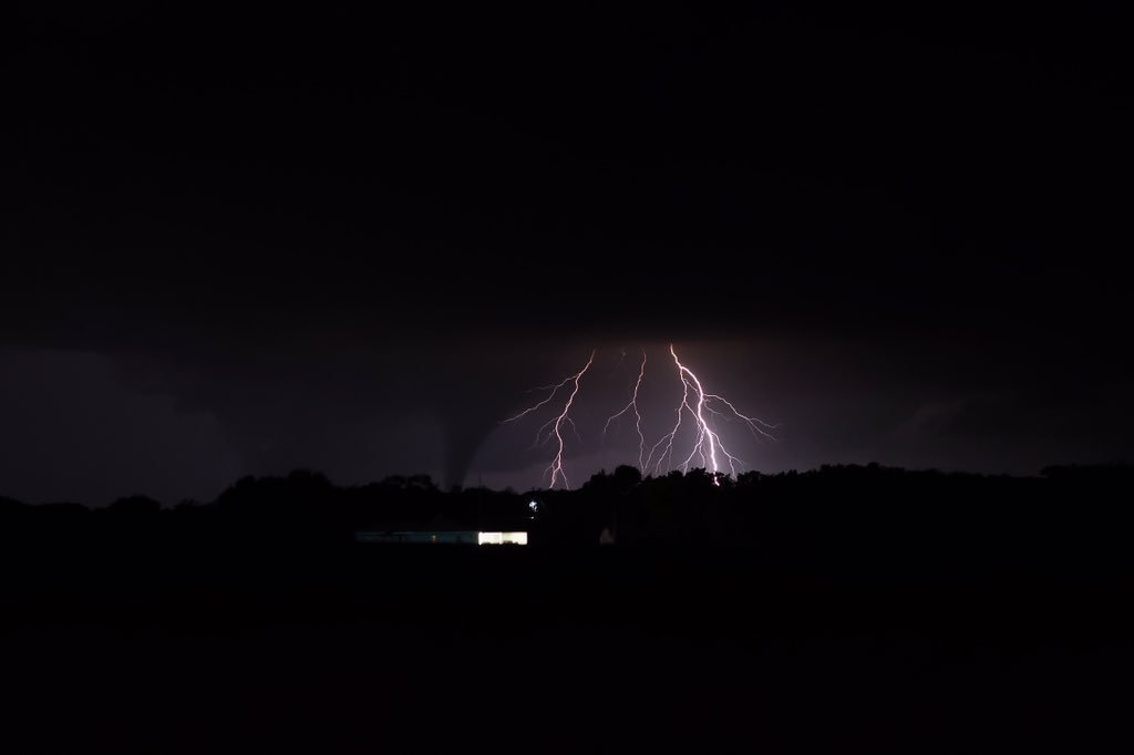
Photo of the tornado illuminated by cloud-to-ground lightning as it moved across Eureka, Kansas. Photo courtesy of Jason Keller via Twitter @jasonkellerpt
|
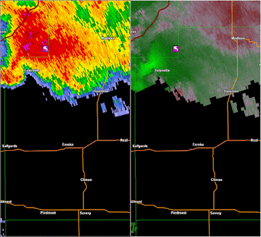
Reflectivity loop showing rotation about the surface low pressure anchored in south central Kansas on the evening of July 7th, 2016.
|
Tornadoes:
|
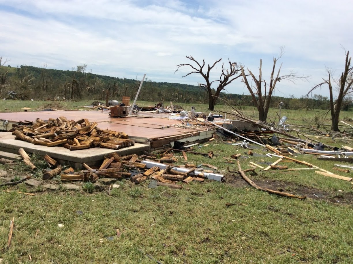
Tornado - NW of Eureka, Kansas (~10 miles NW of Eureka)
Track Map .jpg)  |
||||||||||||||||
|
||||||||||||||||
|
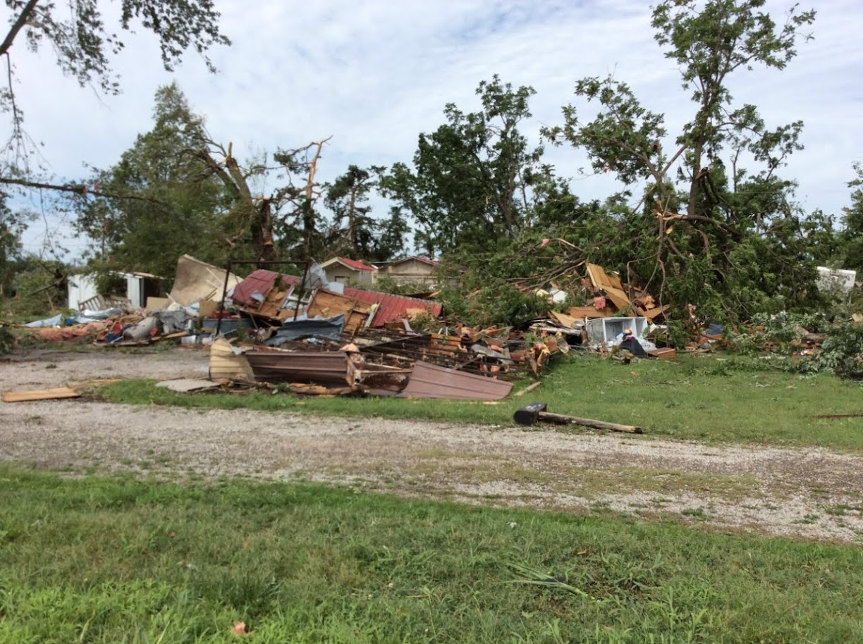
Tornado - Eureka, Kansas
Track Map 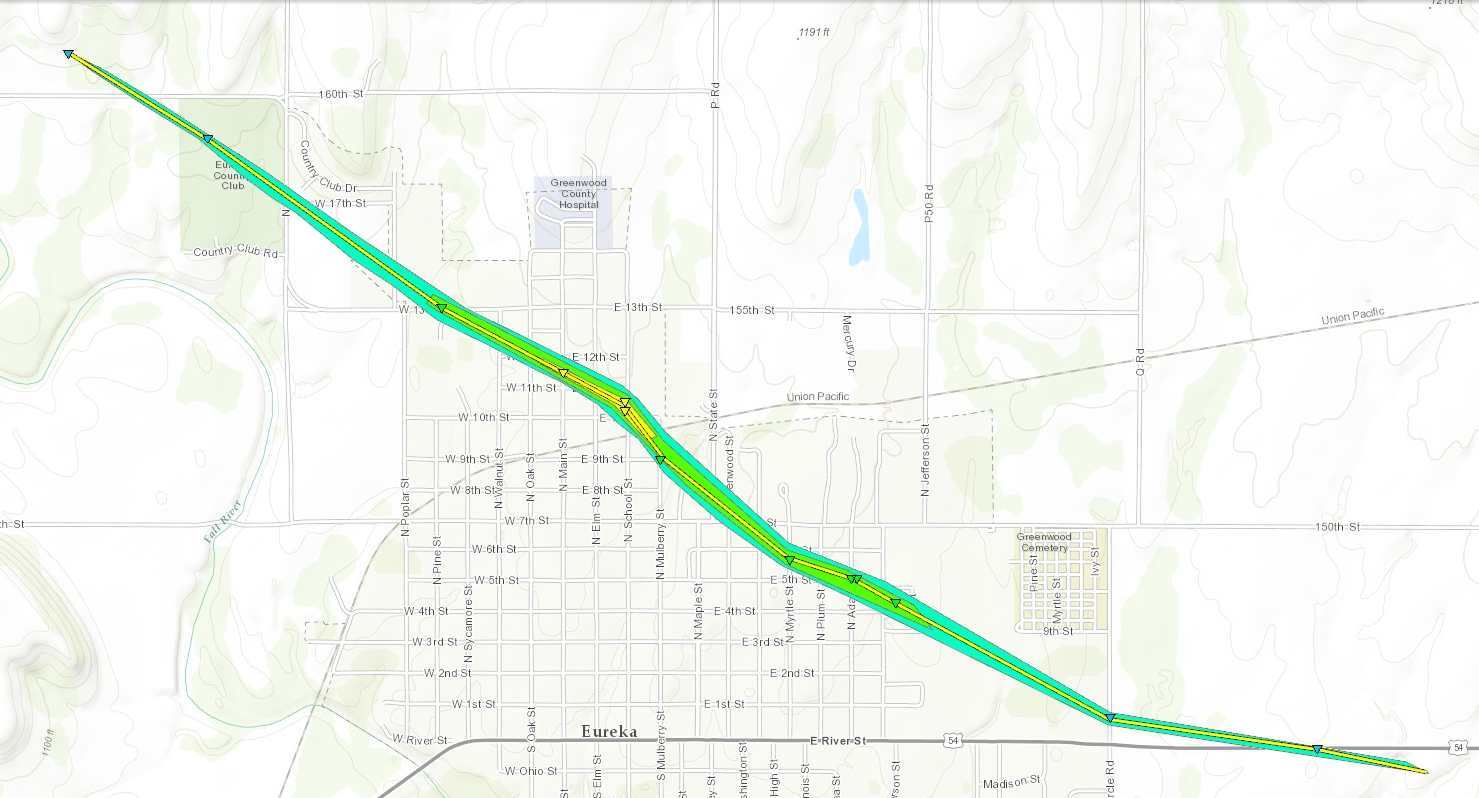
|
||||||||||||||||
|
||||||||||||||||
|
View of supercell from a baseball field in Wichita. Picture by Kevin Darmofal. |
The Enhanced Fujita (EF) Scale classifies tornadoes into the following categories:
| EF0 Weak 65-85 mph |
EF1 Moderate 86-110 mph |
EF2 Significant 111-135 mph |
EF3 Severe 136-165 mph |
EF4 Extreme 166-200 mph |
EF5 Catastrophic 200+ mph |
 |
|||||
Storm Reports

July Tornado Stats
With the handful of tornadoes that hit Chase, Greenwood and Wilson counties during the late evening hours on July 7th, one may inquire about the rarity of July Kansas tornadoes. According to the Storm Prediction Center's tornado database, 318 July Kansas tornadoes have occurred from 1950 through 2015. This averages out to roughly five July tornadoes per year across the state.
So at first glance, this was not an overly unusual event. However, when taking into account tornado strength, this was a rare occurrence. Out of the 318 July Kansas tornadoes, only four have been rated EF3 or stronger, with the Greenwood county EF3 on July 7th increasing that number to just five. No July Kansas tornado has ever been rated stronger than EF3. The last time a July EF3 tornado occurred across the state was last year on the 13th near Nickerson in Reno county. Before that was July 20, 1958 in Wallace county.
| Kansas July EF3 Tornadoes 1950-2016 | |||||
| Date | County | Length (Miles) | Width (Yards) | Injuries | Fatalities |
| July 15, 1956 | Lincoln | 7.1 | 880 | 0 | 0 |
| July 20, 1956 | Anderson | 69.5 | 880 | 0 | 0 |
| July 20, 1958 | Wallace | 3.3 | 700 | 4 | 0 |
| July 13, 2015 | Reno | 5.32 | 350 | 0 | 0 |
| July 07, 2016 | Greenwood | 1.72 | 1365 | 0 | 0 |
| *Note: No Kansas July tornado has ever been rated stronger than EF3. | |||||
 |
Media use of NWS Web News Stories is encouraged! Please acknowledge the NWS as the source of any news information accessed from this site. |
|