Wichita, Kansas
Weather Forecast Office
April 8th 2015 Severe Storms
|
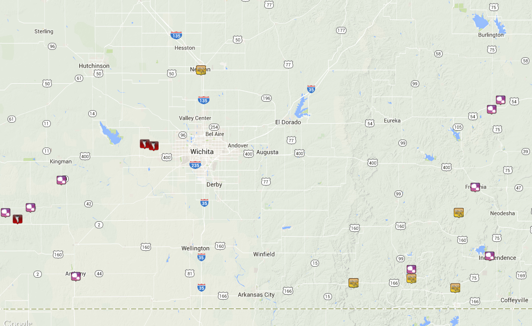
Storms first developed over southeast Kansas around 1 pm and quickly raced off to the northeast. These storms produced 70 to 80 mph winds along with hail up to the size of golf balls. Storms eventually fired back to the west along a retreating dryline around 5 pm over far southern Kansas and northern Oklahoma. These storms produced several reports of tornadoes over Comanche County along with very large hail. Eventually this storm tracked into Kingman county where hail over 3 inches was reported which is larger than the size of baseballs. A possible report of a tornado touchdown southeast of Zenda is being investigated. Another storm formed over eastern Kingman county that quickly intensified. Rotating wall clouds were reported near the town of Cheney and a few brief tornadoes touched down in northwest Sedgwick County. Two tornado touchdowns have been confirmed with a rating of EF0. One tornado touched down in open country north of Garden Plain and the other in open country just southeast of Andale.
|
Radar Images
|
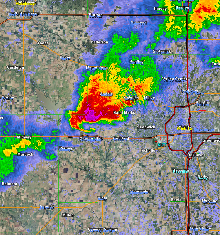
Radar image from 8:27 pm showing the supercell thunderstorm over western Sedgwick county. |
Radar image from 8:32pm showing the same storm northwest of Wichita |
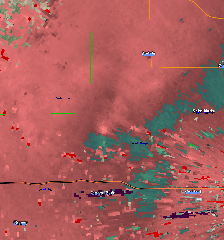
Radar velocity image from 8:32pm showing the rotation associated with the brief tornado touchdown. |
Storm Pictures
|
|
|
|
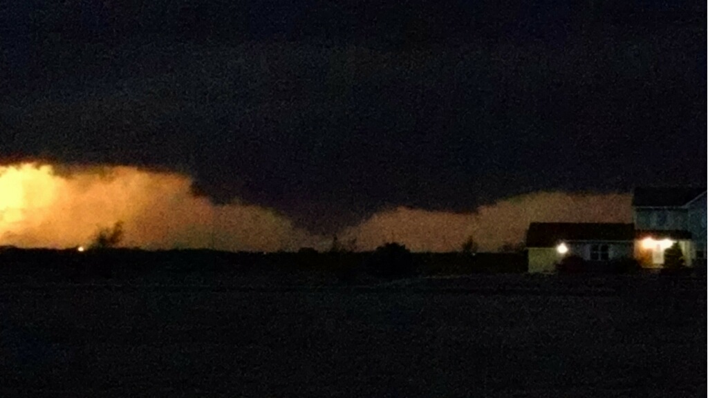
Wall cloud over western Sedgwick county. Picture taken by Paul Howerton |
|
Hazards
Briefing pages
Local weather story
Submit a storm report
Storm Prediction Center
Enhanced Hazardous Weather Outlook
Current Conditions
Local Radar
National Radar
Satellite
Hourly weather(text)
Precip Analysis
Snowfall analysis
This day in weather history
7 Day Lightning Archive
Forecasts
Forecast Discussion
Weather Story
Fire Weather
Activity Planner
Aviation Weather
Soaring Forecast
Hurricane Center
Graphical Forecasts
Regional Weather Summary
Probabilistic Snow
Probabilistic QPF
Wet Bulb Globe temp
Climate
Local Climate Page
Daily/Monthly data(F6)
Daily Records
Climate Normals
Local drought page
Latest Climate Report(ICT)
Latest Climate Report(SLN)
Latest Climate Report(CNU)
CoCoRaHS
7 Day Lightning Archive
US Dept of Commerce
National Oceanic and Atmospheric Administration
National Weather Service
Wichita, Kansas
2142 S. Tyler Road
Wichita, KS 67209-3016
316-942-3102
Comments? Questions? Please Contact Us.