Wichita, Kansas
Weather Forecast Office
Overview
|
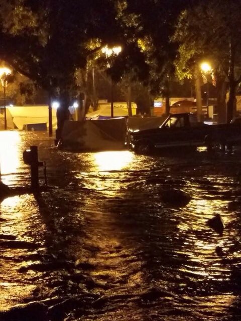
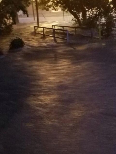
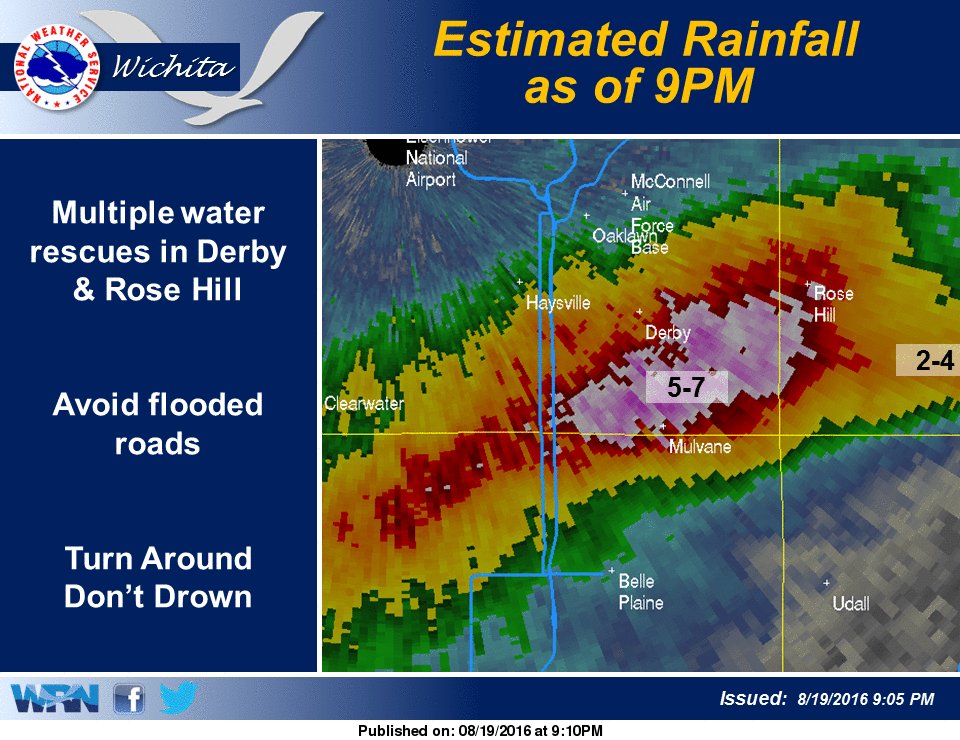
During the evening of August 19th a strong cold front pushed across central and eastern Kansas. Storms developed along this front and tracked off to the southeast during the evening hours. With a very moist atmosphere in place, these storms produced rainfall rates around 2-3 inches per hour. Several rounds of storms affected southern Sedgwick and southern Butler counties which resulted in rainfall in the 5 to 7 inch range with most of it falling in around 2 hours. This lead to significant flash flooding, especially near Mulvane and south of Rose Hill. Numerous water rescues took place with homes also evacuated. |
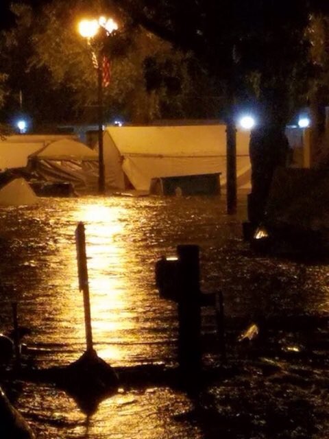 Flooding in Mulvane. Picture courtesy Rebecca Rico |
Flooding
Flooding Pictures
 |
 |
 |
| Flooding in Mulvane. Picture courtesy Rebecca Rico | Flooding in Mulvane. Picture courtesy Rebecca Rico | Day after flooding event in Mulvane |
 |
 |
|
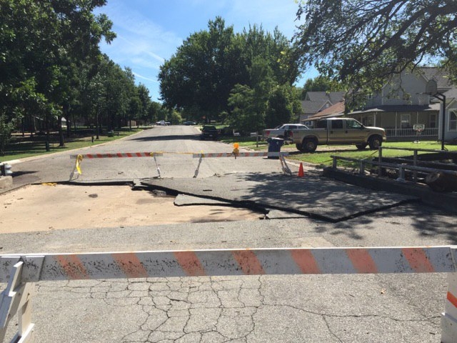
| Day after flooding in Mulvane showing the creek that caused most of the flooding | Day after flooding in Mulvane |
Radar & rainfall amounts
 |
 |
 |
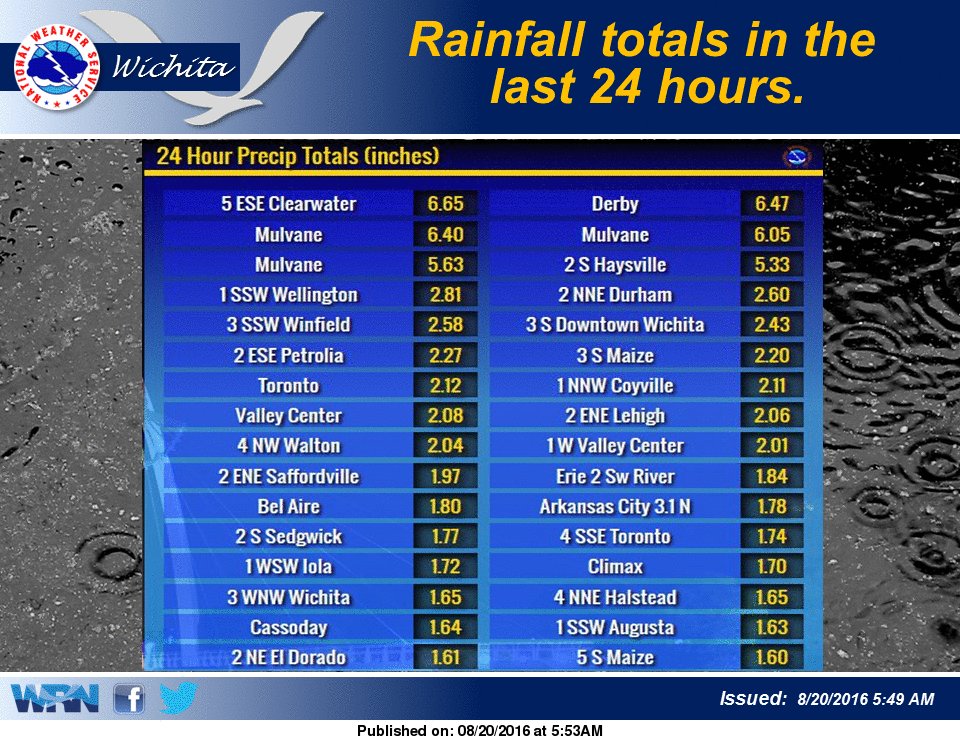 |
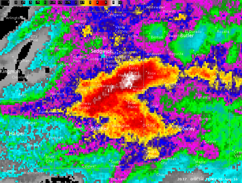
| Radar estimated rainfall from the evening of August 19th | Multi-sensor rainfall map, which uses rainfall reports combined with radar estimates | Regional radar animation from the evening of August 19th. | List of some of the higher rainfall amounts |
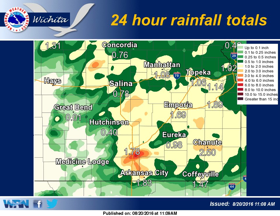 |
| Rainfall map showing rainfall from the evening of August 19th into the early morning hours of August 20th |
Video
|
|
 |
Media use of NWS Web News Stories is encouraged! Please acknowledge the NWS as the source of any news information accessed from this site. |
|
Hazards
Briefing pages
Local weather story
Submit a storm report
Storm Prediction Center
Enhanced Hazardous Weather Outlook
Current Conditions
Local Radar
National Radar
Satellite
Hourly weather(text)
Precip Analysis
Snowfall analysis
This day in weather history
7 Day Lightning Archive
Forecasts
Forecast Discussion
Weather Story
Fire Weather
Activity Planner
Aviation Weather
Soaring Forecast
Hurricane Center
Graphical Forecasts
Regional Weather Summary
Probabilistic Snow
Probabilistic QPF
Wet Bulb Globe temp
Climate
Local Climate Page
Daily/Monthly data(F6)
Daily Records
Climate Normals
Local drought page
Latest Climate Report(ICT)
Latest Climate Report(SLN)
Latest Climate Report(CNU)
CoCoRaHS
7 Day Lightning Archive
US Dept of Commerce
National Oceanic and Atmospheric Administration
National Weather Service
Wichita, Kansas
2142 S. Tyler Road
Wichita, KS 67209-3016
316-942-3102
Comments? Questions? Please Contact Us.

