Overview
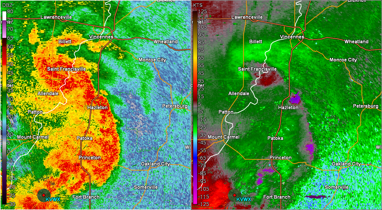
Thunderstorms developed along and north of a warm front and along with an upper disturbance during the evening of May 19 and early morning of May 20. The initial round of storms brought large hail, while the later storms brought damaging winds and a tornado that moved into Knox County from Illinois.Tornado
|
Tornado - Near Monroe City
Track Map 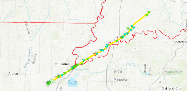 
|
||||||||||||||||
|
||||||||||||||||
The Enhanced Fujita (EF) Scale classifies tornadoes into the following categories:
| EF0 Weak 65-85 mph |
EF1 Moderate 86-110 mph |
EF2 Significant 111-135 mph |
EF3 Severe 136-165 mph |
EF4 Extreme 166-200 mph |
EF5 Catastrophic 200+ mph |
 |
|||||
Radar
Early Evening Storms
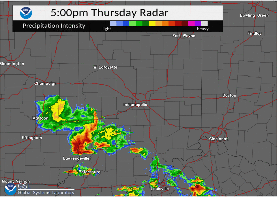 |
| Radar Loop of May 19 Evening |
Late Evening and Early Morning Storms
 |
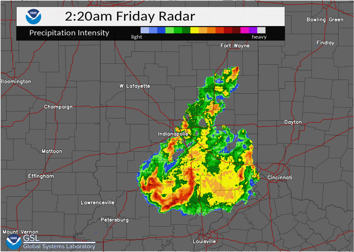 |
| Radar at 11 PM EDT May 19 | Radar at 2:20 AM EDT May 20 |
Storm Reports
Below are reports received by NWS Indianapolis.
..TIME...   ...EVENT...      ...CITY LOCATION...     ...LAT.LON...
..DATE...   ....MAG....      ..COUNTY LOCATION..ST.. ...SOURCE....
            ..REMARKS..

0530 PM     Hail             1 N Sandborn            38.90N 87.19W
05/19/2022  E2.00 inch       Knox               IN   Public

            Report with a picture showing around 2 inch
            hail just north of Sandborn, IN.

0540 PM     Hail             Vincennes               38.68N 87.51W
05/19/2022  E1.00 inch       Knox               IN   Emergency Mngr


0545 PM     Hail             1 WSW Vincennes         38.67N 87.52W
05/19/2022  E1.50 inch       Knox               IN   Public


0552 PM     Hail             4 E Vincennes           38.69N 87.37W
05/19/2022  E1.00 inch       Knox               IN   Trained Spotter


0615 PM     Hail             2 NNE Washington        38.68N 87.17W
05/19/2022  M1.25 inch       Daviess            IN   Broadcast Media

            1.27 inch hail found along the road after a
            bit of melting.

0641 PM     Hail             1 ENE West Boggs Lake   38.73N 86.92W
05/19/2022  E2.00 inch       Martin             IN   Public


0641 PM     Hail             1 E West Boggs Lake     38.73N 86.91W
05/19/2022  E2.75 inch       Martin             IN   Public


0726 PM     Hail             Mitchell                38.73N 86.47W
05/19/2022  E2.00 inch       Lawrence           IN   Broadcast Media

            Picture received via social media of 2 inch
            hail. Time estimated from radar.

0726 PM     Hail             Mitchell                38.73N 86.47W
05/19/2022  E1.75 inch       Lawrence           IN   Public


1054 PM     TORNADO          DECKER                  38.52N 87.53W
05/19/2022                   KNOX               IN   NWS STORM SURVEY

            DELAYED REPORT. NWS SURVEY FOUND EF2 TORNADO
            DAMAGE ALONG A 26 MILE PATH FROM ILLINOIS
            INTO INDIANA. MAX ESTIMATED WIND SPEEDS WITH
            THE TORNADO WERE 115 MPH. DAMAGE IN KNOX
            COUNTY INDIANA WAS ONLY EF1 WITH THE MOST
            SEVERE DAMAGE IN DECKER.


1100 PM     Tstm Wnd Dmg     Decker                  38.52N 87.53W
05/19/2022                   Knox               IN   Emergency Mngr

            Trees and utility lines down in and around
            the Decker area.

1100 PM     Tstm Wnd Dmg     3 NNW Decker            38.56N 87.54W
05/19/2022                   Knox               IN   Emergency Mngr

            Semi truck blown over on US 41.

1100 PM     Tstm Wnd Dmg     3 NNW Decker            38.56N 87.54W
05/19/2022                   Knox               IN   Emergency Mngr

            Semi truck blown over on US 41 near Firemen
            Rd.

1140 PM     Tstm Wnd Dmg     4 SSW Clayton           39.63N 86.54W
05/19/2022                   Hendricks          IN   Public

            15-20 Trees Blown Down. 9173 South County Rd
            100 West. Time estimated.

0220 AM     Tstm Wnd Dmg     1 SW Seymour            38.95N 85.90W
05/20/2022                   Jackson            IN   Emergency Mngr

            Baseball dugout had significant damage with
            roof lifted off and cinder block wall
            knocked down. Aluminum bleachers were blown
            into fence of baseball field. Building
            onsite only had minor siding damage. Damage
            all laid out to north and northeast along
            storm track path.

0239 AM     Tstm Wnd Dmg     1 NE North Vernon       39.02N 85.62W
05/20/2022                   Jennings           IN   Emergency Mngr

            Numerous trees and utility lines down on
            northeast side of North Vernon. Tree fall
            direction mainly to the north and northeast.

0310 AM     Tstm Wnd Dmg     3 ESE Milford           39.34N 85.57W
05/20/2022                   Decatur            IN   Emergency Mngr

            Late report of a pole snapped about half way
            up at West Base Road and North County Road
            500 West. Time estimated from radar.


&&

$$
Environment
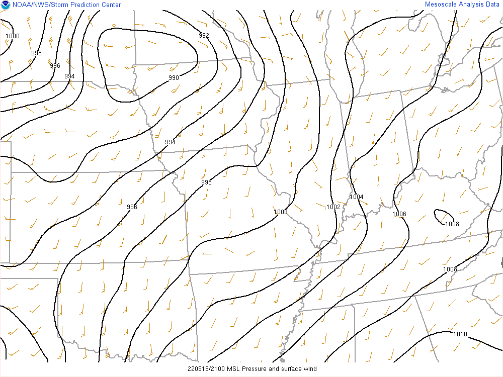
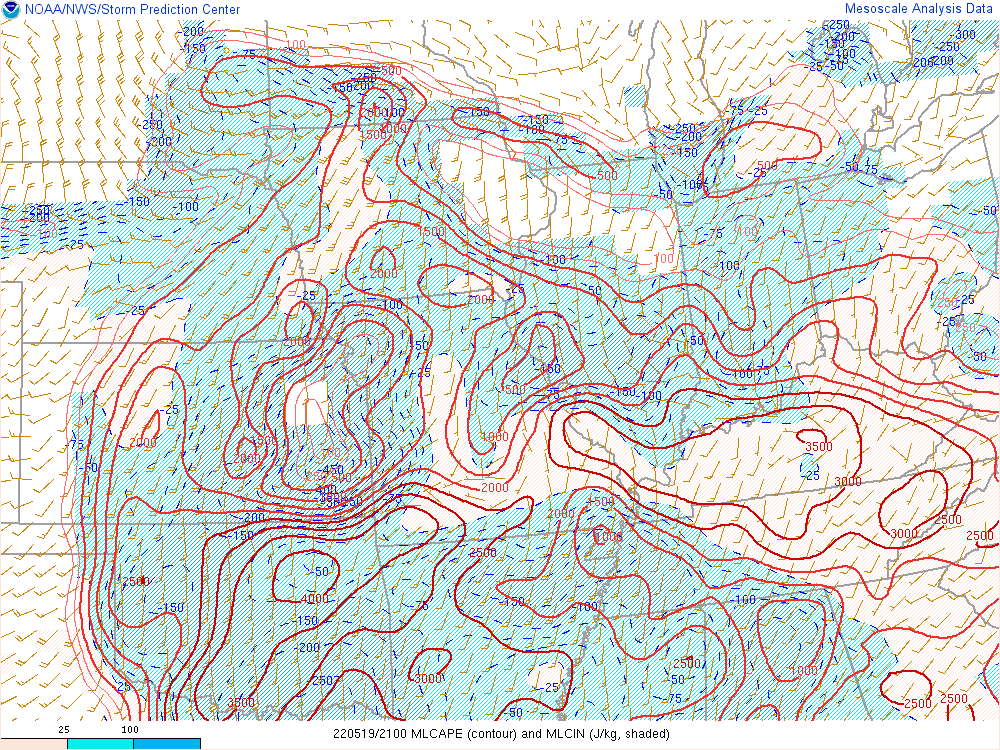
Thunderstorms developed along a surface warm front..
 |
 |
 |
| Figure 1: MSLP at 5 PM EDT | Figure 2: Mixed Layer CAPE at 5 PM EDT | Figure 3: Significant Hail Parameter at 6 PM EDT |
 |
Media use of NWS Web News Stories is encouraged! Please acknowledge the NWS as the source of any news information accessed from this site. |
|