Event Summary
An approaching cold front, an unusually high amount of wind shear, and sufficient instability resulted in an outbreak of severe thunderstorms across portions of the lower Deep South, including a strong tornado which moved through the Hattiesburg area. During the morning hours of February 10th, a line of severe thunderstorms moved into the NWS Jackson forecast area, downing trees and powerlines over portions of southeast Arkansas, northeast Louisiana, and central Mississippi. There was also a barn destroyed near Silver City in Humphreys County. The storms continued to push eastward through the early afternoon, then began to slow down as the cold front began to stall. To the south and east of this line of storms, several supercell thunderstorms developed in the more unstable air mass over south Mississippi, with many of the storms exhibiting strong rotation on radar. Shortly after 4 pm, a tornado developed over southwest Marion County near the Pickwick community and tracked across the county into far western Lamar County before lifting. The same storm which produced this tornado continued eastward across northern Lamar County, producing a large tornado which touched down west of Oak Grove and tracked through the very populated West Hattiesburg area. The tornado continued into Forrest County, tracking through the cities of Hattiesburg and Petal before ending in northwestern Perry County. Considerable damage occurred along the path of this storm, and several were injured. Scattered severe storms continued to affect the Pine Belt area through the remainder of the evening and into the early morning hours of the 11th, before finally moving out of the area.
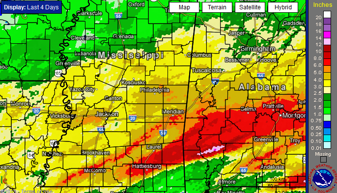
In addition to severe weather, flash flooding was a major issue in several areas. From the 10th through the early morning hours of the 11th, the heaviest rainfall occurred over parts of southeast Mississippi, where 5 to 7 inches of rain fell and flash flooding was reported in the area. Rainfall amounts of up to 3 1/2 inches occurred in the Jackson metro area, leading to considerable flash flooding. Quick rises occurred on several streams in the city of Jackson.
Tornado Track Map
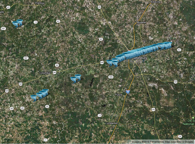
Click on map above to see entire event tracks and damage point notation.
Individual track maps also available on individual tornado pages.
Survey Information - Click on the location in the table for additional maps and details
| Location | Start/ End Time |
Event Type | Fatalities/ Injuries |
Path Length | Path Width |
| Lawrence County 2 S Arm to 2 SE Arm |
3:39 pm - 3:43 pm |
EF-1 Tornado 95 mph |
none | 1.6 miles | 140 yards |
| Marion and Lamar counties 11 SSW Columbia to 10 ESE Columbia |
4:23 pm - 4:50 pm |
EF-2 Tornado 120 mph |
Deaths: 0 Injuries: 3 |
19 miles | 400 yards |
| Lamar and Forrest counties 8.5 WNW Purvis to 3 ESE Macedonia (Perry County) |
5:03 pm - 5:33 pm |
EF-4 Tornado 170 mph |
Deaths: 0 Injuries: 82 |
21 miles | 3/4 mile |
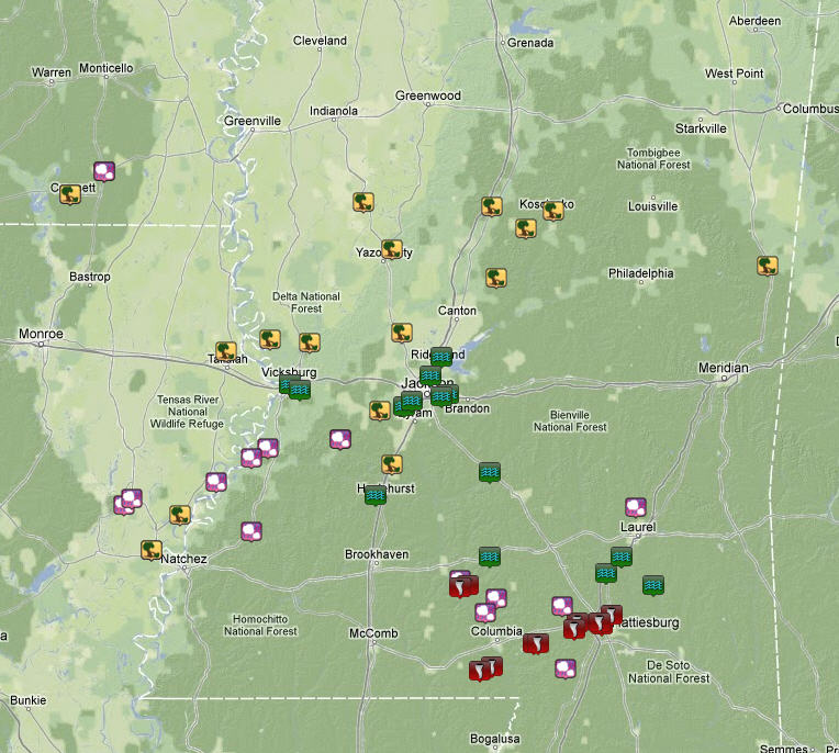
Local Storm Reports
Click on the map below for additional details.

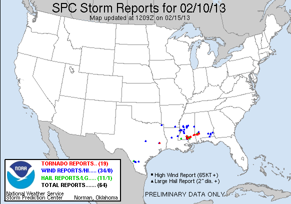
National Storm Reports
Rainfall Totals
(4 day storm total: February 9-13, 2013)