Climate data here is PRELIMINARY (unofficial). CERTIFIED (official) data is available from the National Centers for Environmental Information (NCEI).
Note: Click image to enlarge graphs, click a second time to resize back to original.
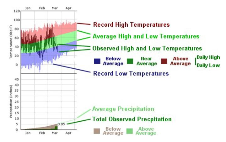
Jacksonville FL - Monthly Temperature
Jacksonville FL - Monthly Precipitation
|
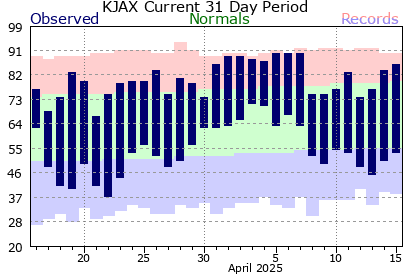
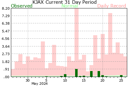
JAX International Airport (KJAX) - Monthly Temperature & Precipitation |
|
Executive Airport at Craig (KCRG) - Jacksonville, FL |
|
Gainesville Airport (KGNV) - Monthly Temperature & Precipitation |
|
Saint Simons Island Airport (KSSI) - Monthly Temperature & Precipitation |
|
Alma Airport (KAMG) - Monthly Temperature & Precipitation |
Questions or comments about the NWS Jacksonville Climate pages? Email - NWS-JAX Webmaster


 Follow us on YouTube