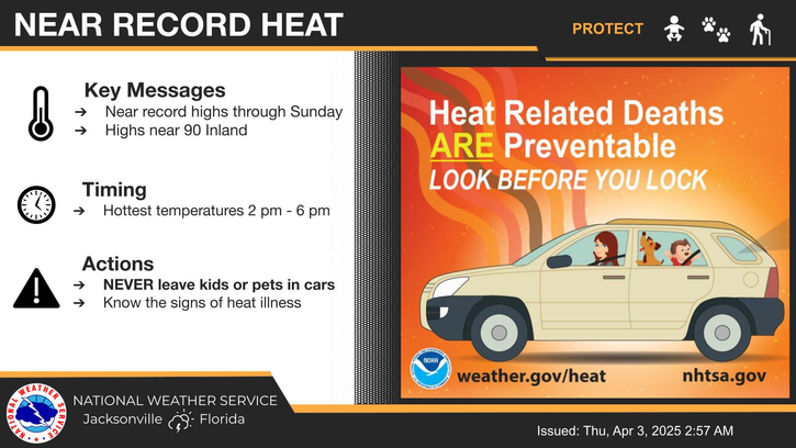
🥵 Dangerously hot and seasonably humid weather will continue into next week
🌡️ Heat index values will peak in the 100° - 107° range this afternoon, with values approaching or exceeding 110° possible across portions of our area this weekend and next week
⚠️ Heat Advisories may be issued for portions of southeast GA, northeast and north central FL this weekend and into next week
🤔4 questions to ask yourself BEFORE heading outdoors:
🥤Do you have enough water?
🌴⛱️Is shade available?
🌡️Do you know the symptoms of heat illness?
📲Do you know who to call in an emergency?


 Jacksonville Radar
 Weather Map
 Regional Satellite
  DAY 1 Convective Outlook
 Tropical Weather Outlook
 Daily Graphics