
Isolated strong to severe thunderstorms will be possible this afternoon and evening ahead of a strong cold front. Sharply colder weather arrives late Sunday night and Monday in the wake of this front, with Gale Watches possible for the Atlantic waters on Monday night. Cold Weather Advisories are likely late Monday night and early Tuesday morning, as wind chills fall into the 20s. Read More >
Lightning Activity Level (LAL) and Haines Index parameters have been discontinued from the Fire Weather Planning Forecast and Spot forecast products as of February 1st.
Please utilize other product parameters, such as "Chance of Thunder". For more information, please see the Service Change Notice HERE
|
NWS Jacksonville Fire Weather Support |
||
|
|
|
| Florida Fire Danger | |||
| FFS County Index Report | |||
|
|
![]() |
![]() |
|
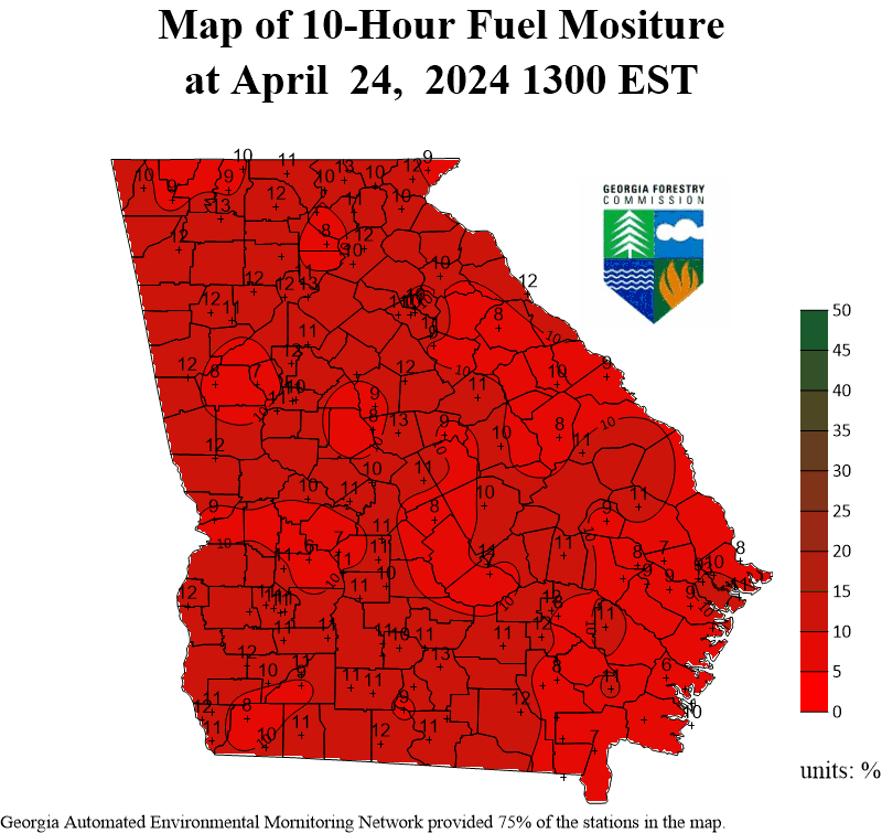
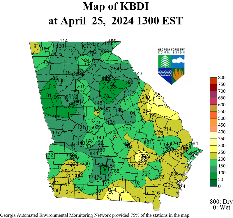
| Current Georgia Fire Danger | |||
|
|
|
|
|
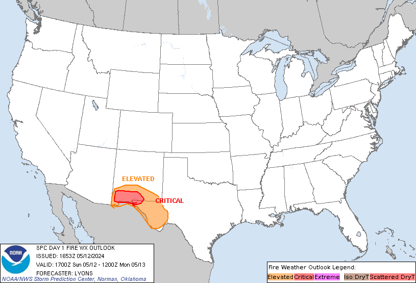
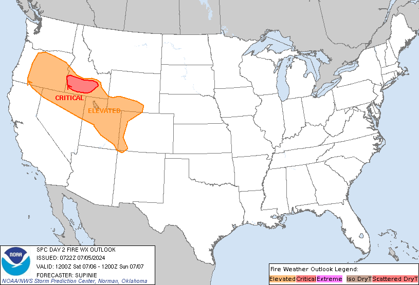
| SPC Wildland Fire Outlooks | ||
| SPC Fire Weather | ||
![]() |
![]() |
![]() |
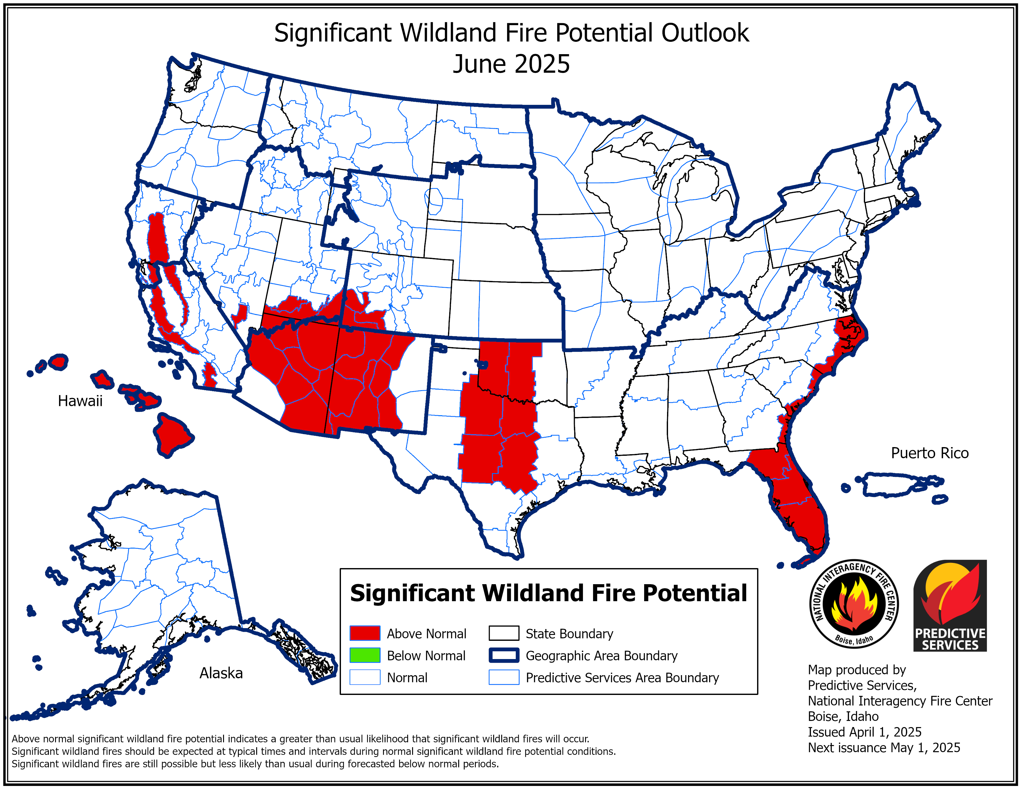
| Wildland Fire & Drought Outlooks | ||
| Drought Outlooks | ||
![]() |
![]() |
![]() |
|
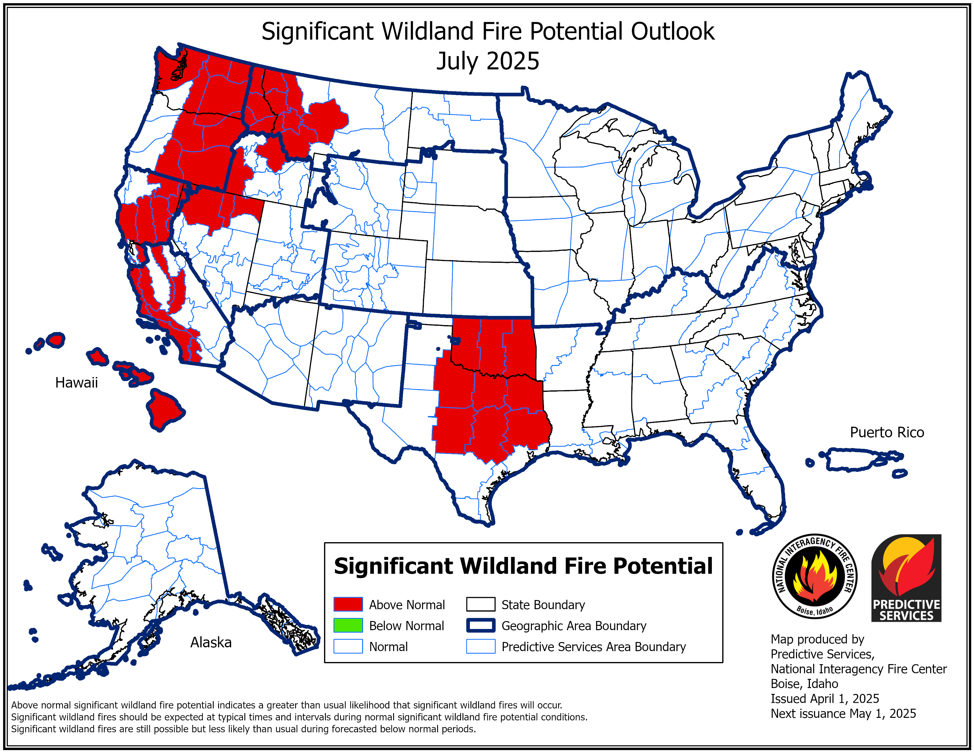
Month 4 Wildfire Outlook |
Monthly Drought Outlook |
Seasonal Drought Outlook |
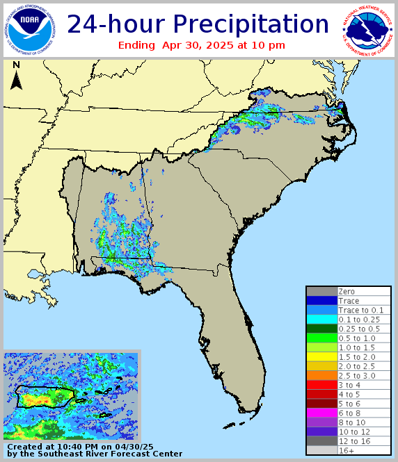
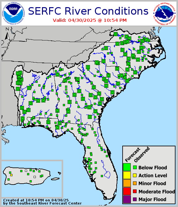
| Rainfall & Fuels | ||
| Past Rainfall Maps | SE River Forecast Center | Weather Predication Center |
![]() |
![]() |
![]() |
| Extended & Seasonal Outlooks | ||
| Climate Prediction Center | ||
![]() |
![]() |
|
![]() |
![]() |
|