Entire Path
Begin Time: 2:50 PM EST
End Time: 3:39 PM EST
EF Scale: EF-4
Wind Speed: 175 mph
Begin Point: South side of Fredericksburg in Washington County, Indiana
End Point: 4 miles north-northwest of Bedford along Highway 2870 in Trimble County, Kentucky
Path Length: 49 miles
Path Width: 0.4 mile
Injuries: Unknown
Fatalities: 11
Washington County, IN Segment
Begin Time: 2:50 PM EST
End Time: 3:08 PM EST
EF Scale: EF-4
Wind Speed: 170 mph maximum
Begin Point: South side of Fredericksburg
End Point: Washington County-Clark County line just east of South Flatwood Road
Path Length: 18.8 miles across Washington County
Path Width: 0.4 mile
Injuries: Unknown
Fatalities: 5
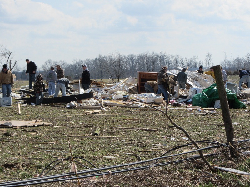
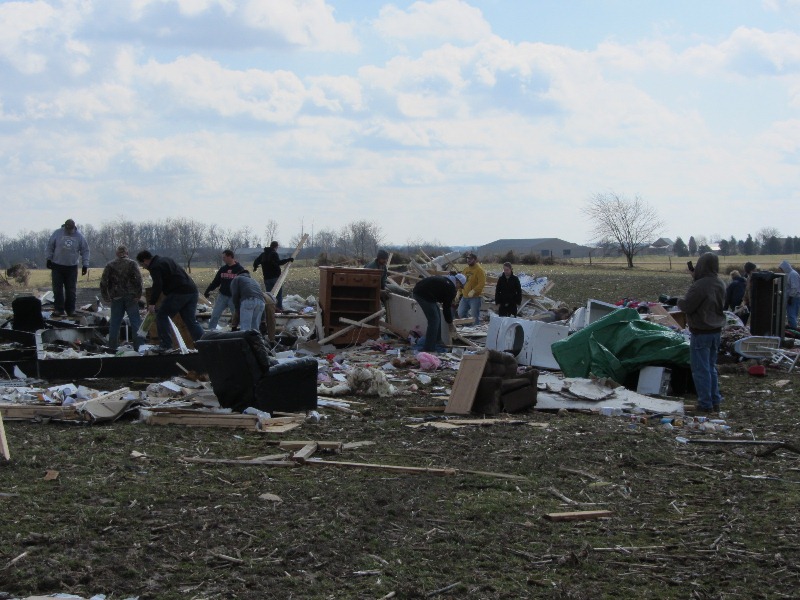
The National Weather Service in conjunction with Washington County Emergency Management conducted a detailed tornado damage survey on Saturday, March 3. Below are the results.
The tornado first touched down on the south side of Fredericksburg just south of U.S. 150 where several trees were snapped off. In this area, winds were estimated to be 90 mph (EF1) with a damage width of 30 yards along the south fork of the Blue Lick River.
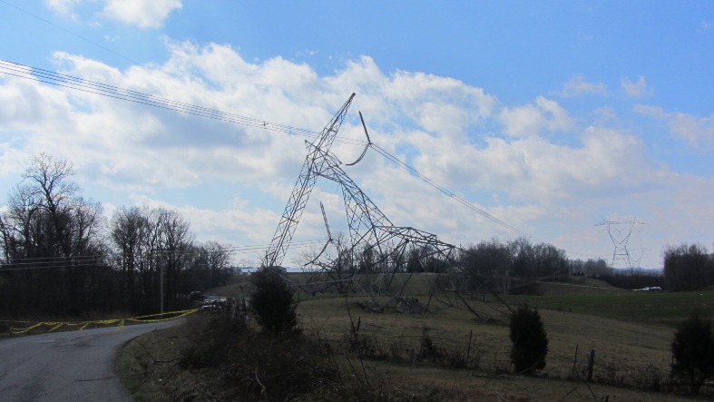
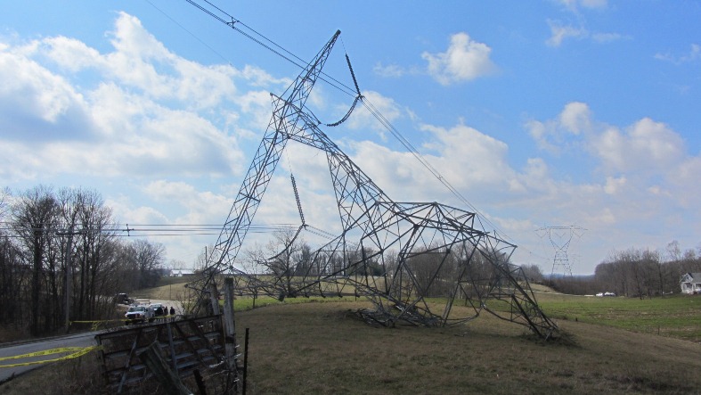
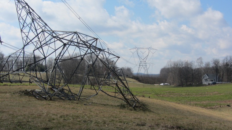
Additional tree damage was observed as the tornado moved east- northeast across farmland. Near the intersection of Horners Chapel Road and Fredericksburg Road, a high tension metal power structure was toppled along with numerous trees uprooted and snapped. Here, damage was estimated as EF2 with 130 mph winds. Along Palmyra Road near Strickland Road, several trees were snapped with EF1 damage 50-100 yards wide and estimated winds of 100-110 mph. High tension wires were down and trees snapped along West End Road just north of Shanks Hill Road.
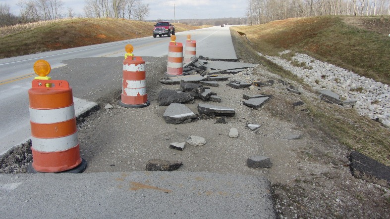
The tornado then traveled over a ridge and intensified as it hit State Route 135 at Dutch Creek Road. Here, large chunks of 5- or 6-inch thick asphalt from an approximately 4-by-4-yard section of roadway were blown 10 to 30 yards into the adjacent grass next to the road. Just east of Route 135, tremendous tree damage was observed. At this location, the tornado was estimated to be of EF3 strength with 150 mph winds. The width of the damage path also began to widen, increasing to 200 yards.
Tree and structural damage was widespread northeast of Route 135 as the tornado crossed Trainer Lane and then State Road 335 to Robbs Lane. The width of observable damage increased to one-quarter to one-third of a mile. Countless trees were snapped and uprooted. The degree of damage suggested a mix of EF2 and EF3 damage in this area, with estimated winds of 120-150 mph.
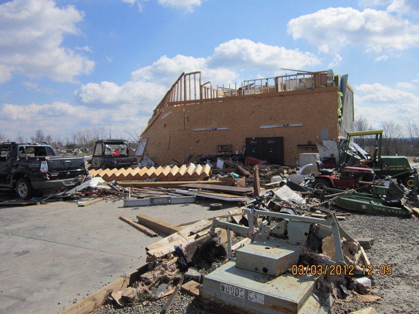
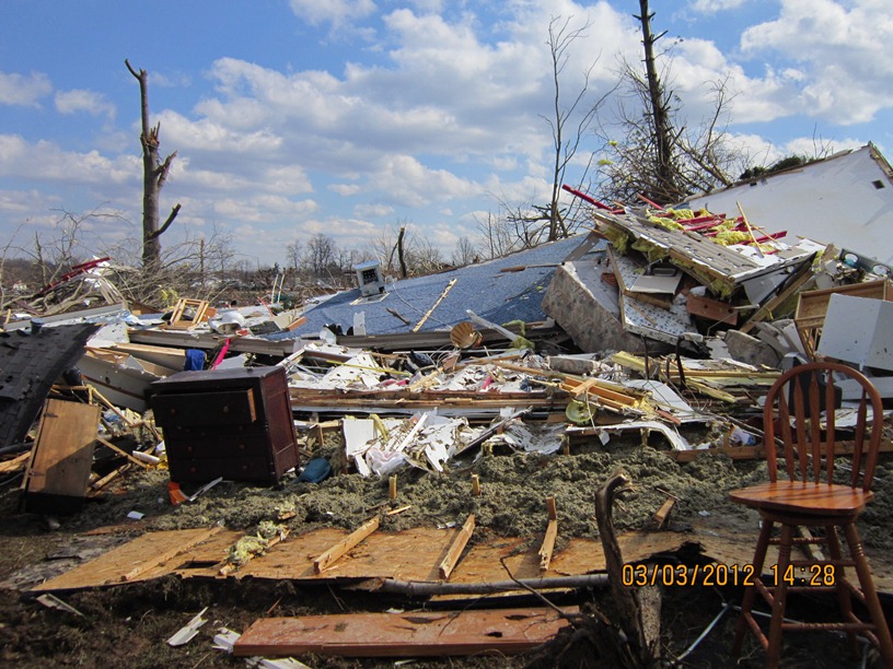
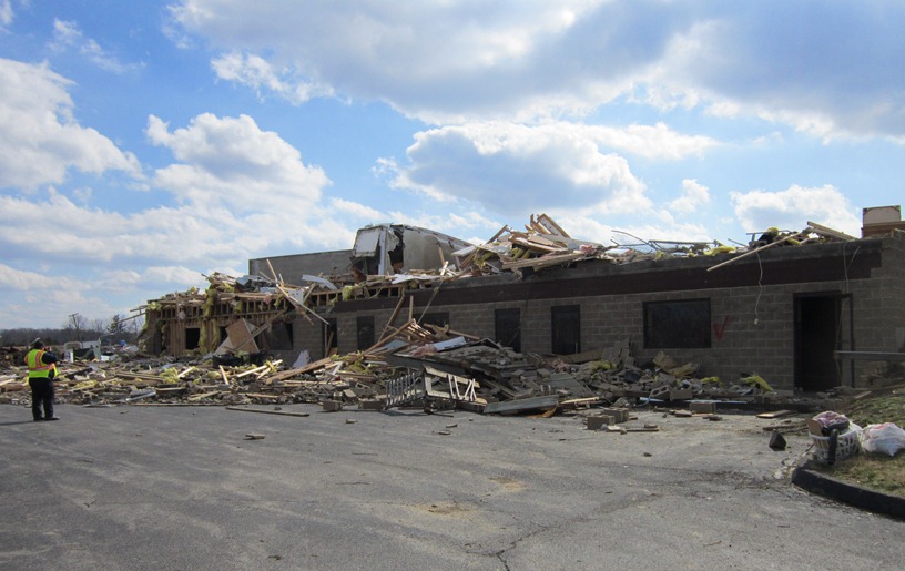
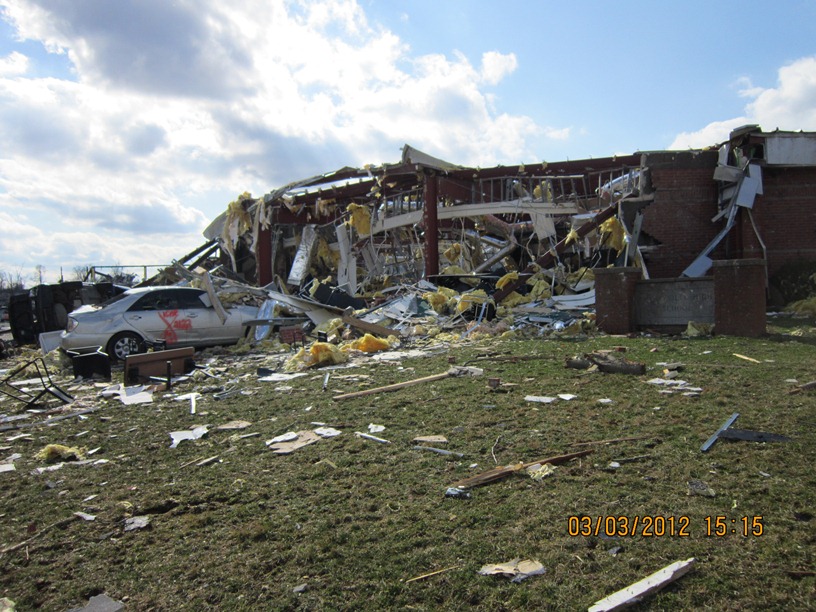
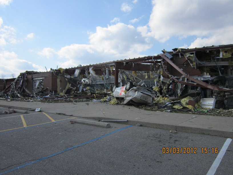
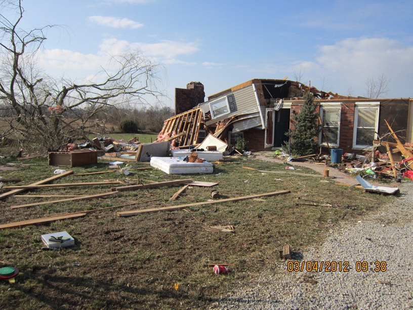
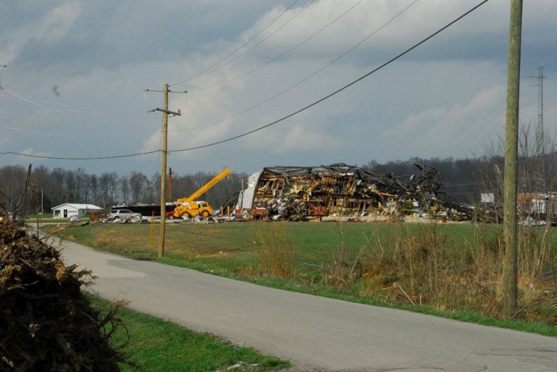
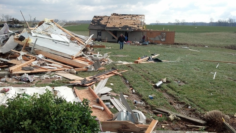
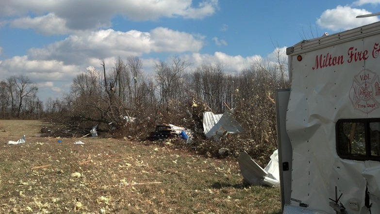
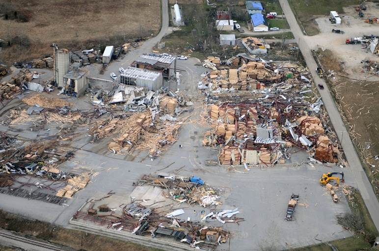
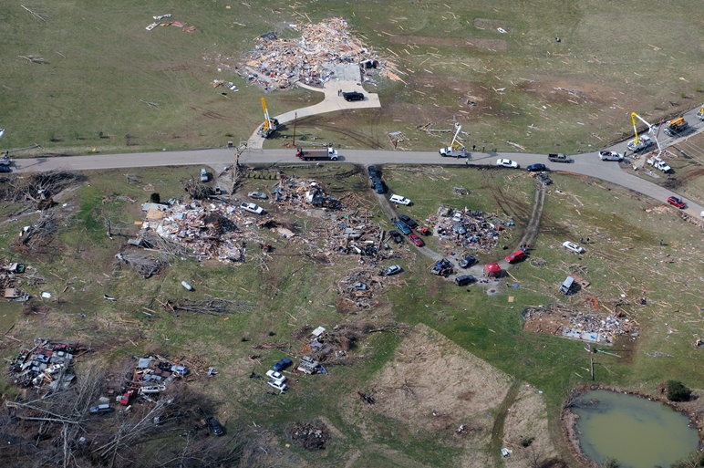
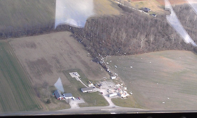
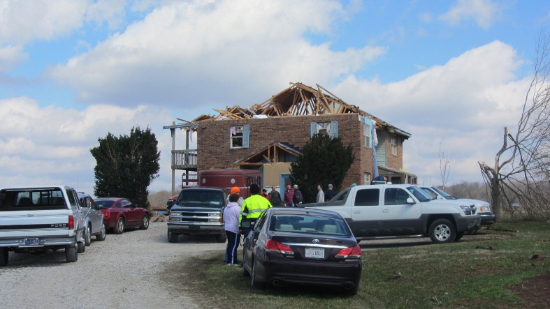
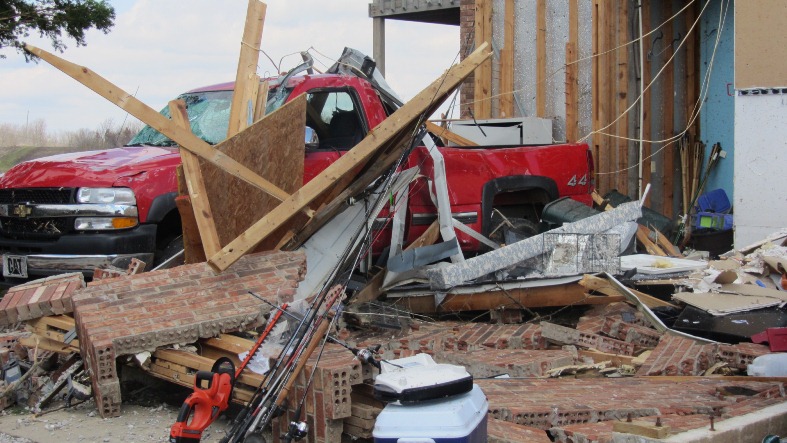
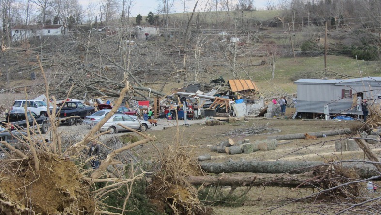
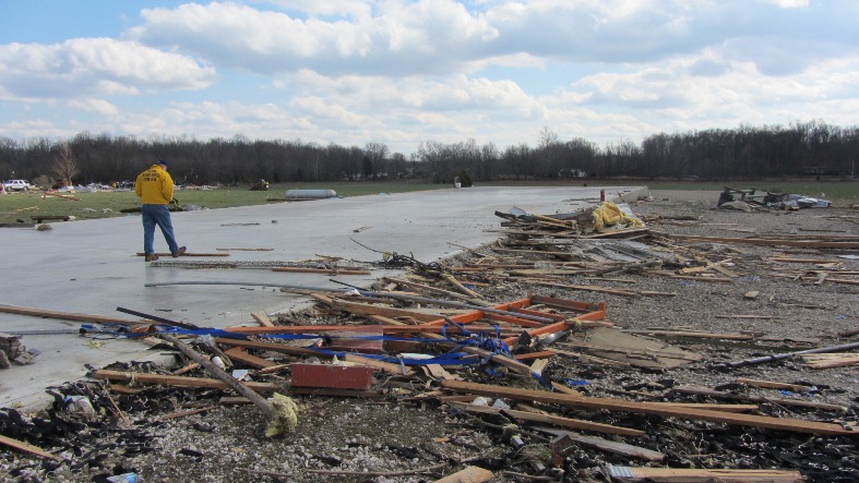
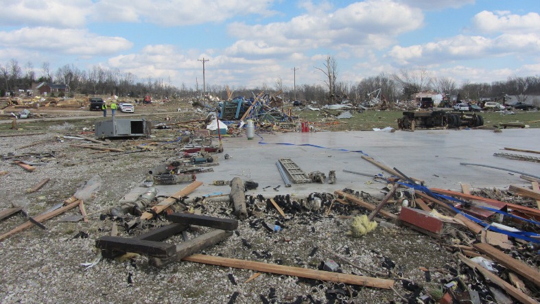
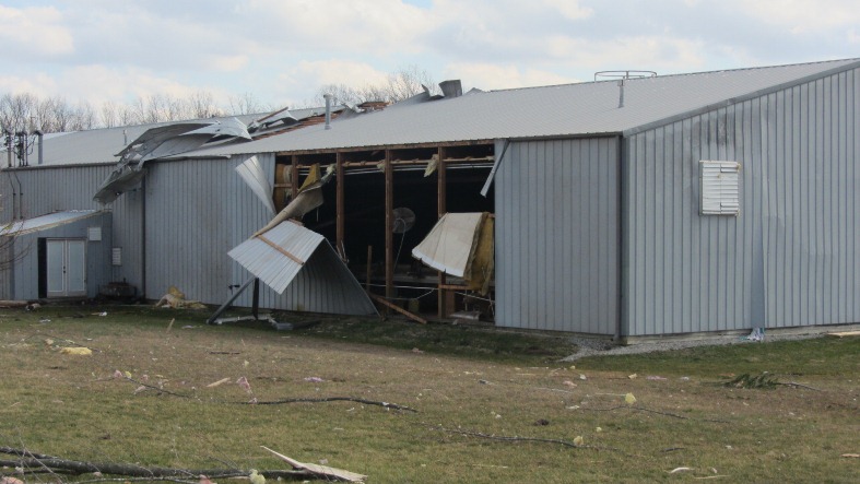
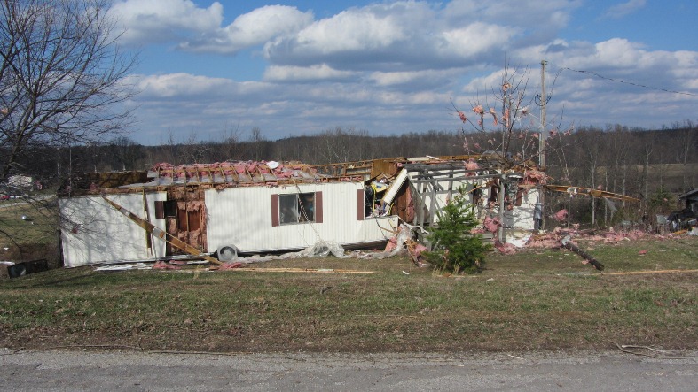
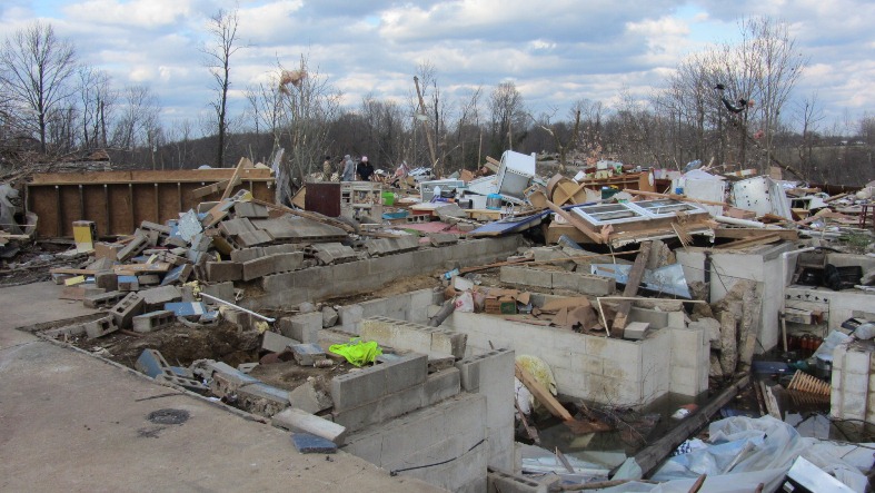
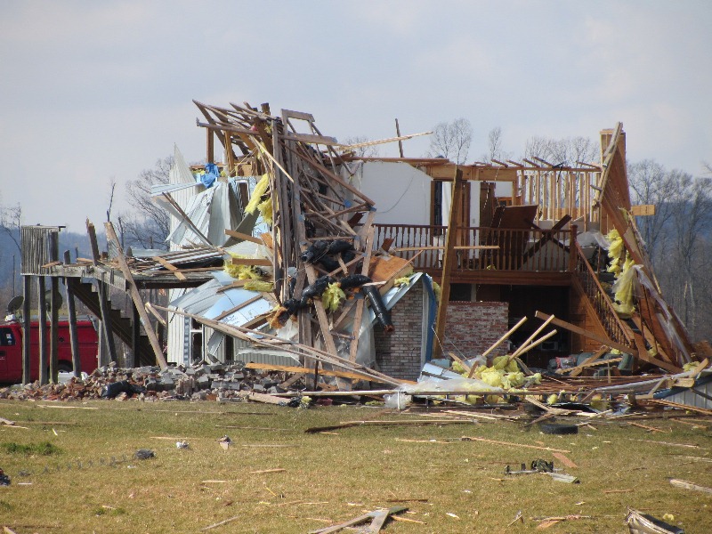
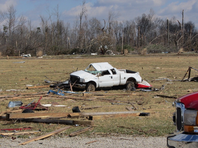
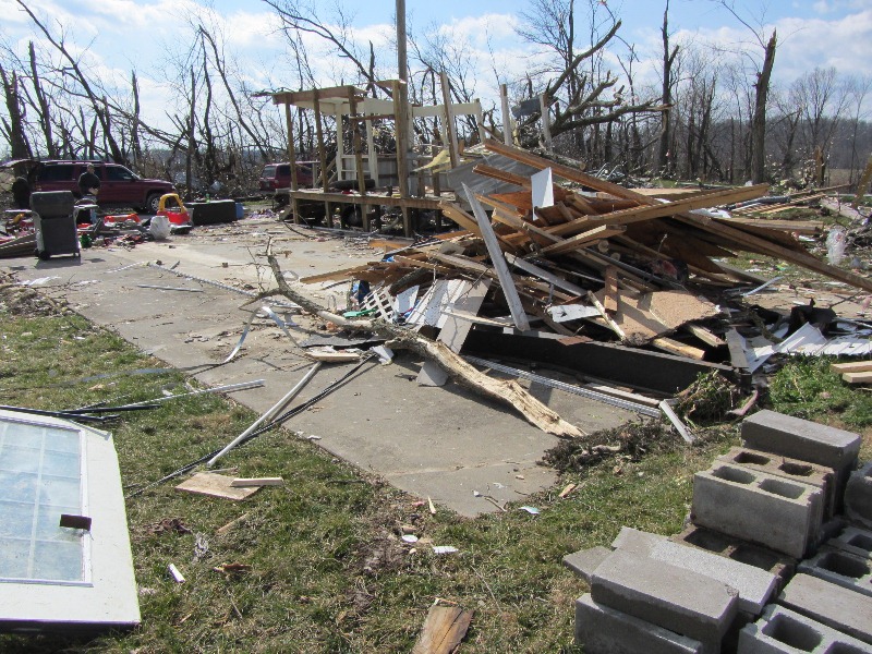
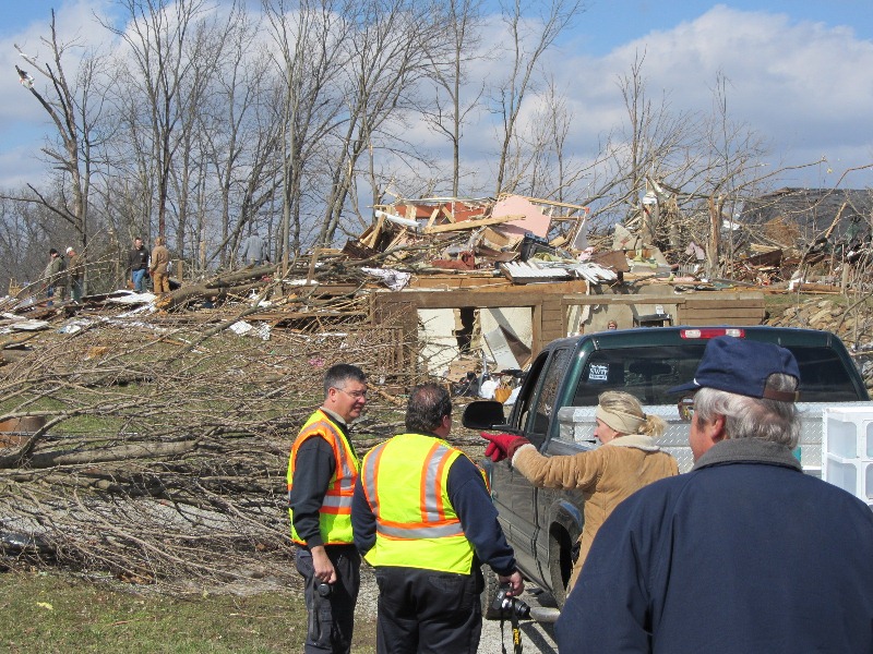
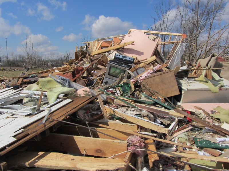
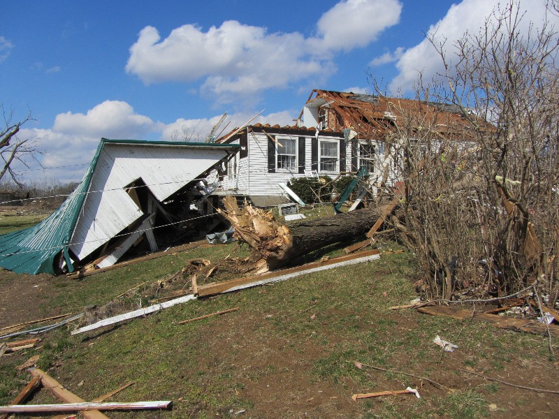
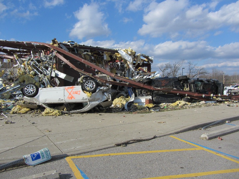
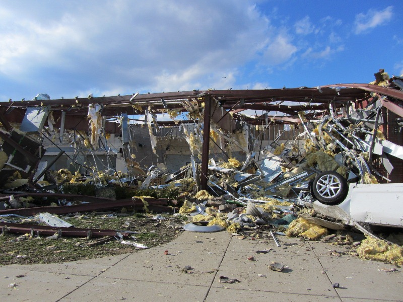
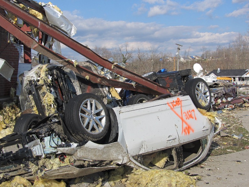
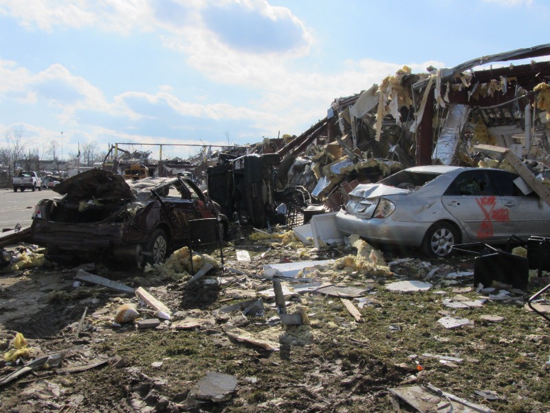
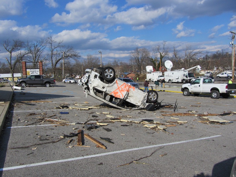
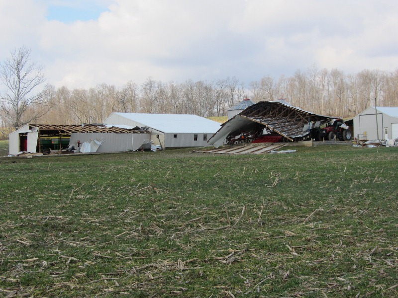
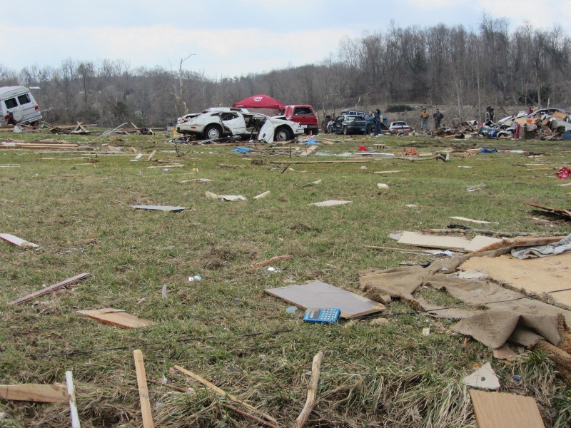
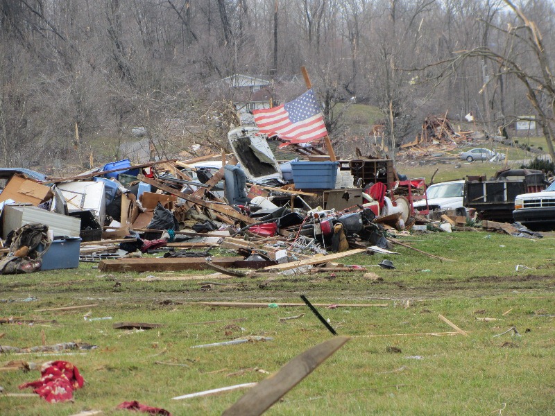
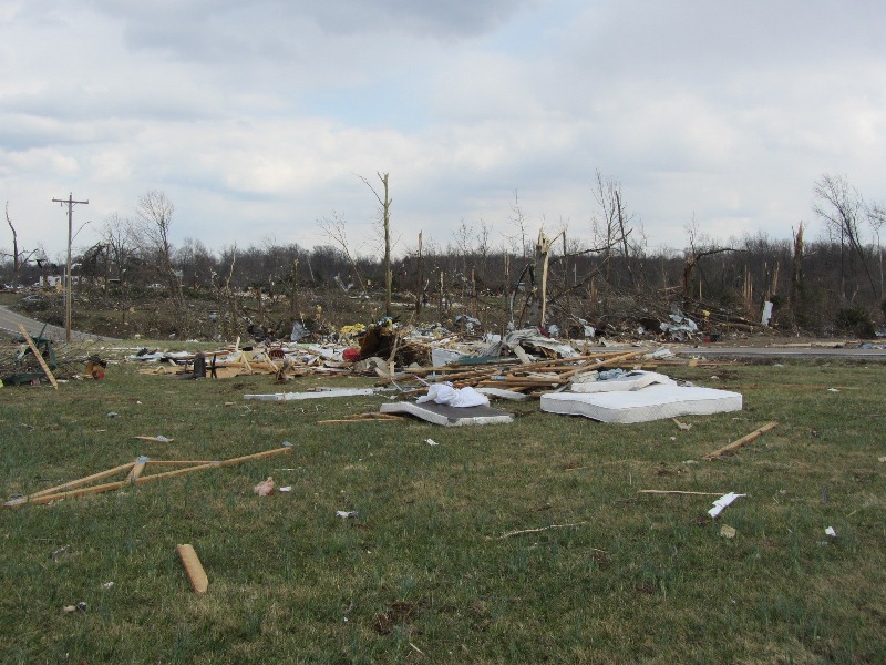
The tornado crossed U.S. 60 just south of New Pekin. Immediately east of the highway, tremendous structural damage was observed. A well-constructed and large factory building (Airgo Industries) was cleared to its foundation slab with numerous anchoring bolts bent in the direction of the storm. Debris from this building was observed one-half to three-quarters of a mile downwind. Large power poles were snapped. Another metal out building on the right periphery of the damage path had sheeting pulled off the back of the building apparently from the force of the inbound winds into the tornado. This was the area where 5 people were tragically killed in a mobile home. In this location just east of U.S. 60, damage suggested an EF4 tornado with 170 mph estimated winds, and a width of observed damage from 0.3-0.4 mile.
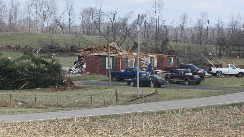
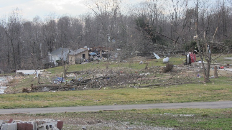
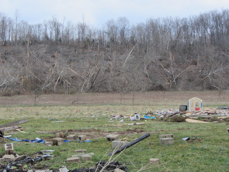
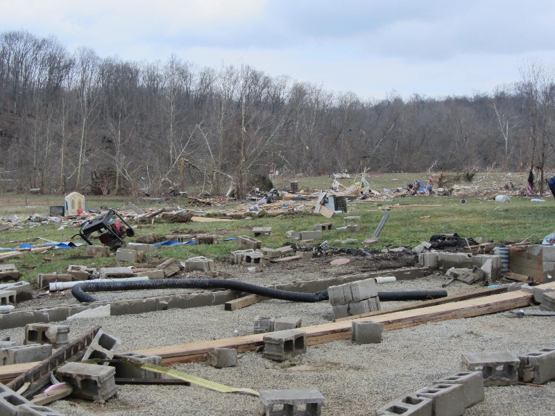
Damage continued to the east along and south of Hurst Road in extreme southeast Washington County. The tornado crossed into extreme northwest Clark County along and near Daisy Hill Road. In this area, a well-constructed one-story brick house at the top of a small ridge was completely destroyed ith no walls standing. People onsite reported that cows were missing and could not be located. They also stated that the tornado looked like a black wall as it approached. A heavy trailer cab was blown from this house to another demolished brick home about one-quarter mile away. Damage here suggested EF4 damage with 170 mph winds.
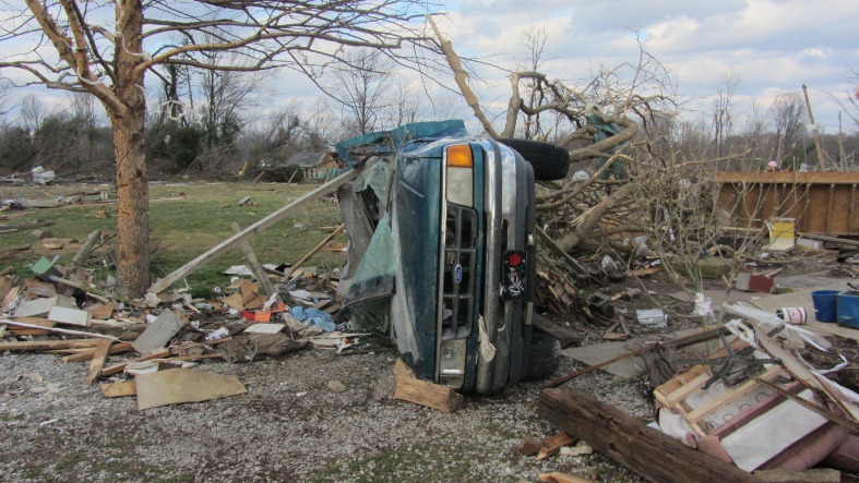
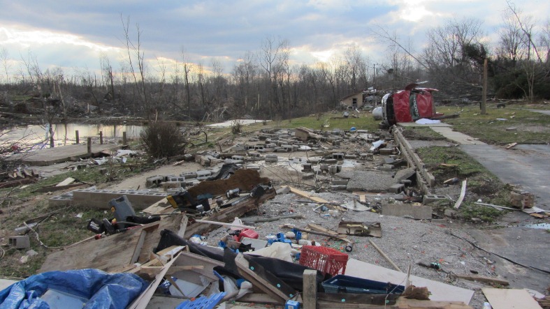
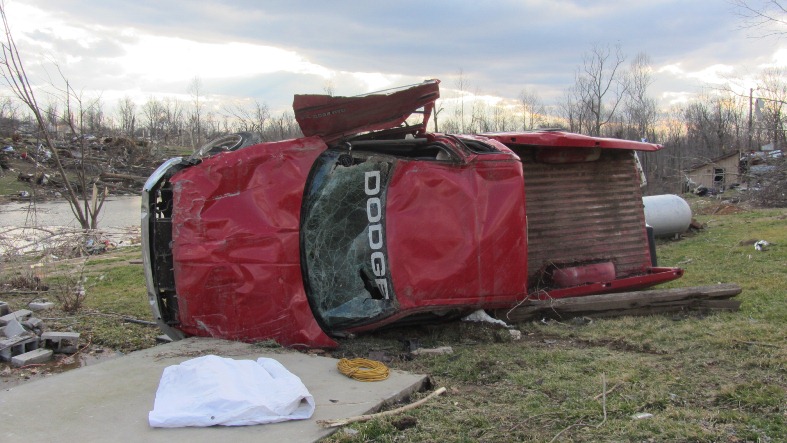
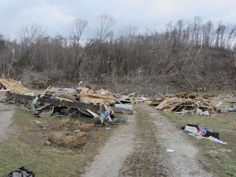
As the tornado re-entered Washington County near the intersection of Daisy Hill Road and Williams Knob Road, widespread damage occurred. This included a home which was totally leveled as well as a couple of anchored down double wide trailers. A car was destroyed and tossed about 100 yards in the direction of storm motion from its origin at the home. At one of the destroyed trailers, a Dodge Ram pickup truck was tossed onto its side and destroyed in the opposite direction from the car (i.e., on the left side of the tornado track). Here, EF3-EF4 damage was estimated with winds of 150-170 mph. There were also snapped trees and structural damage along Whiskey Run Road. The width of the observed damage straddling the Washington-Clark County line was estimated to be one-third to one-half mile wide, although the width of the most concentrated damage was narrower. The last observed damage in Washington County was near S. Flatwood Road in a wooded area before the tornado entered Clark County.
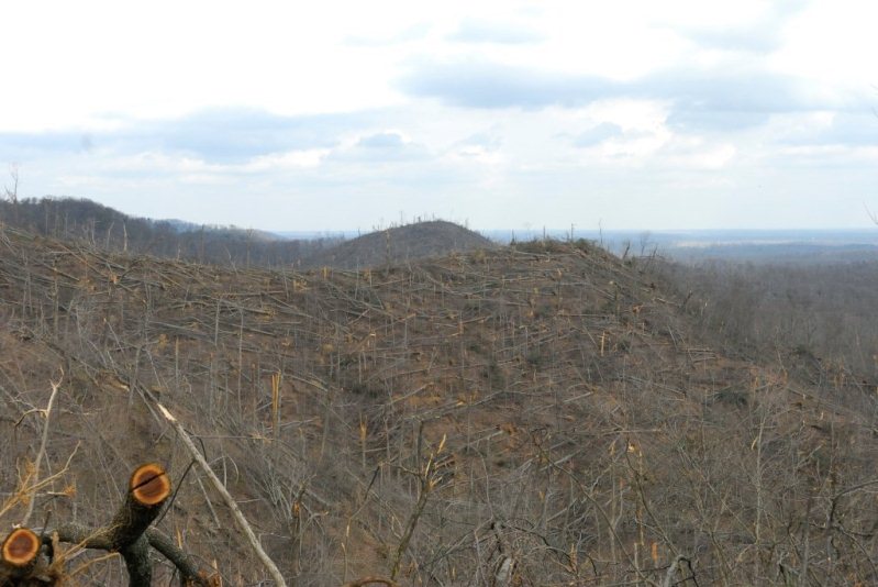
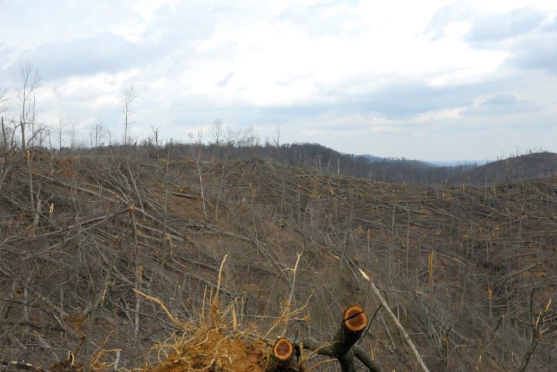
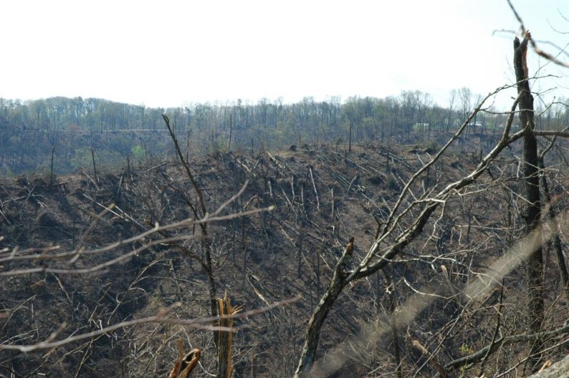
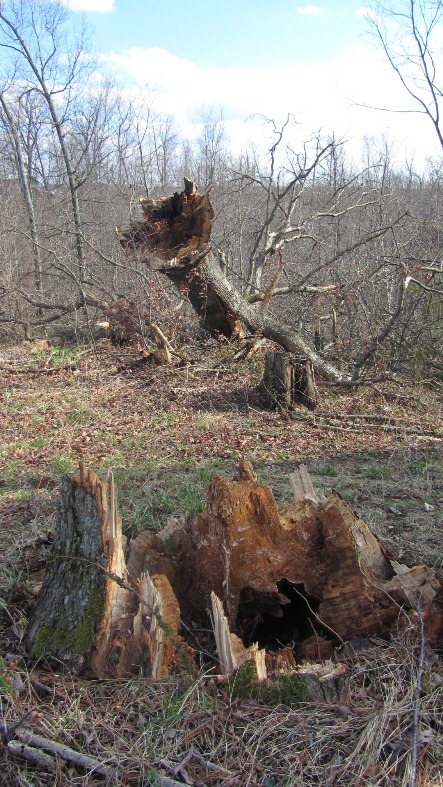
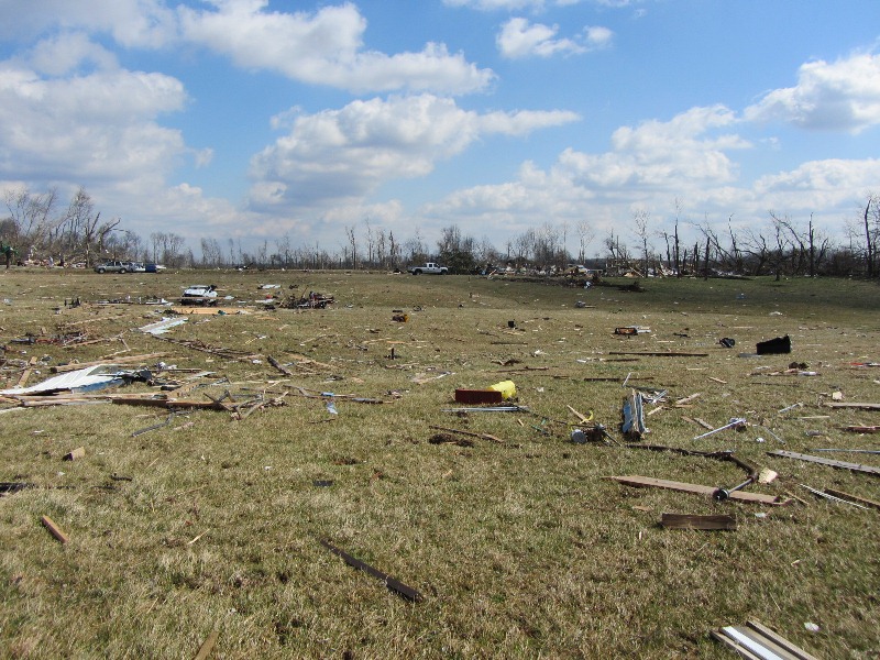
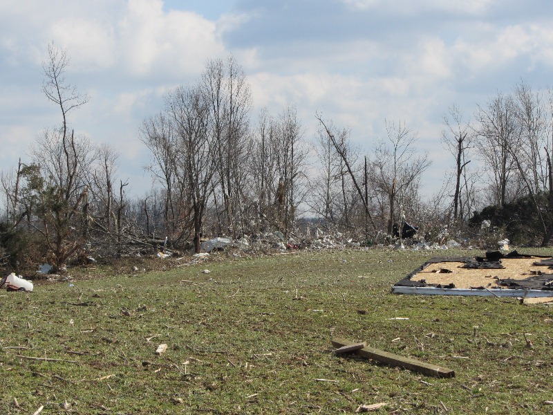
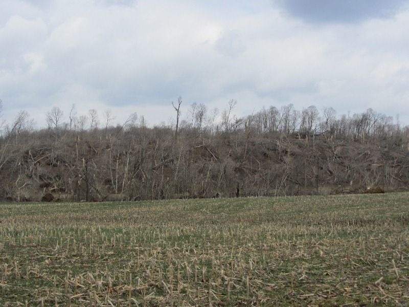
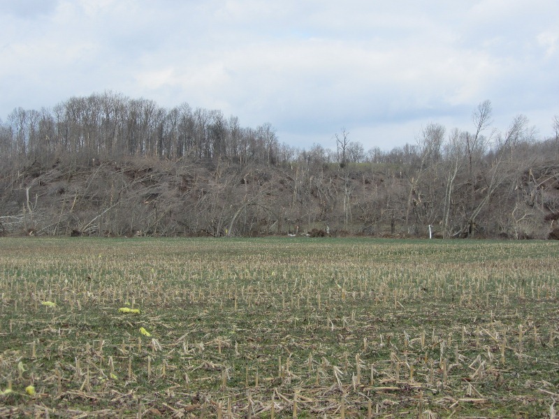
Across Washington County, particularly east of IN 135, thousands of trees were uprooted and snapped.
Clark & Scott Counties, IN Segment
Begin Time: 3:09 PM EST
End Time: 3:26 PM EST
EF Scale: EF-4
Wind Speed: 175 mph maximum
Begin Point: Washington County-Clark County line just east of South Flatwood Road
End Point: Near Clark-Scott-Jefferson County line just north of State Highway 362
Path Length: 17.0 miles across Clark County
Path Width: 0.4 mile
Injuries: Unknown
Fatalities: 2 (1 in Clark County, 1 in Scott County)
The National Weather Service in conjunction with Clark County Emergency Management conducted an exhaustive tornado damage survey on Saturday and Sunday, March 3 and 4. Below are the results. The tornado continued east-northeast in far northwest Clark County on Dan Gray Road where the twister leveled many well-built homes and caused extensive tree damage. The tornado here was rated EF4 with estimated wind speeds of 170 mph and a damage width of one-third mile.
The tornado moved into far southeast Washington County before reappearing in Clark County. In Clark, the damage width narrowed to one-quarter mile as the tornado crossed Pixley Knob Road and decreased in intensity to EF2 with wind speeds of 115-120 mph.
Farther east, the tornado intensified again as it destroyed two double wide homes on Speith Road. One family residence on the west side of the road was severely damaged, reflecting EF3 damage with 150 mph winds.
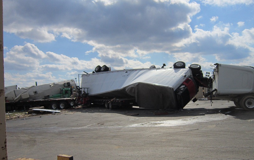
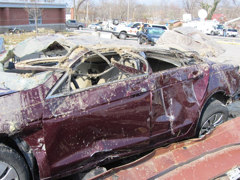
The tornado crossed Interstate 65, damaging several vehicles and semis and closing the interstate for several hours. Several people were trapped in these vehicles, but were later rescued.
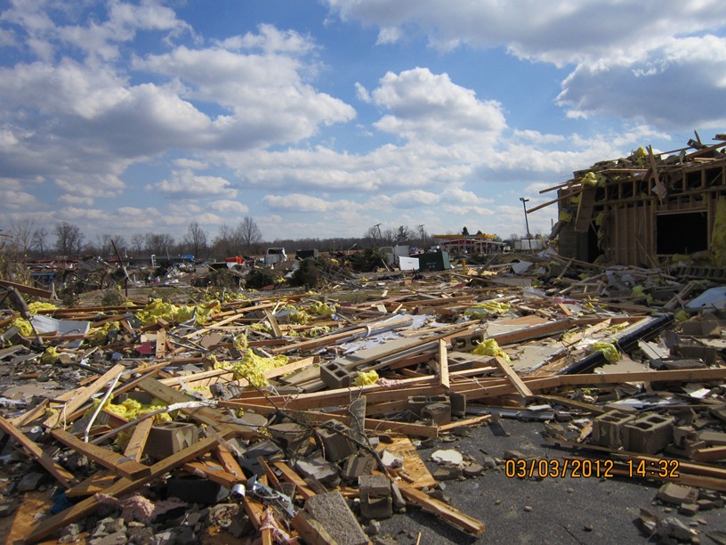
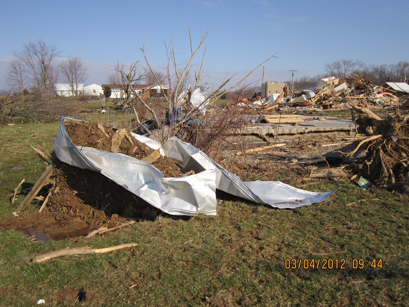
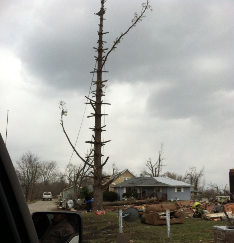
The tornado continued to strengthen just east of Exit 19 of Interstate 65 in a heavily industrialized area. Here, buildings containing several businesses were severely damaged. A home was destroyed on the east side of North Fraucke Road. The violent tornado also seriously damaged several homes on the north side of State Highway 160. Here, there was evidence of multi-vortex structure with EF4 damage and 175 mph estimated winds.
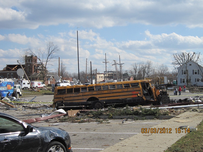
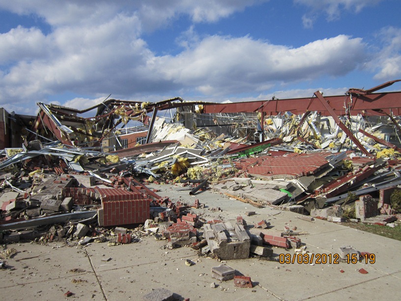
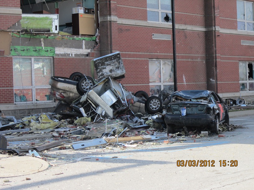
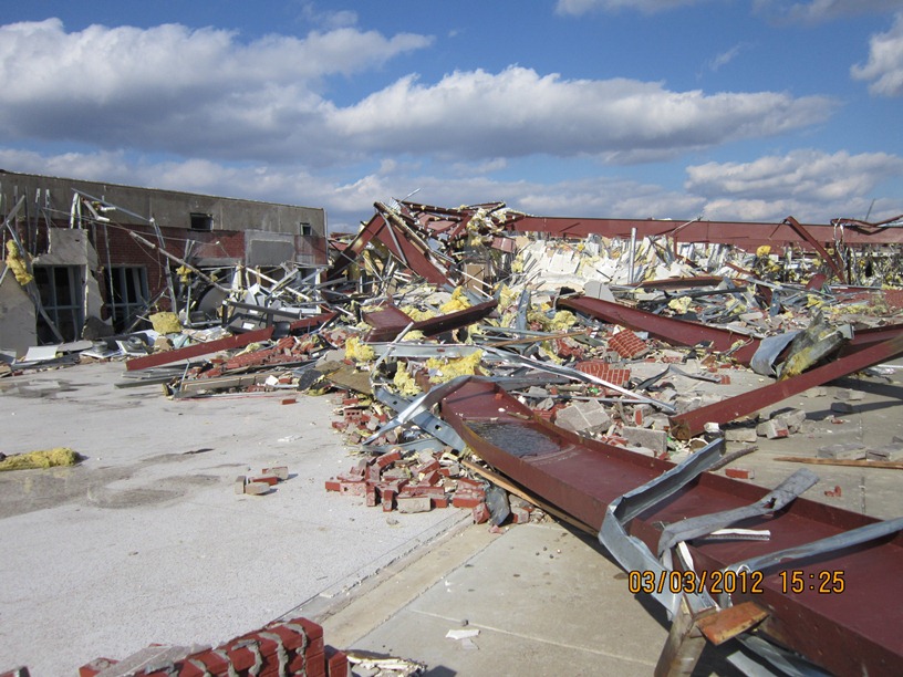
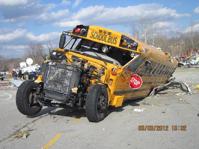
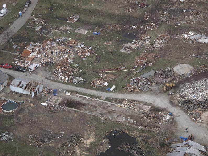
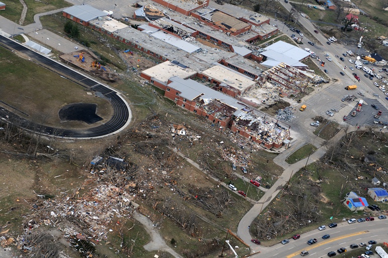
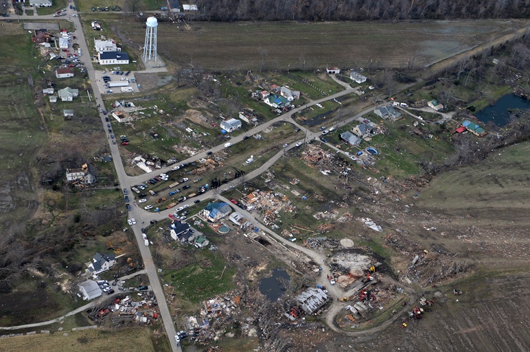
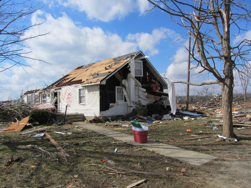
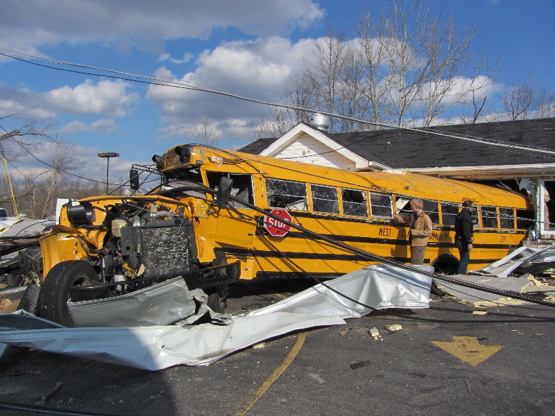
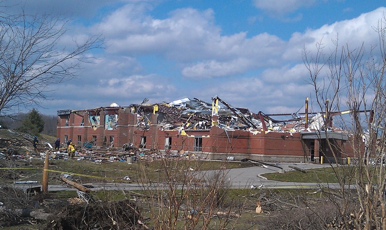
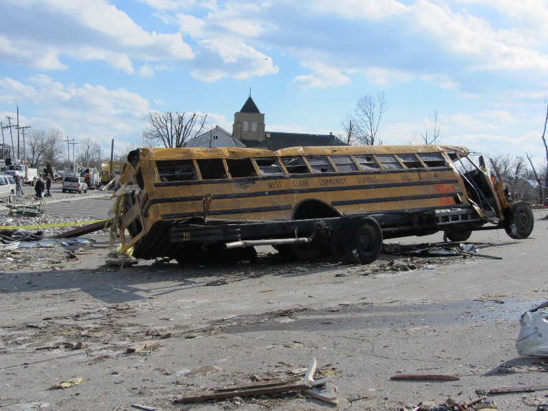
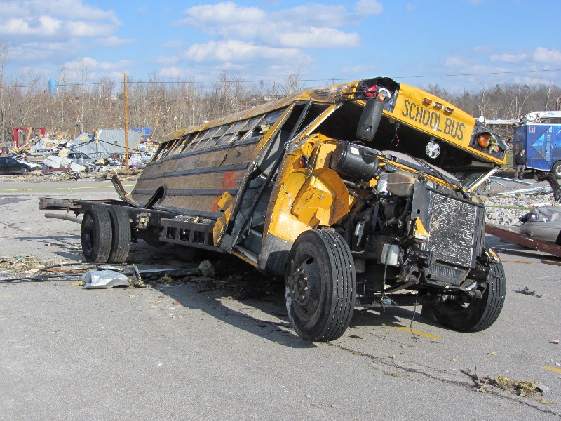
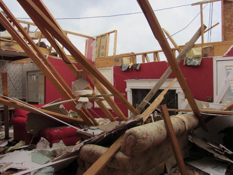
The tornado then struck the south buildings of the Henryville middle and high school complex, with severe damage and 170 mph winds (EF4). The middle school experienced the worst damage. The cafeteria was completely destroyed. Two school buses were ripped off their chassis.
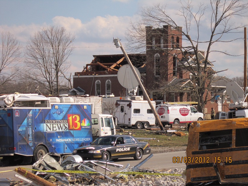
There was also extensive structural damage on the east side of Henryville on North Front Street and Pennsylvania Street. A high tension tower and other homes were damaged on Pine Drive. Incredible tree damage also occurred just west of Pine Drive as the tornado traveled up a ridge. In this region, the tornado was an EF3 with 150 mph winds.
On Brownstown Road, many homes were severely damaged especially on the north side of the tornado track with estimated speeds of 150 mph (EF3). Farther east, there was massive deforestation on the east side of a ridge just west of and along Henryville Otisco Road. Several more homes were severely damaged along this road. One of these homes reflected EF4 damage and 170 mph winds.
The tornado rapidly narrowed to a rope-like structure and ended as an EF1 with 90-95 mph winds and an 80 yard wide path. This occurred near the intersection of Blackberry Trail and State Highway 3.
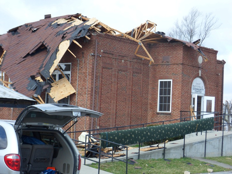
Simultaneously, a new cyclic tornado vortex rapidly formed from the same supercell near Mahan Road and Old State Road 3 immediately southwest of the first tornado. The second tornado began as an EF1 and damaged a church and a few trees. The vortex quickly intensified to EF3 strength as it crossed the south portion of the town of Marysville, severely damaging several homes.
East of Marysville, another cyclic vortex from the parent storm formed just southwest of the intersection of Nabb New Washington Road and Nabb Marysville Road. This vortex intensified and merged with the primary circulation. The tornado severely damaged or destroyed several houses and double wide mobile homes around the intersection of Nabb New Washington and Nabb Marysville. Debris from the double wides was tossed around a mile downwind. The tornado was rated EF3 here with 150 mph winds and a damage width of one-third mile.
A Civil Air Patrol flight on Sunday, March 4 revealed extensive ground scouring in farmers` fields east of Marysville all the way to the Jefferson-Scott County line. This scouring was evidence of a multi-vortex tornado, which was confirmed by multiple videos and photographs.
The tornado continued north of Barnes Road, damaging several clusters of trees in open country. The tornado intensified east of the intersection of Kettle Bottom and State Highway 362.
In Scott County, immediately north of Highway 362 and east of Concord Road, three homes were severely damaged while five double wide mobile homes were completely destroyed. Here, the tornado was an EF4 with 170 mph winds. Just south of 362 in Clark County, two additional homes and power poles were damaged greatly. From there, the tornado crossed into Jefferson County, Indiana.
Jefferson County, IN Segment
Begin Time: 3:26 PM EST
End Time: 3:34 PM EST
EF Scale: EF-4
Wind Speed: 175 mph maximum
Begin Point: Immediately north of the 3 county intersection of Clark, Scott, and Jefferson Counties
End Point: Ohio River near Lee Bottom
Path Length: 7.3 miles across Jefferson County
Path Width: One-third mile maximum (diameter of damage)
Injuries: Unknown
Fatalities: 4
The National Weather Service in conjunction with Jefferson County, IN Emergency Management conducted the tornado damage survey in Jefferson County. The tornado traveled from Clark County, Indiana across extreme southeast Scott County and into far southern Jefferson County. Damage was observed along and just north of State Highway 362 near the 3-county line. This included several mobile homes totally destroyed, several framed houses heavily damaged, tremendous tree damage, and power poles snapped and shredded. The observed damage width was one-third of a mile with estimated winds of 170 mph (EF4).
The tornado traveled east-northeast snapping trees and power poles on County Road 850, and did its most significant damage at the intersection of Jackson Road, State Highway 62, and Swan Road about 2 miles south of the town of Chelsea.
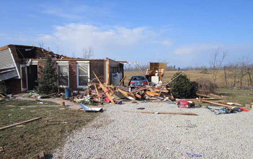
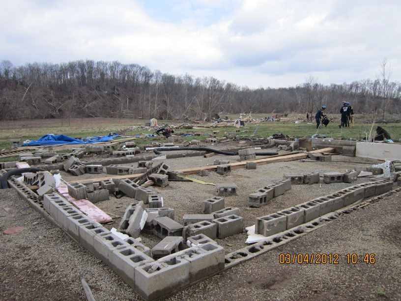
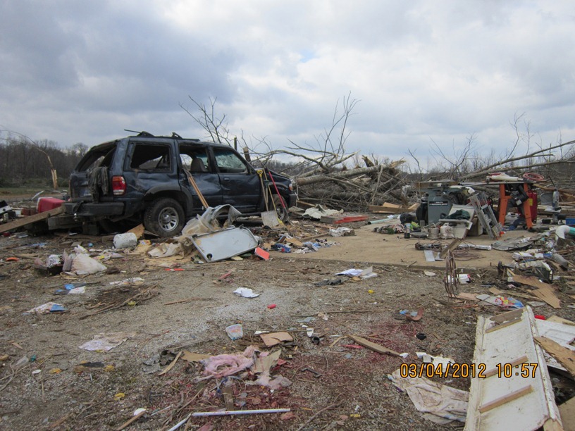
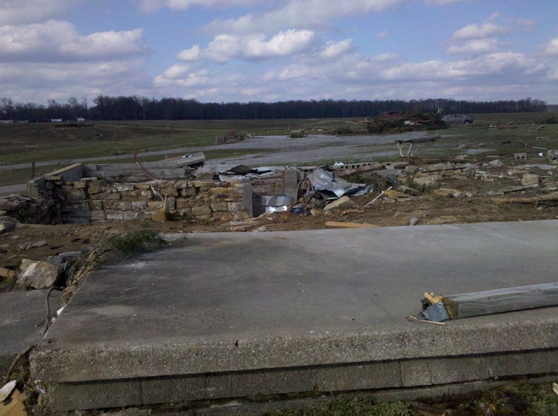
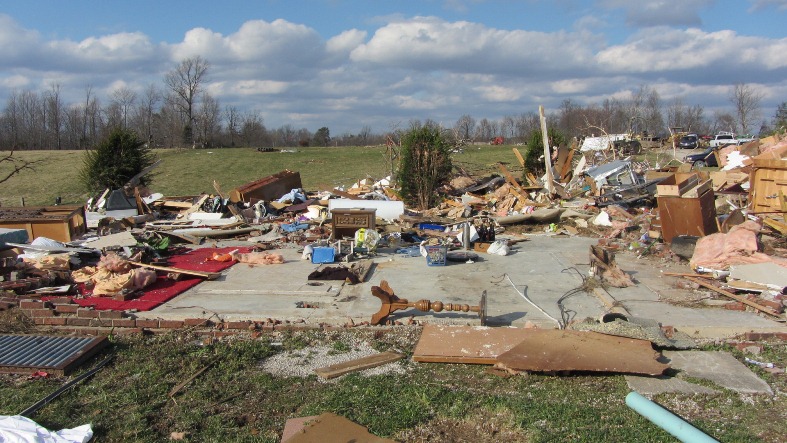
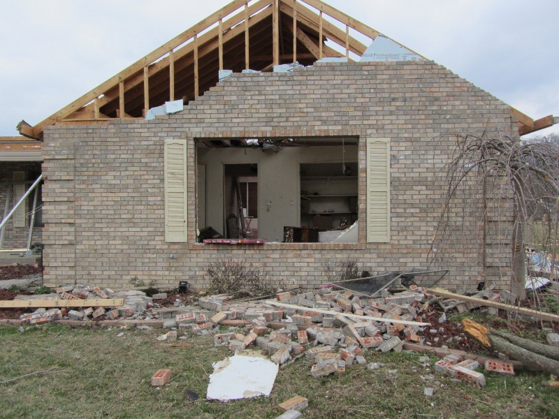
In this area, several well-built brick homes were destroyed. The homes had anchor bolts attached to steel plates and a concrete foundation. One house was lifted and slid 65 yards off its foundation while mostly still intact. Another home was completely demolished and thrown downwind several hundred yards, within which there were 3 fatalities. The garage of this house was destroyed with one vehicle thrown 30 yards and another tossed 75 yards. A piece of farm equipment was thrown 200 yards as well. A third well-built brick home had its roof completely lifted and thrown over 300 yards downwind. Also, an above ground pool half filled with water was missing. Wind speeds in the area were estimated at 170-175 mph (EF4) with a damage width of one-quarter mile.
The tornado tracked to the north of Paynesville and south of Lee Bottom, extensively damaging forests in southern Jefferson County before crossing the Ohio River into Trimble County, Kentucky. The damage width narrowed in this area to only a couple hundred yards.
Trimble County Segment
Begin time: 3:35pm EST
End time: 3:39pm EST
Begin point: Ohio River southwest of Trout
End point: 4 miles north-northwest of Bedford on Highway 2870
EF Scale: EF2
Wind speed: 115 mph
Path length: 5.4 miles
Path width: 200 yards
Injuries: 2
Fatalities: 0
The National Weather Service in conjunction with Trimble County Emergency Management conducted an extensive tornado survey in Trimble County. The tornado crossed the Ohio River from Jefferson County, Indiana and narrowed to about 200 yards wide. The tornado damaged a home on Rodgers Road, overturned two barns, and uprooted and/or twisted several trees. This was consistent with EF1 damage and 105-110mph estimated winds.
At the same time a second vortex formed immediately adjacent to the first vortex and totally destroyed a barn on Rodgers Road and extensively damaged another. This tornado also damaged a lot of rugged forested area before intersecting with the path of the first vortex near the confluence of Highway 1838 (Corn Creek Road, Highway 625, and Joyce Mill Road. In this area the tornado was rated as an EF2 with 115 mph estimated winds.
Three single-wide mobile homes near the intersection of Joyce Mill Road and Highway 625 were destroyed along with tree damage and downed power lines and poles. This was consistent with EF1 damage, 105 mph estimated winds, and a damage width of 75 yards.
No evidence of further damage was observed until Rawlett Lane, where some trees were snapped and uprooted. There could have been damage in-between although the survey team was unable to access this area. The tornado then struck two homes and a single-wide mobile home on New Hope Ridge Road (Highway 2870) about 1.5 miles west of Highway 421. Here EF1 damage, 90 mph winds, and a path width of 50 yards were estimated. The tornado lifted near this location.
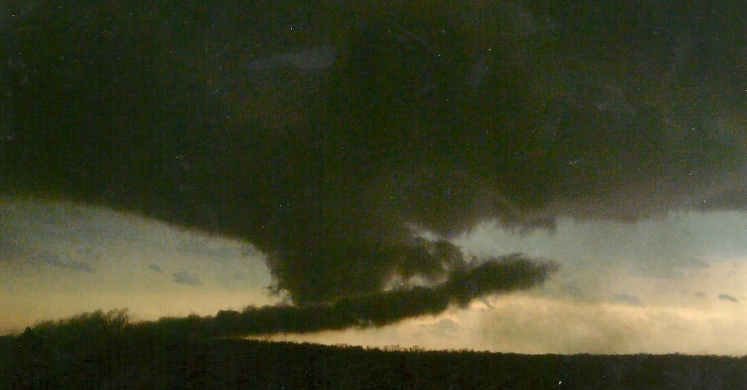
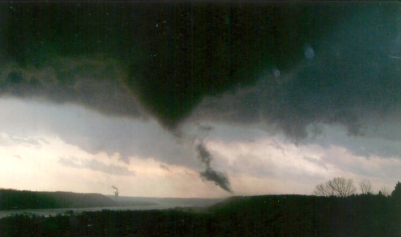
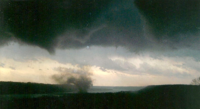
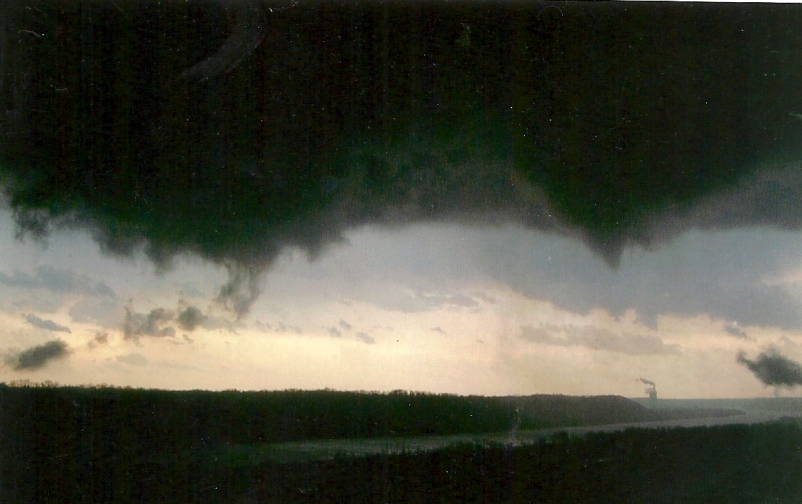
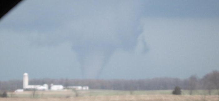
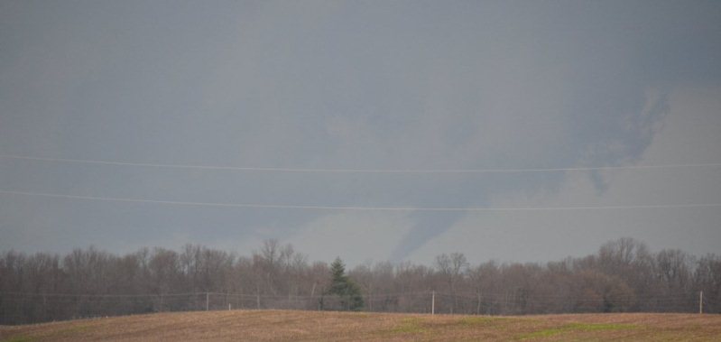
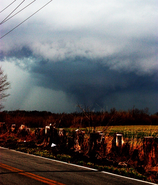
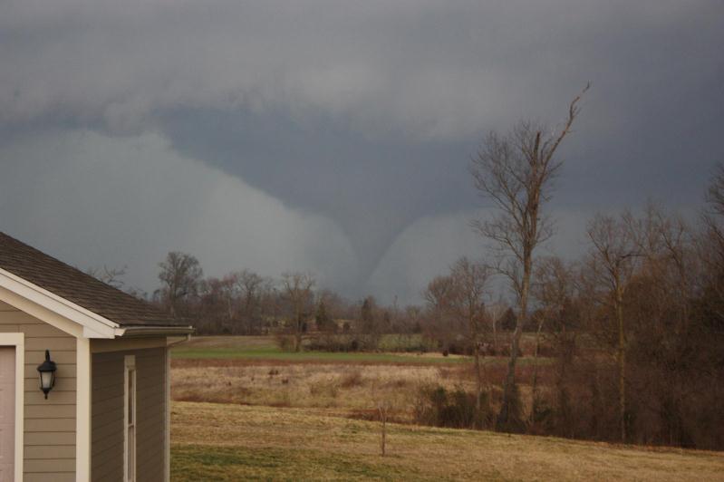
Southern Indiana EF-4 tornado -- 49 miles -- 2:50 PM EST to 3:39 PM EST.
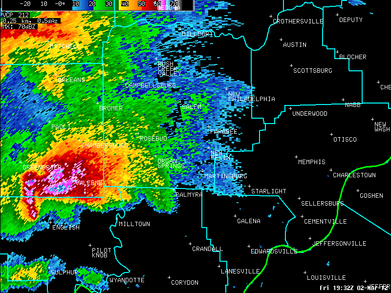
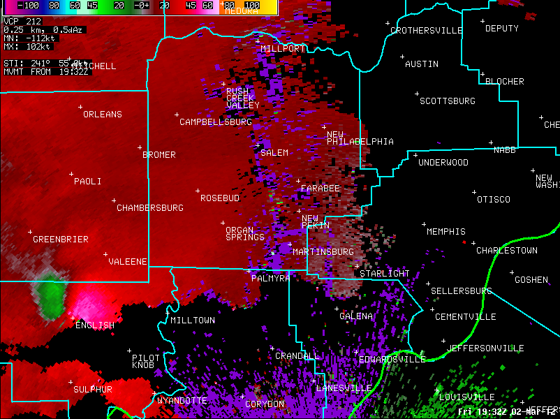
The radar loops above of Reflectivity (left) and Storm Relative Velocity (right) show two classic supercells tracking across southern Indiana. The lead
supercell is the storm that produced the long track EF-4 tornado, while the second supercell produced a weaker EF-1 tornado just south of
the EF-4, along with softball sized hail.
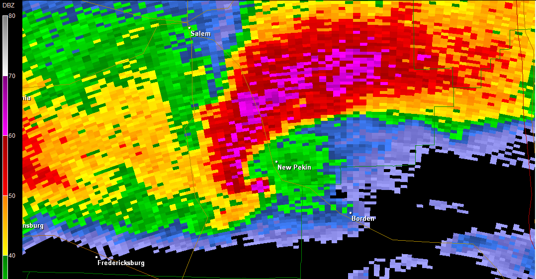
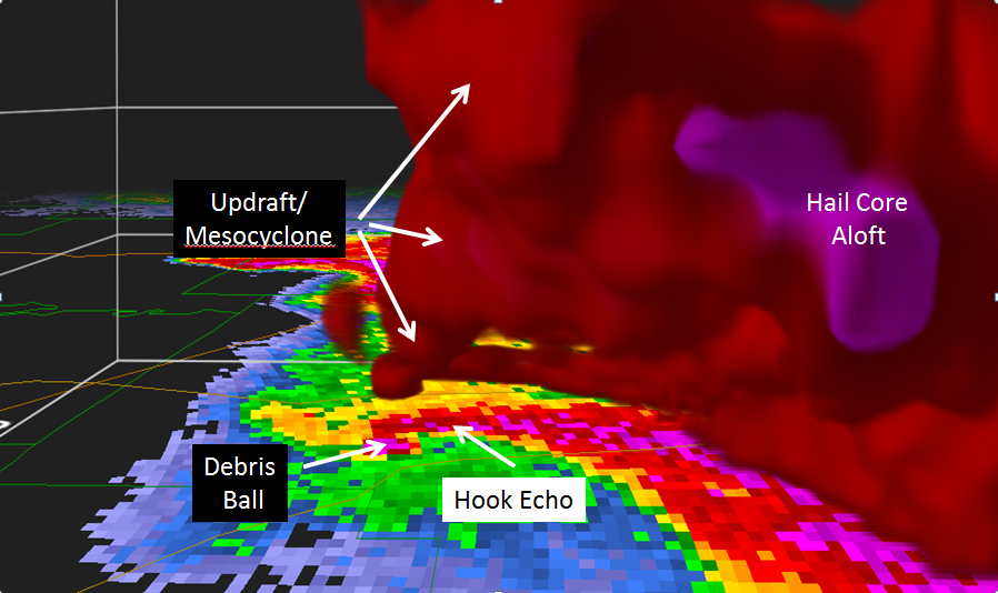
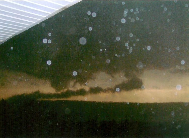
Pictured above are a 2D reflectivity image (left) and a 3D reflectivity image (right) showing the EF-4 producing supercell as it nears New Pekin, Indiana.
The 3D image is from the east looking west through the storm. Notice how visible the storm updraft and mesocyclone are above the debris ball indicated on
either reflectivity image. This is where the tornado was located. Also of note is a large hail core suspended aloft, and low level reflectivites being wrapped around
the back side of the updraft, creating the "hook" in reflectivity.
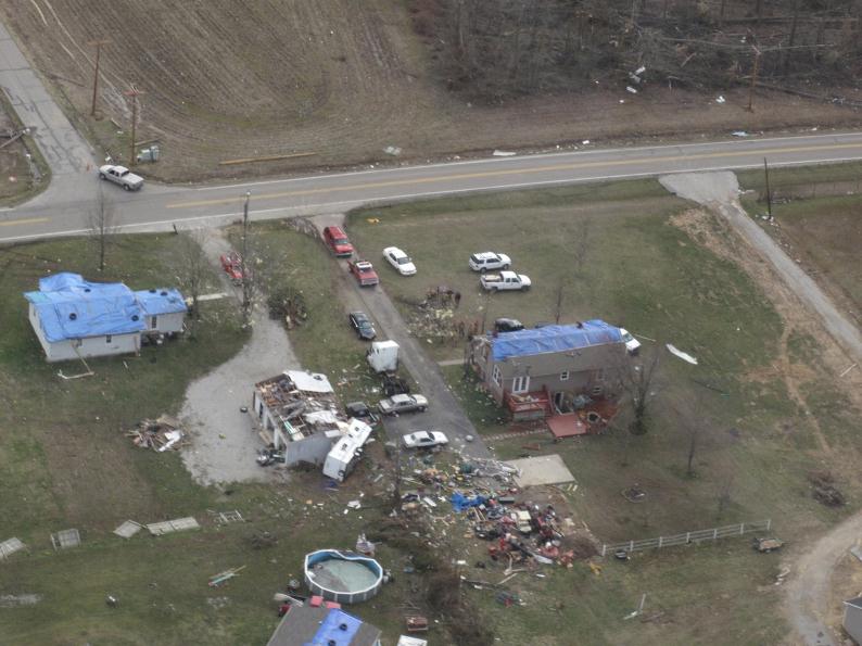
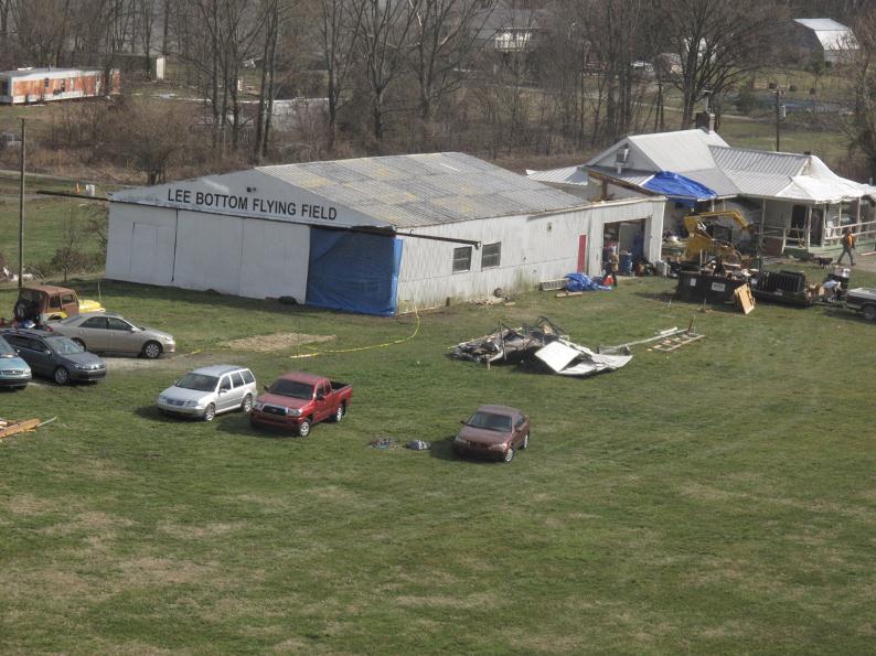
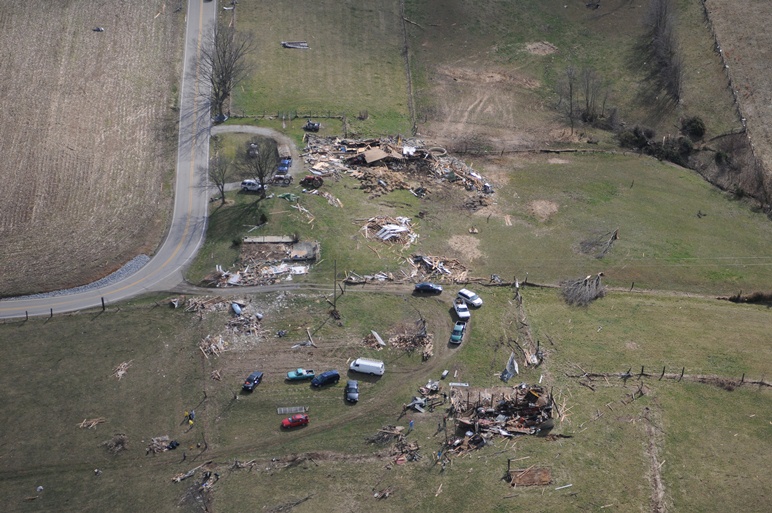
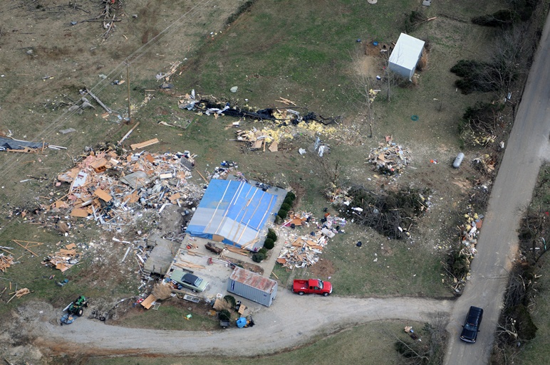
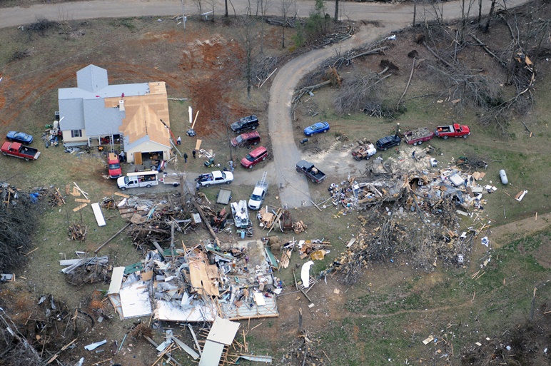
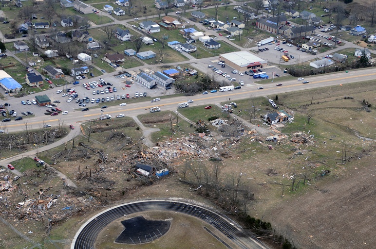
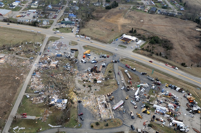
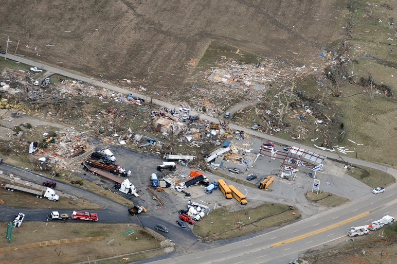
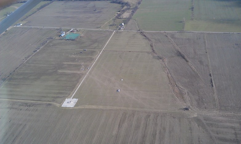
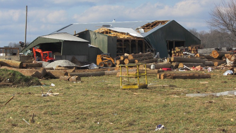
Aerial Photos courtesy Dr. Keith Mountain:
|
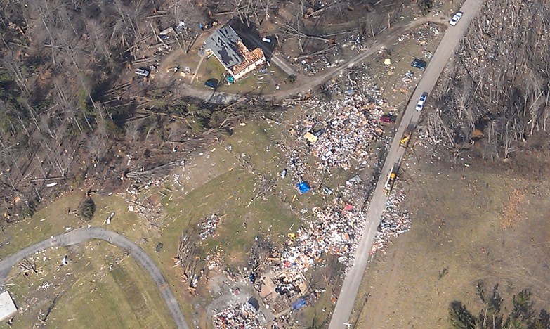
New Pekin |
New Pekin |
New Pekin |
New Pekin |
New Pekin |
|
New Pekin |
New Pekin |
New Pekin |
New Pekin |
New Pekin |
|
New Pekin |
New Pekin |
New Pekin |
New Pekin |
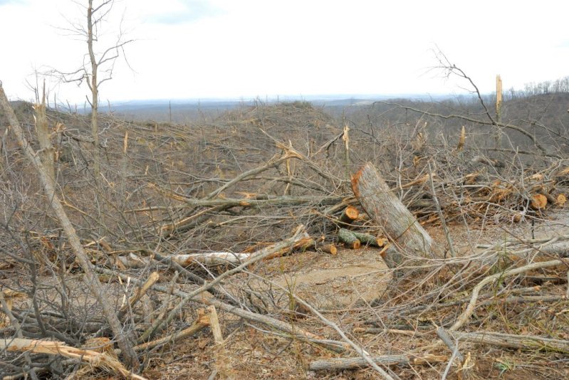
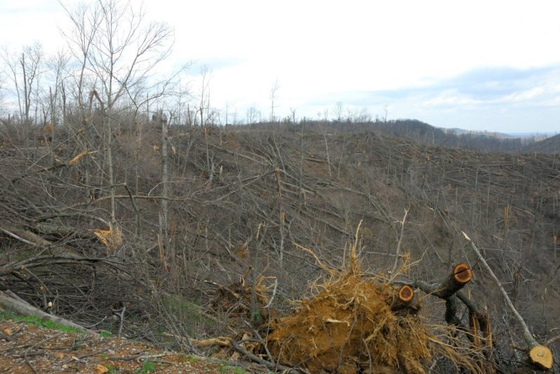
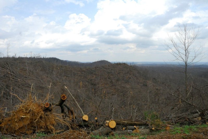
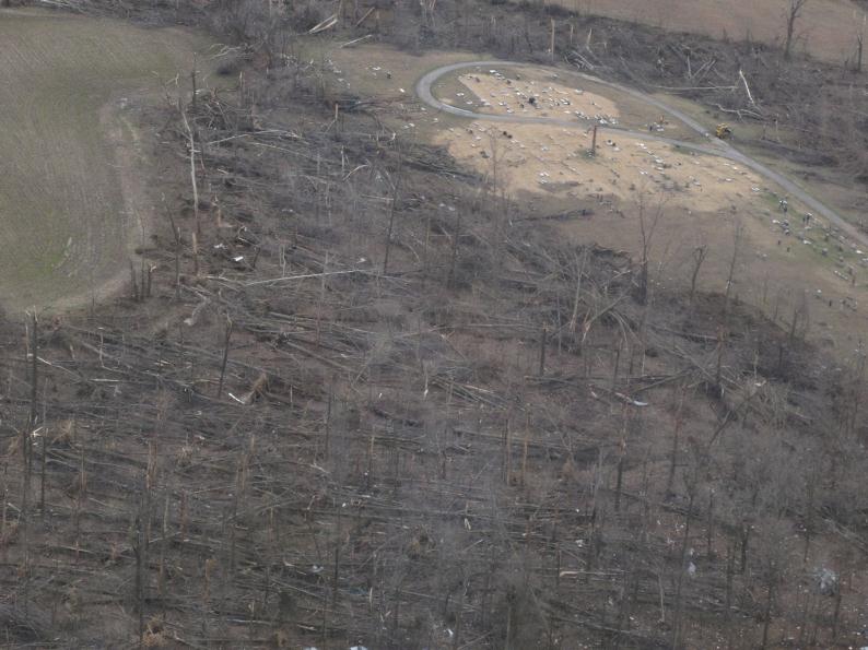
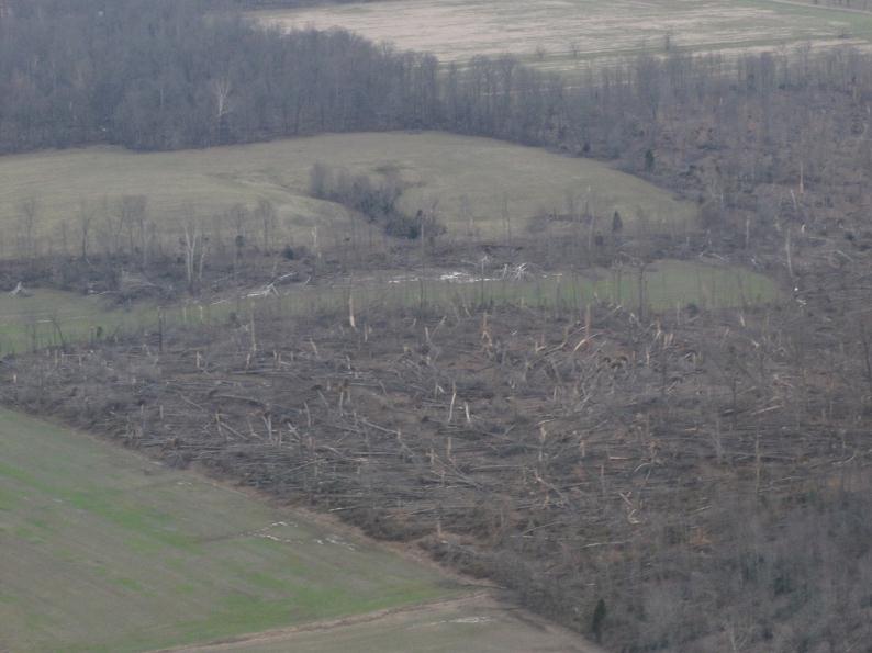
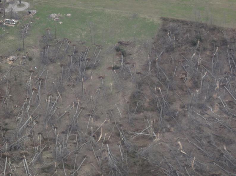
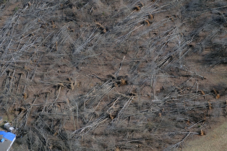
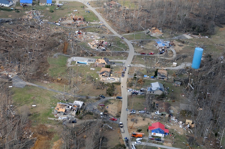
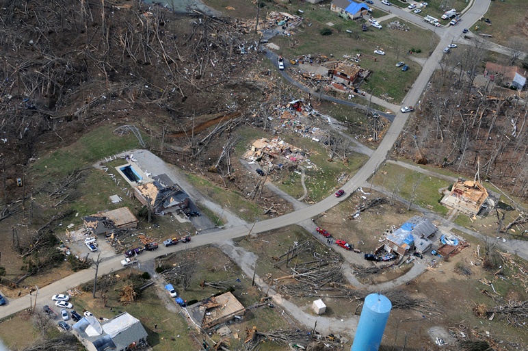
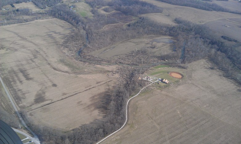
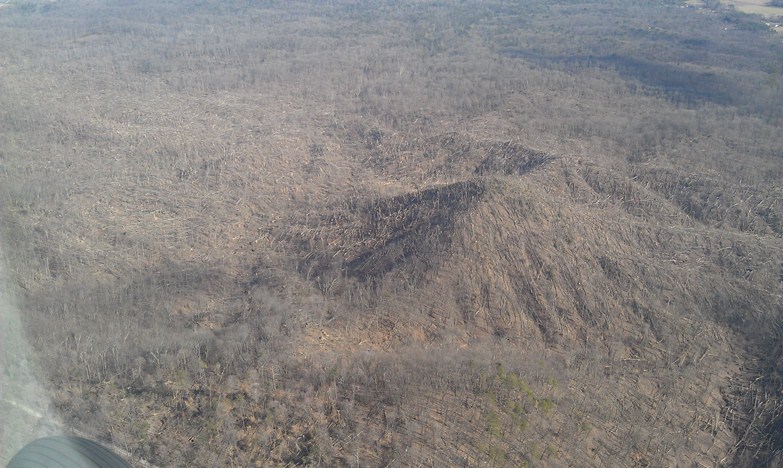
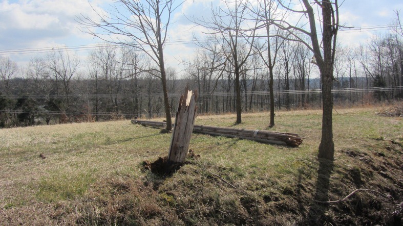
Clark State Forest |
|
Clark State Forest |
Clark State Forest |
Clark State Forest |
Clark State Forest |
Clark State Forest |
|
Clark State Forest |
Clark State Forest |
Clark State Forest |
Clark State Forest |
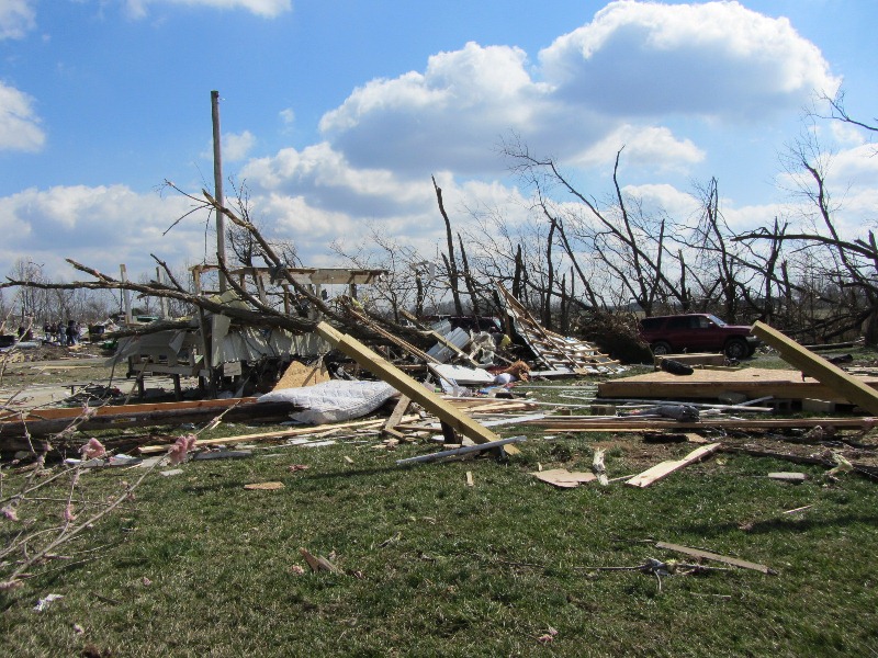
Between I-65 and Henryville |
|
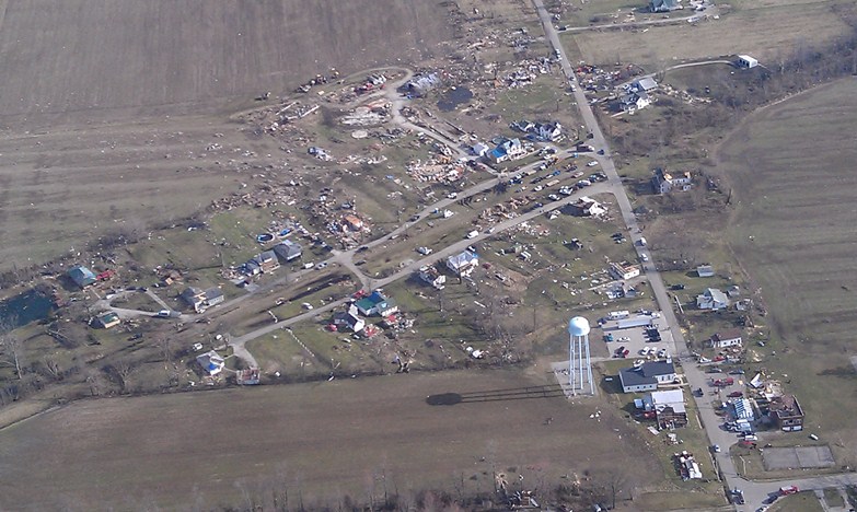
Henryville |
Henryville |
Henryville |
Henryville |
Henryville |
|
Henryville |
Henryville |
Henryville |
Henryville |
Henryville |
|
Henryville |
Henryville |
Between Henrysville |
Between Henryville |
Marysville |
Aerial Photos from NWS Storm Survey:
|
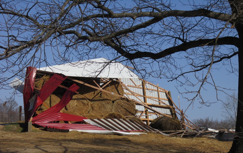
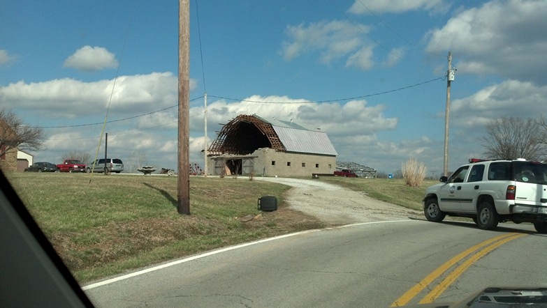
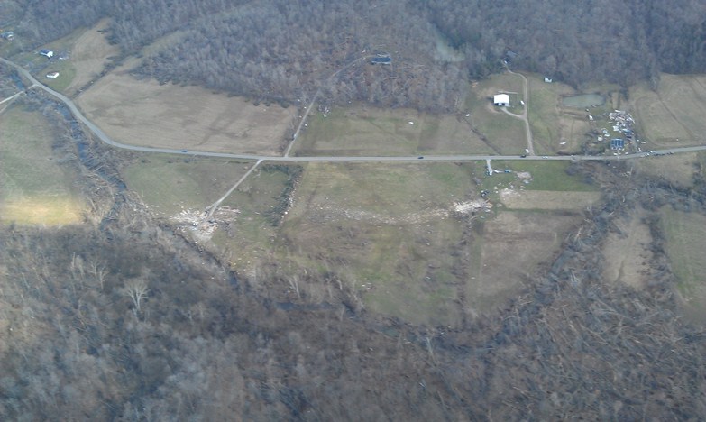
North of Palmyra |
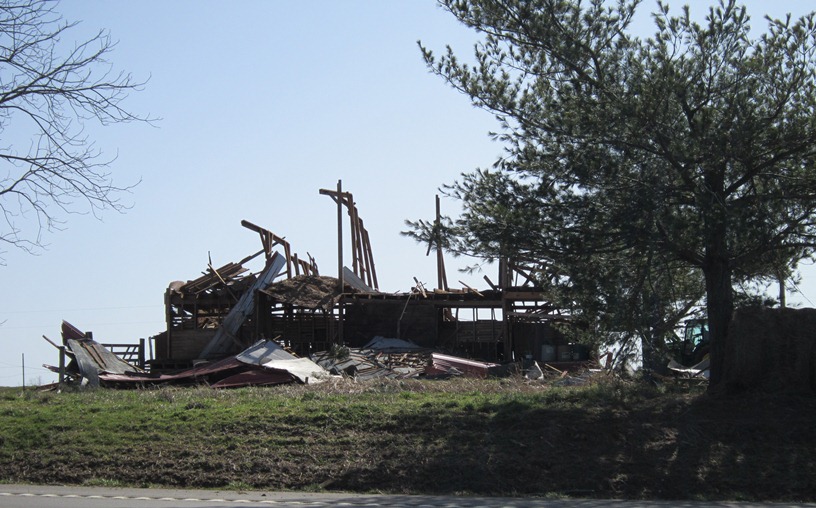
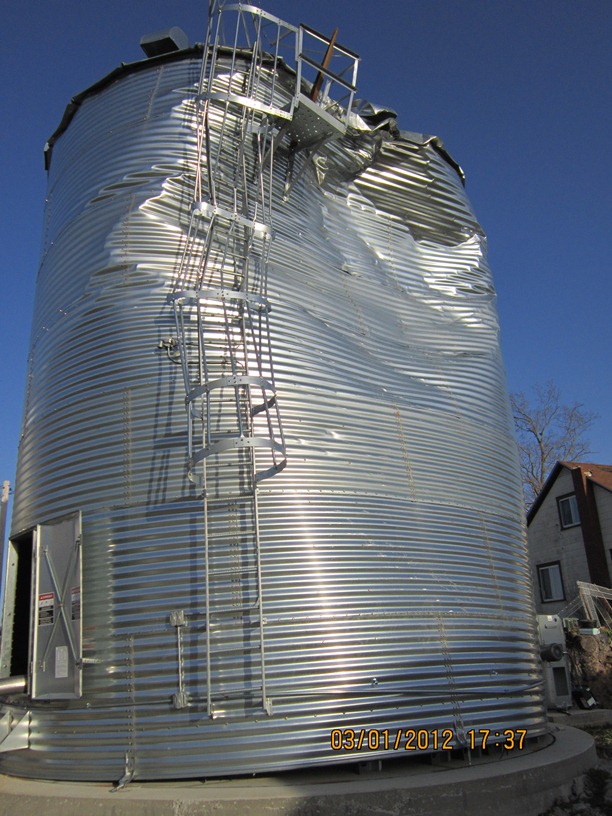
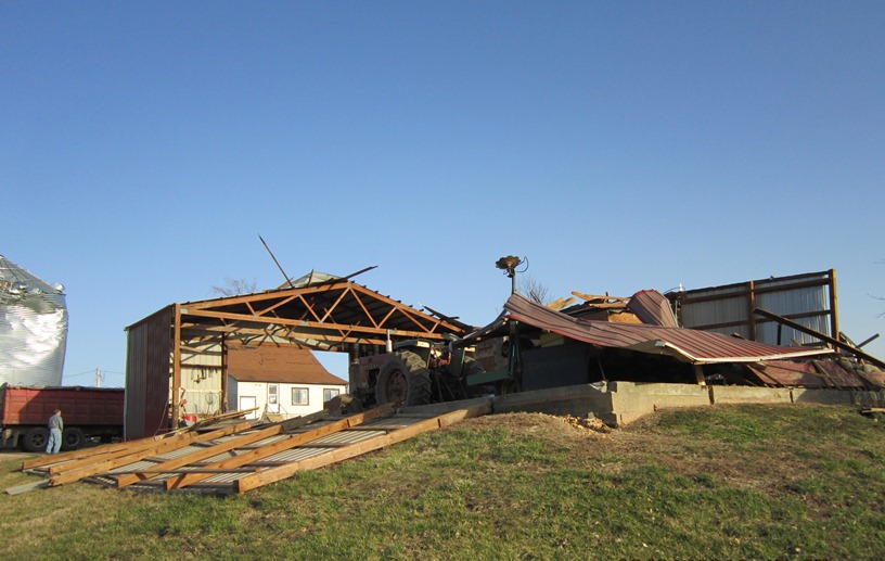
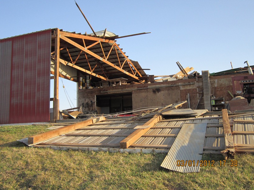
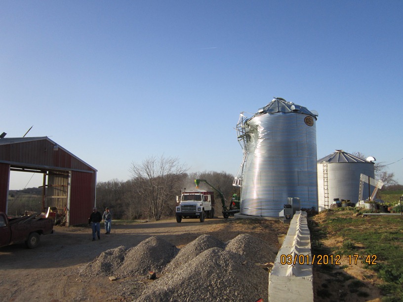
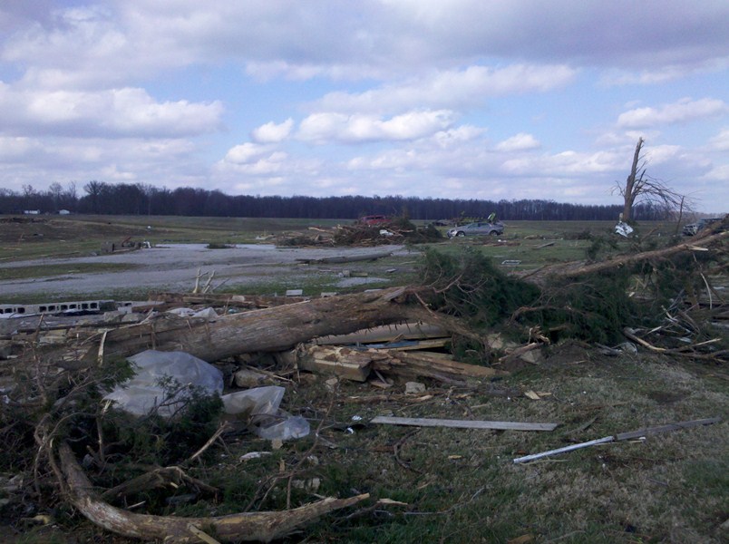
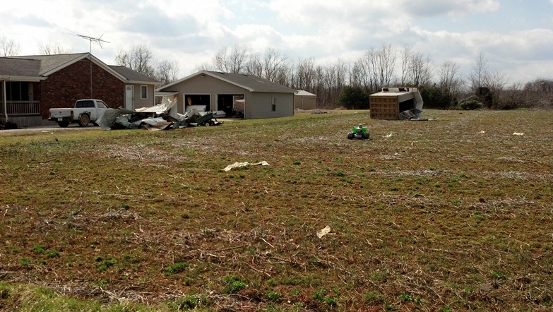
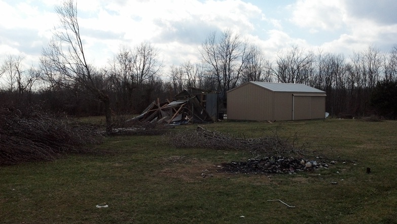
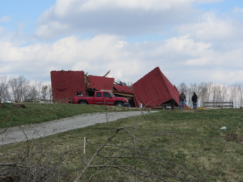
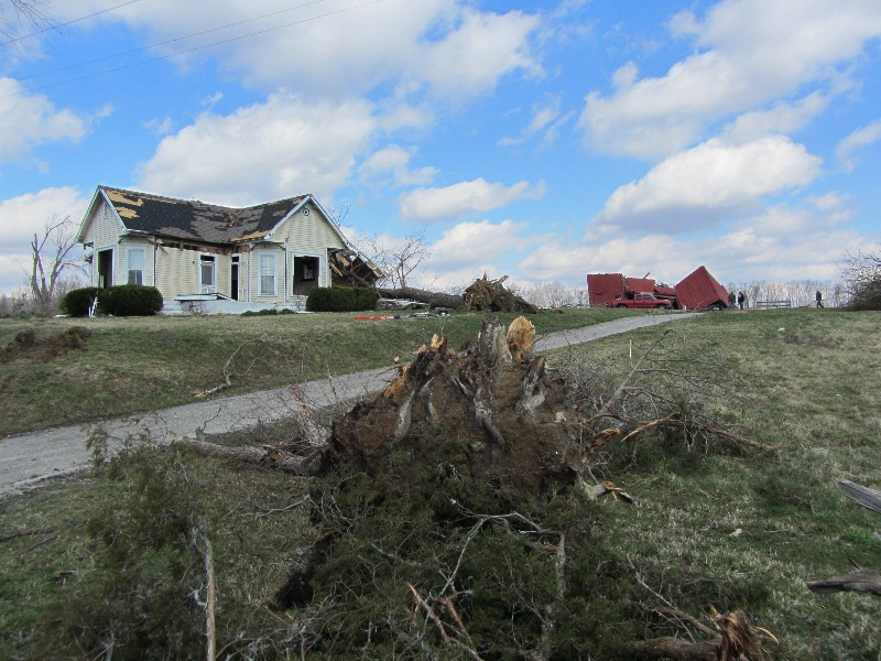
Southern Washington County |
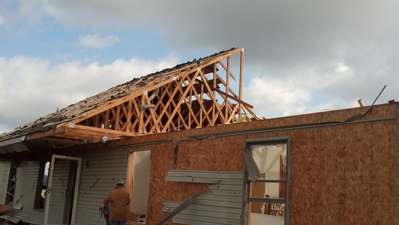
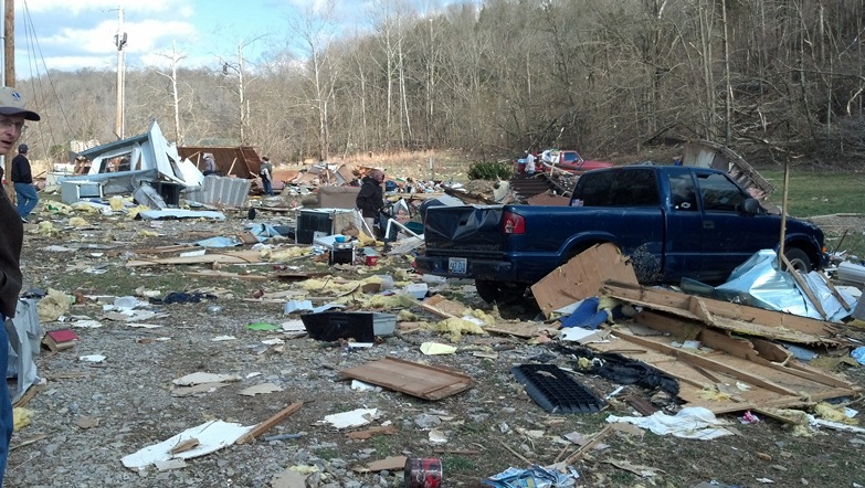
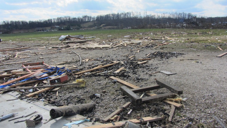
East of New Pekin in Washington County |
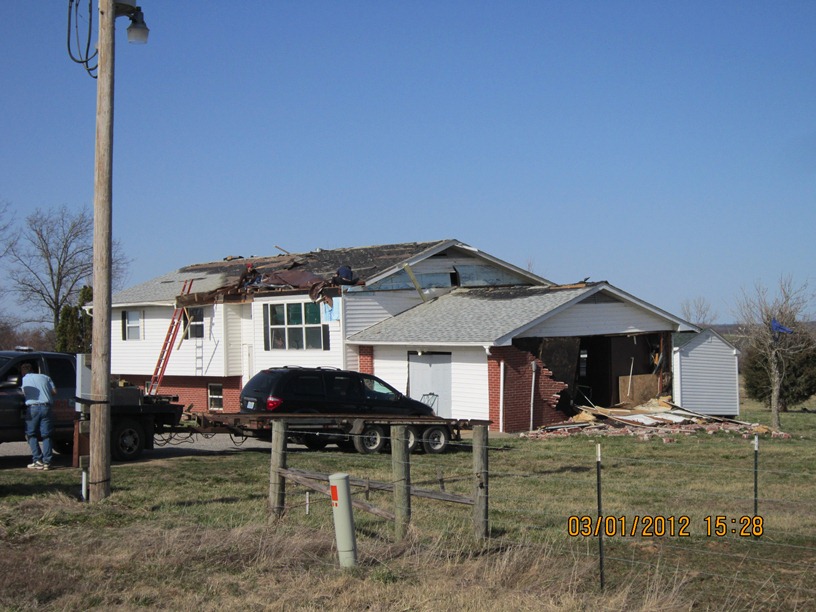
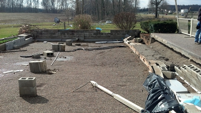
Daisy Hill Road southeast of New Pekin |
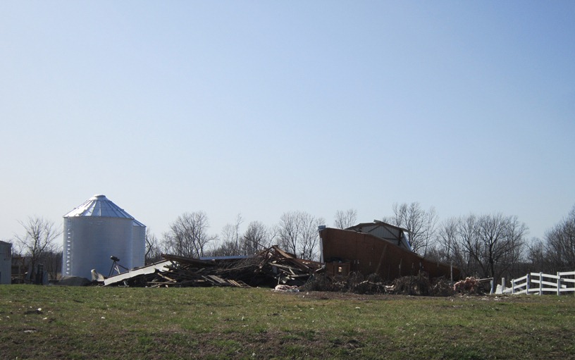
Washington/Clark county line |
|
Henryville |
Near Henryville |
Marysville |
Marysville |
Scott/Clark county line |
|
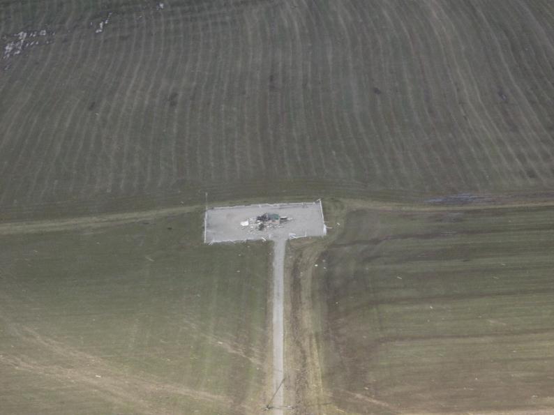
Southern Jefferson County north of Paynesville |
Trimble County |
|
|
|
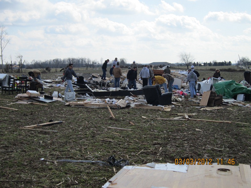
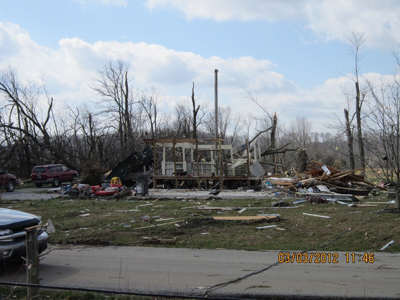
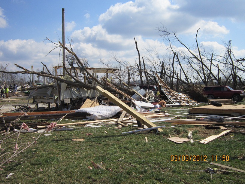
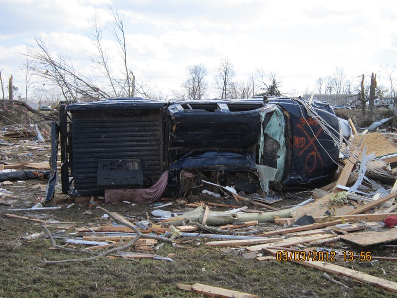
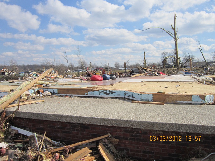
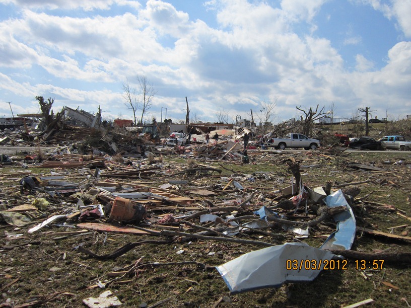
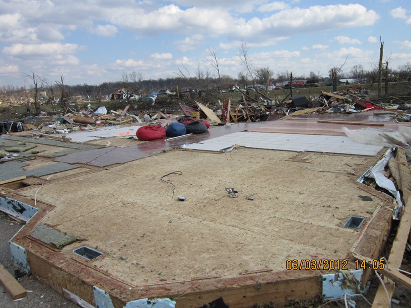
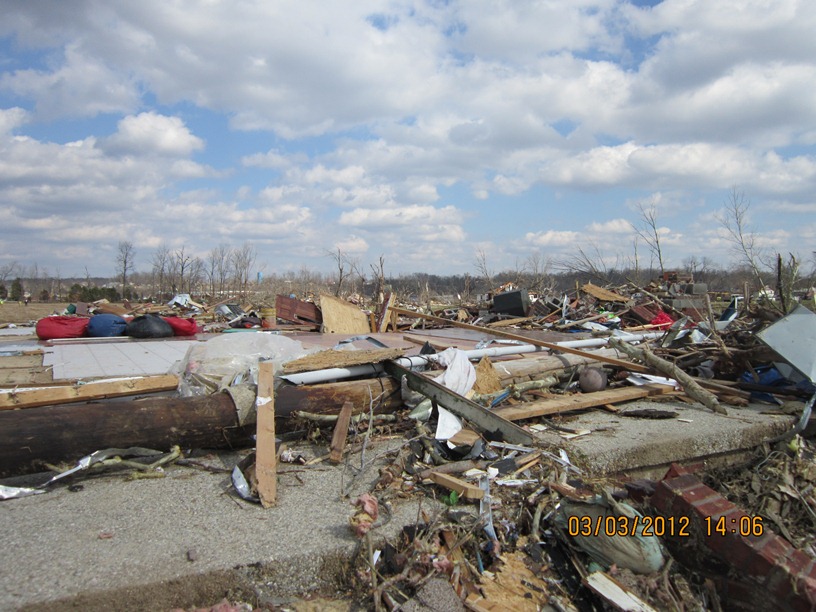
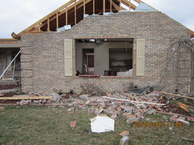
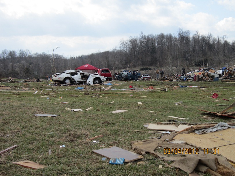
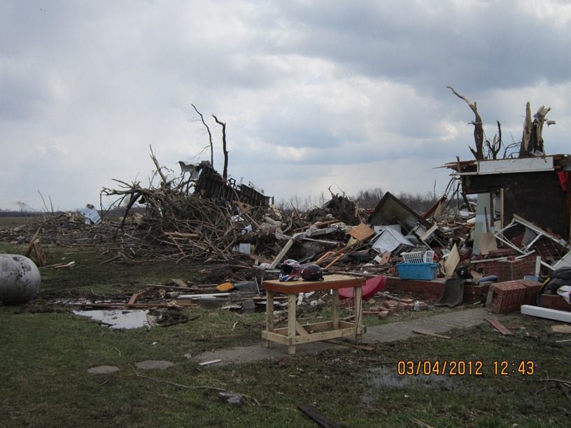
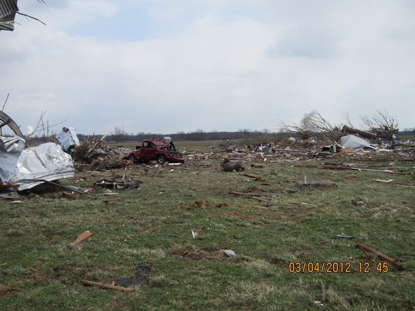
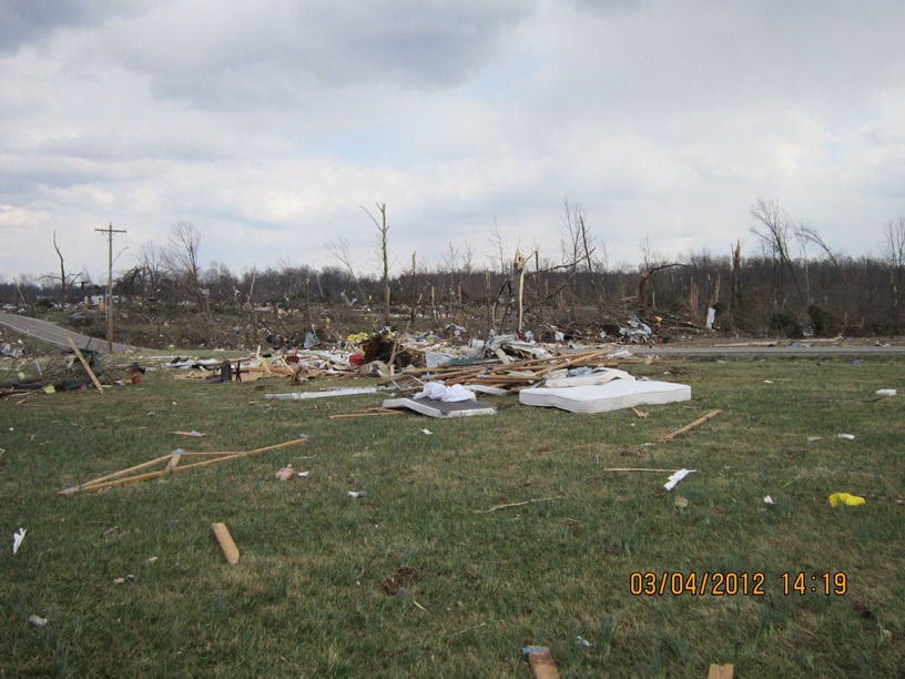
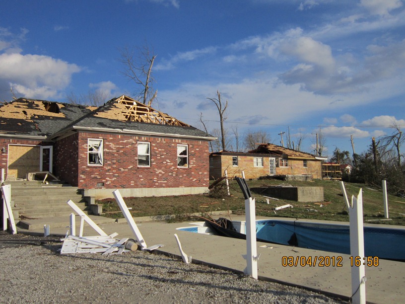
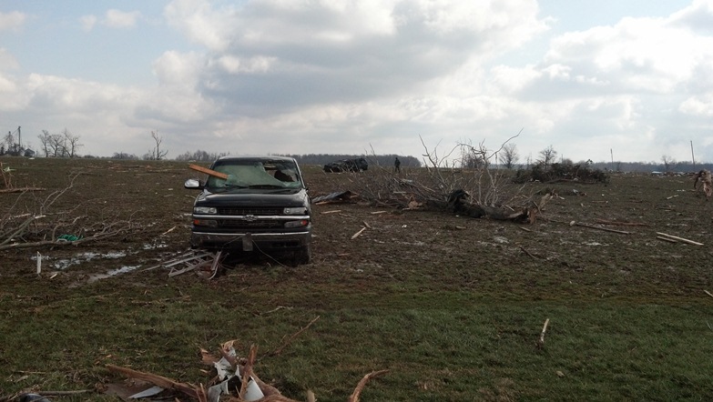
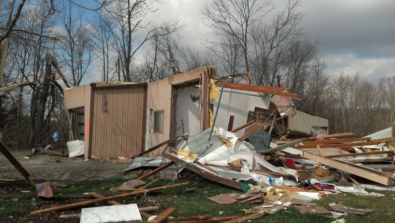
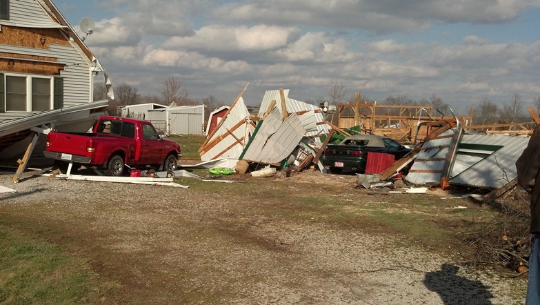
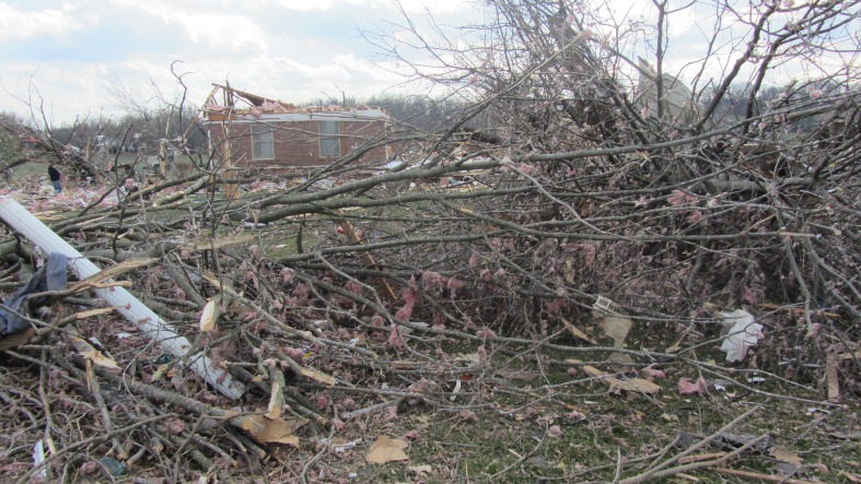
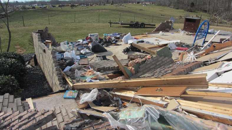
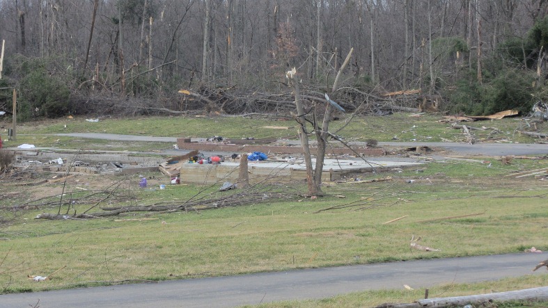
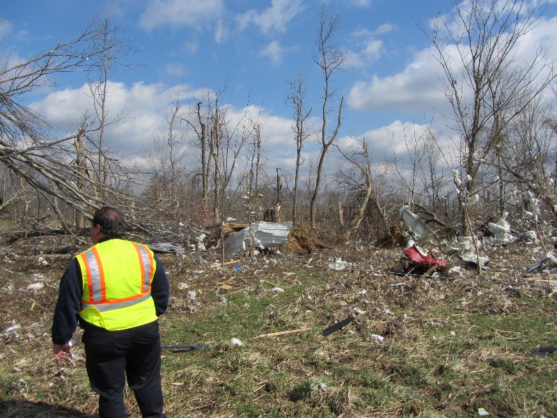
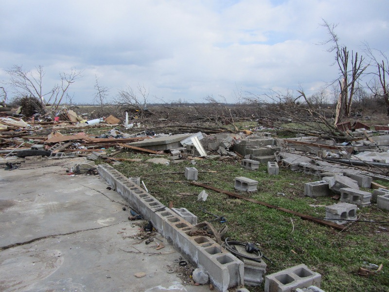
Washington County, IN Photos from NWS Storm Survey:
|
Horners Chapel Road near Fredericksburg |
Horners Chapel Road near Fredericksburg |
Horners Chapel Road near Fredericksburg |
Horners Chapel Road near Fredericksburg |
Horners Chapel Road near Fredericksburg |
|
Route 135 north of Palmyra |
East Trainer Lane southwest of New Pekin |
East Trainer Lane souothwest of New Pekin |
Route 335 south of New Pekin |
Robbs Lane south of New Pekin |
|
East Old Pekin Road |
East Old Pekin Road |
East Old Pekin Road |
East Old Pekin Road |
East Old Pekin Road |
|
East Old Pekin Road |
East Old Pekin Road |
East Old Pekin Road |
East Old Pekin Road |
East Old Pekin Road |
|
East Old Pekin Road |
East Old Pekin Road |
East Hurst Road |
East Hurst Road |
Washington/Clark County line |
|
Washington/Clark County line |
Washington/Clark County line |
Washington/Clark County line |
Washington/Clark County line |
Washington/Clark County line |
|
Washington/Clark County line |
Washington/Clark County line |
Daisy Hill Road |
Daisy Hill Road |
Daisy Hill Road |
|
Daisy Hill Road |
Daisy Hill Road |
Daisy Hill Road |
Daisy Hill Road |
Daisy Hill Road |
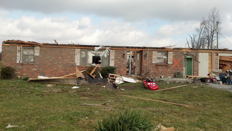
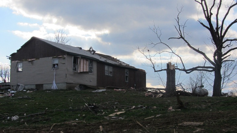
Washington County, IN Photos from the Public:
|
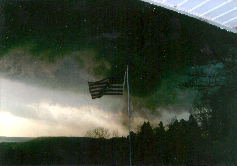
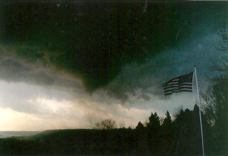
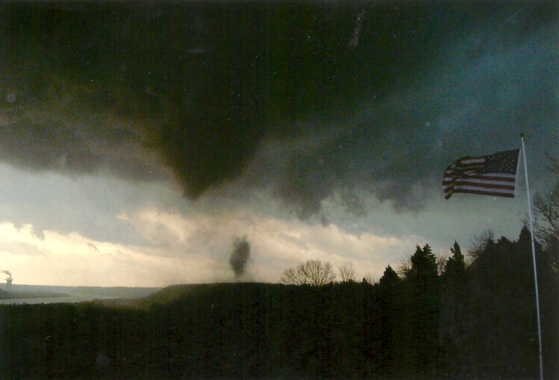
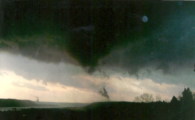
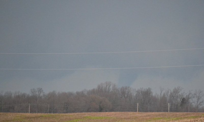
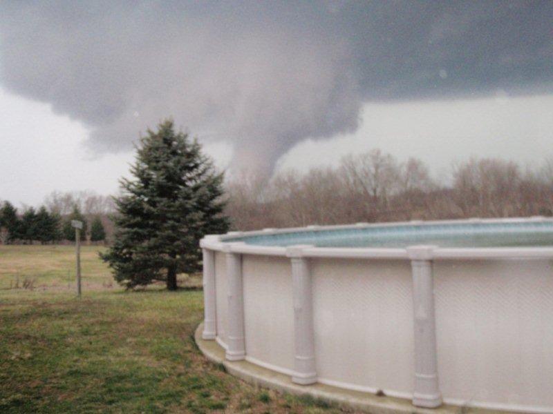
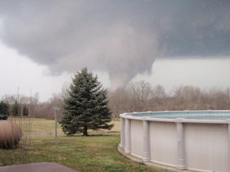
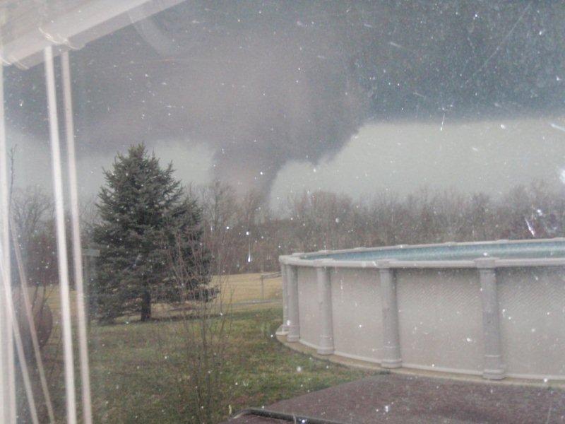
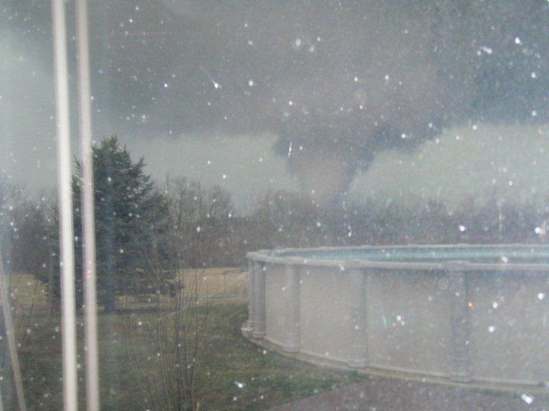
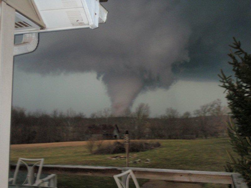
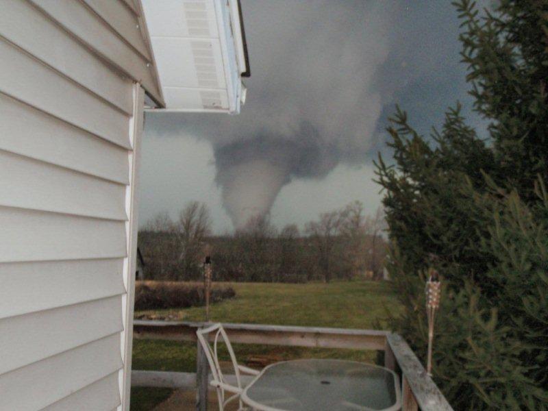
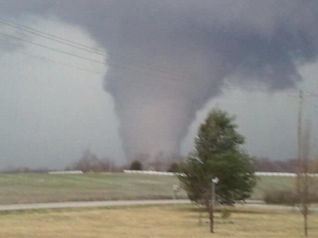
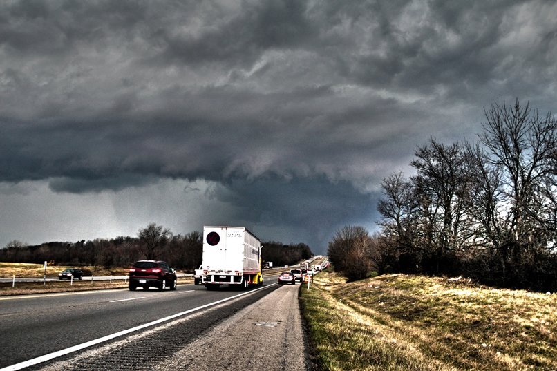
5 miles north of Palmyra. Photo: Bill Bordonaro |
5 miles north of Palmyra. Photo: Bill Bordonaro |
5 miles north of Palmyra. Photo: Bill Bordonaro |
5 miles north of Palmyra. Photo: Bill Bordonaro |
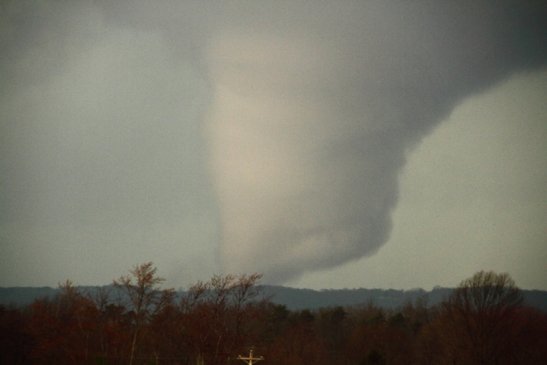
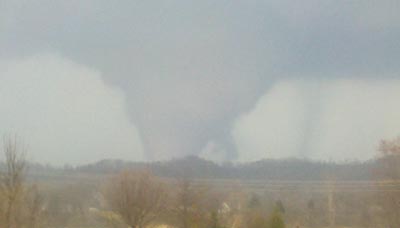
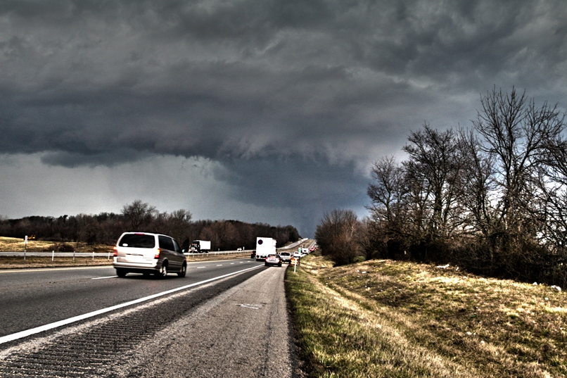
North of Palmyra. Photo: Hack Albertson |
|
North of Palmyra. Photo: Hack Albertson |
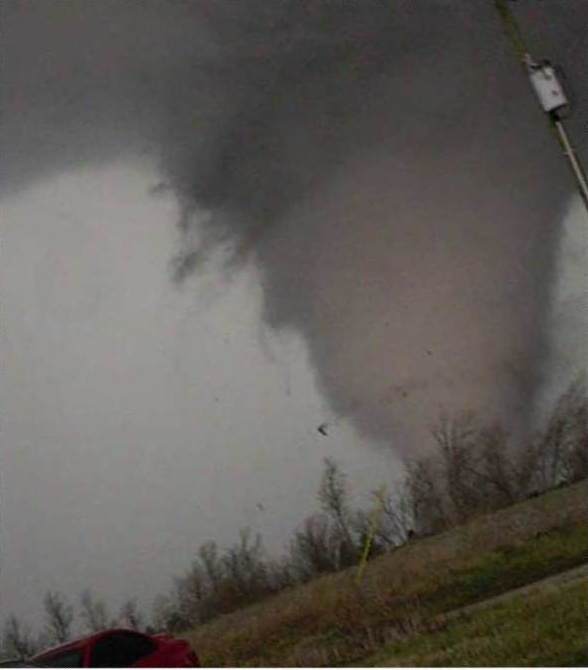
North of Palmyra. Photo: Simon Brewer of The Weather Channel |
North of Palmyra. Photo: Simon Brewer of The Weather Channel |
North of Palmyra. Photo: Mike Kovalchick |
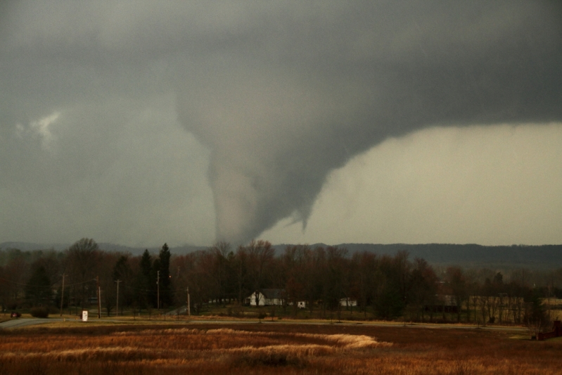
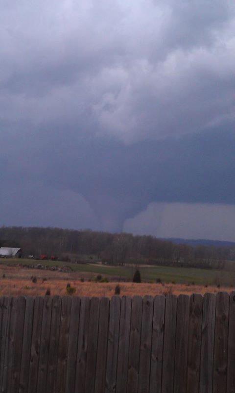
Martinsburg. Photo: Mark Schweiger |
|
Martinsburg. Photo: Mark Schweiger |
Martinsburg. Photo: Mark Schweiger |
Martinsburg. Photo: Mark Schweiger |
Martinsburg. Photo: Mark Schweiger |
Martinsburg. Photo: Mark Schweiger |
|
Martinsburg. Photo: Mark Schweiger |
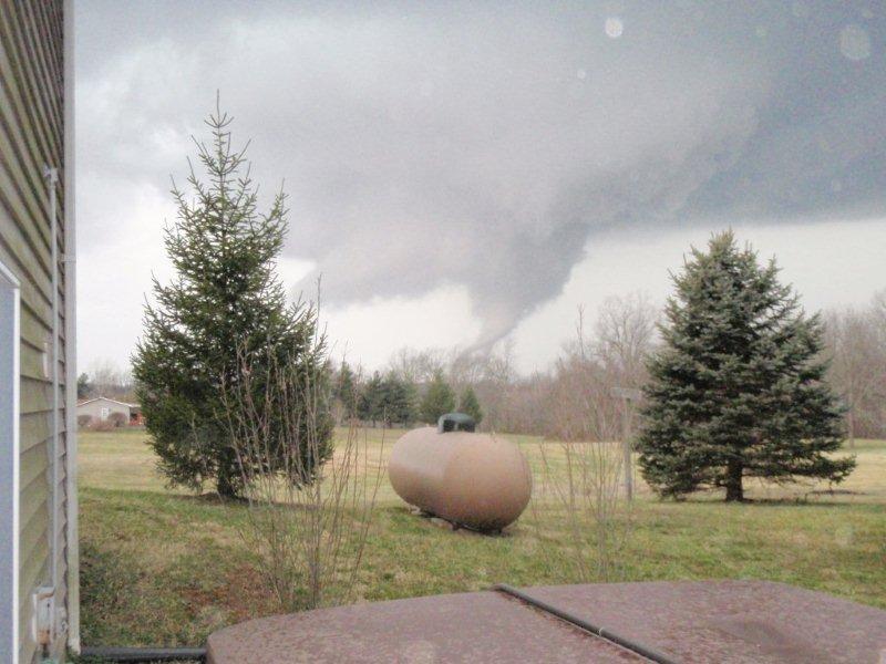
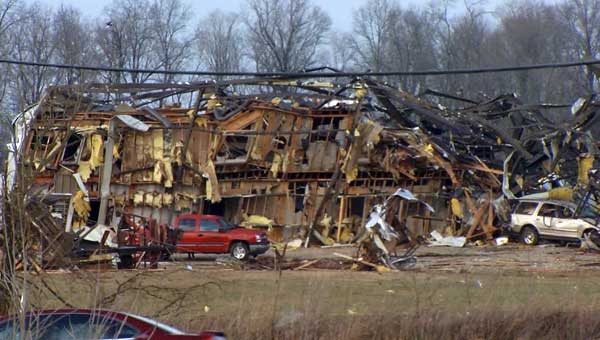
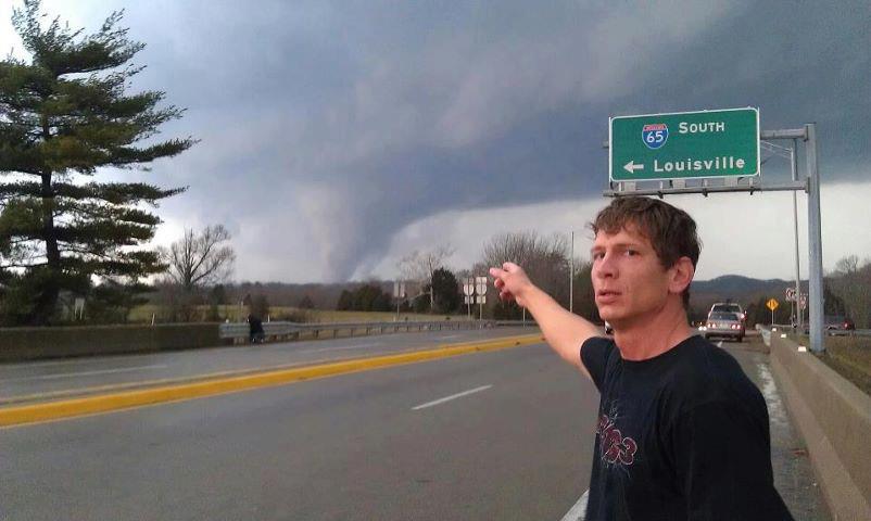
New Pekin. Photo sent by WDRB |
New Pekin. Photo sent by WDRB |
New Pekin. Photo sent by WDRB |
New Pekin. |
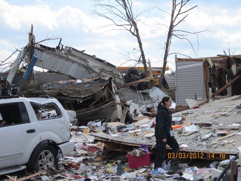
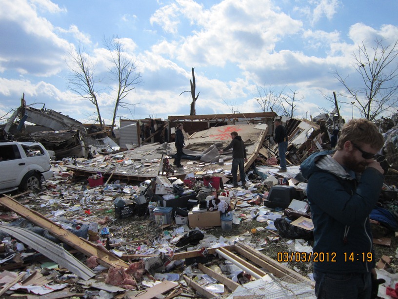
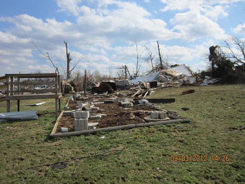
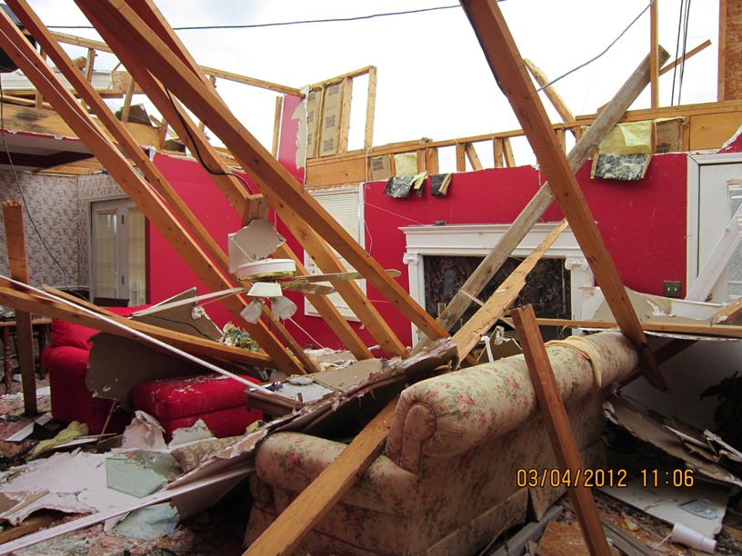
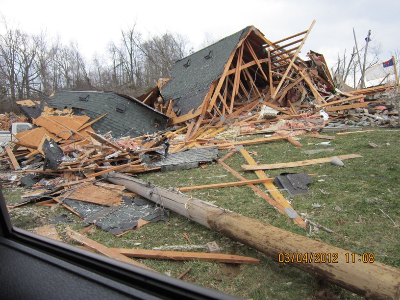
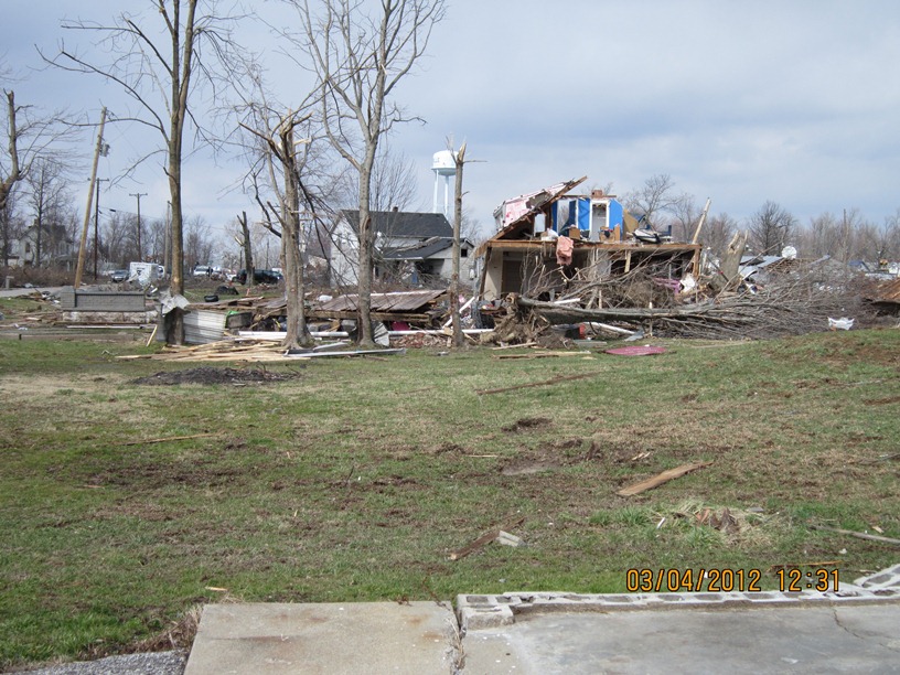
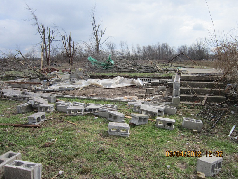
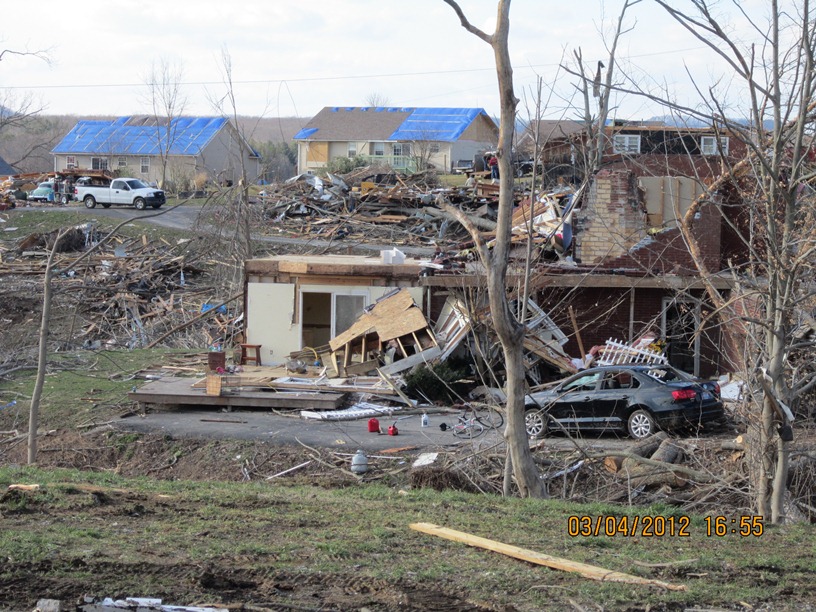
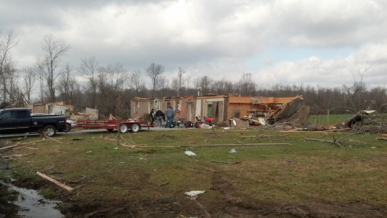
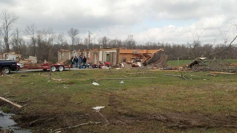
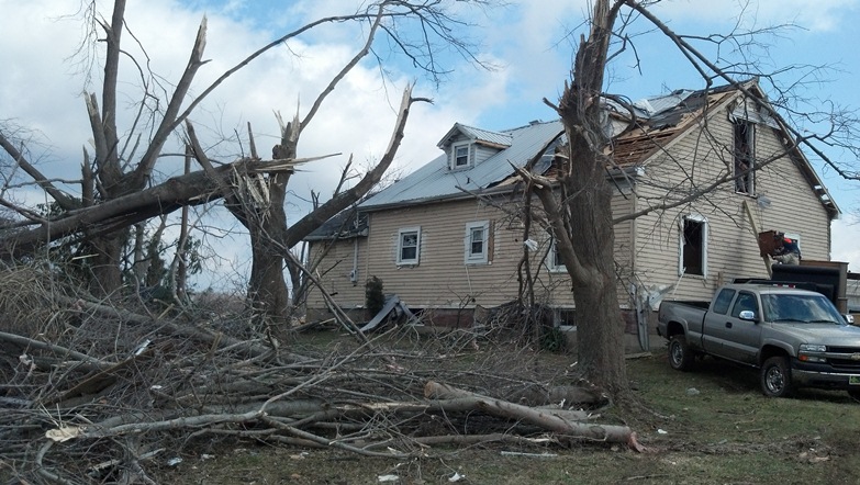
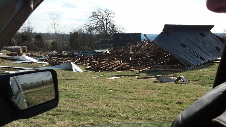
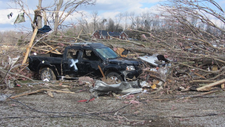
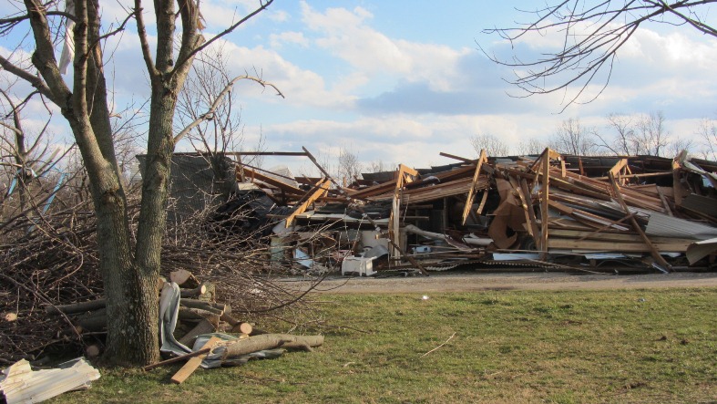
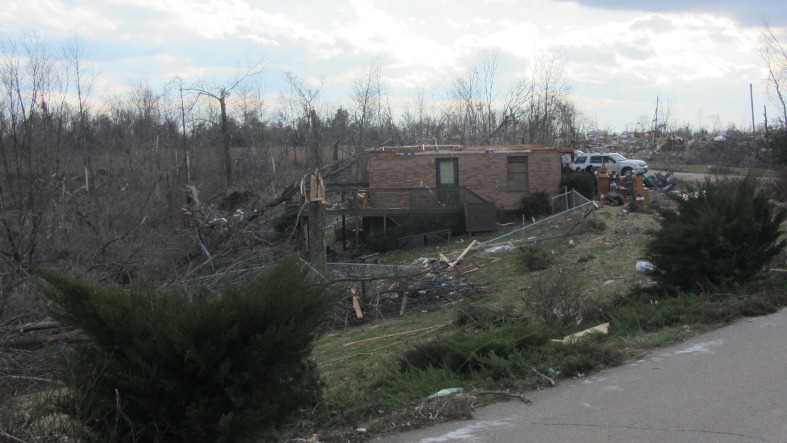
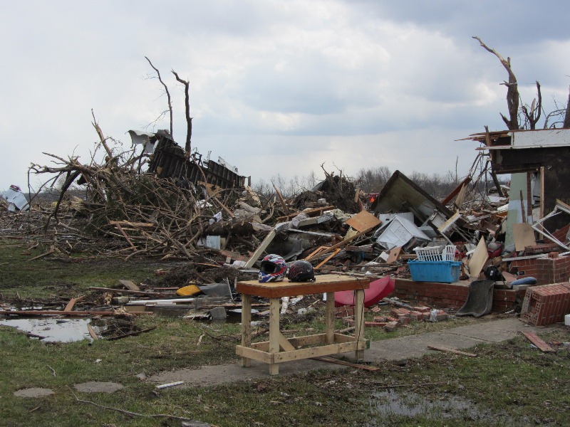
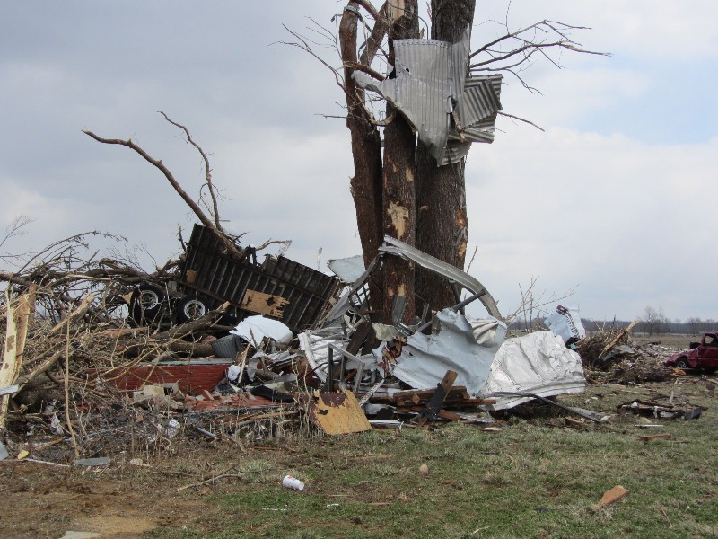
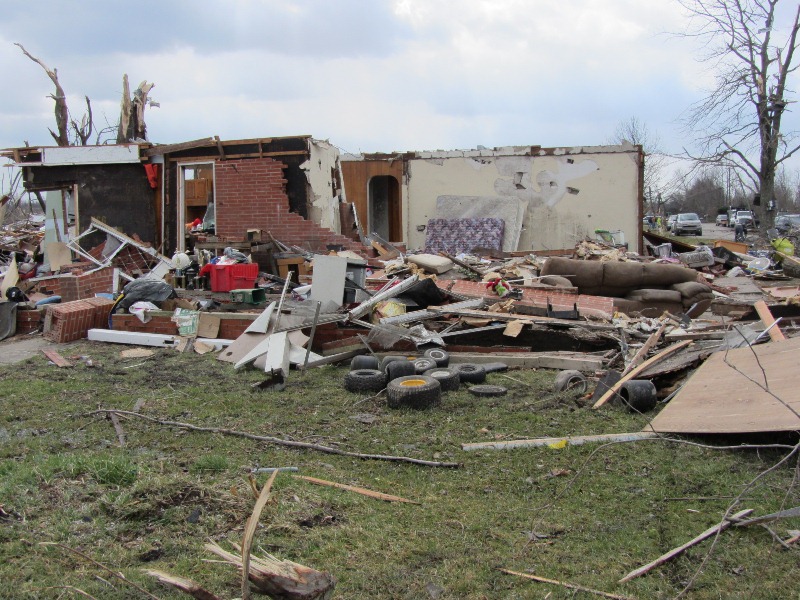
Clark County, IN Photos from NWS Louisville Storm Survey Team:
|
West of Henryville |
West of Henryville |
West of Henryville |
West of Henryville |
West of Henryville |
|
Pixley Knob Road |
Pixley Knob Road |
Pixley Knob Road |
Pixley Knob Road |
Speith Road |
|
Speith Road |
Speith Road |
Speith Road |
Speith Road |
Speith Road |
|
Speith Road |
Speith Road |
Speith Road |
Speith Road |
Speith Road |
|
Henryville near Route 160 and College Street |
Henryville near Route 160 and College Street |
Henryville near Route 160 and College Street |
Henryville near Route 160 and College Street |
Henryville |
|
Henryville |
Henryville |
Henryville |
Henryville, North Ferguson Street |
Henryville, North Ferguson Street |
|
Henryville near Route 160 and College Street |
Henryville, North Ferguson Street |
Henryville, Cherry Street |
Henryville, Route 160 and Front Street |
Henryville, South Ferguson Street |
|
Henryville, North Ferguson Street |
Henryville, North Ferguson Street |
Henryville, North Ferguson Street |
Henryville, North Ferguson Street |
Henryville, North Ferguson Street |
|
Henryville, North Ferguson Street |
Henryville, North Ferguson Street |
Henryville, North Ferguson Street |
Henryville, North Ferguson Street |
Henryville, North Ferguson Street |
|
Henryville, Mitchell Street |
Henryville, Railroad Street |
Henryville, Pine Drive |
Brownstown Road east of Henryville |
Brownstown Road east of Henryville |
|
Brownstown Road east of Henryville |
Brownstown Road east of Henryville |
Heil Road east of Henryville |
East of Henryville |
East of Henryville |
|
East of Henryville |
East of Henryville |
Henryville Otisco Road |
Henryville Otisco Road |
Henryville Otisco Road |
|
Henryville Otisco Road |
Henryville Otisco Road |
Henryville Otisco Road |
Henryville Otisco Road |
Henryville Otisco Road |
|
Henryville Otisco Road |
Henryville Otisco Road |
Henryville Otisco Road |
Henryville Otisco Road |
Henryville Otisco Road |
|
Henryville Otisco Road |
Henryville Otisco Road |
Henryville Otisco Road |
Marysville Road in Marysville |
Marysville Road in Marysville |
|
Marysville Road in Marysville |
Marysville Road in Marysville |
Lakeview Road in Marysville |
Lakeview Road in Marysville |
Lakeview Road in Marysville |
|
Scott/Clark County line |
Clark County |
|
|
|
Clark County, IN Photos from NWS St Louis Storm Survey Team, Who Assisted NWS Louisville:
 |
 |
 |
 |
 |
 |
 |
 |
 |
 |
 |
 |
 |
 |
 |
 |
 |
 |
 |
 |
 |
 |
 |
 |
 |
 |
 |
 |
 |
 |
 |
 |
 |
 |
 |
 |
 |
 |
 |
 |
 |
 |
 |
 |
 |
 |
 |
 |
 |
 |
 |
 |
 |
 |
 |
 |
 |
 |
 |
 |
 |
 |
 |
 |
 |
 |
 |
 |
 |
 |
 |
 |
 |
 |
 |
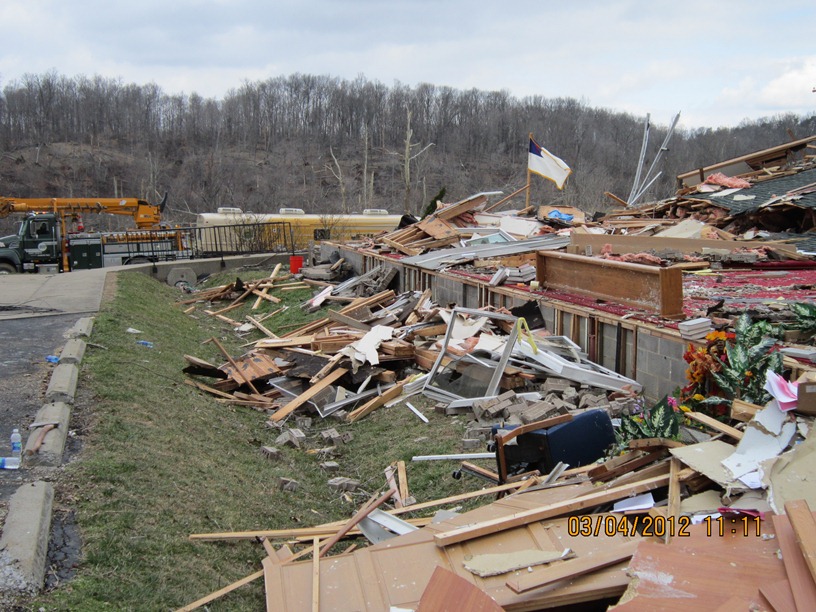
Clark County, IN Photos from Emergency Management:
 |
 |
 |
 |
 |
 |
 |
 |
 |
 |
 |
 |
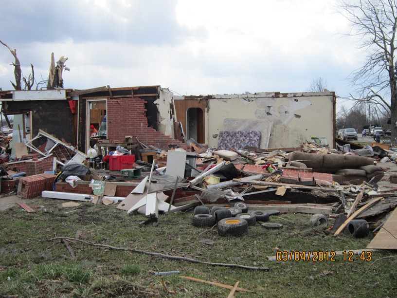
Clark County, IN Photos from resident Gary Cooper, south of Marysville:
 |
 |
 |
 |
 |
 |
 |
 |
 |
 |
Clark County, IN Photos from the Public:
|
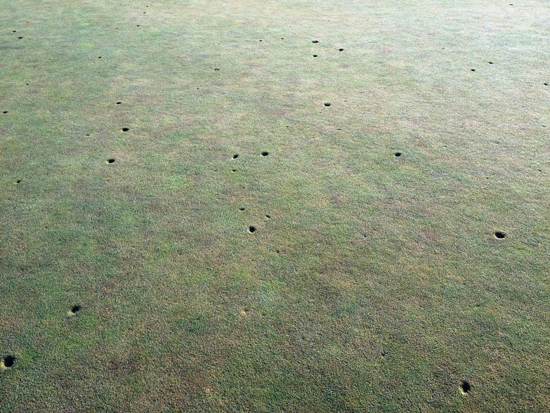
Champions Pointe Golf Course |
Champions Pointe Golf Course |
Debris found 57 miles away in Hebron, KY. Photo: Rob Edwards |
I-65 at Henryville exit. Photo: John Kinley |
I-65 at Henryville exit. Photo: John Kinley |
|
I-65 at Henryville exit. Photo: John Kinley |
I-65 at Henryville exit. Photo: John Kinley |
Between Memphis and Henryville. Photo: Bryan Wood |
Between Memphis and Henryville. Photo: Bryan Wood |
Between Memphis and Henryville. Photo: Bryan Wood |
|
View from Memphis. WDRB |
Sarah Brauner |
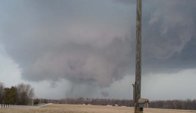
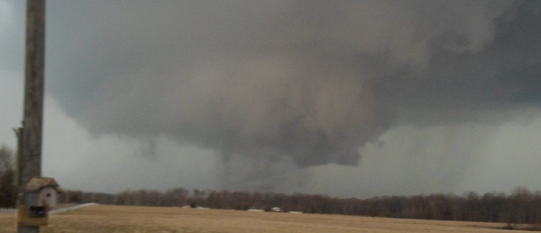
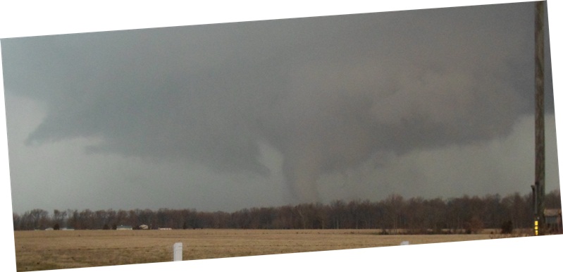
Looking towards Marysville from about 11 miles to the southwest. Grady Joslin |
Four miles south of Henryville. Drew LaMaster |
|
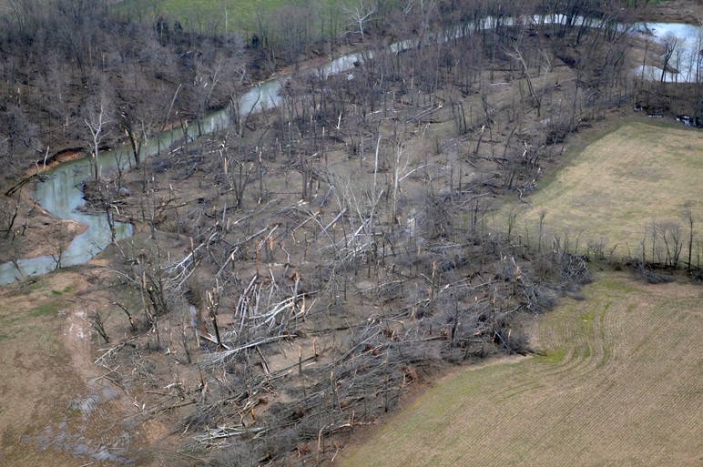
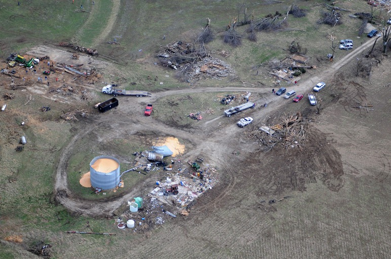
Jefferson County, IN Aerial Pictures Courtesy of Mark Powers and Josh Kiefer:
 |
 |
 |
 |
 |
 |
 |
 |
 |
|
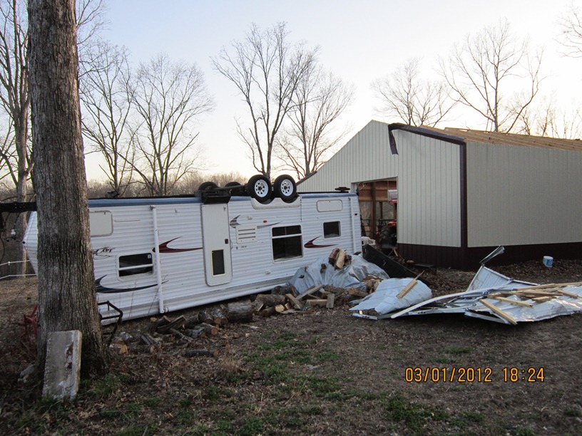
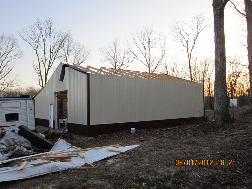
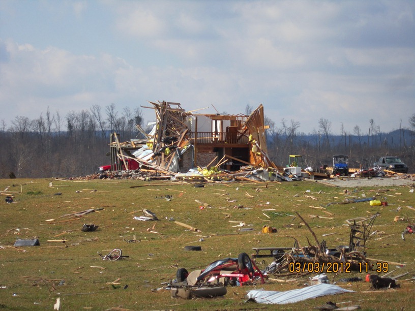
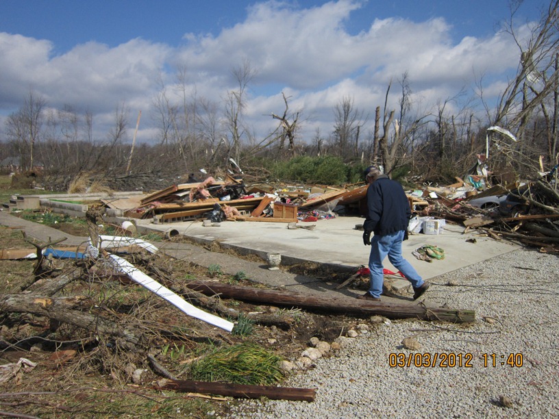
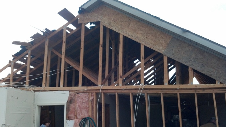
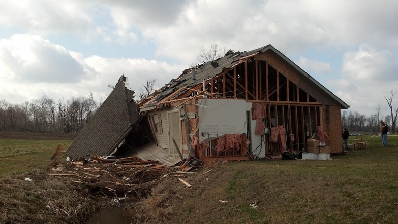
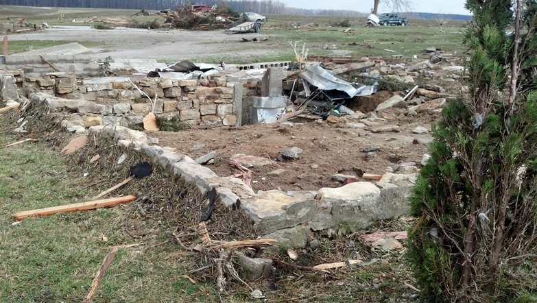
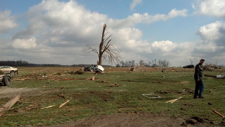
Jefferson County, IN Photos from Samantha Corbin (Jackson). Three fatalities occurred at this location near Chelsea:
 |
 |
 |
 |
 |
 |
Before the storm |
|
|
|
Jefferson County, IN Photos from NWS Louisville Storm Survey Team:
 |
 |
 |
 |
 |
 |
 |
 |
 |
 |
 |
 |
 |
|
|
Jefferson County to Trimble County Photos from Wayne Mahoney:
 |
 |
 |
 |
 |
 |
 |
 |
 |
 |
Trimble County Photos from NWS Louisville Storm Survey Team:
 |
 |
 |
 |
 |
 |
 |
 |
|
|


 Weather Story
 Weather Map
 Local Radar
 Follow us on YouTube