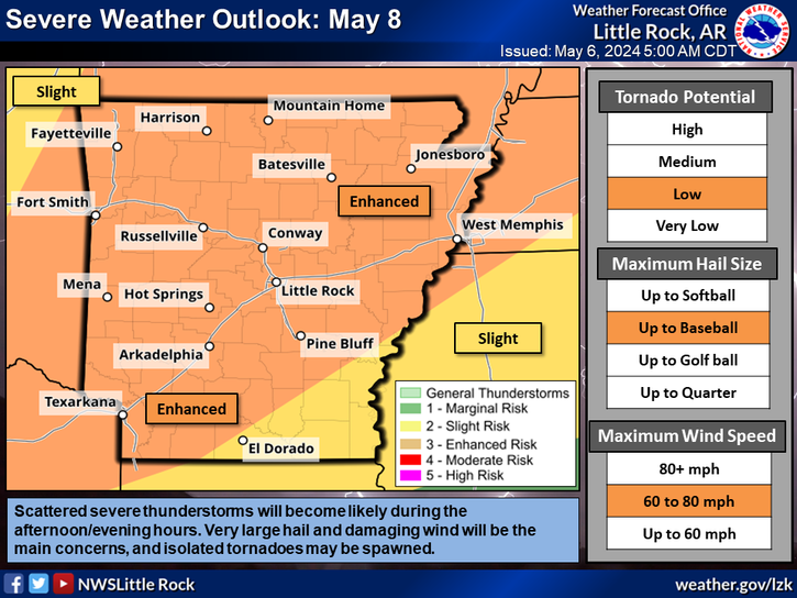
Strong to severe thunderstorms will be possible on Friday afternoon into Friday night. All modes of severe weather will be possible with the highest confidence for severe weather across the northwestern half of the state.
Friday afternoon into Friday night will see all modes of severe weather possible with the highest threat for large hail and damaging winds, but a tornado or two can't be ruled out.
Chances for showers and a few thunderstorms will continue overnight into Friday morning, with the best chances again over northern and northwest sections.
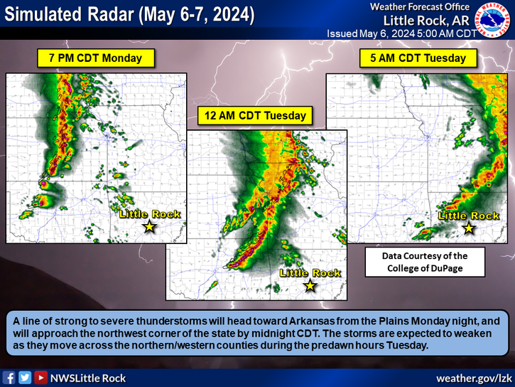
Several rounds of rainfall will remain possible tonight through the weekend, into Tuesday afternoon. Rainfall amounts could exceed 4 inches in some areas across portions of western Arkansas.
Note: "N/A" or "MISG" will be displayed if values are not available. In the LOCATION column, click on links for a list of recent observations at sites of interest. In the WIND column, VRB is "variable" and G is "gust". Wind speeds are in MPH. In the BARO (pressure) column, values are in inches. In the REMARKS column, HX is "heat index", WCI is "wind chill index", and VSB is "visibility" (if shown).


 Regional Radar
 Weather Map
 Social Media Dashboard
 Follow us on YouTube