 |
| Product Notice |
| If a product is not current or unavailable, try clicking the LATEST button. |
|
|
 |
Quick Climate Information |
 |
| |
|
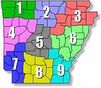
Climate Information for Site ( )
|
| Sunrise |
Sunset |
Average High |
Average Low |
Record High |
Record Low |
|
N/A
|
N/A
|
N/A
|
N/A
|
N/A
|
N/A
|
| Note: The latest record highs/lows are displayed. Some of the records may have been set in previous years as well. |
|
|
|
| |
|
Arkansas Extremes |
|
| |
| Type of Record |
Record Set/Date of Record |
| Hottest Temperature |
120° at Ozark (Franklin Co.) - Aug 10, 1936 |
| Coldest Temperature |
-29° at Gravette (Benton Co.) - Feb 13, 1905 |
| Most Rain in a Day |
16.17" at Dierks (Howard Co.) - Jul 16, 2019 |
| Most Snow in a Day |
25.0" at Corning (Clay Co.) - Jan 22, 1918 |
| Most Rain in One Year |
101.05" at Big Fork 1 SSE (Polk Co.) - 2015 |
| Least Rain in One Year |
19.89" at Fort Smith (Sebastian Co.) - 1917 |
| Most Snow in One Year |
48.0” at Calico Rock 2 WSW (Izard Co.) - 1918 |
| Most Rain in 12 Months |
101.05" at Big Fork 1 SSE (Polk Co.) -
Jan, 2015 to Dec, 2015 |
| Least Rain in 12 Months |
17.91" at Abbott (Scott Co.) - Dec, 1962 to Nov, 1963 |
| Most Snow in 12 Months |
64.5" at Hardy (Sharp Co.) - Feb, 1917 to Jan, 1918 |
| Longest Period At/Above 100 Degrees |
54 days at Ozark (Franklin Co.) -
Jun 21, 1934 to Aug 13, 1934 |
| Longest Period Without Measurable Rain |
101 days at Wilson (Mississippi Co.) -
Jul 18, 1953 to Oct 26, 1953 |
| Most Tornadoes in One Year |
107 tornadoes - 1999 |
| Largest Tornado Outbreak |
56 tornadoes - Jan 21-22, 1999 |
| Longest Tornado Track |
122 miles - Feb 05, 2008 |
| Deadliest Tornado Outbreak |
111 fatalities - Mar 21, 1952 |
| Deadliest Flash Flood |
20 fatalities at Albert Pike Rec Area (Montgomery Co.) -
Jun 11, 2010 |
| |
|
Daily Climate Data |
|
|
Monthly and Seasonal Climate Data |
|
|
Arkansas Winter Storm Database (1819 to Present) |
|
| |
 |
| In the picture: It was a winter wonderland in Sherwood (Pulaski County) following an extremely rare Christmas snowstorm on 12/25/2012 and early the next morning. At Little Rock National Airport (Pulaski County), 10.3 inches of snow was measured. |
|
| |
|
About the Database
This is a series of ArcGIS maps documenting significant or unusual winter storms affecting Arkansas since written weather history began in the state in 1819. Each map has known accumulations from each winter storm or series of storms mentioned.
How the Database is Divided:
|
|
Arkansas Tornado Database |
|
| |
 |
| In the picture: Houses were demolished in the Parkwood Meadows subdivision near Vilonia (Faulkner County) by a monster tornado (rated EF4) on 04/27/2014. |
|
| |
|
About the Database
This is a series of ArcGIS maps documenting significant tornadoes and tornado outbreaks affecting Arkansas since comprehensive tornado rating and tracking began in 1950. Additional cases are planned that pre-date the official NCEI Storm Data database. Included maps show estimated tornado tracks and damage indicator points (2013 or later), and supplemental photos, radar data (if available), and historical data are provided.
How the Database is Divided:
|
|
Normals/Records/F6 Data |
|
| |
| Record Reports (Much of Little Rock County Warning Area) |
Record Reports (Little Rock National Airport) |
| Record Reports for Harrison |
Record Reports for Pine Bluff |
| |
| Station Records |
To get records at individual sites for every month of the year, choose
MONTHLY RECORDS. For records at all sites for every day of the year,
choose DAILY RECORDS.
|
| Monthly Records |
Daily Records |
|
|
|
|
| |
|
|
| |
|
|
| |
|
|
| |
| Preliminary Climate (F6) |
|
|
| Note: Data for a full month is usually available on the first day of the following month, and is obtained by "Version 1" above. If the data was edited/quality controlled and re-issued on a later date (somewhat rare), it is acquired by "Version 2" above. The latter version queries a very large file, so results may be slow. All data is preliminary, and may contain errors. Final and certified climate data is available at the National Centers for Environmental Information (NCEI) in Asheville, NC (https://www.ncei.noaa.gov). |
| |
 |
| In the picture: Average annual snowfall across Arkansas (based on 1991-2020 normals). |
|
| |
|
In Arkansas, most snow falls in the months of January, February, March, and December. Average annual accumulations range from less than an inch in the southeast to more than a foot in the northwest.
|
| |
|
| 1991-2020 Normals for Arkansas |
| Use the dropdown menu below to find monthly temperature and precipitation normals for a location near you. |
SITE: LITTLE ROCK AP ADAMS FLD

ELEMENT   JAN     FEB     MAR     APR     MAY     JUN     JUL
   MAX   50.5    55.2    63.7    72.8    80.5    88.2    91.7
   MEAN  40.7    44.7    52.7    61.4    69.9    78.0    81.4
   MIN   30.9    34.2    41.8    50.1    59.3    67.7    71.2
   PCPN  3.50    3.97    4.96    5.59    5.08    3.55    3.33
   SNOW   1.1     1.6     0.5     0.0     0.0     0.0     0.0

ELEMENT   AUG     SEP     OCT     NOV     DEC      ANN
   MAX   91.5    85.1    74.2    61.9    52.6     72.3
   MEAN  80.8    74.0    62.6    51.1    43.0     61.7
   MIN   70.1    62.9    50.9    40.2    33.3     51.1
   PCPN  3.16    3.01    4.47    4.72    5.08    50.42
   SNOW   0.0     0.0     0.0     0.0     0.6      3.8
|
|
|
| Note: Temperatures across the U.S. were roughly 0.5 degree F warmer than the 1981-2010 normals. |
| |
|
|
| |
|
In Arkansas, freezes typically occur by the last week in October across northern and western sections of the state (Ozark and Ouachita Mountains). Elsewhere, freezes tend to hold off until the first couple of weeks in November. In the spring, the last freeze usually happens by mid-March in the southeast. For the remainder of the region, freezes usually linger into April and sometimes into early May in parts of the north.
|
| |
|
| Frost and Freeze Information for Arkansas |
| Use the dropdown menu below to find first (Fall) and last (Spring) frost and freeze dates for a location near you. |
SITE: LITTLE ROCK AP ADAMS FLD

FFrost   FFreeze   LFreeze    LFrost
10/31    11/10     03/21      04/03
Please Note: The dates shown are based on climatological normals, with a temperature of 36° for frost and 32° for a freeze. There is at least a 50 percent probability that a first (F) or last (L) Frost/Freeze will occur on these dates. Probabilities go up to 90 percent for a FFrost/FFreeze two weeks later and a LFrost/LFreeze two weeks prior. Probabilities go down to 10 percent for a FFrost/Freeze two weeks prior and a LFrost/LFreeze two weeks later. The dates are courtesy of the National Climatic Data Center.
|
|
|
| Note: This information is based on 1991-2020 normals. |
| |
|
Compiled Data |
|
|
Significant Weather Events |
|
| |
| For summaries of significant weather events (severe storms, wintry precipitation, heavy rain, etc) in Arkansas, and access to an event archive since 1950 from the National Centers for Environmental Information (NCEI), go to our "Monthly Storm Reports and Storm Data" page by clicking here. |
| |
|
NCEI |
|
| |
| Need certified weather information? Contact the National Centers for Environmental Information (NCEI) at (828) 271-4800 or visit them on-line at https://www.ncei.noaa.gov. |
| |
|