Paducah, KY
Weather Forecast Office
The year 2016 was noteworthy for the large number of heavy rainfall events that occurred. The year kicked off with major flooding along the Mississippi River, including record high river levels in the Cape Girardeau area. During the summer, numerous cities recorded over 20 inches of rain, making it the wettest summer on record for about a dozen cities. The year was also noted for persistent warmth. Every month except May averaged warmer than normal at Paducah.
|
Top 10 Event Summaries for the Year 2016 (in chronological order) |
|||||
|
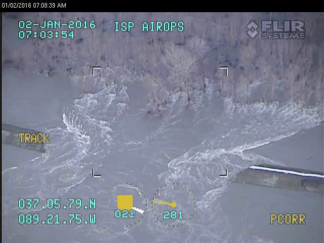
1. Record flooding on the Mississippi River (Jan. 1-3) Photo: Breach in Len Small Levee (Illinois State Police) |
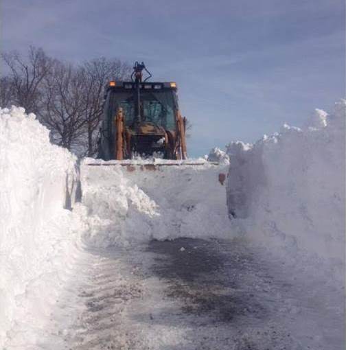
2. Jan. 22 Winter Storm (western KY) Photo: Near Cadiz, KY (Trigg Co. Road Dept.) |
||||
3. April 26 Severe Weather (mainly IL/IN) |
4. April 27 Severe Weather (mainly KY) |
||||
|
5. May 10 tornado at Mayfield, KY (EF-3) Photo: Car dealership in Mayfield (NWS photo) |
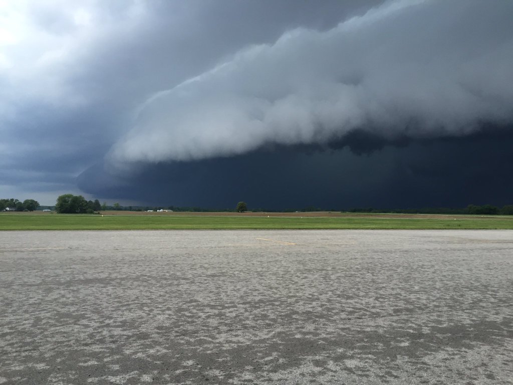
6. May 11 Severe Weather (mainly IL/IN) Photo of shelf cloud near Harrisburg, IL (Saline Co. EMA) |
||||
7. July 6 Severe Weather (mainly MO/KY)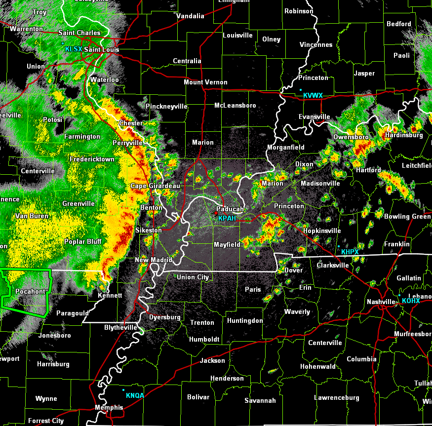 |
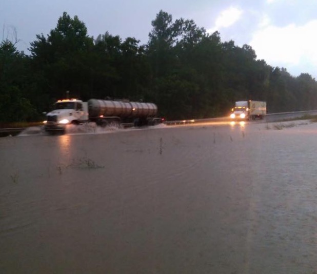
8. Jul. 6-7 Flash Flooding (west KY) Photo: Flooded I-69 in Marshall Co., KY |
||||
9. August Flooding in MO & IL (1 fatality) |
10. Fall Warmth and Drought 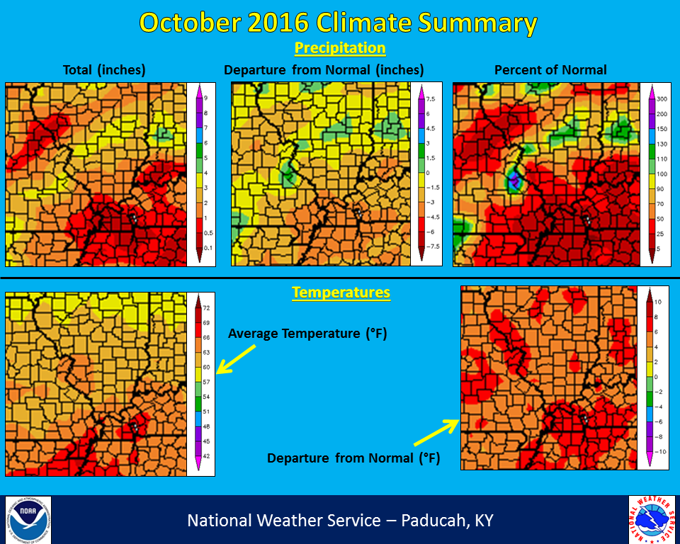 |
||||
FORECASTS
Forecast Discussion
User Defined Area Forecast
Hourly Forecasts
Fire Weather
Activity Planner
LOCAL INFORMATION
Aviation Weather
Our Office
SKYWARN
Items of Interest
Hazardous Weather Support
Local Observations
Weather History
NWS Paducah KY Weekly Partner Briefing
US Dept of Commerce
National Oceanic and Atmospheric Administration
National Weather Service
Paducah, KY
8250 Kentucky Highway 3520
West Paducah, KY 42086-9762
270-744-6440
Comments? Questions? Please Contact Us.