Storm Report for September 12, 2023
Impacts: Supercell thunderstorm with extensive damaging winds
|
|
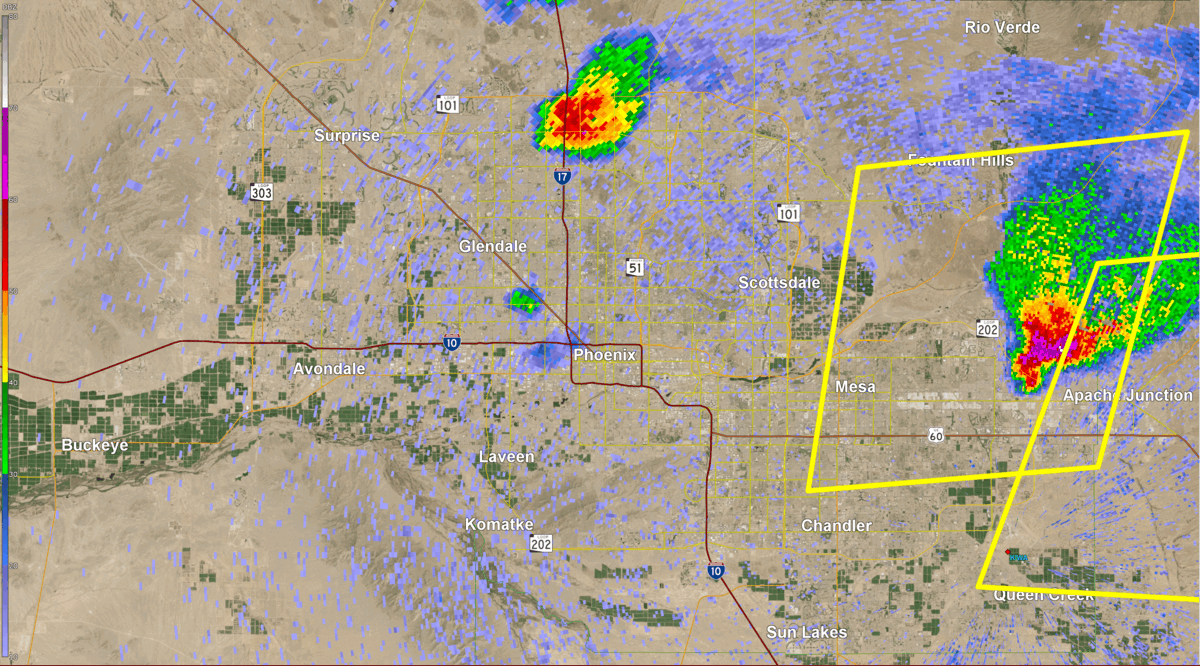
Fig. 1-2. Top Image: Radar imagery showing the supercell thunderstorm as it was traversing the Phoenix Metro area from west to east with the yellow polygons denoting the severe thunderstorm warnings issued; Bottom Image: Zoomed in reflectivity and velocity loops showing the supercell thunderstorm as it was traversing from Scottsdale through East Mesa. Note on the velocity field the inbound (green) and outbound (red) pixels denoting a divergent wind pattern as annotated by the arrows, which is indicative that the damage was from straight line winds.
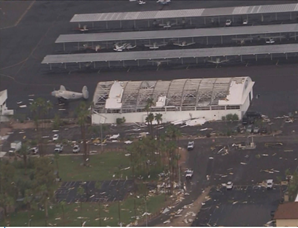
During the evening hours of Tuesday, September 12, 2023, an organized severe thunderstorm complex known as a “supercell” developed and affected a large portion of the Phoenix metro area. The thunderstorm developed in the West Valley and tracked generally eastward affecting areas such as Goodyear, Glendale, Phoenix, Scottsdale, Mesa and Apache Junction (Fig. 1-2). As the storm plowed its way eastward, it resulted in extensive wind damage as well as isolated large hail, as large as 1-1.5” in diameter. Dozens of large downed tree limbs and uprooted trees were reported (Fig. 3). Numerous power poles were snapped or blown over, resulting in tens of thousands of customers losing power at one point (Fig. 4). There was also structural damage, mainly to roofs, carports, and garage doors (Fig. 5-6). The most severe damage, however, occurred at Falcon Field Municipal Airport in northern Mesa, where several small Cessna planes were damaged with some of the planes flipped over as well as roof and door damage to several hangars (Fig. 7-8). The total damages to the airport was estimated at around $7.2 million. Based on the magnitude of the damage observed, it was estimated that winds topped out anywhere between 60-90 mph.
|
|
|
|
|
|
|
|
|
Fig. 3-8. Images of the wind damage. Top row (left image): Large pine tree uprooted in the area of North 66th Street near Oak Street in Scottsdale (photo credit: @dukeofwindsor on twitter); Top row (right image): toppled power poles along Recker Rd in Mesa (photo credit: Tom Frieders); Middle row (left image): damage to mobile home near the area of University Drive and Loop 202 (photo credit: Rich Flores); Middle row (right image): roof damage at a home on McKellips Road in Mesa (photo credit: Tom Frieders); Bottom row (left image): damaged Cessna planes at Falcon Field Municipal Airport in Mesa (photo credit: Sarah Cullipher); Bottom row (right image): roof damage to hangar at Falcon Field Municipal Airport in Mesa (photo credit:12News)
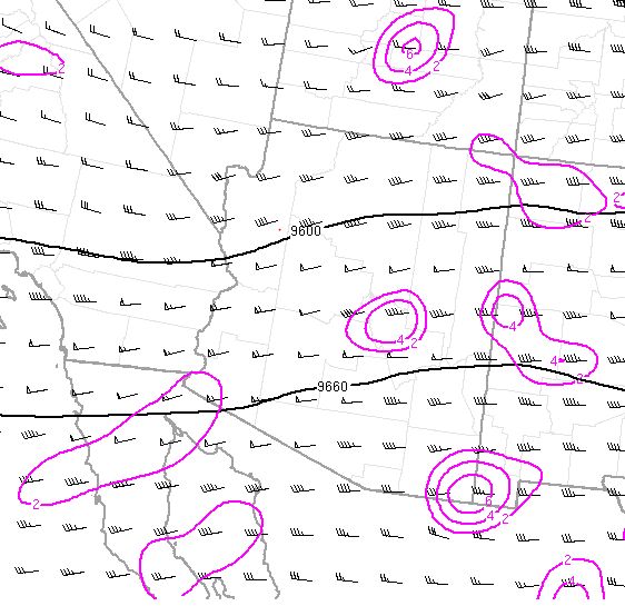
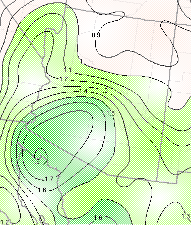
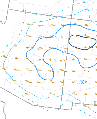
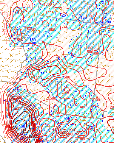
Setup: Strong westerly flow aloft was present across the Desert Southwest and although this flow pattern usually brings dry air into the region, suppressing thunderstorm development, abundant moisture was present in this setup (Fig. 9). Moisture remnants from what was once Hurricane Jova over the eastern tropical Pacific was transported into the region with precipitable water values, a measure of the amount of moisture in the atmosphere, exceeding 1.5” across most of central and southern Arizona (Fig. 10). The combination of the available moisture and strong daytime heating that occurred through much of the morning and afternoon hours resulted in moderate instability with the Mixed Layer Convective Available Potential Energy, a measure of the amount of atmospheric instability, ranging between 1000-1500 J/kg (Fig. 11). The strong westerly flow aloft resulted in strong vertical wind shear ranging between 35-45 kts across central and southern Arizona (Fig. 12). The strong shear aided with the organization and longevity of the storm.
|
|
|
|
|
|
Fig. 9-12. Objective analysis fields at 7 PM MST on September 12, 2023, of (clockwise from top-left): 300 mb heights, divergence, and winds; Precipitable water values; Mixed layer Convective Available Potential Energy (MLCAPE) and Mixed Layer Convective Inhibition (MLCIN); Surface to 6 km shear


 Follow us on YouTube