| Local Discussions, Zones, and other Forecast Products | ||||||||||||||||||||||||||||||||||||||||||||||||||||||
|
||||||||||||||||||||||||||||||||||||||||||||||||||||||
| NWS Glossary of Terms and Contractions | ||||||||||||||||||||||||||||||||||||||||||||||||||||||
| Digital Weather Grids, Local and Regional Scales (for states/locations not listed, select national view) |
||||||||||||||||||||||||||||||||||||||||||||||||||||||
|
||||||||||||||||||||||||||||||||||||||||||||||||||||||
Other Unique Forecast Discussions
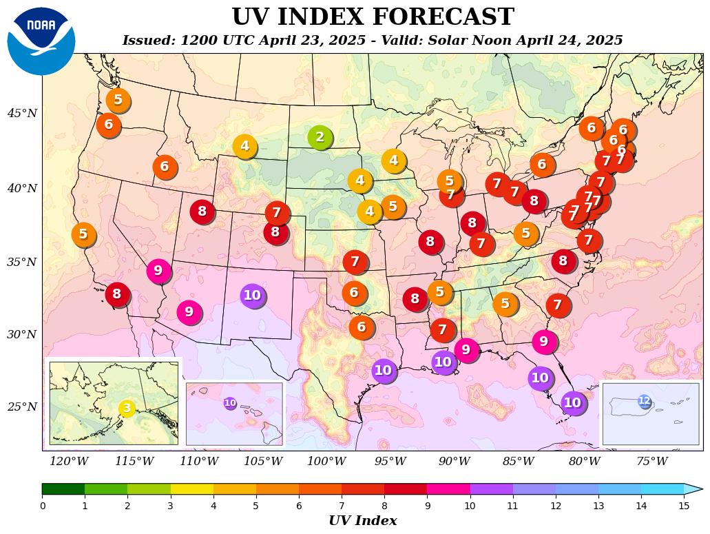
UV Index Forecasts: graphic map. |
||||||||||||||||||||||||||||||||||||||||||||||||||||||

