|
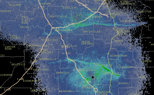
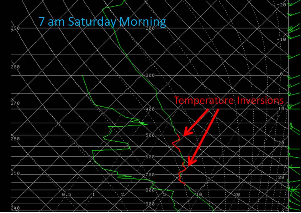
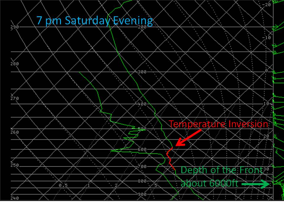
In the study of weather, meteorologists can not limit themselves to why something occurs; you have to try to answer why something does NOT occur, as well. After digging through the upper air soundings for the morning of April 17 (below left) and that evening (below right), the evidence becomes apparent as to why there was no convection along this boundary collision. First, looking at the Skew-T on the left from the morning, this would be the atmospheric conditions in between these boundaries. Clearly, you can see an isothermal layer (layer of temperatures of the same value), which would act as a "cap". Pilots in the area that morning reported the tops of the clouds at about 10K ft, and this is exactly where this isothermal layer is set up. For the Skew-T on the right, which would be the atmospheric conditions along the front (northern boundary), you can plainly see a similar type of "cap". Another component could be the depth of the actual cold front. At approximately 6K ft in depth, the cold front was just not deep enough to reach the Level of Free Convection (LFC), which had this happened, would have aided in the developement of convection. In the same vain, the sea breeze was only approximately 1700 ft in depth. (Click on the Skew-Ts to enlarge).
|