Scattered thunderstorms with severe gusts, hail and a tornado risk are possible near a cold front from the Ohio Valley to the Mid-Atlantic tonight. Tropical Storm Bertha is expected to bring tropical storm conditions to portions of the Gulf Coast from the panhandle of Florida into Louisiana through Wednesday. Read More >
Overview
|
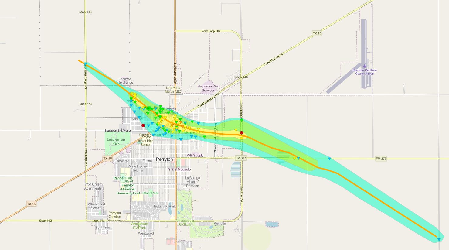
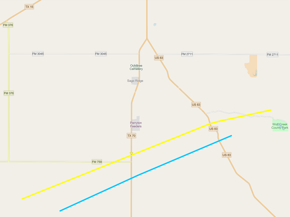
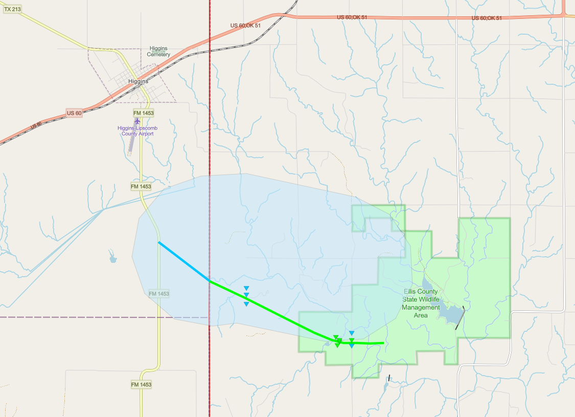
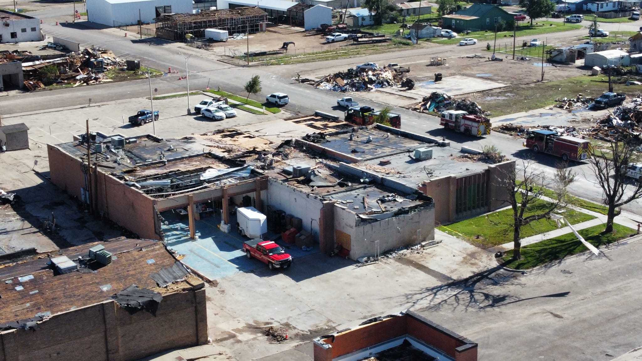
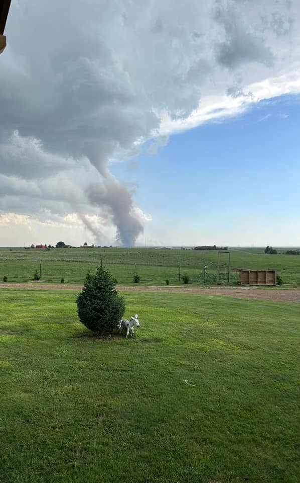
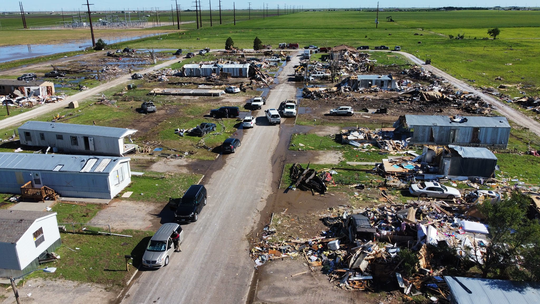
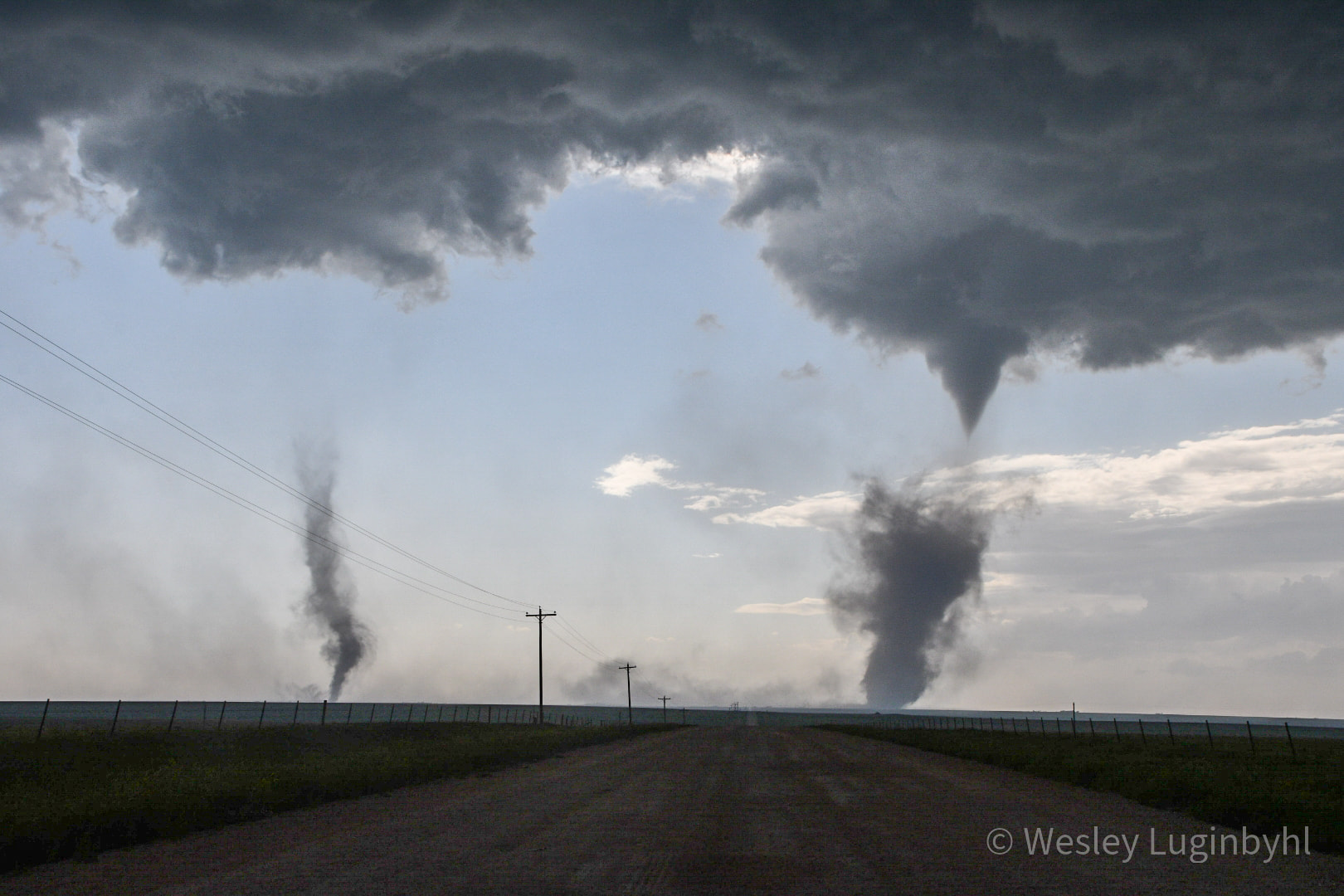
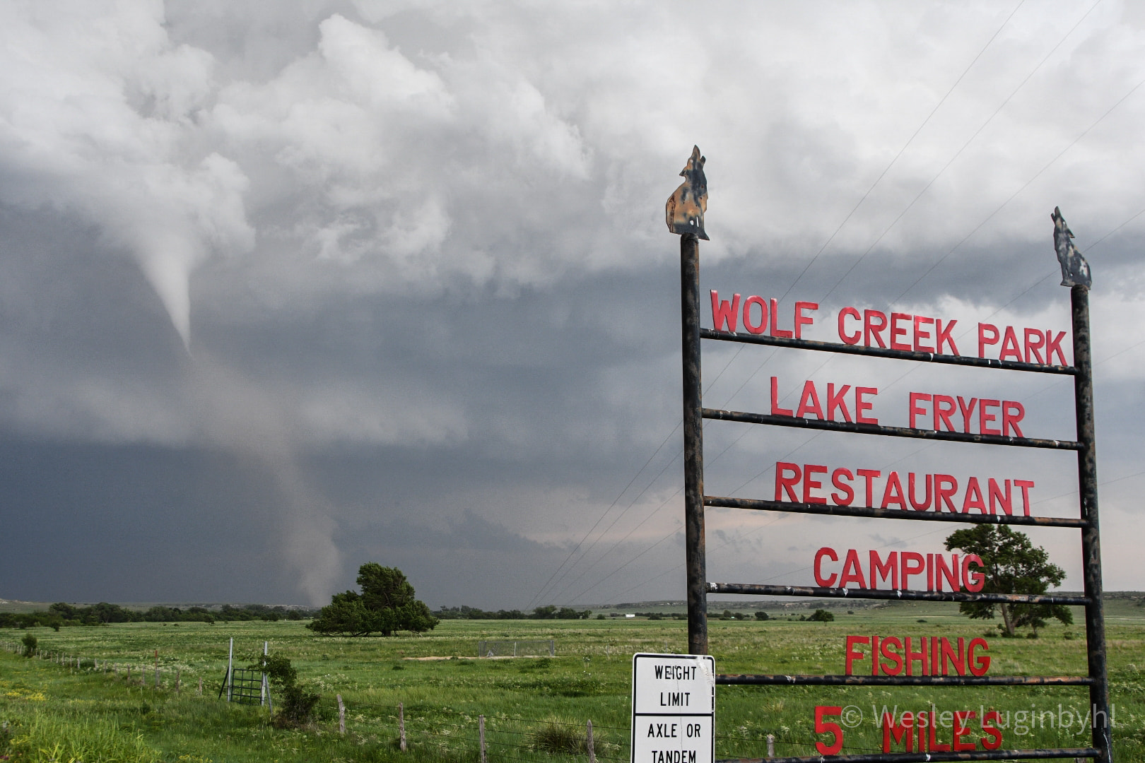
During the evening of June 15th, 2023, a line of storms with embedded supercells formed over portions of southwest Kansas and extended south through Beaver County, OK into the northeastern portions of the Texas Panhandle. The farthest south supercell produced a tornado that tracked through Perryton, killing three people and leaving a path of destruction over 6 miles long. Several other landspout tornadoes developed farther south of Perryton along the flanking line of the tornadic supercell. One of these landspouts damaged some power poles but remained mostly in open grassland. An additional tornado developed south of Higgins and tracked eastward into western Oklahoma, also remaining mostly in open grassland. The Perryton tornado was the first fatal tornado to occur in the Oklahoma and Texas Panhandles since March 28th, 2007, when one person died near Canadian, TX and two people died in south central Beaver County, OK. Additionally, this was the first tornado to cause a recorded injury in the Panhandles since the May 27th, 2015 tornado near Canadian, TX. |
 |
Tornadoes:
|
Tornado - Perryton
|
||||||||||||||||
|
Tornadoes - Southern Ochiltree Landspouts
|
||||||||||||||||
|
Tornado - South of Higgins
|
||||||||||||||||
The Enhanced Fujita (EF) Scale classifies tornadoes into the following categories:
| EF0 Weak 65-85 mph |
EF1 Moderate 86-110 mph |
EF2 Significant 111-135 mph |
EF3 Severe 136-165 mph |
EF4 Extreme 166-200 mph |
EF5 Catastrophic 200+ mph |
 |
|||||
Photos & Video
| Video of the Perryton tornado from the Ochiltree County Sheriff's office. Tornado visible around 2:00 through 6:30. (Ochiltree County Sheriff) |
| Another video of the Perryton tornado from the Ochiltree County Sheriff's office (Ochiltree County Sheriff) |
| A third video of the Perryton tornado from the Ochiltree County Sheriff's office. Tornado visible from 2:20 - look behind the tower. (Ochiltree County Sheriff) |
| A fourth video of the Perryton tornado from the Ochiltree County Sheriff's office. Tornado is visible from 1:30 - look at the top right portion of the video. (Ochiltree County Sheriff) |
 |
 |
 |
 |
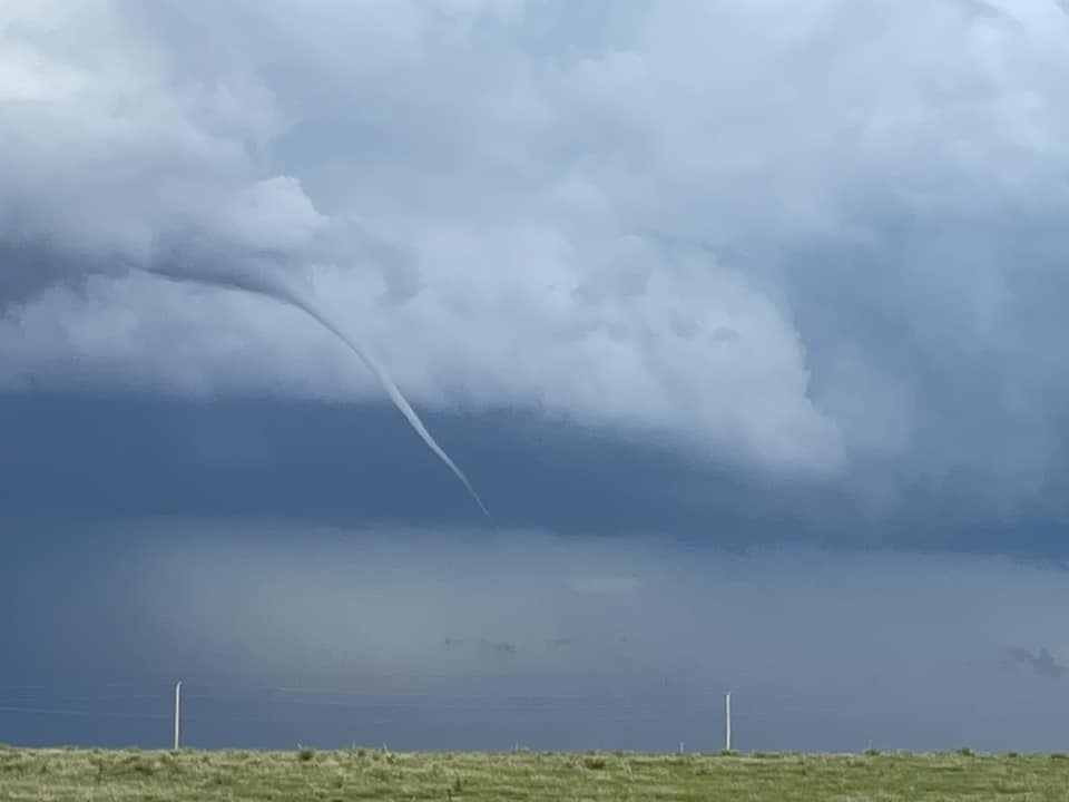
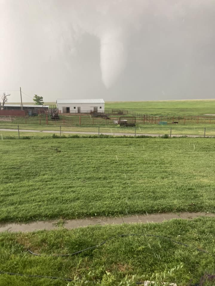
| Funnel cloud near Hooker, OK (Amanda Johnson Christie) |
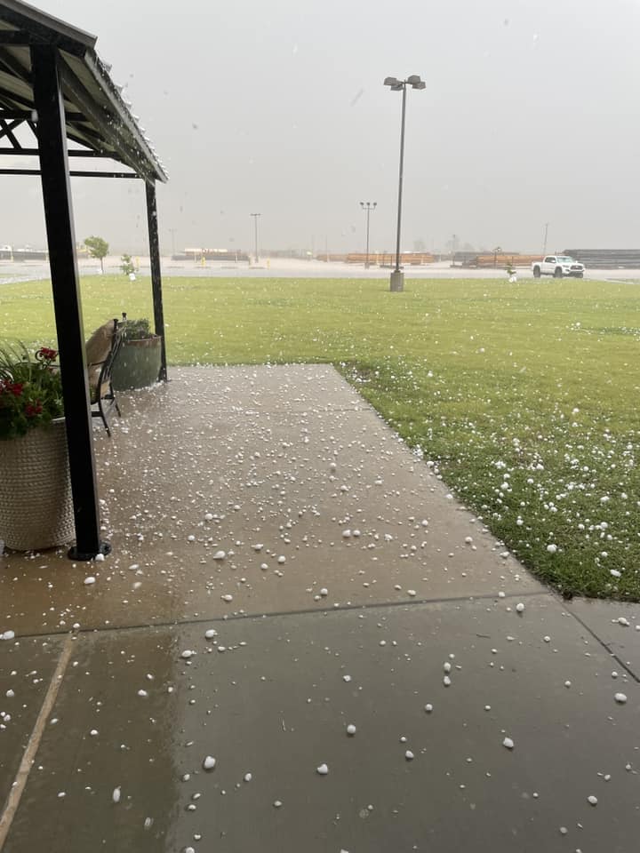
Up to tennis ball size hail near Hooker, OK (Amanda Johnson Christie) |
Landspout in southern Ochiltree County, TX (Chaz Rutledge) |
Two landspouts 15 miles south of Perryton, TX (Laura Jumper) |
 |
 |
 |
 |
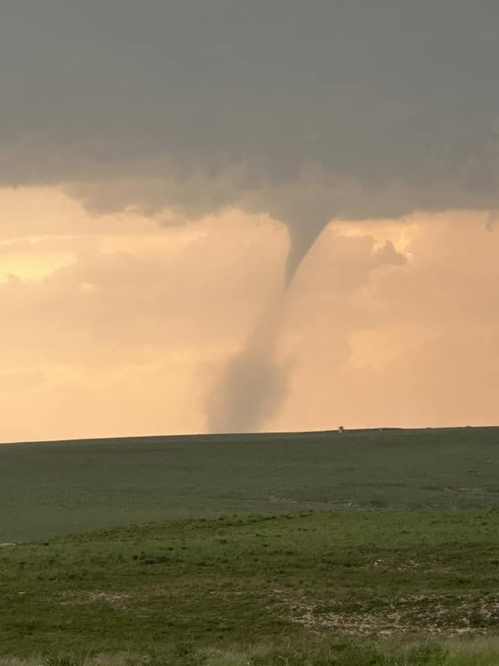
| Tornado 6 miles south of Higgins, TX (Dusty Witcher) |
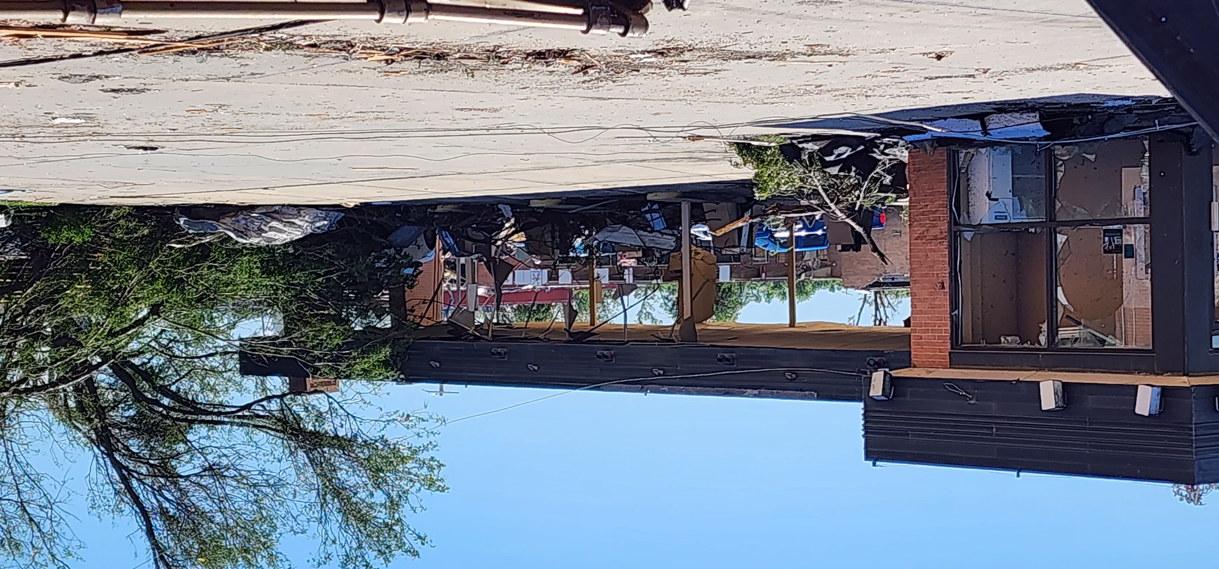
Collapsed telecommunications tower in Perryton, TX (Angela Margrave) |
Destroyed bank branch in Perryton, TX (Angela Margrave) |
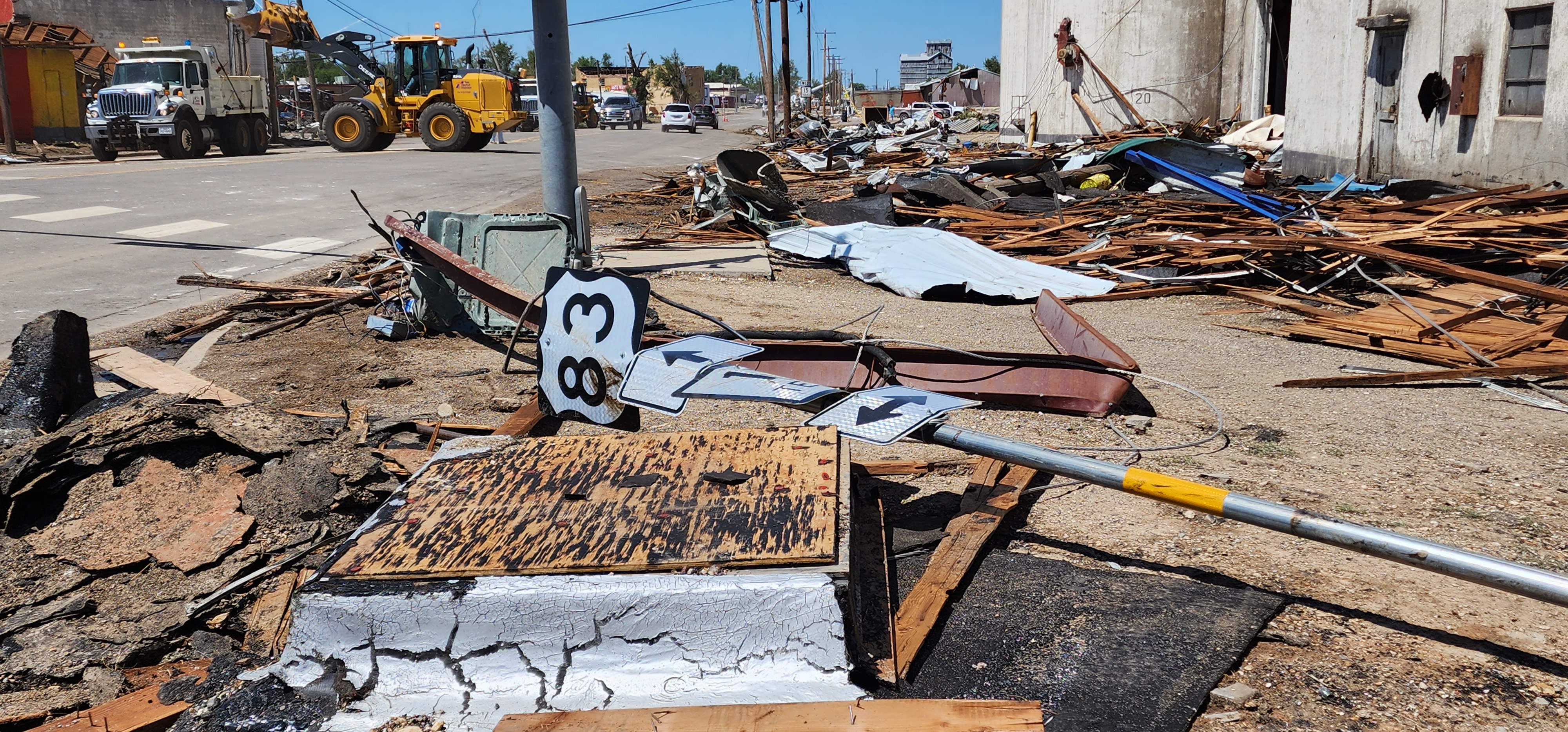
Debris and downed road signs in Perryton, TX (Angela Margrave) |
 |
 |
 |
 |
| Damaged mobile homes in Perryton, TX (Perryton Fire/EMS) |
Damage to Perryton Fire Station (Perryton Fire/EMS) |
Building with collapsed brick walls and roof in Perryton, TX (Perryton Fire/EMS) |
Damage to Perryton municipal building (Perryton Fire/EMS) |
 |
 |
| Twin landspouts south of Perryton (Wesley Luginbyhl) |
Landspout dissipating near Wolf Creek Park (Wesley Luginbyhl) |
Radar
| Composite radar loop covering the June 15th, 2023 severe weather event (Radar data, warnings, and reports from NWS; radar loop by Iowa Environmental Mesonet) |
| A closer look at radar data covering all four tornadoes that occurred in the northeastern Texas Panhandle. (National Weather Service) |
Storm Reports
For information on tornadoes that occurred, please see the "Tornado" tab above.
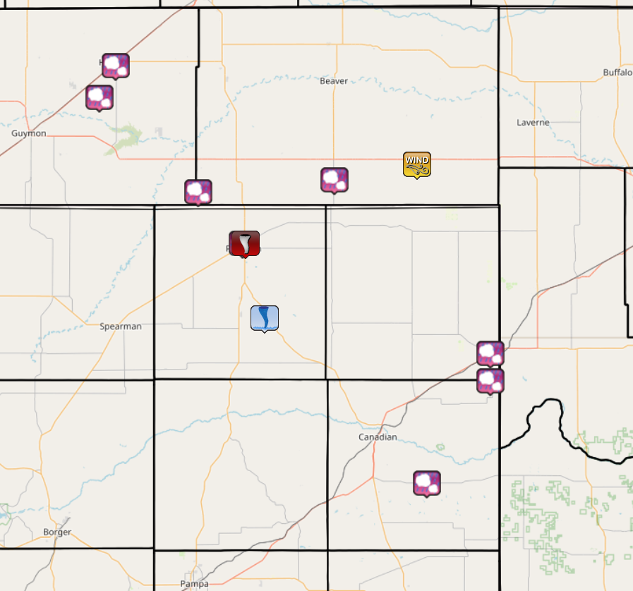 |
| Map of storm reports received covering the June 15th, 2023 severe weather event (Reports from NWS; map by Iowa Environmental Mesonet) |
| Report Time (CDT) | County | Location | Event Type | Magnitude | Source | Remark |
| 2023/06/15 15:57 | Texas | 1 S Hooker | HAIL | 2.5 | Trained Spotter | Estimated between 2 to 2.5 in hail. |
| 2023/06/15 15:57 | Texas | 5 E Optima | HAIL | 2 | Public | Public sent in an image. |
| 2023/06/15 16:48 | Ochiltree | Perryton | HAIL | 0.75 | Public | Dime (0.75 in.). |
| 2023/06/15 16:51 | Ochiltree | 1 NW Perryton | HAIL | 1 | Trained Spotter | via spotternetwork.org. |
| 2023/06/15 17:01 | Texas | 8 W Gray | HAIL | 1.75 | Public | via spotternetwork.org-measured 1.85 hail stone at this location. |
| 2023/06/15 17:20 | Beaver | 8 W Slapout | TSTM WND GST | 58 | Mesonet | |
| 2023/06/15 17:36 | Beaver | 4 S Elmwood | HAIL | 1.75 | Emergency Mngr | Ping Pong to Golf ball hail. Person was blown off the road 3 time. |
| 2023/06/15 18:21 | Hemphill | 8 SSW Lake Marvin | HAIL | 1.75 | Trained Spotter | via spotternetwork.org. |
| 2023/06/15 18:32 | Lipscomb | Higgins | HAIL | 2 | Public | |
| 2023/06/15 18:36 | Hemphill | 5 S Higgins | HAIL | 2.5 | Public |
 |
Media use of NWS Web News Stories is encouraged! Please acknowledge the NWS as the source of any news information accessed from this site. |
|