Damaging Winds & Tornadoes - February 26th, 2008
Event Summary for Central Alabama
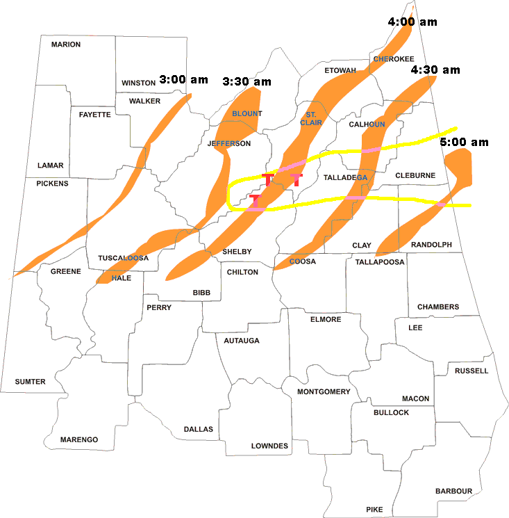
A long-lived windstorm produced by severe thunderstorms, known as a derecho, caused a widespread swath of damage across Central Alabama during the early morning hours of February 26, 2008. Although there were some sporadic reports of light tree damage and small hail west of Interstate 65, a more intense and widespread swath of damage started in southern Jefferson and northern Shelby Counties between 3:30 am and 4:00 am. From there, the damage swath moved eastward, roughly parallel to Interstate 20, reaching the Georgia border by 5:00 am. Thunderstorm wind gusts estimated at 60 to 70 mph were widespread in this damage swath, with occasional hurricane force peak wind gusts, estimated just over 100 mph in some areas.
The National Weather Service has completed an aerial survey of the damage that occurred early Tuesday morning. After combining all of the information from the aerial survey and the ground surveys conducted Tuesday afternoon... it has been concluded that... in addition to widespread severe thunderstorm wind damage... three EF-1 tornadoes touched down across Central Alabama.
As the strong cold front continued eastward, additional damaging winds occurred in Georgia, Florida and South Carolina.
... Swath of Wind Damage...
Survey crews found a wide swath of 90 to 105 mph straight-line wind damage. In this swath, hundreds of trees and numerous power lines were toppled. Multiple structures including homes and businesses sustained damage. The primary damage swath moved generally from west to east... starting in the southern portion of Metro Birmingham and continuing all the way to the Georgia state line. Significant damage was reported in the following portions of counties:
Southern Jefferson.
Northeast Shelby.
Southern St. Clair.
Southern Calhoun.
Northern Talladega.
Southern Cleburne.
Northern Clay.
Northern Randolph.Within this main damage swath... there were several areas of enhanced damage... caused by tornadoes and straight line winds.
EF-1 Pell City Tornado - St. Clair County
EF-1 Highland Lakes Tornado - Shelby County
EF-1 Leeds Tornado - Jefferson County
Talladega & Calhoun Counties Wind Damage
Randolph County Wind DamagePreliminary Local Storm Reports
In the map below, the orange shapes indicate approximate location of strongest part of thunderstorm line at the times indicated. The yellow area outlines the location of the worst thunderstorm wind damage, and letter "T"s denote tornado locations..
Severe Weather Episode Data
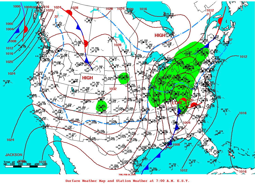
Surface Analysis
Feb. 26th 6 am
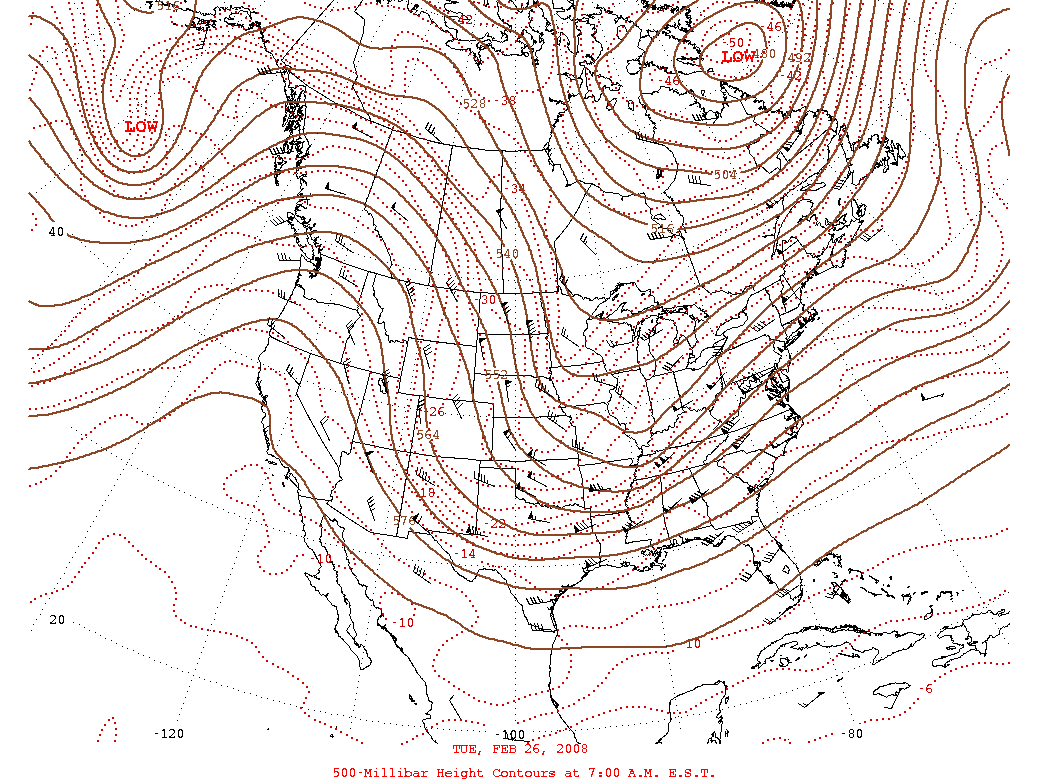
500 mb Chart
Feb. 26th 6 am
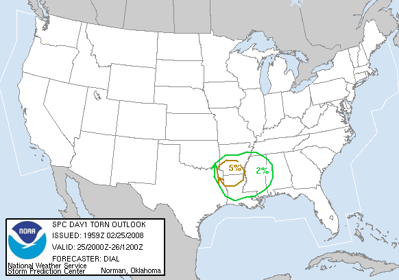
Day 1 Severe Weather Outlook
Issued Feb. 25th
Day 1 Probabilistic Outlook
Issued Feb. 25th
Severe Weather Reports
Feb. 25th
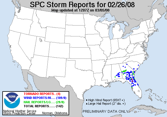
Severe Weather Reports
Feb. 26th