NWS Birmingham, Alabama
Weather Forecast Office
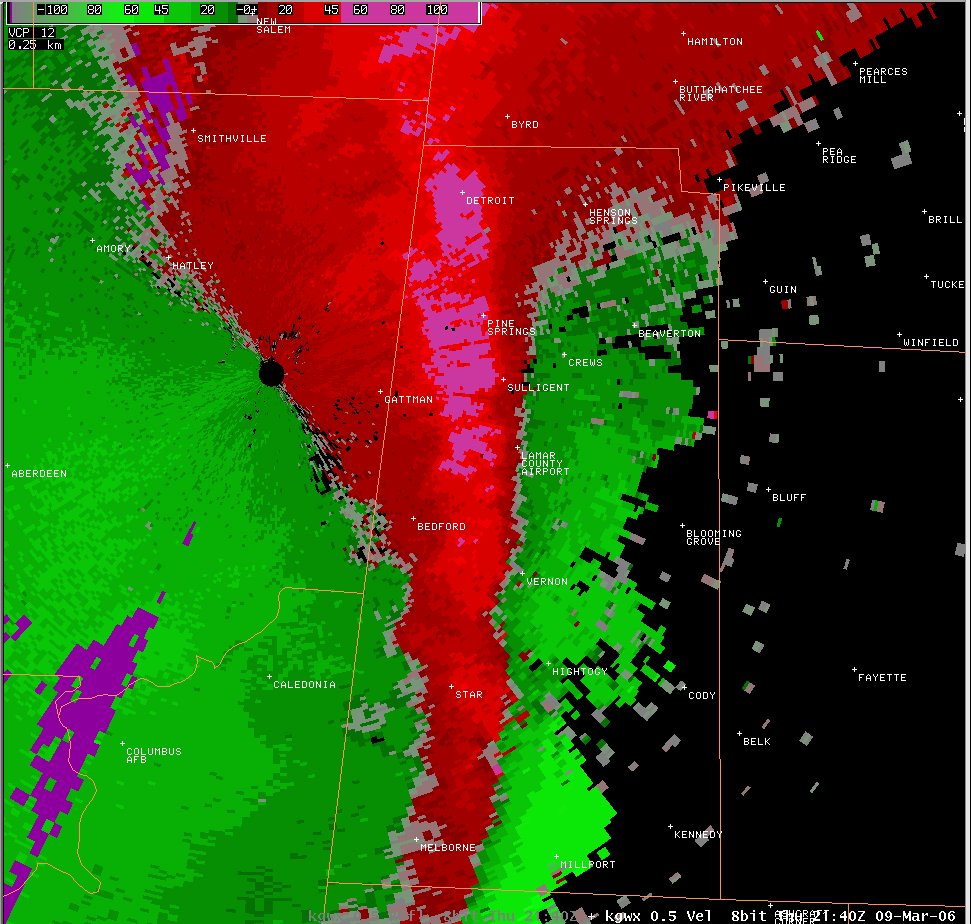
Severe Thunderstorm Damage - March 9, 2006
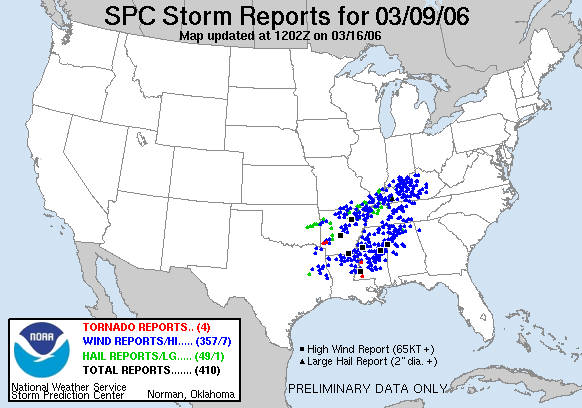
...Straight Line wind gusts reach 58 to 80 mph...
After further evaluation of damage photos...surface observations...and other pertinent damage information, it has been determined that the maximum wind gusts were around 80 mph. National Weather Service Meteorologists surveyed several locations across Central Alabama. It has been determined that the thunderstorms moving across west central Alabama Thursday afternoon and evening produced straight line wind gusts estimated between 58 and 80 miles an hour. The National Weather Service issued a Severe Thunderstorm Watch at 2:40 PM for most of western and northern Alabama valid through 9:00 PM. A line of severe thunderstorms crossed the Mississippi Alabama state-line at approximately 3:30 PM. The strongest segment of the line traveled northeast and affected Lamar...Marion...Fayette...Walker... and Winston Counties. Each of these counties reported wind damage and some large hail.
|
|
|||||||||||||||||||
View Local Storm Reports...Here
Current Hazards
National Outlooks
Tropical
Local Storm Reports
Public Information Statement
Graphical Hazardous Weather Outlook
Current Conditions
Regional Weather Roundup
Rivers and Lakes
Drought Monitor
Forecasts
Fire Weather
Aviation Weather
Graphical Forecasts
Forecast Discussion
Air Quality
Climate and Past Weather
Past Events
Storm Data
Tornado Database
Daily Rainfall Plots
Tropical Cyclone Reports
Monthly Climate
Annual Climate
Warnings and Other Products
Tornado Warnings
Severe Thunderstorm Warnings
Flash Flood Warnings
Winter Weather Warnings
Special Weather Statements
Non-Precipitation Warnings
Flood/River Flood Warnings
Productos en Español
Conciencia y Preparación
Previsión de 7 Días
Weather Safety
NOAA Weather Radio
Severe Weather Preparedness
Severe Safety Rules
Tornado Safety Rules
Severe Safety w/ ASL
Awareness Weeks
Severe Weather
Hurricane Preparedness
Summer Safety Campaign
Winter Weather
US Dept of Commerce
National Oceanic and Atmospheric Administration
National Weather Service
NWS Birmingham, Alabama
465 Weathervane Road
Calera, AL 35040
205-664-3010
Comments? Questions? Please Contact Us.