|
Widespread Rain and Severe Weather Events: March 8-9th, 2011
|
|
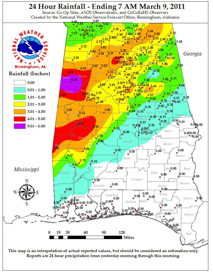
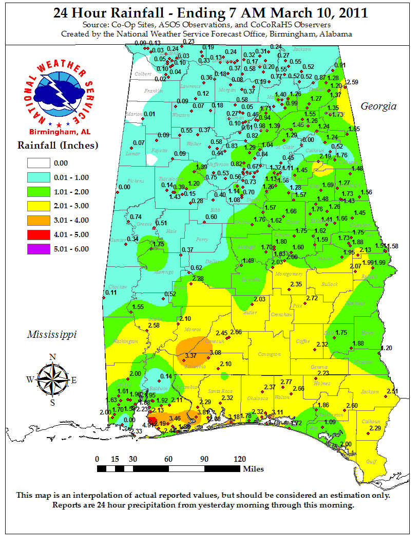
Moderate to heavy rainfall spread into Central Alabama Tuesday night ahead of an approaching storm system. Rain continued through much of Wednesday, resulting in widespread flash flooding and river flooding. Rainfall totals ranged from around 6 inches in western portions of the area to 2 to 4 inches elsewhere. In addition, a line of thunderstorms with areas of embedded rotation moved through Central Alabama early Wednesday morning. These thunderstorms caused wind damage across southern portions of the area, knocking down trees, power lines and causing structural damage at several locations.
|
 |
 |
|
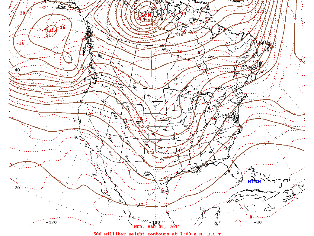
500mb Analysis at 6 am CST on March 9th, 2011
|
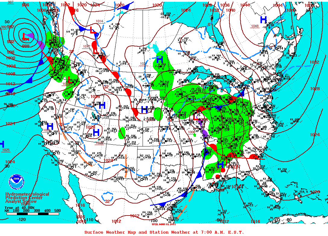
Surface Analysis at 6 am CST on March 9th, 2011
|
 |
 |
|
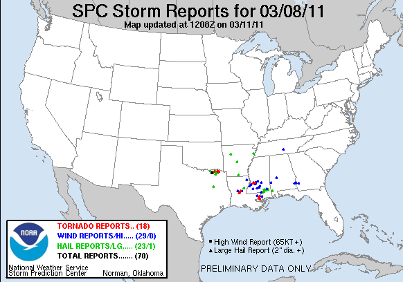
Storm Reports March 8th, 2011
|
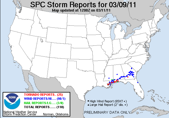
Storm Reports March 9th, 2011
|
 |
 |
|
24 Hour Rainfall Plot ending 7 am March 9, 2011
|
24 Hour Rainfall Plot ending 7 am March 10, 2011
|
 |
 |
|
Straight Line Wind Damage from Pike County
|
Straight Line Wind Damage from Perry County
|
 |
 |
|
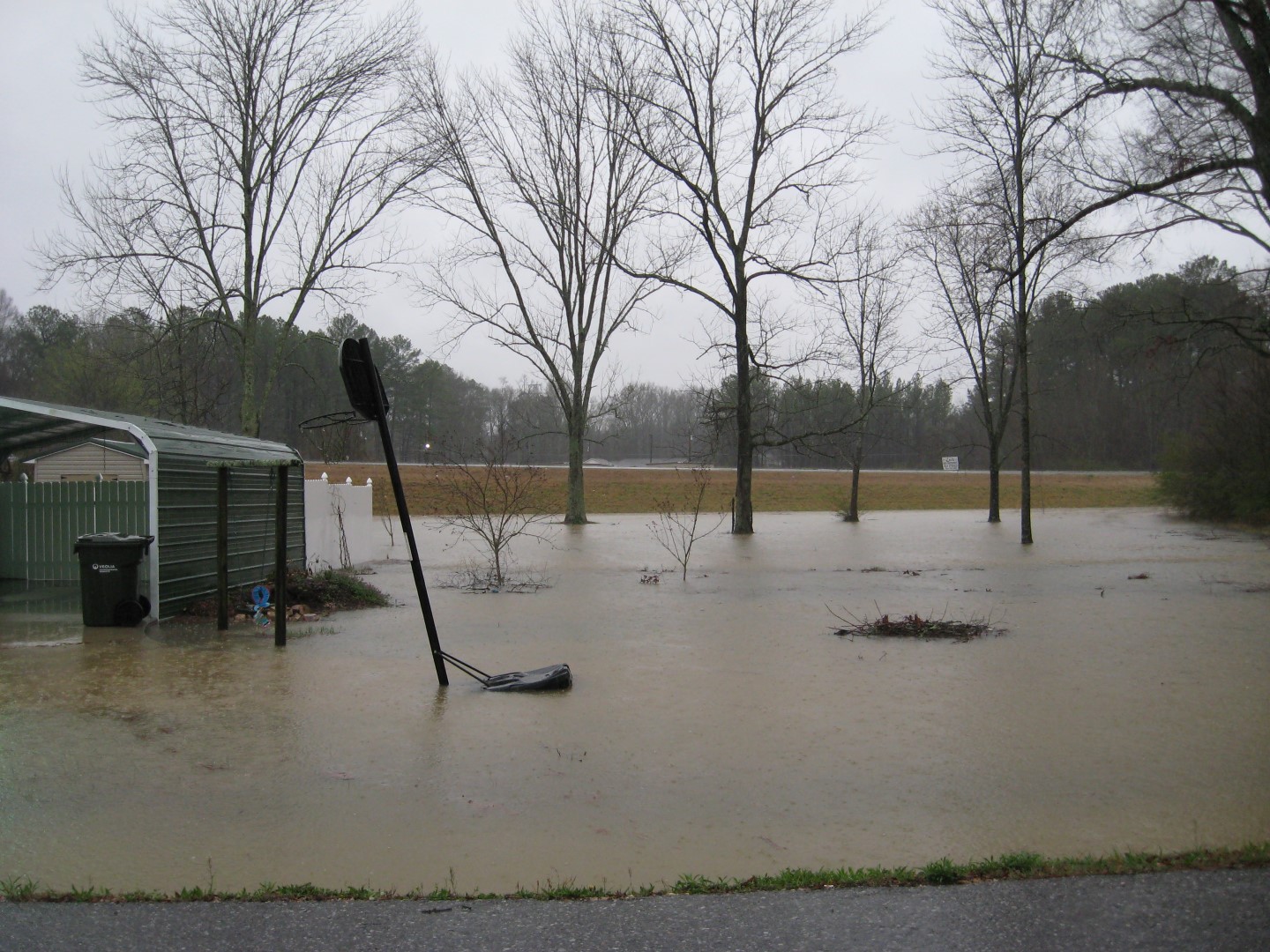
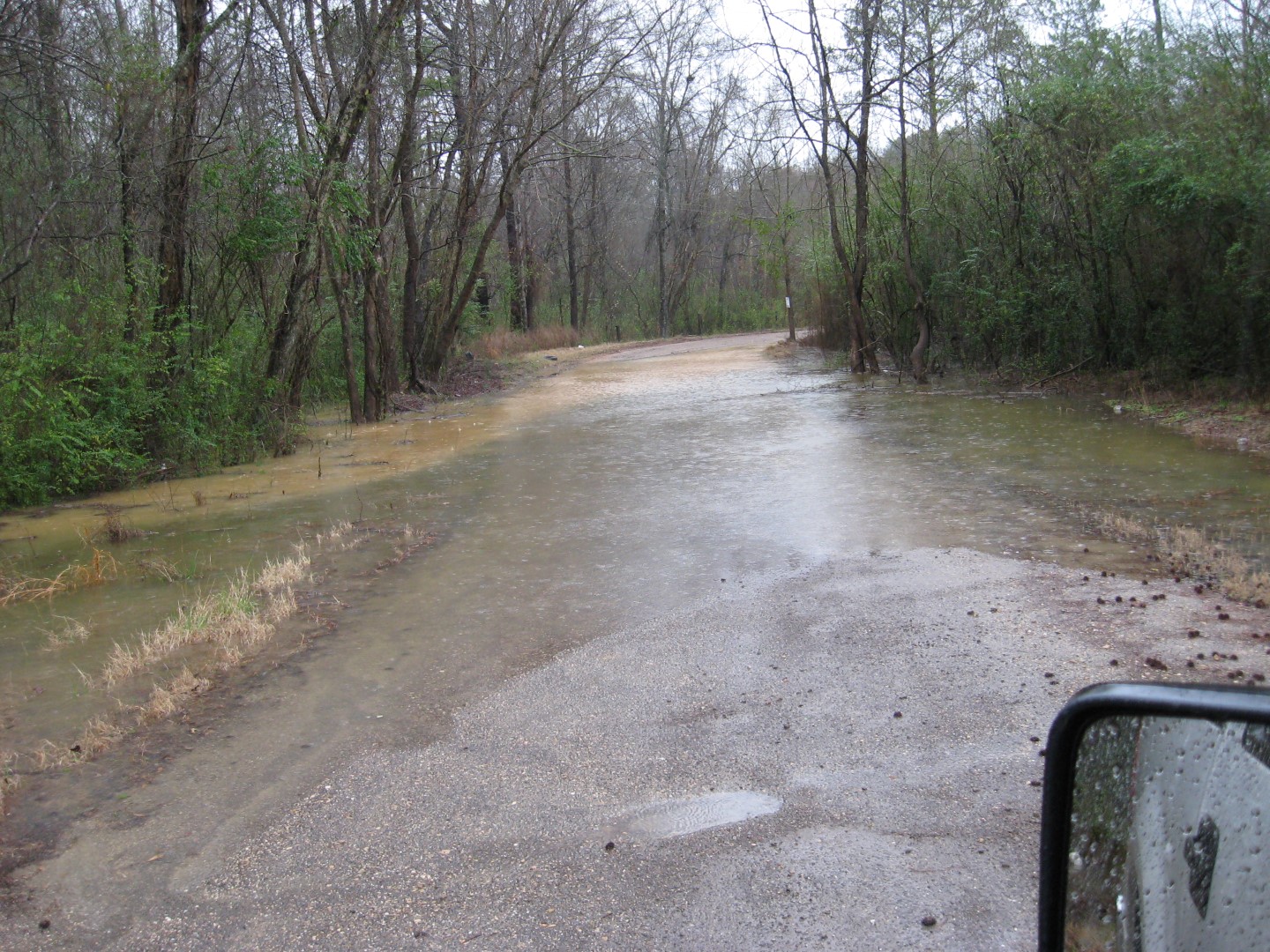
Etowah County Flooding
|
Etowah County Flooding
|
 |
 |
|
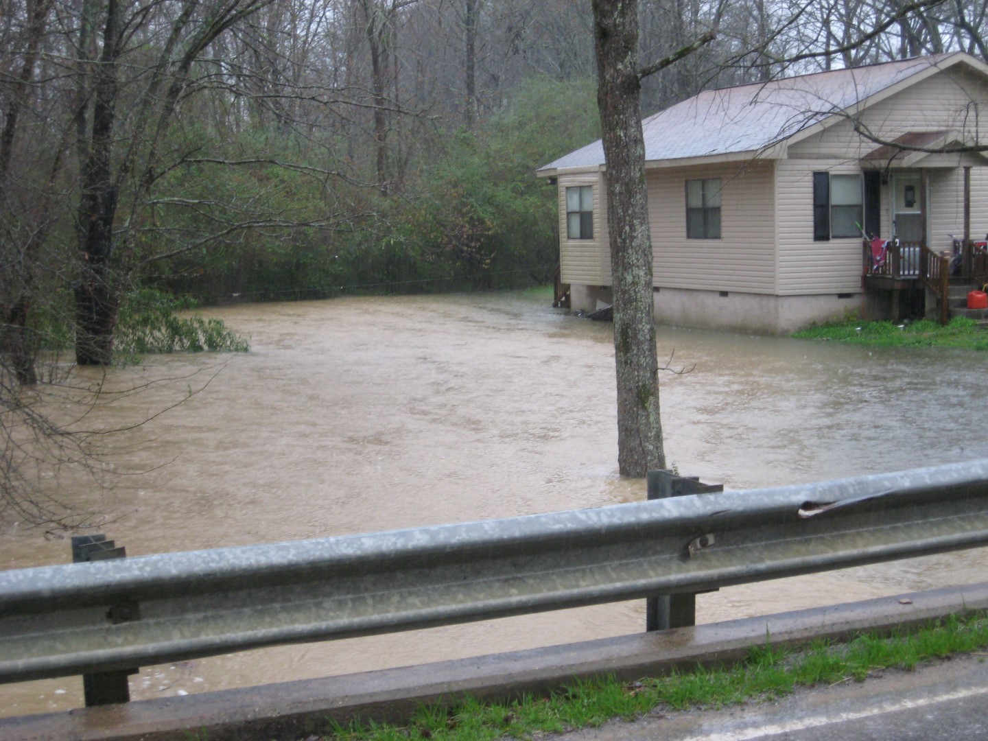
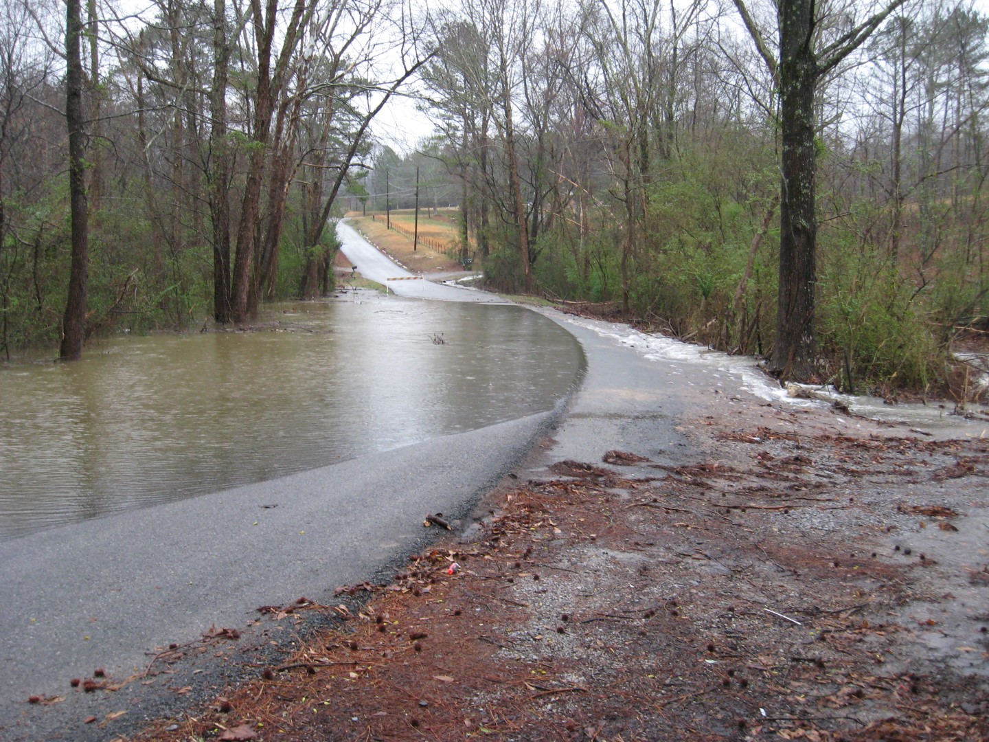
Etowah County Flooding
|
Etowah County Flooding
|
 |
 |
|
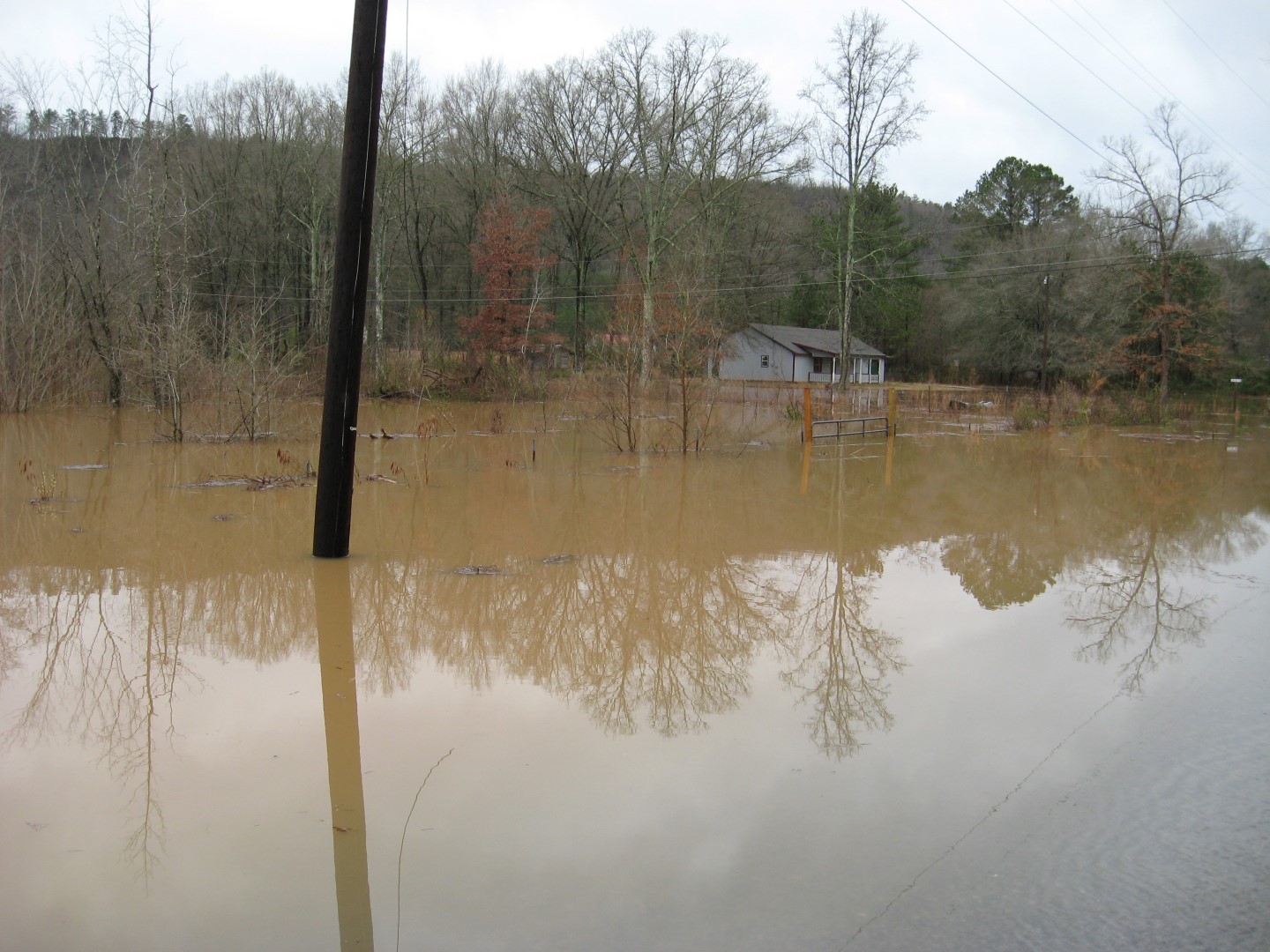
Etowah County Flooding
|
Etowah County Flooding
|
|


