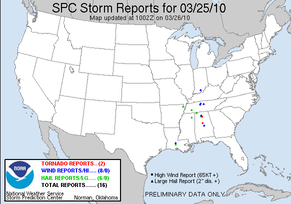
Tornado Event - March 25, 2010
Event Summary for Central Alabama
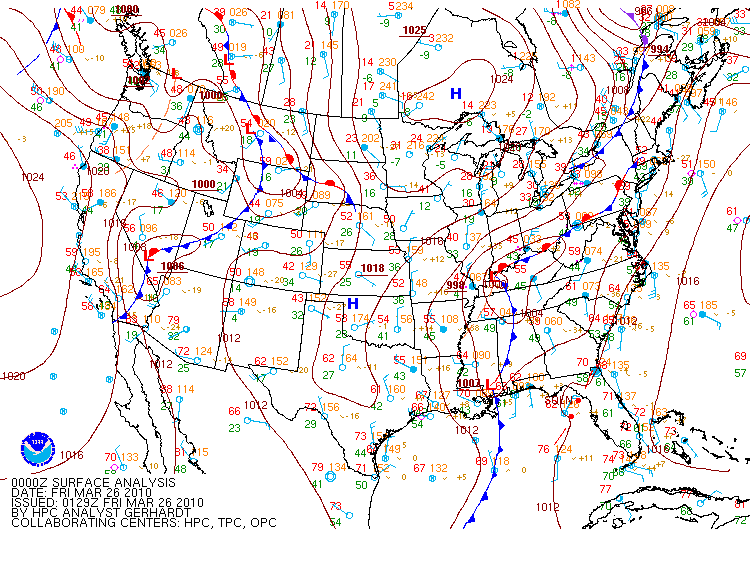
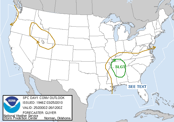
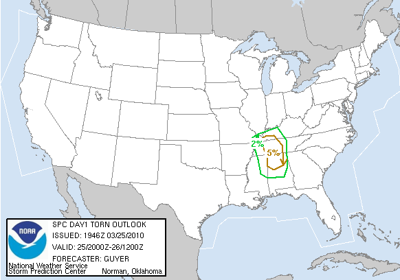
On March 24th, a low pressure system developed in the southern Plains and tracked across the Tennessee valley, just to the north of Alabama. Ahead of the front, pre-frontal showers and scattered thunderstorms moved across central Alabama. Once those showers moved out on the morning of March 25th, a dry air slot caused skies to clear out in the early afternoon hours, allowing for temperatures to climb into the middle and upper 60s. As the cold front moved through central Alabama, multiple low-topped supercells developed along the I-65 corridor. Two of them produced tornadoes. Click on each for a summary.
|
Location/Clickable Detailed Summary Link
|
Damage Rating/Estimated Maximum Wind Speeds
|
Injuries/Fatalities
|
Damage Path Length/Width
|
Starting Point/Time
|
Ending Point/Time
|
|
|
EF-1
90 mph
|
None
|
2.75 miles
100 yards
|
33.2391/-86.8670
702 pm
|
33.2538/-86.8223
707 pm
|
|
|
EF-1
95 mph
|
None
|
2.76 miles
200 yards
|
32.8472/-86.6814
759 pm
|
33.8553/-86.6351
805 pm
|
Preliminary Local Storm Reports
Public Information Statement
Severe Thunderstorm Watch 35 was in effect from 320 pm CDT until 7 pm CDT.
Severe Weather Episode Data