National Weather Service United States Department of Commerce

Straight Line Wind Damage - Lamar & Marion Counties - April 2, 2009


Estimated Maximum Wind:
80-100 mph
Injuries/Fatalities:
None
DamageArea:
Northern Lamar & Much of Marion County
Approximate Start Time:
640 pm
Approximate End Time:
720 pm

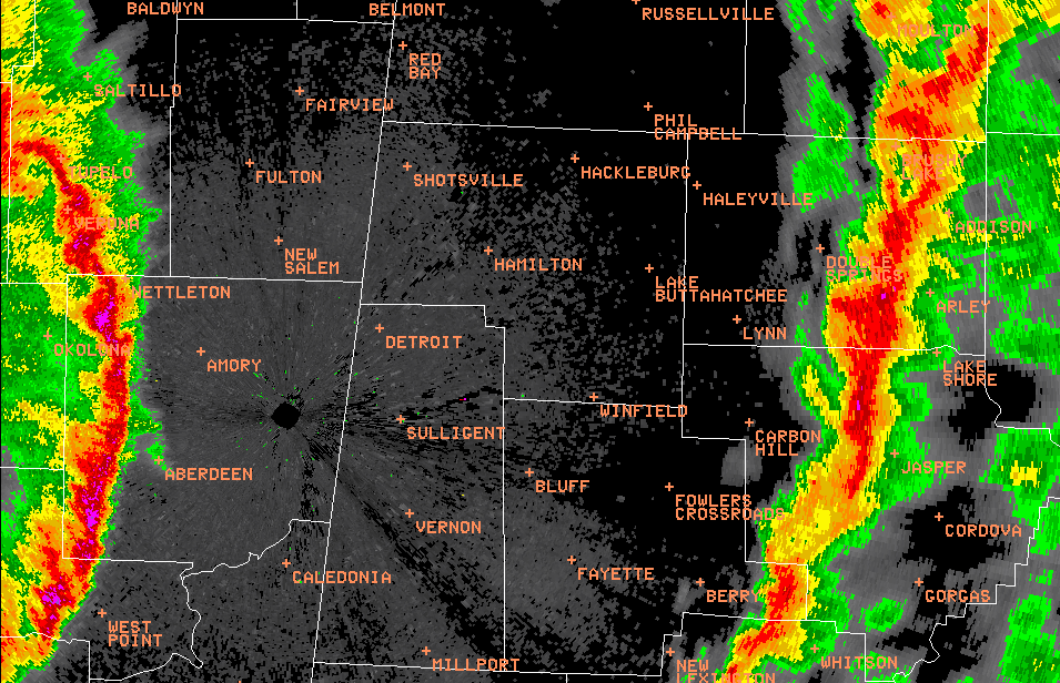
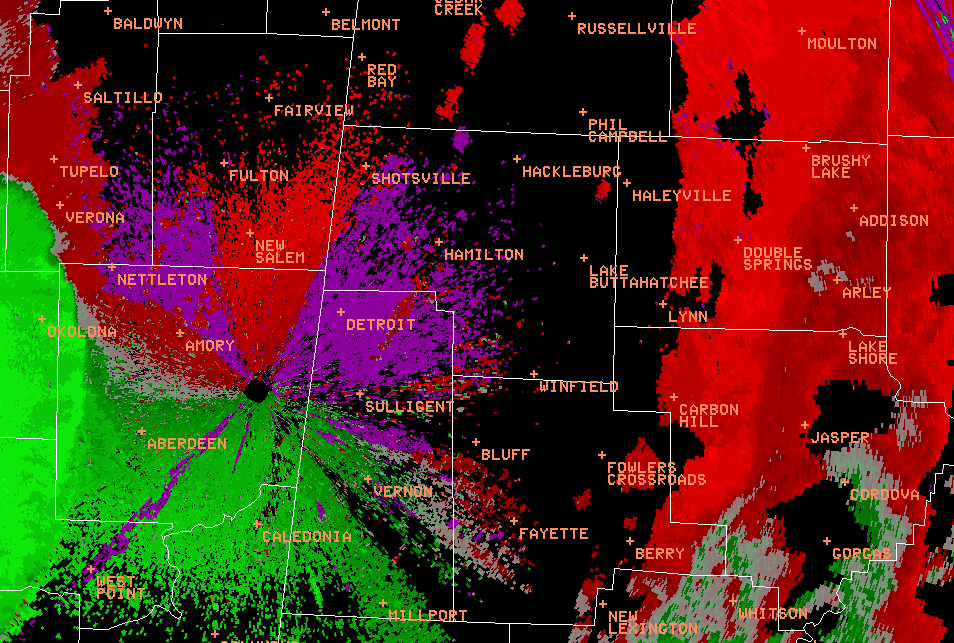
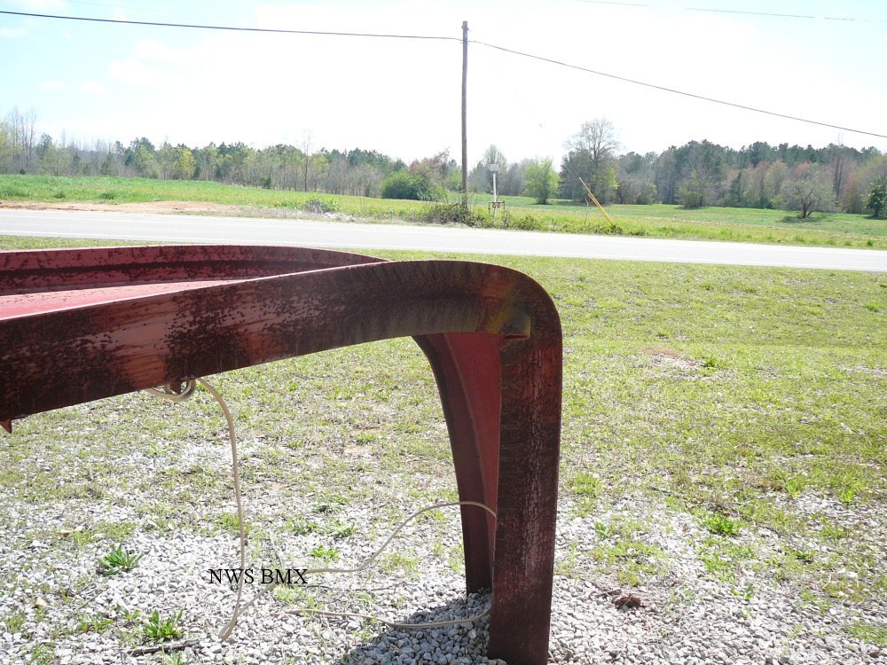
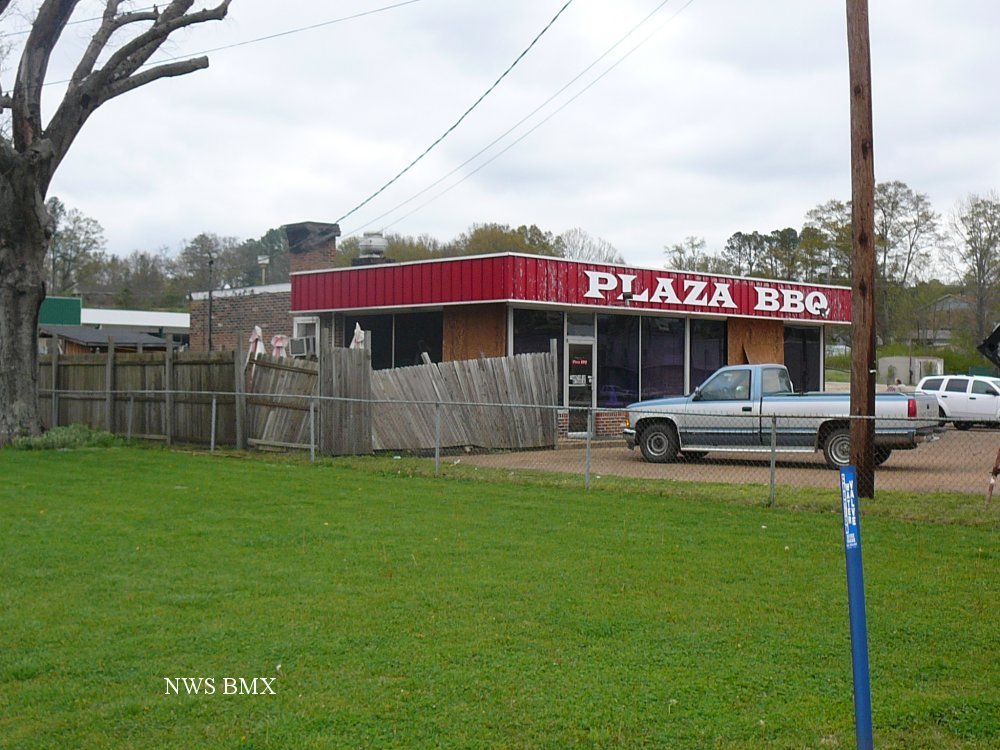
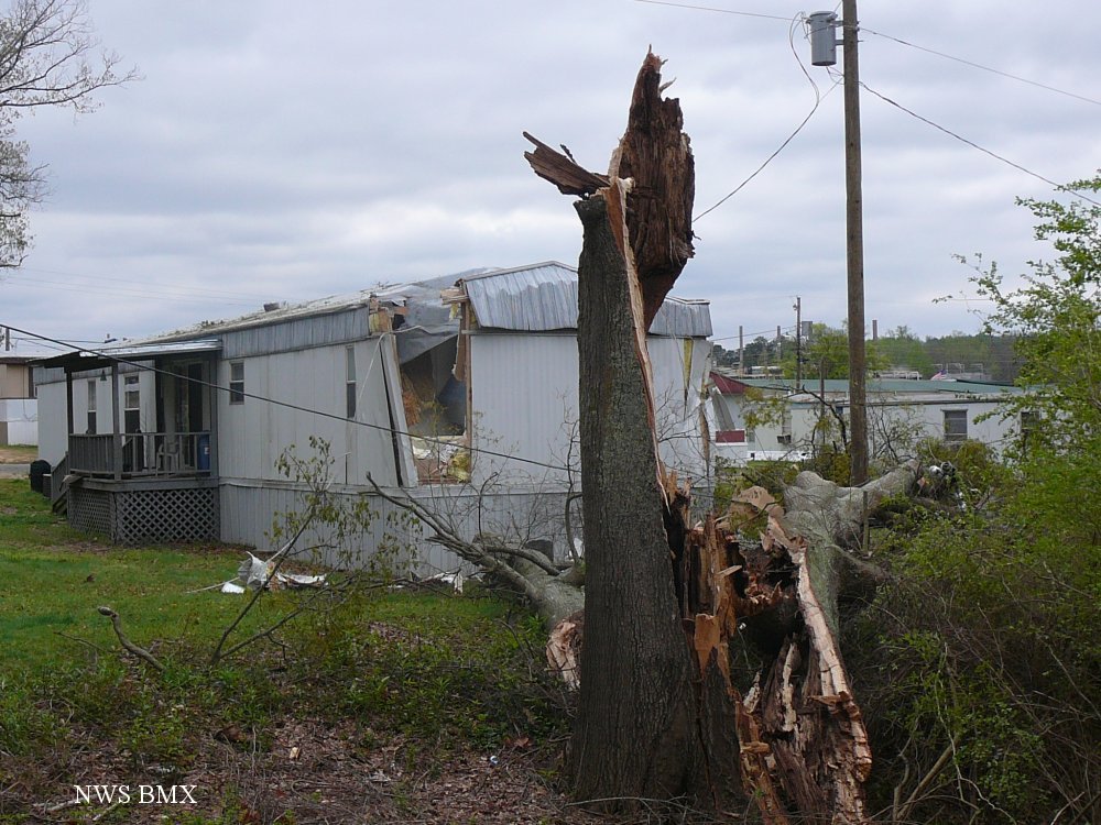
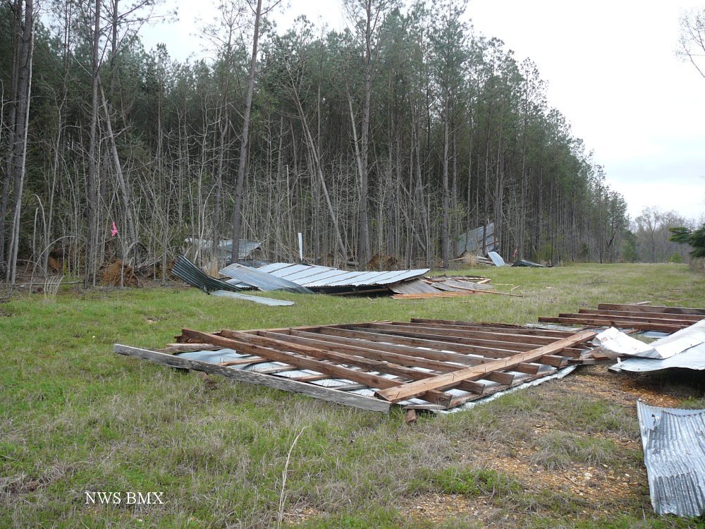
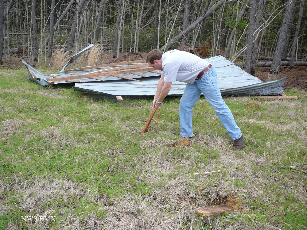
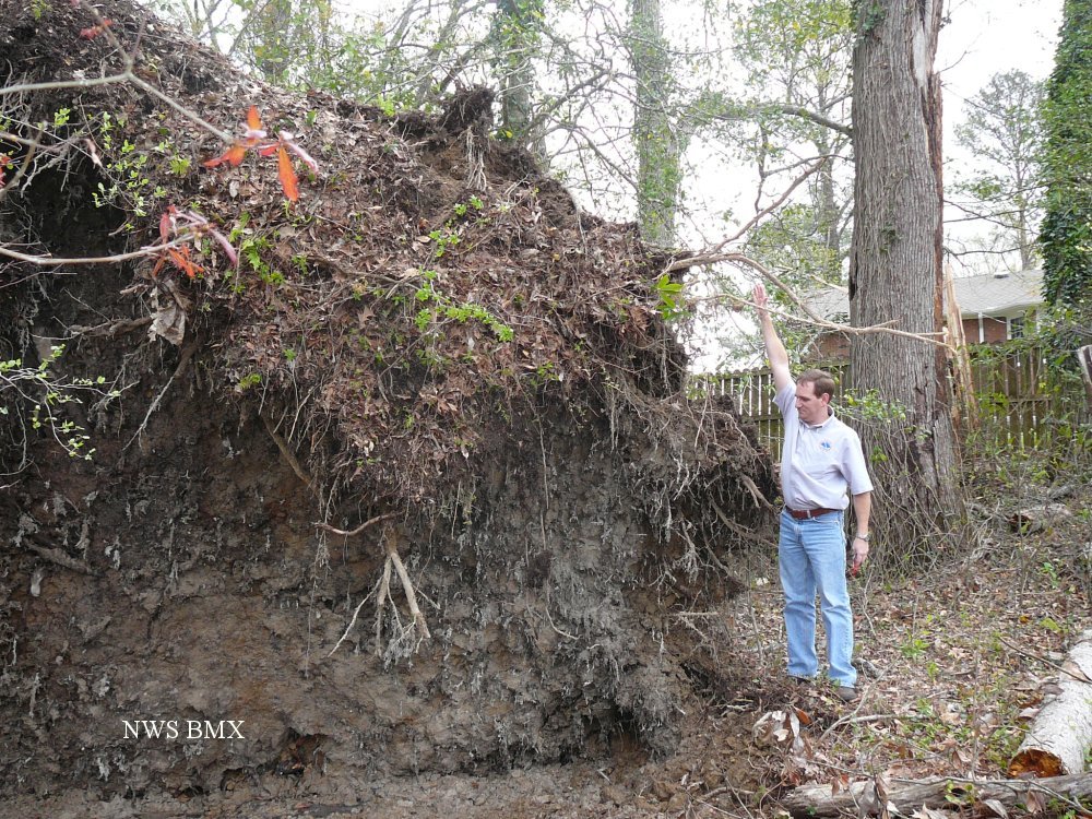
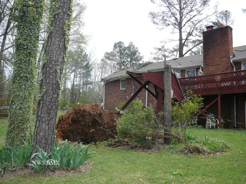
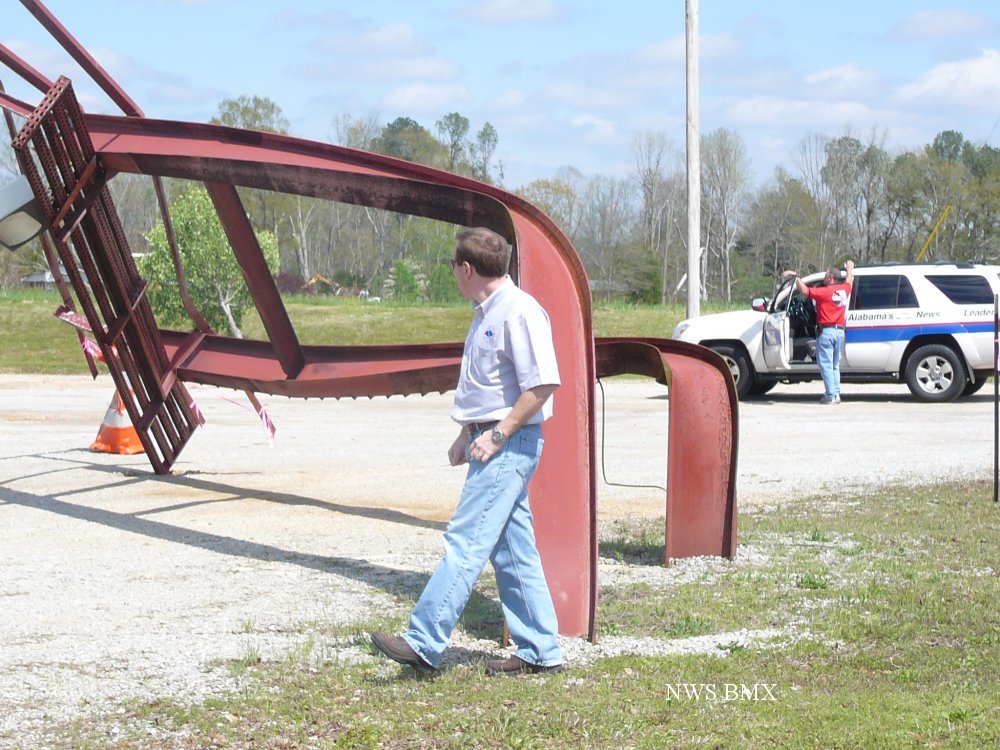
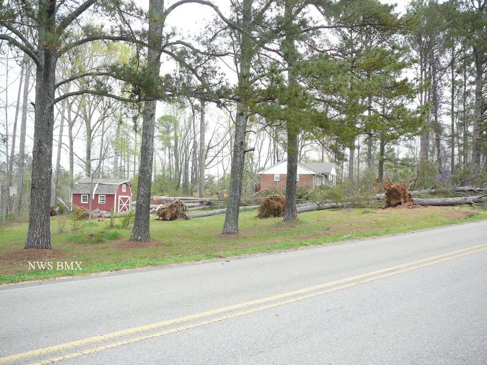
A National Weather Service Damage Assessment Team has surveyed the storm damage in northern Lamar and Marion Counties. It has been determined the damage was the result of damaging straihgt line winds. Damage estimates were consistent with winds between 80 & 100 mph, possibly higher in a few locations.

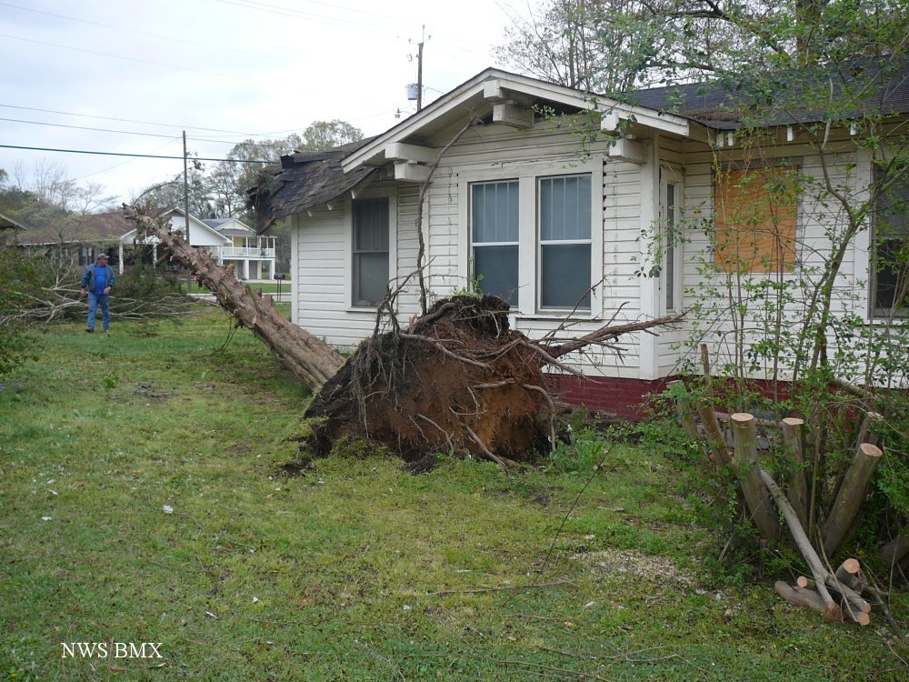
Hundreds of trees were either blown down or were snapped off across northern Lamar County and across much of Marion County. Several structures and vehicles were damaged by the fallen trees.

All the pictures below are in Marion County.


Damage Path

Damage Path

The top image is a KGWX 0.5 degree reflectivity loop. The bottom image is a KGWX 0.5 degree velocity loop. The green indicates wind blowing toward the radar while red indicates wind blowing away from the radar. Notice the large area of green approaching the radar changing to red as it passes the radar. The radar estimated winds around 75 mph very close to the ground.

Damage
Tree Down

Damage
Iron Pole Bent

Damage
Windows Blown Out of BBQ

Damage
Tree Snapped

Damage
Roof Damage

Damage
Wood Missiles

Damage
Large Uprooted Tree

Damage
Trees Down

Damage
Iron Pole Bent

Damage
Trees Uprooted