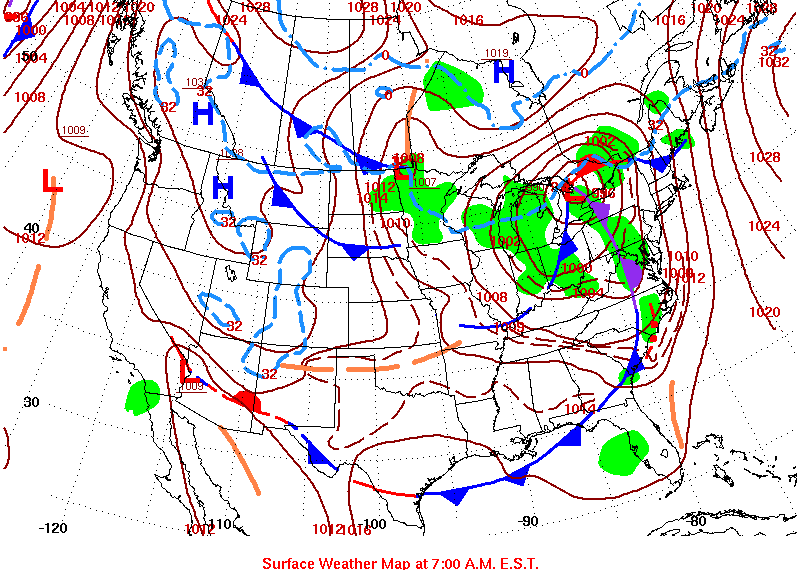
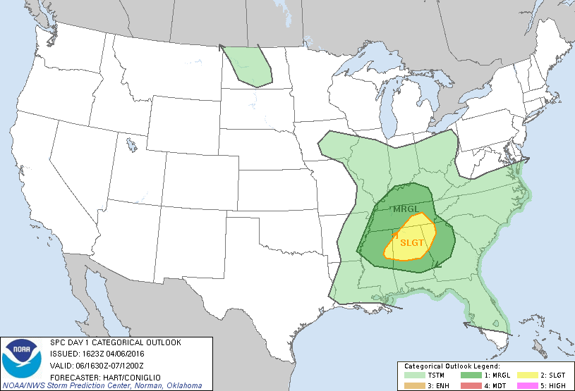
|
Location/Clickable Detailed Summary Link
|
Damage Rating/Estimated Maximum Wind Speeds
|
Injuries/Fatalities
|
Damage Path Length/Width
|
Starting Point/Time
|
Ending Point/Time
|
|
|
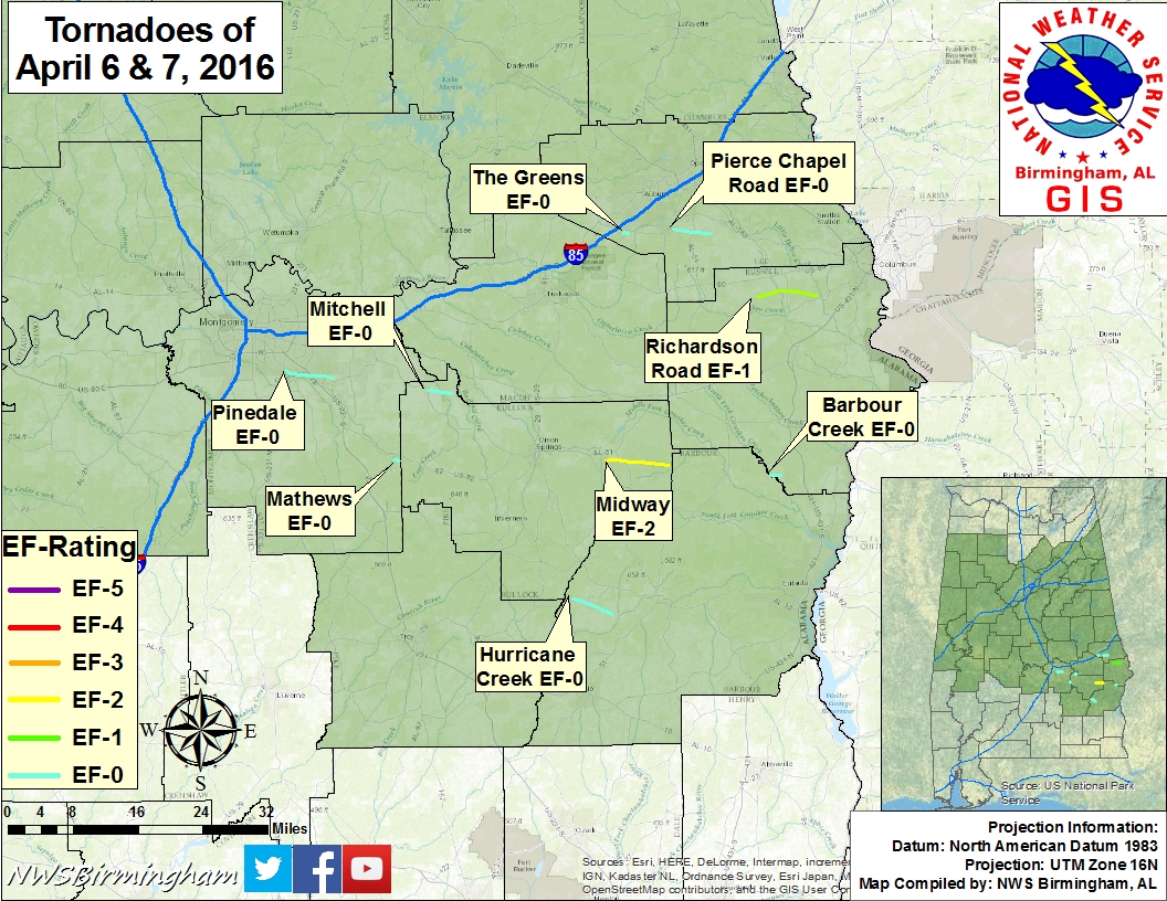
EF-0
80 mph
|
None
|
6.01 miles
250 yards
|
5 SSE Montgomery
32.2960/-86.2387
1055 pm
|
2 W Pike Road
32.2809/-86.1384
1104 pm
|
|
|
EF-0
75 mph
|
None
|
3.03 miles
300 yards
|
6 WSW Hardaway
32.2579/-85.9388
1118 pm
|
3 SW Hardaway
32.2503/-85.8879
1123 pm
|
|
|
EF-0
65 mph
|
None
|
0.77 miles
50 yards
|
4 WNW Shopton
32.1341/-86.0133
1124 pm
|
4 WNW Shopton
32.1324/-86.0002
1126 pm
|
|
|
EF-0
85 mph
|
None
|
0.72 miles
250yards
|
5 SSW Auburn
32.5347/-85.5247
1132 pm
|
4 SSW Auburn
32.5352/-85.5125
1133 pm
|
|
|
EF-0
76 mph
|
None
|
4.71 miles
200 yards
|
5 SE Auburn
32.5400/-85.4183
1144 pm
|
2 ESE Beauregard
32.5311/-85.3385
1150 pm
|
|
|
EF-2
120 mph
|
None
|
7.74 miles
250 yards
|
4 NW Midway
32.1271/-85.5662
1154 pm
|
6 ENE Midway
32.1174/-85.4352
1206 am
|
|
|
EF-1
90mph
|
None
|
7.49 miles
200 yards
|
4 SW Crawford
32.4187/-85.2417
1157pm
|
3 SSW Ladonia
32.4184/-85.1158
1205 am
|
|
|
EF-0
75 mph
|
None
|
5.37 miles
200 yards
|
Boot Hill
31.8815/-85.6408
1216 am
|
5 N Louisville
31.8515/-85.5568
1227 am
|