National Weather Service United States Department of Commerce

Cullman & Blount Counties Severe Weather

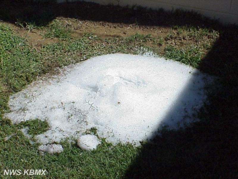
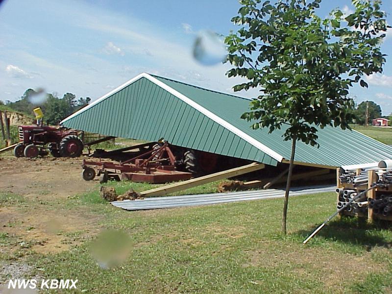
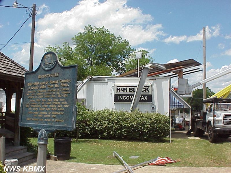
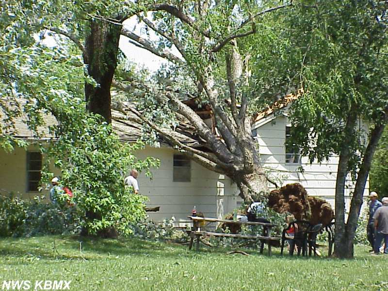
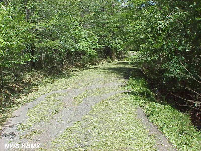
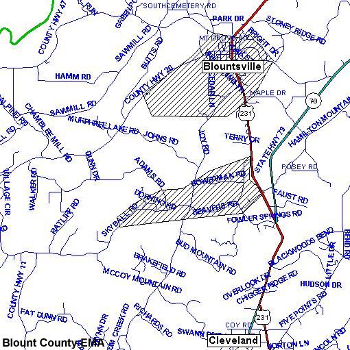
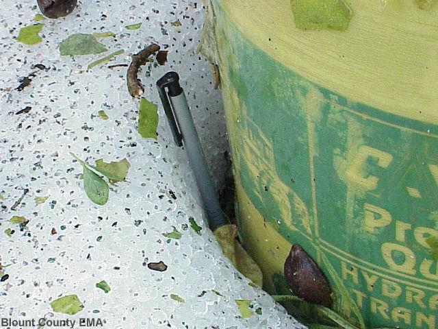
Severe thunderstorms developed and moved across parts of south Cullman County and continued into Blount County on May 24, 2001. The storms occurred from 5:00 to 7:00 PM CDT. Reports of hail covering the ground were received after the passage of these storms. Move your mouse over an image to view a description or read it below the table. The images shown here are smaller versions of the images taken of the severe weather damage. Clicking on an image will display a larger version of the smaller image displayed on this page.

Pile of hail left over from storms that occurred over 16 hour earlier. Cold Springs area of Cullman County (near Bremen). An eyewitness reported that hail at least 1-inch in diameter covered the ground for as far as she could see creating hail fog. Pole Barn downed by storms. Same location as the pile of hail, Cold Springs area of Cullman County (near Bremen). Billboard blown down in the town of Blountsville, Blount County. Large tree on house in the Blountsville, Blount County.
Hail knocked leaves off of trees, so much so that the leaves covered this road in the Blountsville area of Blount County. Map showing damaged reports in Blount County. Hatched areas show where the damage occurred. From Blount County EMA. Shows a hail piled up next to a garden sprayer. The pen next to the pile of hail is four inches long showing the depth of the hail to be just under 4 inches. From Blount County EMA. Roof on house peeled up from severe thunderstorm winds. This is in the Bountsville area of Blount County. From Blount County EMA.


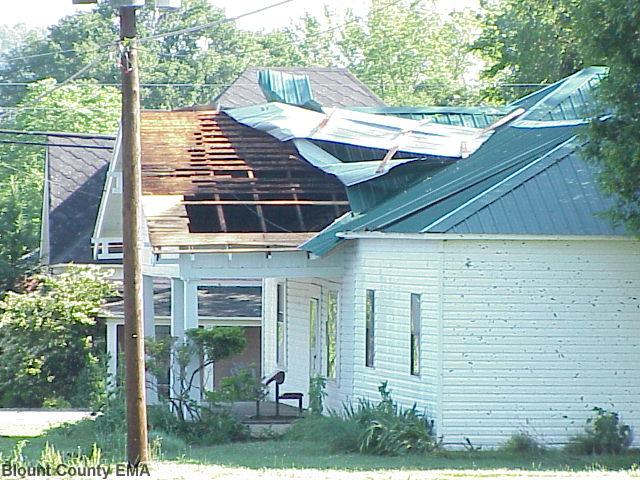
Description of images, starting on the top row, from left to right;

  • Pile of hail left over from storms that occurred over 16 hour earlier. Cold Springs area of Cullman County (near Bremen). An eyewitness reported that hail at least 1-inch in diameter covered the ground for as far as she could see creating hail fog.
  • Pole Barn downed by storms. Same location as the pile of hail, Cold Springs area of Cullman County (near Bremen).
  • Billboard blown down in the town of Blountsville, Blount County.
  • Large tree on house in the Blountsville, Blount County.

Descriptions continued, bottom row, from left to right;

  • Hail knocked leaves off of trees, so much so that the leaves covered this road in the Blountsville area of Blount County.
  • Map showing damaged reports in Blount County. Hatched areas show where the damage occurred. From Blount County EMA.
  • Shows a hail piled up next to a garden sprayer. The pen next to the pile of hail is four inches long showing the depth of the hail to be just under 4 inches. From Blount County EMA.
  • Roof on house peeled up from severe thunderstorm winds. This is in the Bountsville area of Blount County. From Blount County EMA.


The photo was taken by Weldon Faust from his house just north of Rosa looking north.  Off in the distance is a weak tornado, F0.  Time of the event was estimated to be from 7:02 to about 7:04 pm.  Based on terrain, it appears the tornado was in the Locust Fork river valley.  No property damage was reported in this area. 
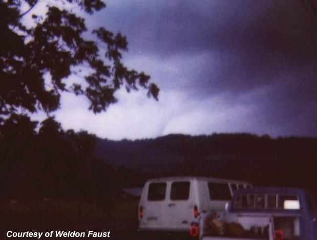
The photo on the right was taken by Weldon Faust from his house just north of Rosa looking north. Off in the distance is a weak tornado, F0 - winds speeds of 40 to 72 mph. Time of the event was estimated to be from 7:02 to about 7:04 pm. Based on terrain, it appears the tornado was in the Locust Fork river valley. No property damage was reported in this area. Clicking on the image will display a larger version.

Survey by Brian Peters and Kevin Pence. Photos takes by Brian Peters and Kevin Pence unless otherwise noted. Special thanks is extended to the Blounty County Emergency Management Agency for some of the images used on this page.