|
Event Summary
|
|
EF-1
|
|
Estimated Maximum Wind:
|
110 mph
|
|
Injuries/Fatalities:
|
None |
|
Damage Path Length:
|
3.89 miles
|
|
Maximum Path Width:
|
350 yards
|
|
Approximate Start Point/Time:
|
3 SSW Eufaula
31.8562/-85.1877
at 1209 PM CDT
|
|
Approximate End Point/Time:
|
1 WSW Georgetown
31.8786/-85.1285
at 1220 PM CDT
|
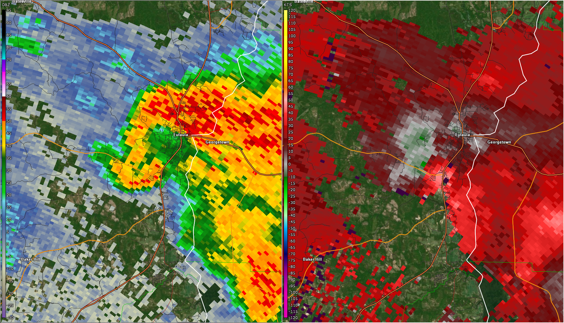
An unseasonably strong amount of wind shear and a very unstable air mass combined to create conditions favorable for the development of supercell thunderstorms across south central Alabama. One of the supercells was able to develop and spawn a tornado in Barbour County in the early afternoon. The tornado produced high-end EF1 damage in Eufaula.
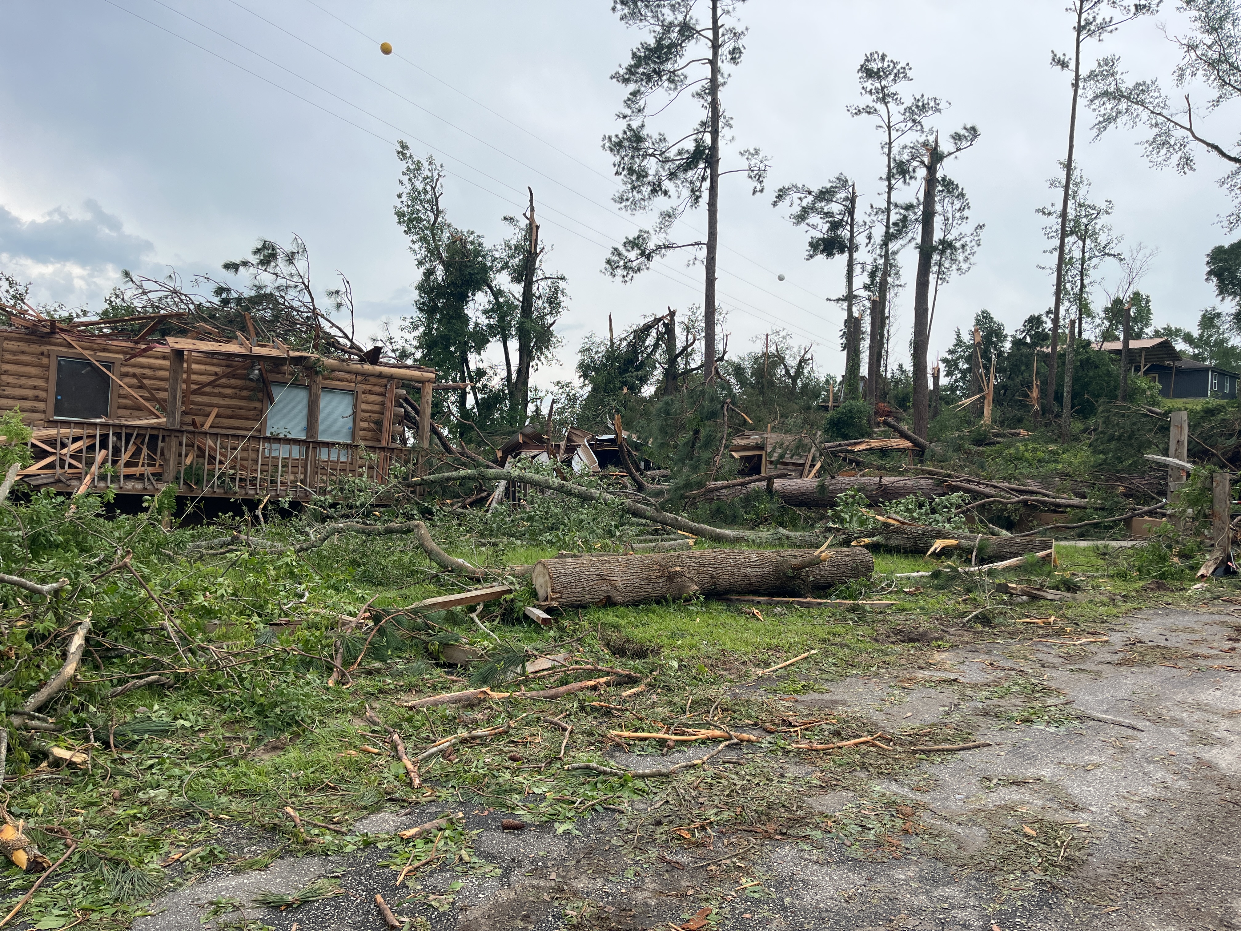
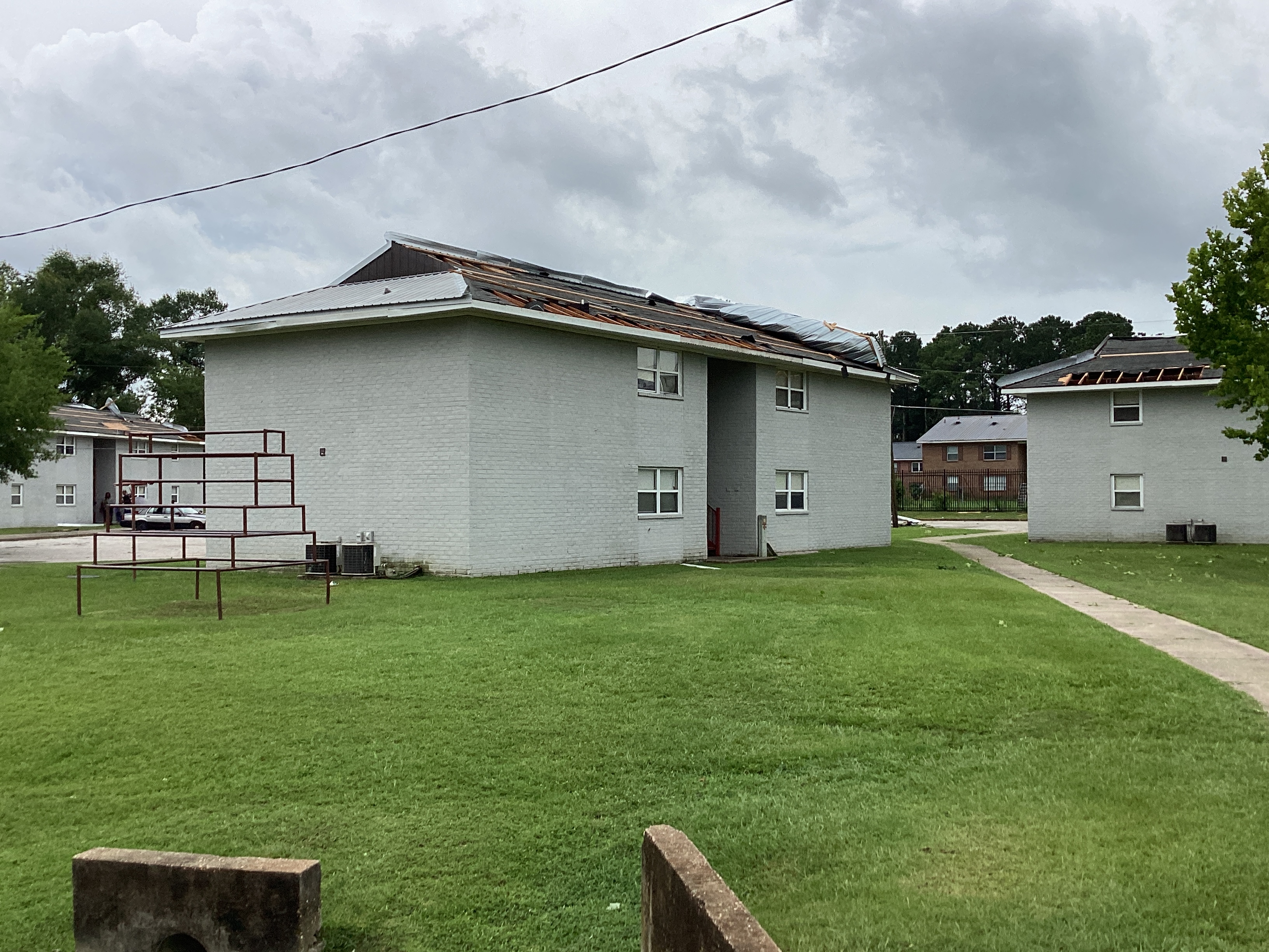
The tornado began somewhere in a forested area between Sandy Lane W west of Highway 30 west of Barbour Creek in Eufaula. It intensified quickly and snapped or uprooted a number of large pine trees on the south side of Hwy 30. The storm crossed HWY 30 and uprooted another grove of pine trees causing damage to a church. The tornado weakened slightly as it crossed US Highway 431, then rapidly intensified and caused the most significant tree damage along the path on the western banks of Barbour Creek, with snapped and uprooted trees and trees causing major damage to a home. As the tornado crossed Barbour Creek, a passing motorist caught the wispy and ragged tornado on video. The tornado continued to the east-northeast and crossed Paul Lee Parkway and State Docks Road, where trees were uprooted, the side of a metal building structure was removed, and 3 units of an apartment complex sustained partial roof damage. The tornado then caused another area of significant tree snaps and uproots between Cypress Cove Drive and Inlet Rd. The tornado weakened somewhat before moving off the banks and over the waters of the Walter F George Reservoir.
The data is PRELIMINARY and may be subject to change.
|