|
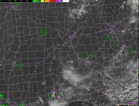
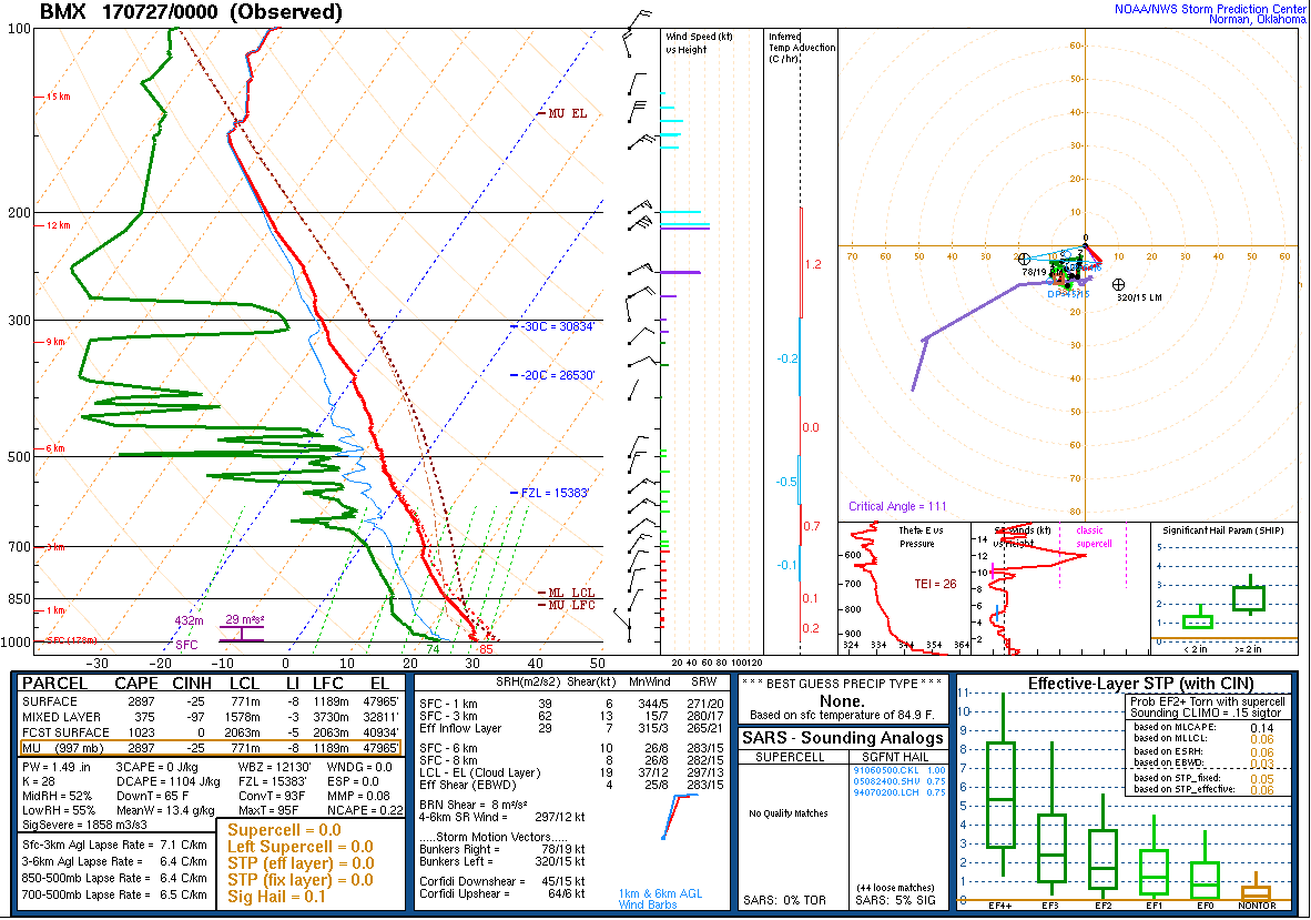
Satellite data on the morning of July 26th, revealed a wedge of drier air across the E/NE counties and a N-S oriented convergence band near/along I-65. No obvious old outflow boundaries were noted, but enhancements in the cumulus field began fairly early within the convergence zone. It wasn't long before showers began to develop within this zone, especially along the ridges and higher elevations. Then, outflow boundary collisions provided additional focus for thunderstorm development.
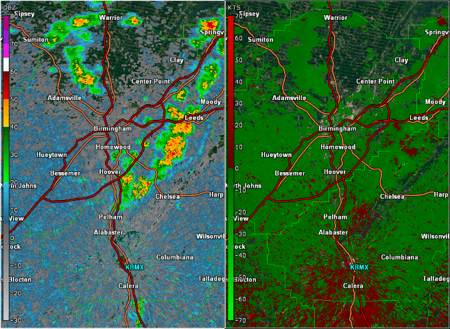
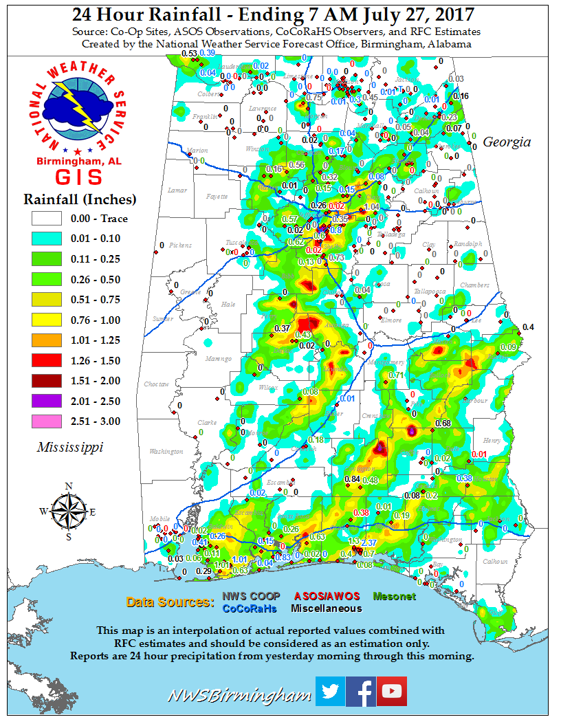
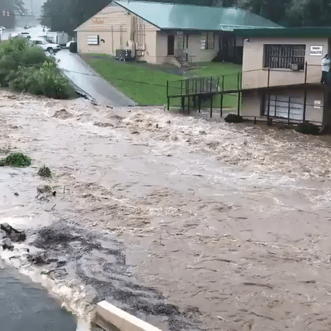
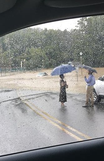
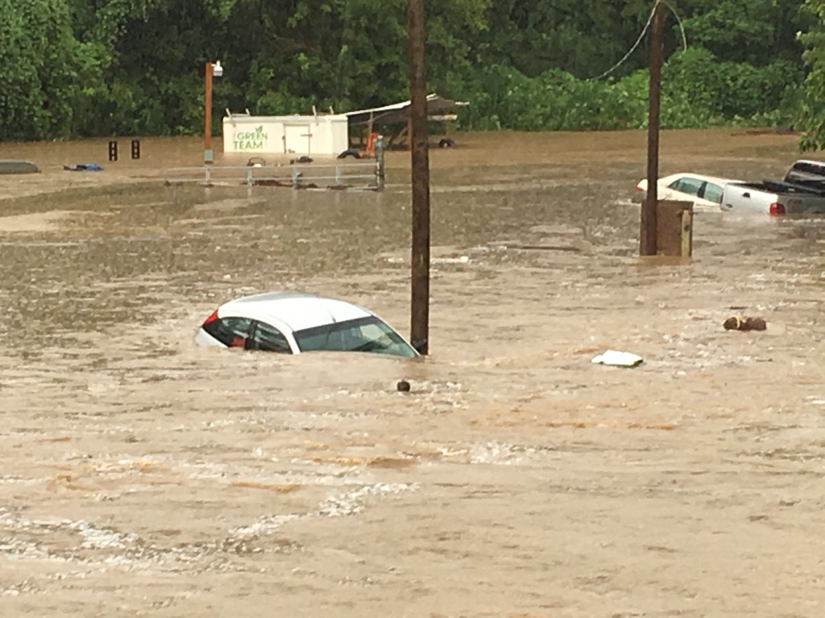
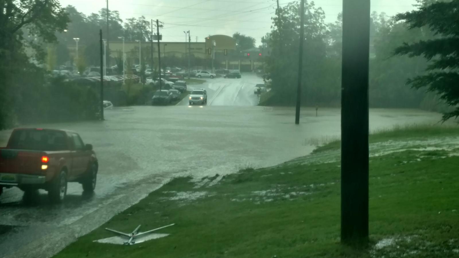
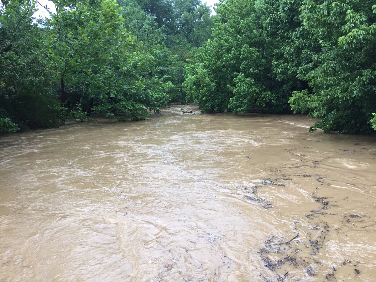
The localized flooding in and around the Vestavia Hills and Hoover areas was the result of boundary collisions, very heavy rainfall, poor runoff/drainage in the urban areas, and flashy creeks. There were at least 3 different outflow boundaries that contributed to the thunderstorm development over the area...1) Northwestward-moving outflow from ridgetop convection along Jefferson/Shelby Co line, 2) Southward-moving outflow from dying shower near Adamsville, 3) Northward-moving outflow from collapsing storm near Indian Springs. Although there was movement with the storms over Vestavia Hills, the rainfall was very intense. Radar estimates showed upwards of 2 inches of rain in just one hour. Storm total rainfall amounts of 2-4 inches were noted. Significant flash flooding occurred near/along Hwy 31. At least a couple vehicles were swept downstream in the floodwaters. Much of the flooding was due to Patton Creek overflowing its banks. Thankfully, no injuries or deaths occurred.
|