|
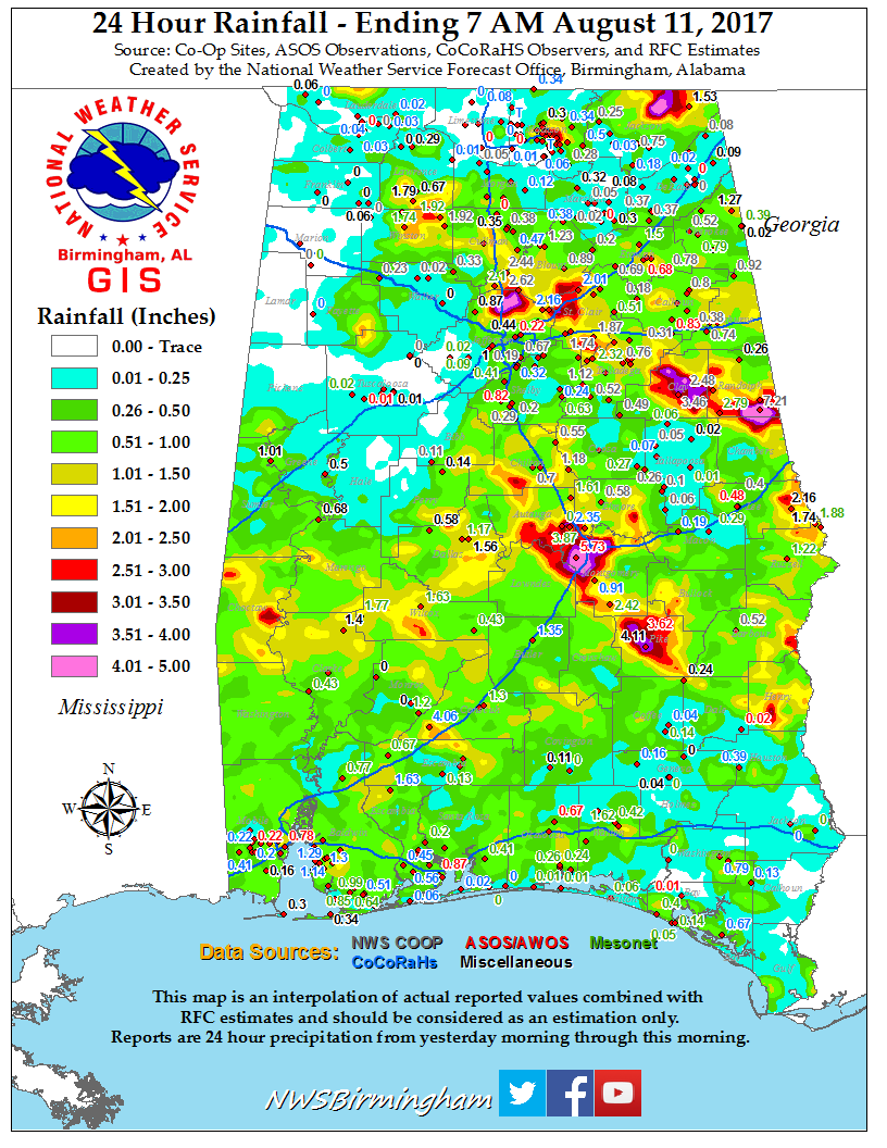
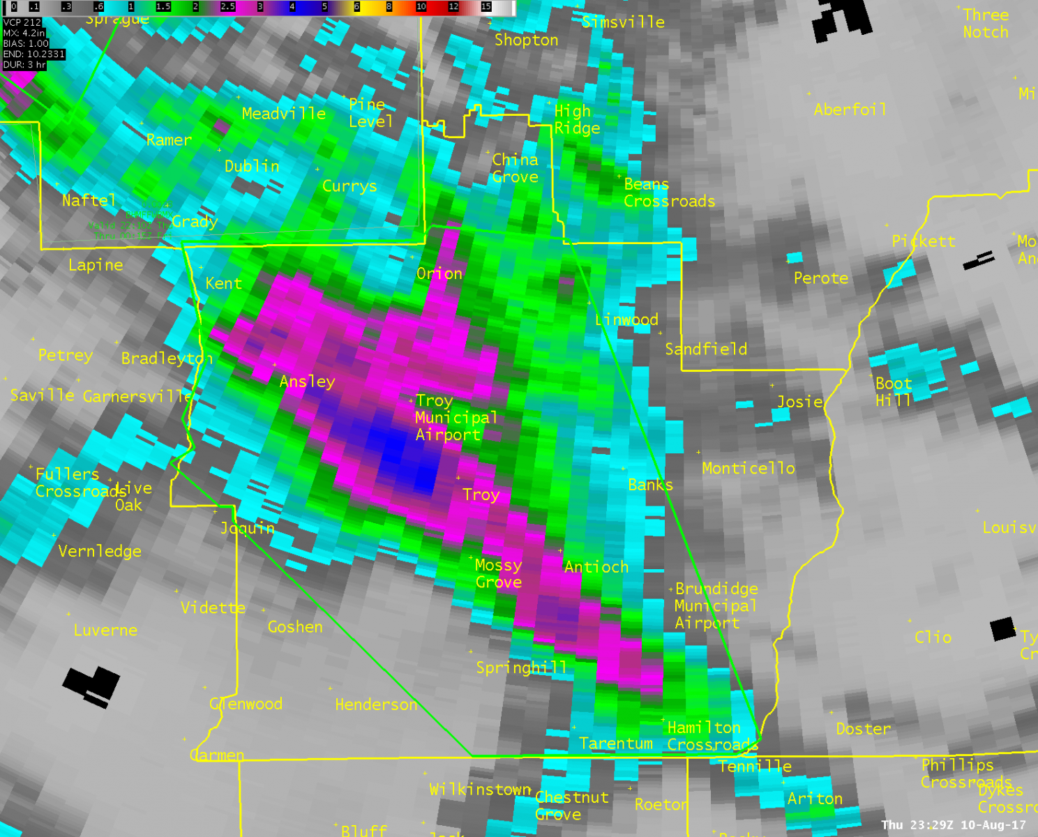
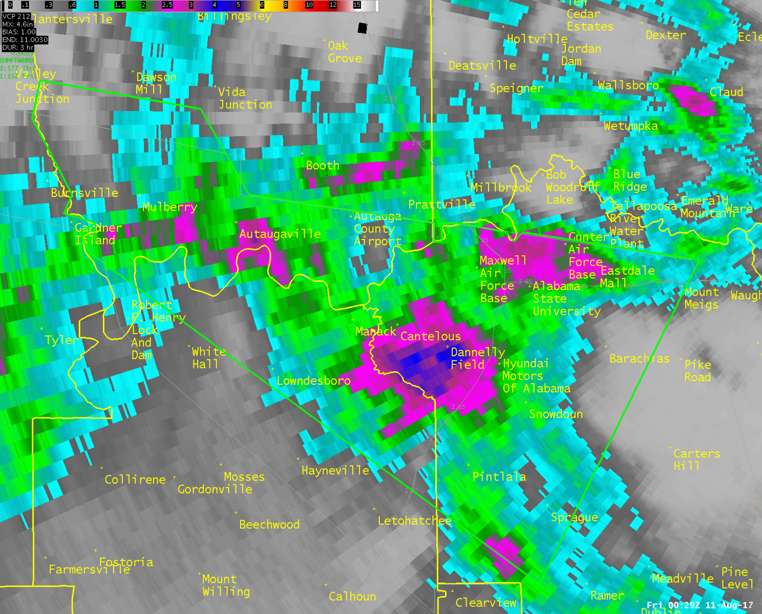
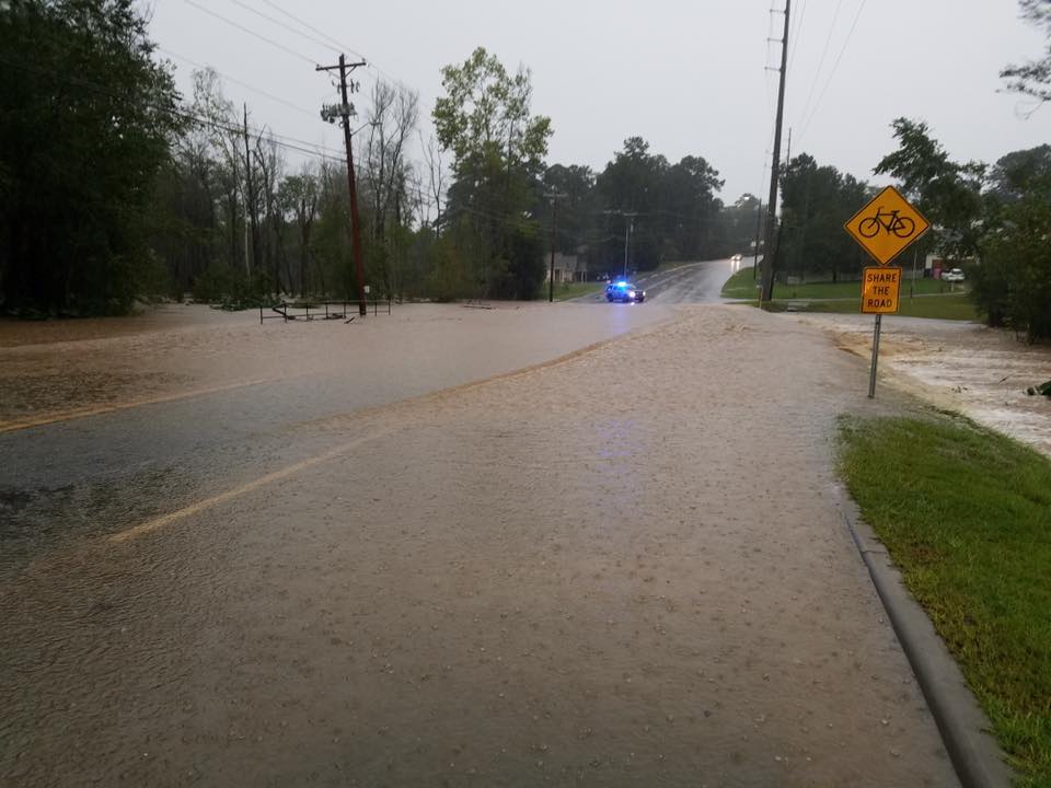
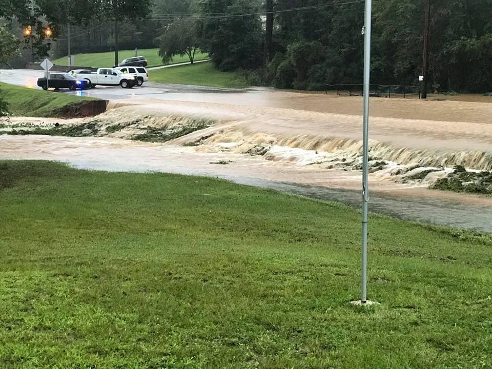
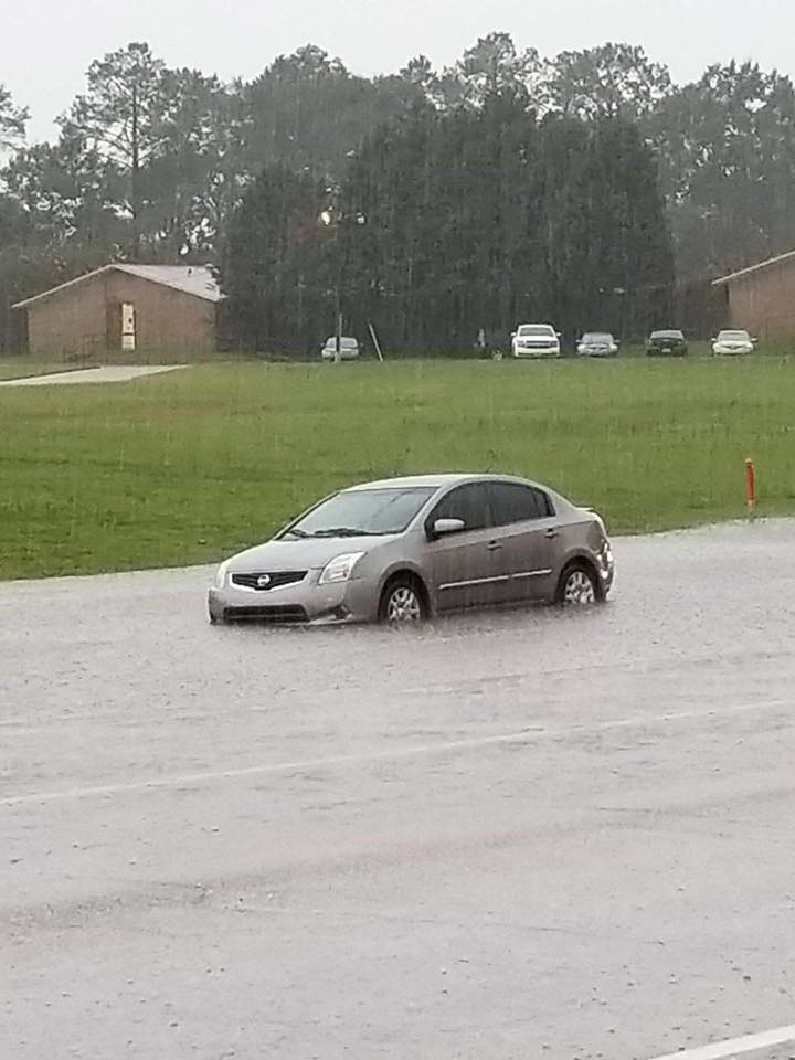
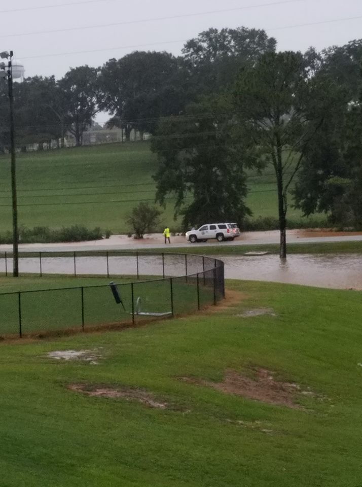
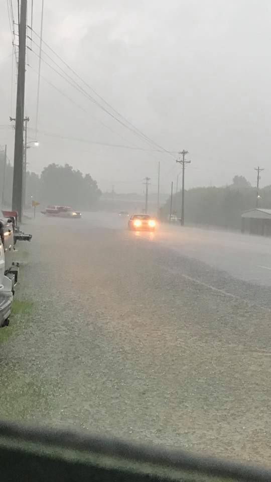
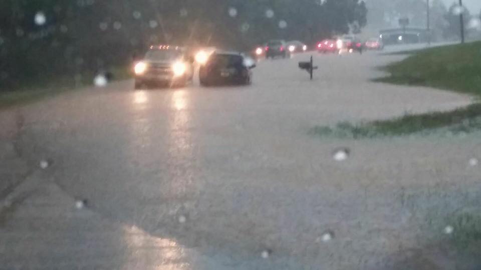
Several flash flood events occurred across Central Alabama during the late afternoon and evening hours on Thursday, August 10th. Mesoscale features contributed to the development of thunderstorms containing heavy downpours. A Mesoscale Convective Vortex (MCV) tracked eastward across Mississippi during the morning hours. A line of thunderstorms oriented south to north developed over southwest Alabama along the leading edge of the MCV. At the same time, a sea breeze line of thunderstorms oriented west to east formed over south Alabama. The MVC line of thunderstorms moved eastward while the sea breeze storms moved northward. The two lines of storms collided over south central Alabama which resulted in a band of 3-6 inch rainfall amounts from southern Chilton County, and extending southeast across Autauga, Montgomery, and Pike Counties. Additional outflow boundary collisions enhanced rainfall rates in some locations within this band. The Montgomery Regional Airport had the highest rainfall total (5.73 inches), with 5.01 inches occurring in just 1 hr and 22 min! Troy Municipal Airport recorded 4.11 inches for the day, with 3.31 inches falling in just 1 hr and 33 min. Numerous roads were flooded and impassable in the cities of Montgomery and Troy.
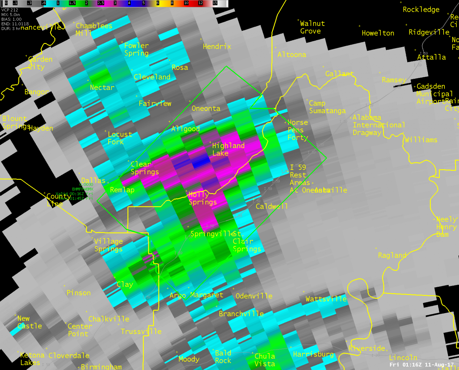
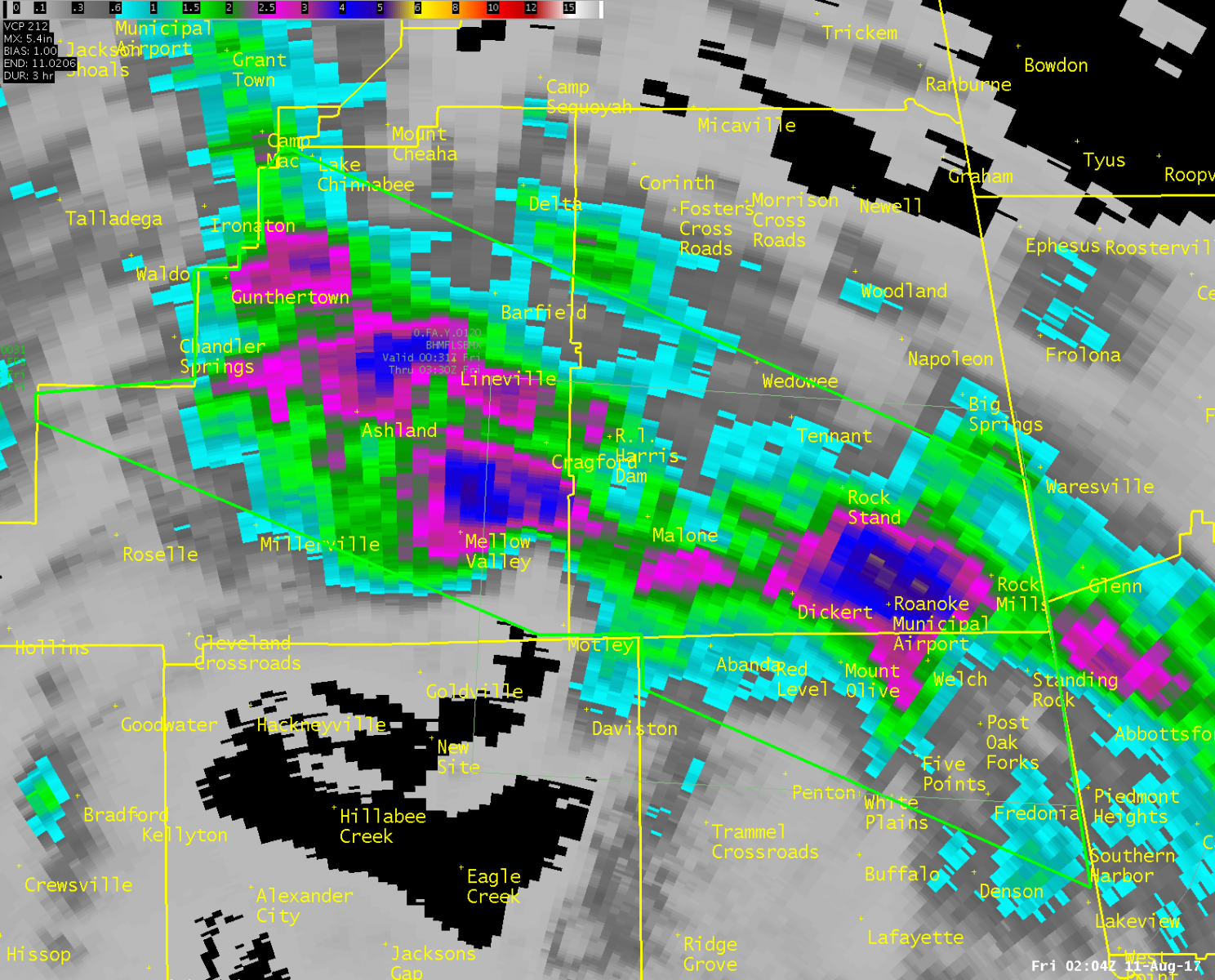
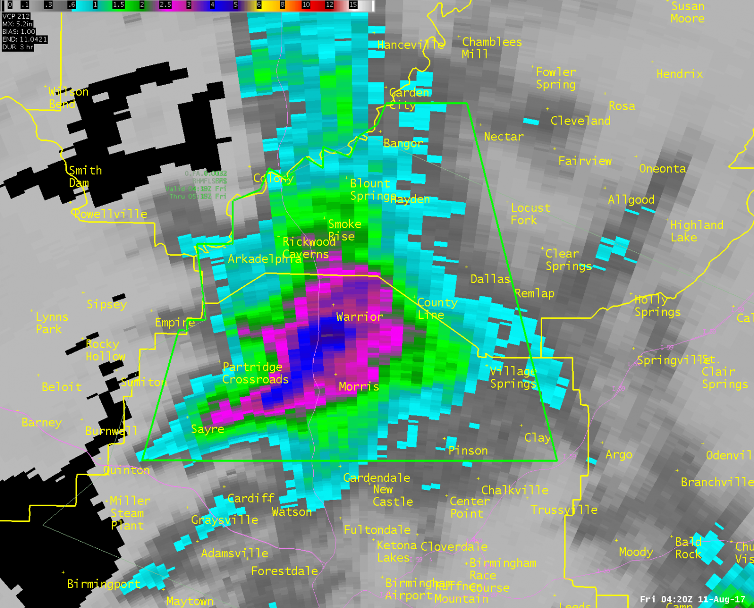
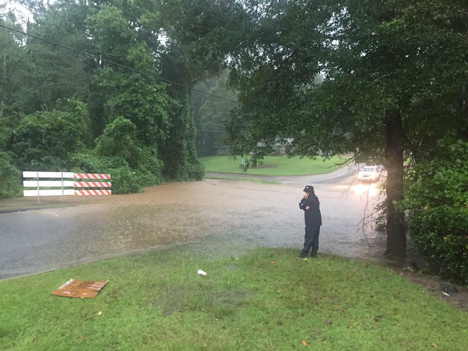
Another band of heavy rainfall developed along an outflow boundary moving northward from the south Alabama thunderstorms. The zone of heaviest rainfall amounts extended from the Jefferson/Blount County line southeast across southern St. Clair County, northern Talladega County, Clay and Randolph Counties. Here again, the collision of smaller outflow boundaries contributed to the enhancement of rainfall rates in some locations. Rainfall amounts of 4-7 inches were reported in areas such as Roanoke, Rock Mills, Ashland, Lineville, Warrior, and Springville, with one report of 7.21 inches in Roanoke. Numerous roads were reported flooded and impassable in these areas. Major flooding was also reported in the city of Roanoke with several roads and bridges washed out and water rescues performed.
|