Denver/Boulder, CO
Weather Forecast Office
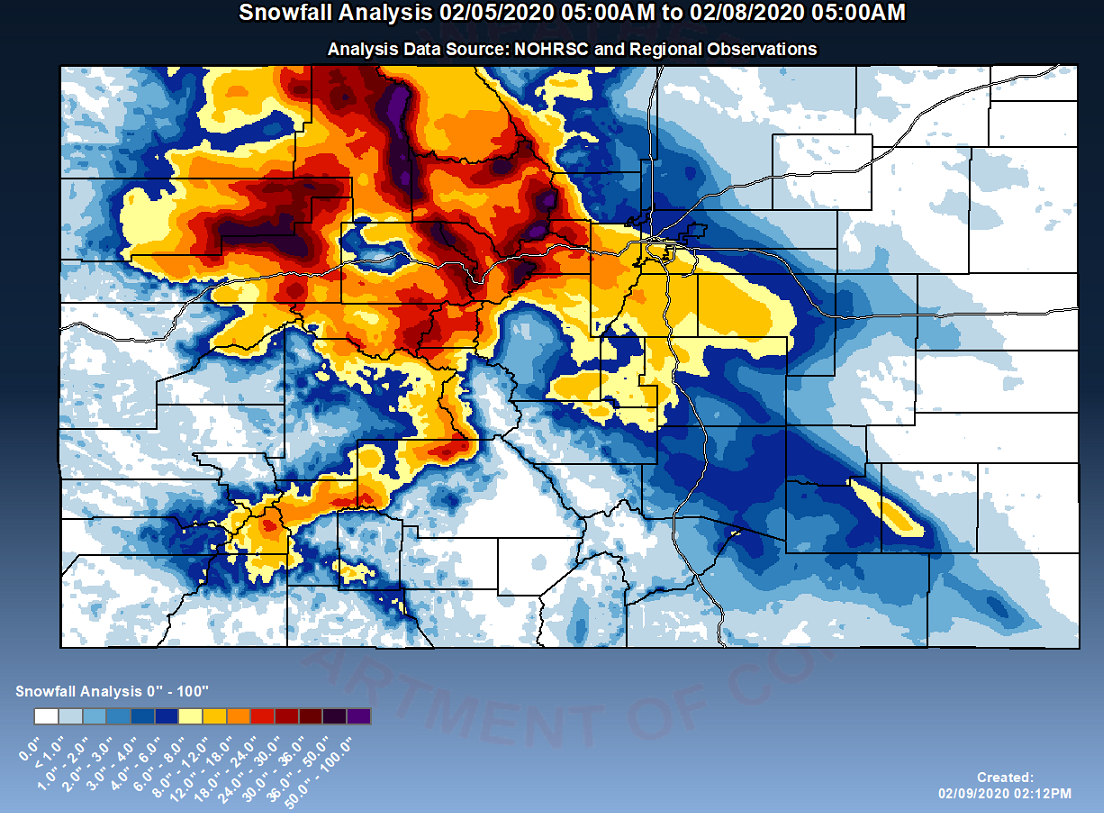
February 5th through 7th, 2020 Snow Event
A moist air mass combined with a strong upper level jet stream caused an extended period of heavy snowfall across the mountains, southern foothills and portions of the I-25 corridor from Denver south to the Palmer Divide.
Very heavy snow occurred in the mountains from Thursday through Friday with 18" to 36" common. A few areas received from 4 to 5 feet of snow. At lower elevations, along the front range, 6 to 14 inches occurred over portions of the Denver metro area with up to 20" in the southern Foothills.
US Dept of Commerce
National Oceanic and Atmospheric Administration
National Weather Service
Denver/Boulder, CO
325 Broadway
Boulder, CO 80305-3328
303-494-3210 for a recording call 303-494-4221
Comments? Questions? Please Contact Us.

