
Wildfire smoke continues to impact air quality from the Great Lakes region into New England and the Mid-Atlantic today with widespread Air Quality Alerts in effect. Severe thunderstorms are expected across portions of the Ohio Valley and Lower Great Lakes into the Mid-Atlantic and Northeast, this afternoon into the evening. Monsoonal thunderstorms may bring areas of flooding to the Southwest. Read More >
Denver/Boulder, CO
Weather Forecast Office
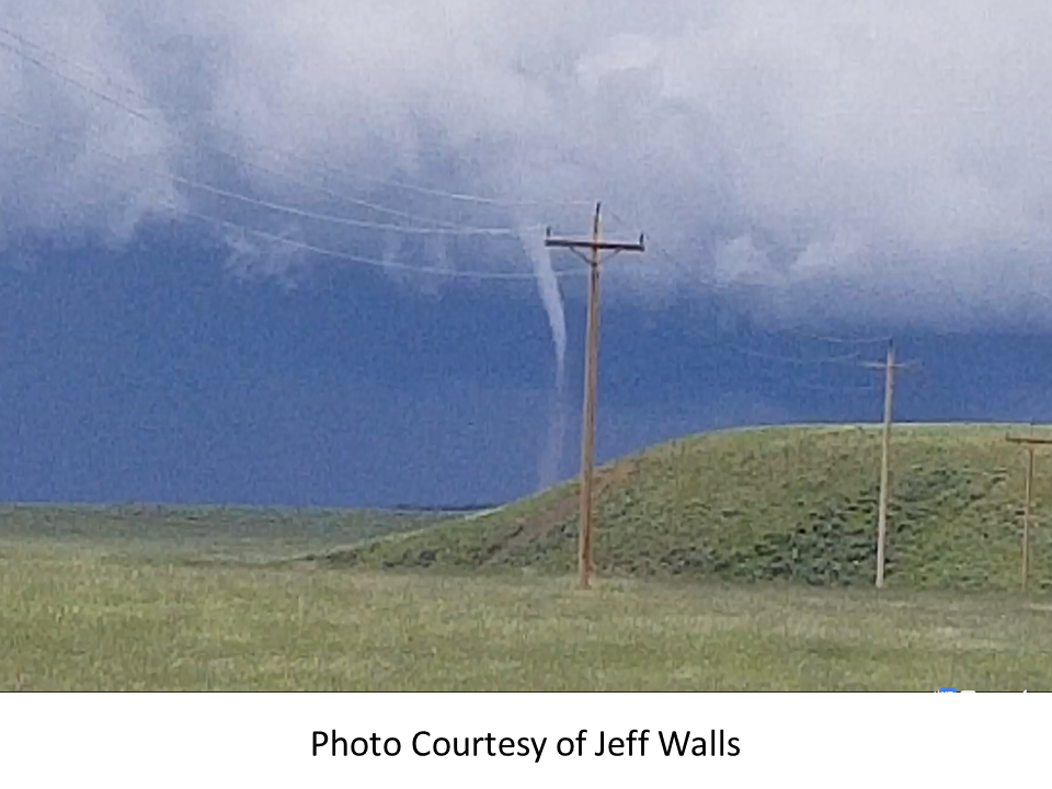
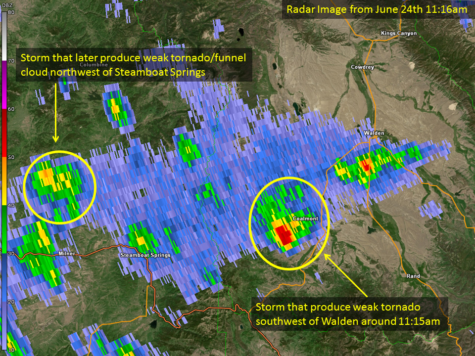
Around 11:15am on Sunday June 24th, a tornado briefly touched down approximately 19 miles southwest of Walden. This was determined based on social media videos, photos, trained spotter reports, public reports, and radar data. No damage has been reported with this tornado. This tornado will be rated an EF-0 unless reports of damage surface. If additional data is received this report will be updated. This is only the second documented tornado in Jackson County since 1950. The first reported tornado was May 10th 1974.
US Dept of Commerce
National Oceanic and Atmospheric Administration
National Weather Service
Denver/Boulder, CO
325 Broadway
Boulder, CO 80305-3328
303-494-3210 for a recording call 303-494-4221
Comments? Questions? Please Contact Us.

