
Scattered thunderstorms with severe gusts, hail and a tornado risk are possible near a cold front from the Ohio Valley to the Mid-Atlantic tonight. Tropical Storm Bertha is expected to bring tropical storm conditions to portions of the Gulf Coast from the panhandle of Florida into Louisiana through Wednesday. Read More >
Denver/Boulder, CO
Weather Forecast Office
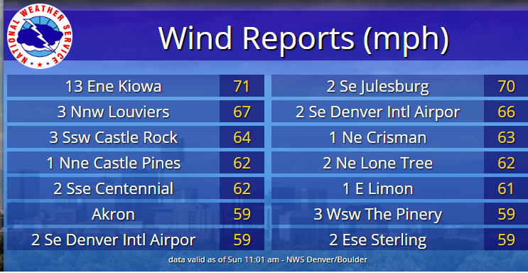
The combination of an upper level trough moving across, along with a strong level pressure gradient, led to numerous reports of strong winds across much of the area on Saturday. Strong wind gusts from 55 to 70 mph, not associated with thunderstorms, occurred over the plains of northeast Colorado.
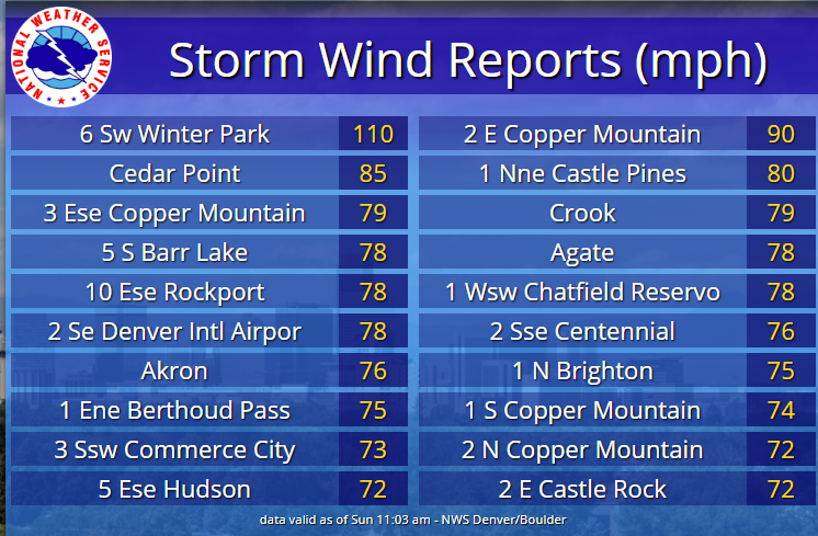
Meanwhile, by midday, thunderstorms developed over the higher terrain and then moved rapidly northeast across the I-25 corridor by mid afternoon. These storms then tracked across the plains from late afternoon into the early evening hours. Wind gusts from 60 to 80 mph were common with a few gusts exceeding 90 mph. The highest gust observed was 110 mph, at the Winter Park Ski area, around 12000 feet.
Highest Wind Gusts from Thunderstorms
Non Thunderstorm Wind Gusts
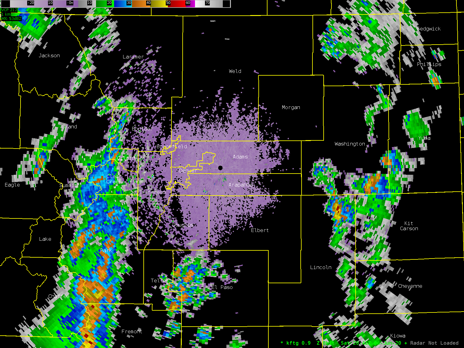
Radar Loop of Thunderstorms as they moved across the area.
 |
Radar Loop of Velocity Data
 |
US Dept of Commerce
National Oceanic and Atmospheric Administration
National Weather Service
Denver/Boulder, CO
325 Broadway
Boulder, CO 80305-3328
303-494-3210 for a recording call 303-494-4221
Comments? Questions? Please Contact Us.

