
Wildfire smoke continues to impact air quality from the Great Lakes region into New England and the Mid-Atlantic today with widespread Air Quality Alerts in effect. Severe thunderstorms are expected across portions of the Ohio Valley and Lower Great Lakes into the Mid-Atlantic and Northeast, this afternoon into the evening. Monsoonal thunderstorms may bring areas of flooding to the Southwest. Read More >
Overview
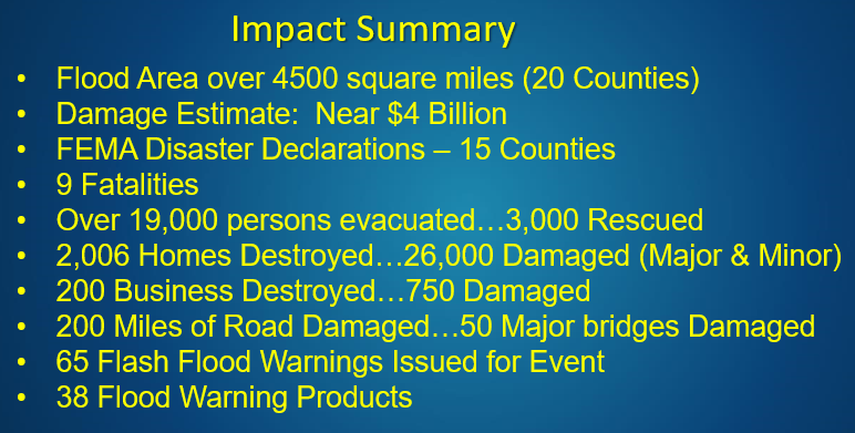
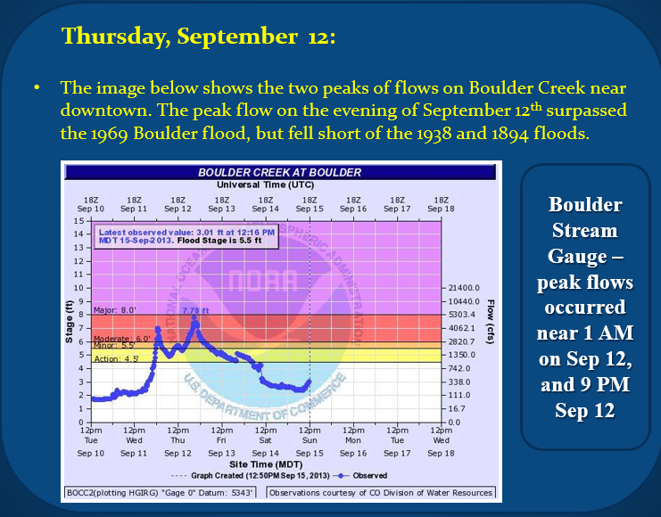
In almost unanimous fashion, topping the list of Colorado weather events in the past decade were the Floods of September 2013. Following a few days of light to moderate rains in portions of the state, the clouds unleashed torrents of rain across relatively large portions of the Front Range from the evening of September 11th through much of September 12th.
A very rich, subtropical airmass situated itself over the state through much of this week, but on the evening of September 11th a weak disturbance coincided with the showers and thunderstorms. That resulted in a very slow and almost stationary area of heavy rain along the Front Range. That rainfall, heavy at times, lasted through much of September 12th, before finally decreasing late that night. A few showers and storms occurred in the days that followed, with the last bout of locally heavy rain on Sunday, September 15th.
 |
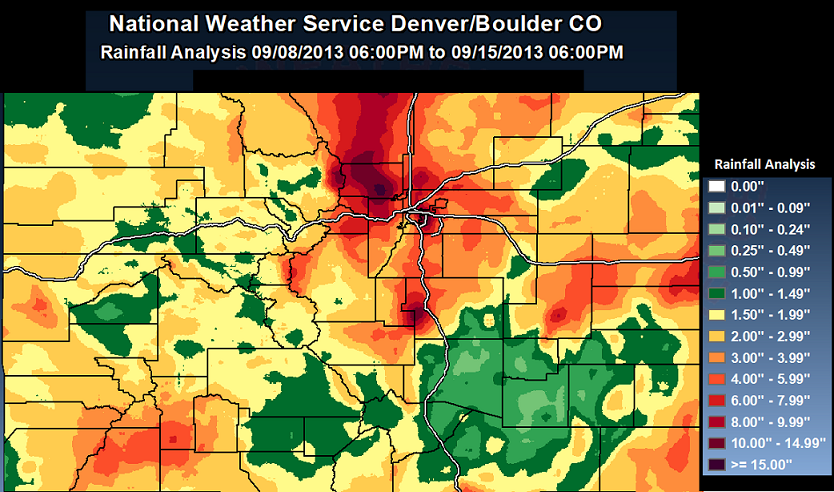
Rainfall
Rainfall totals through this period reached 6 to 18 inches in many areas of the Front Range, including most of the foothills from around I-70 northward to the Wyoming border, eastern and northern sections of the Denver Metro area, and portions of Teller and El Paso county including western sections of Colorado Springs. The heaviest totals of 12 to 18 inches were widespread through much of Central Boulder County, stretching from Boulder north and west toward Jamestown, Lyons, and into Central Larimer County including the Estes Park area. The vast majority of this rain fell in about 30 hours from the 11th through the 12th. The 24 hour state precipitation record was broken in Fort Carson, Colorado, with a whopping 11.85 inches of rain falling on September 12th. Boulder set a calendar day all-time record rainfall of 9.08 inches, which shattered the previous wettest day of 4.80 inches set on July 31, 1919. Finally, a one month record of 18.16 inches in September also shattered Boulder’s previous all-time monthly record of 9.59 inches set in May of 1995.
 |
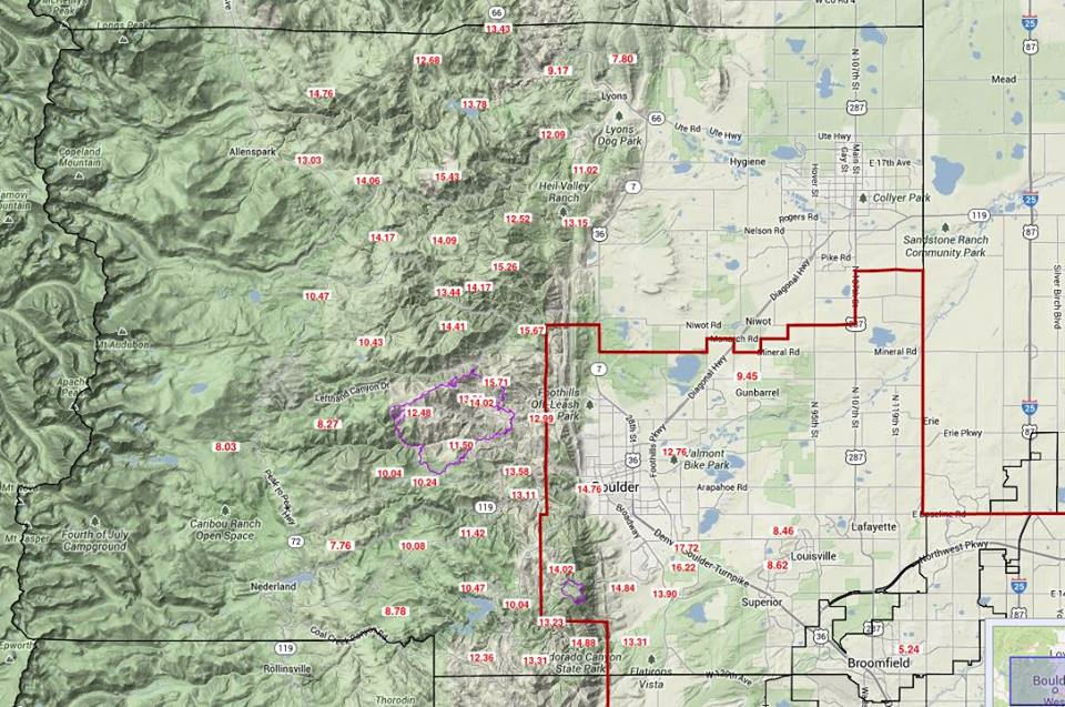
7 Day Rainfall Totals across Boulder County. A few observers had close to 18" of rain.
 |
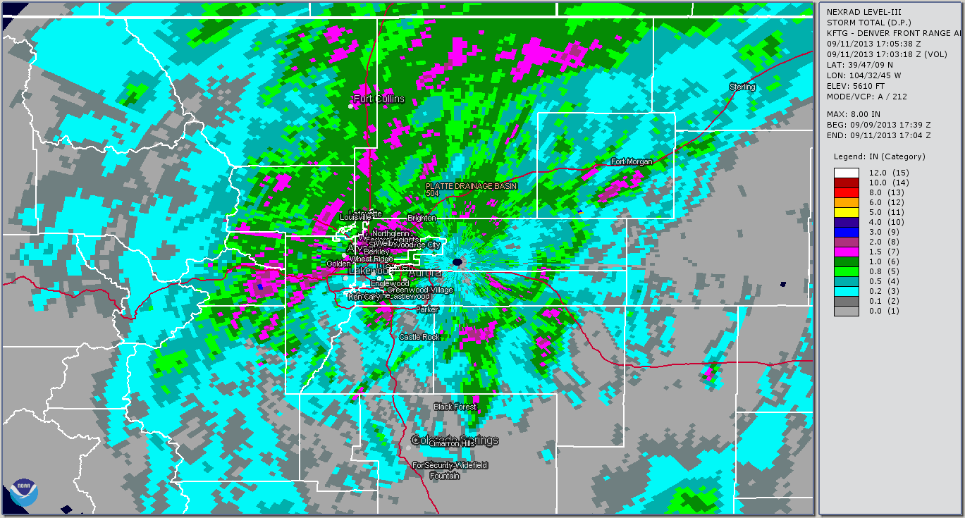
Radar Loops
Loop of Storm Total Rainfall
 |
September 11
September 12th
September 13th
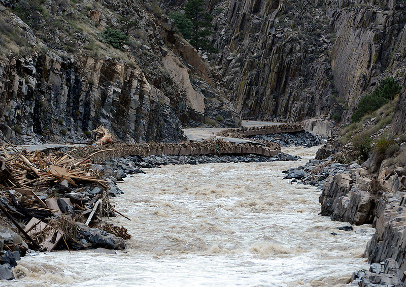
Flooding
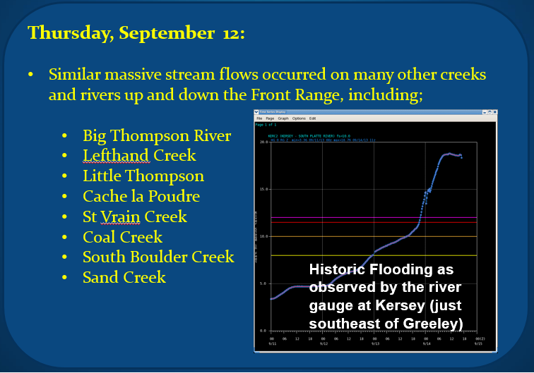
Flash flooding quickly ensued the onset of heavy rainfall, and large streams and rivers also became raging torrents as the flood waters accumulated throughout the several days of heavy rainfall. Streams and rivers that swelled well above flood stage included; Big Thompson River, Little Thompson River, Cache La Poudre River, Lefthand Creek, St Vrain Creek, Boulder Creek, South Boulder Creek, Coal Creek, Sand Creek, and Fountain Creek. Record flood levels were observed on the St. Vrain near Lyons, as well as the South Platte River at Balzac, Weldona, and Julesburg.
 |
 |
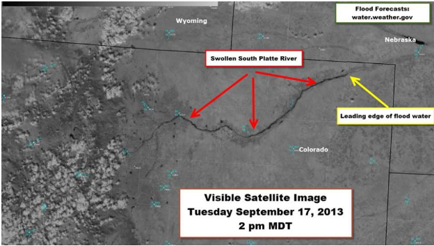
Satellite Imagery shows flooding along the South Platte over northeast Colorado
 |
Pictures of Historic Flooding
Lefthand Canyon in Boulder County (courtesy of Boulder Daily Camera)
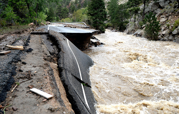 |
Highway 36 in Big Thompson Canyon (courtesy of Loveland Reporter Herald)
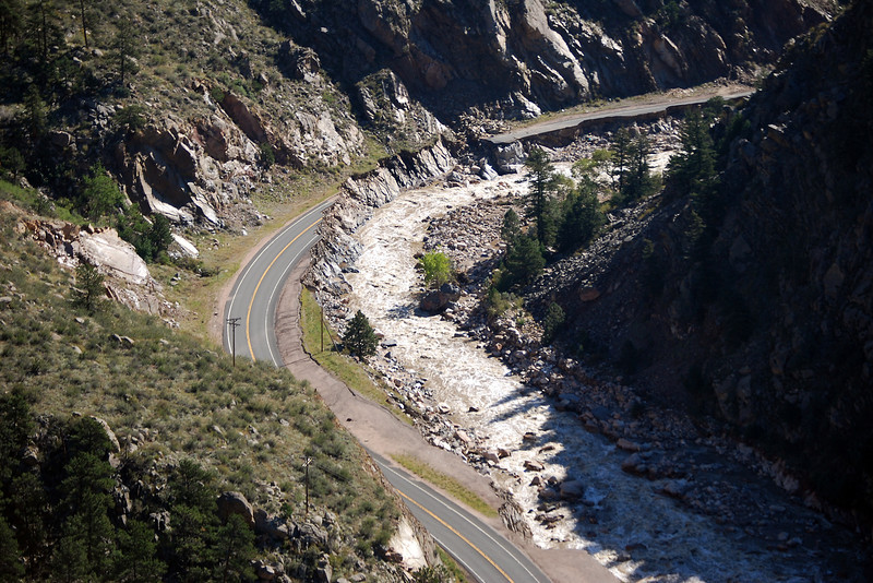 |
Another area of Highway 36 in Big Thompson Canyon (courtesy of Loveland Reporter Herald)
 |
For a more detailed analysis of the event you can visit
https://www.weather.gov/media/bou/Sep_2013_Flood.pdf

