National Weather Service United States Department of Commerce

Heavy to Excessive Rainfall in Eastern Florida; Unsettled Weather Along the West Coast

Heavy to excessive rainfall will likely bring flash and urban flooding impacts along the I-95 corridor from St. Augustine to Palm Beach, Florida through this weekend. A Pacific Storm moving into the West Coast tonight through Wednesday will bring moderate to heavy rainfall to low elevations and heavy snowfall to the Sierra Nevada Mountains. Read More >

This smoke management and dispersal page is intended for prescribed fire use. For general smoke forecasts for the state of Colorado, click here.


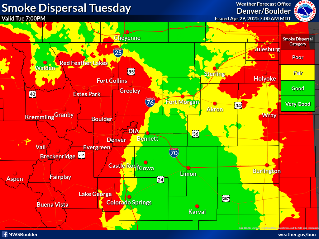
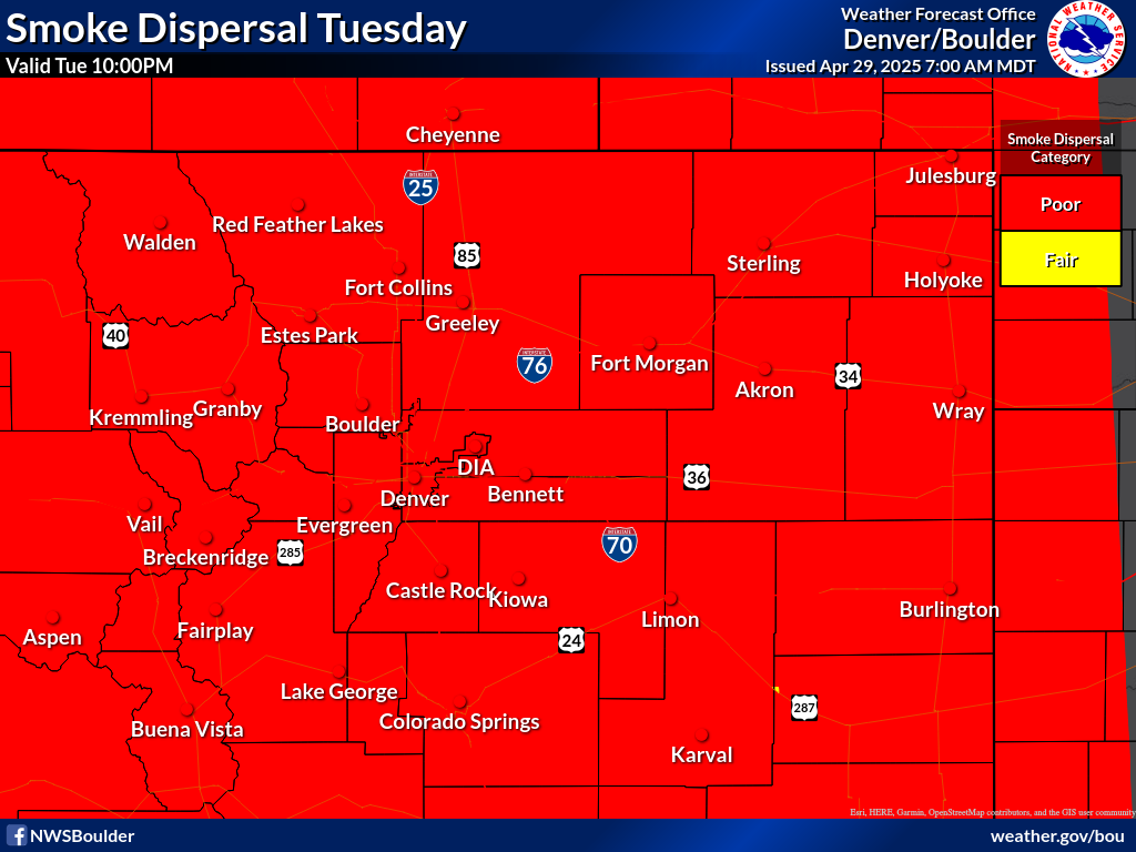
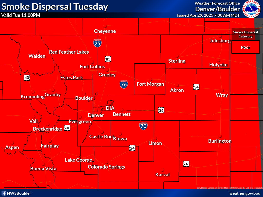
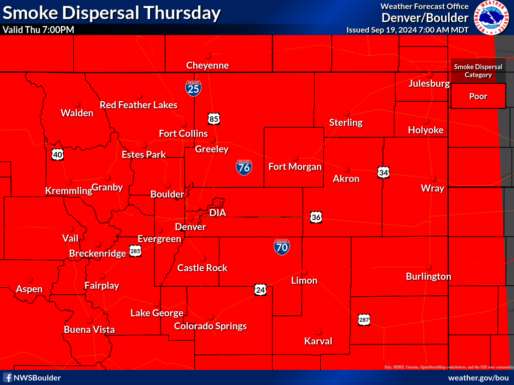
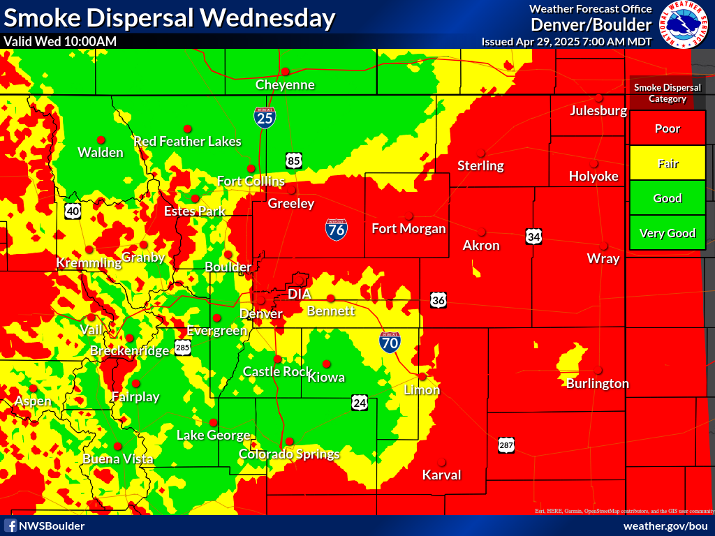
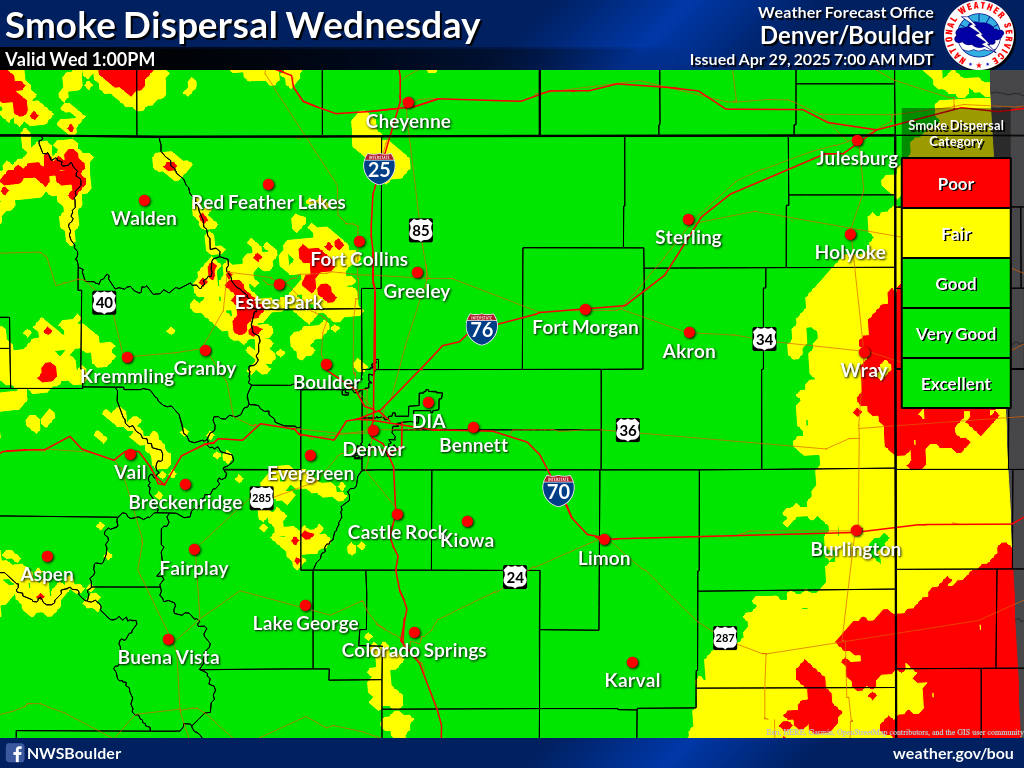
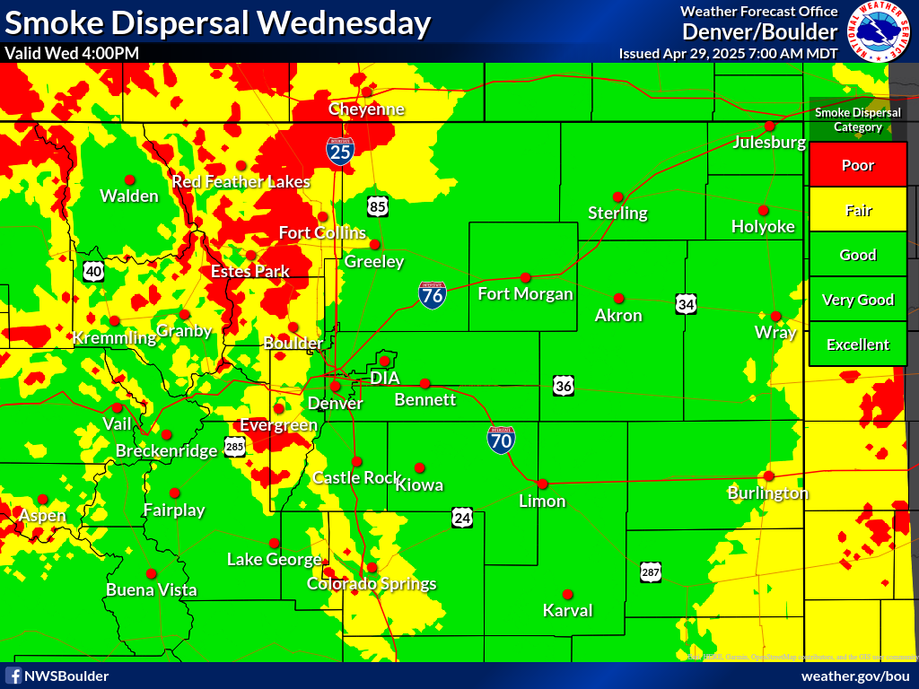
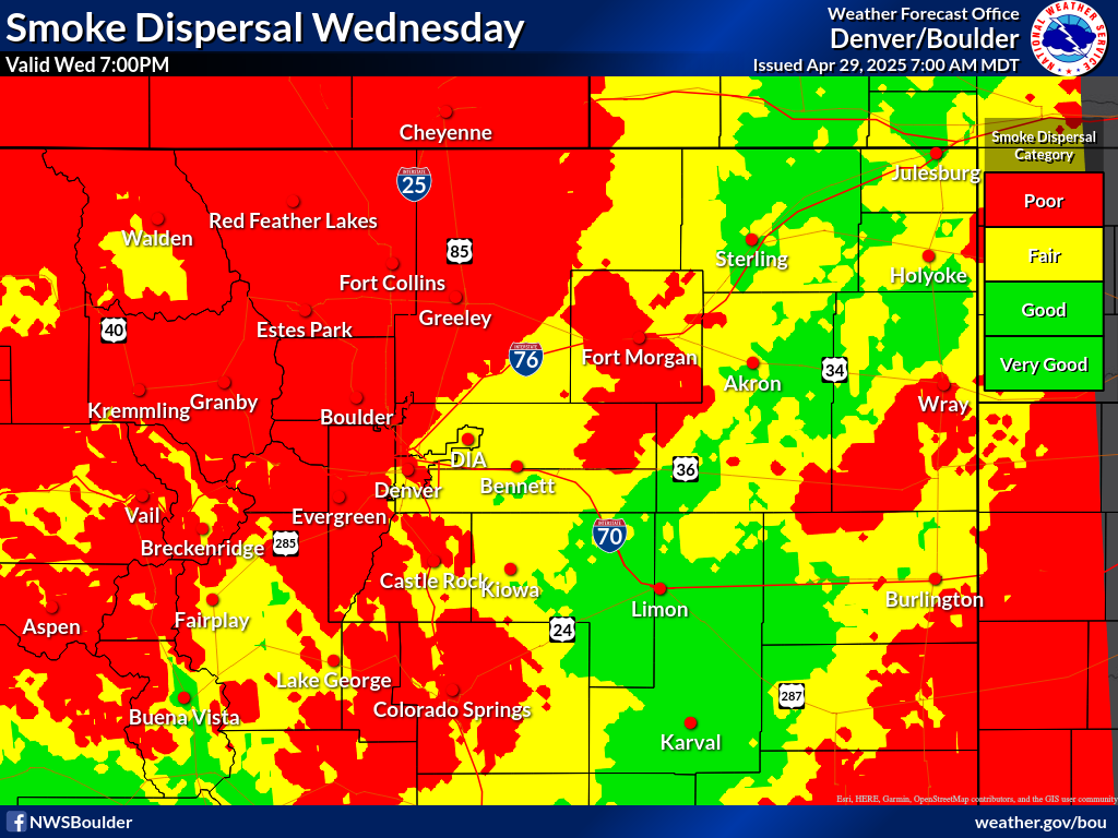
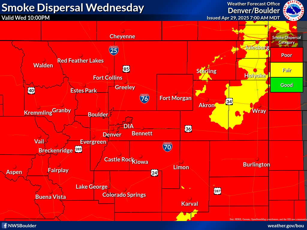
Smoke dispersal is categorized by using the Ventilation Rate. Ventilation Rate forecasts for a specific point can be found using the Fire Weather Dashboard below. Click a spot on the map and scroll down to find daily and hourly Ventilation Rate values for the next few days.

** Fire Weather Dashboard **


** As of October 2026, smoke adjective ratings and their associated colors are being adjusted on the fire weather dashboard. There may be a discrepancy between the table below and the categories/colors displayed on the dashboard and the graphics below. Please refer to the table below for the latest thresholds and adjective ratings. Contact CDPHE for any questions. **


The link above is configured to display smoke dispersal categories as shown here:

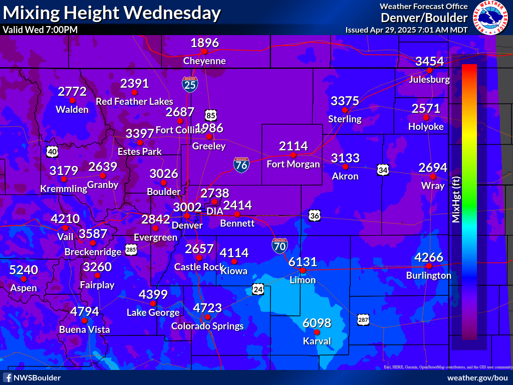
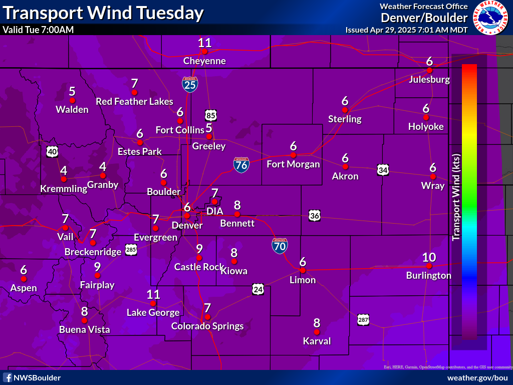
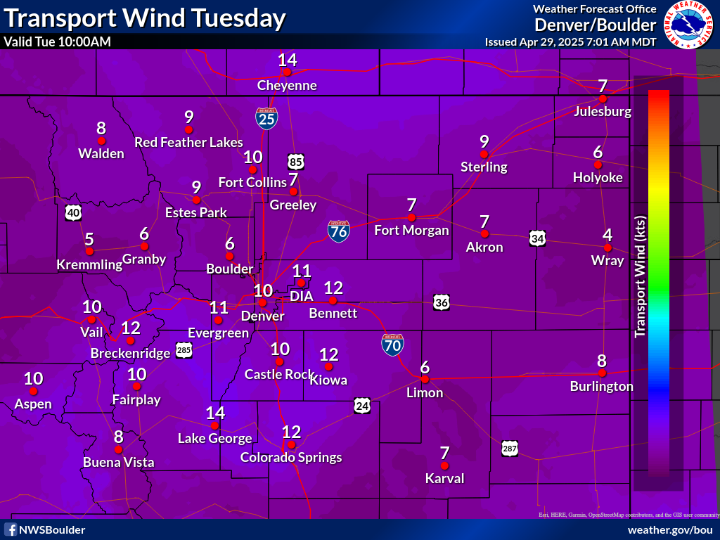
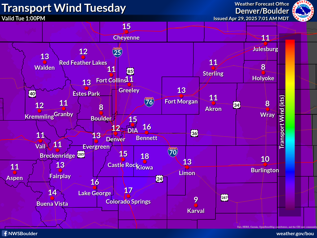
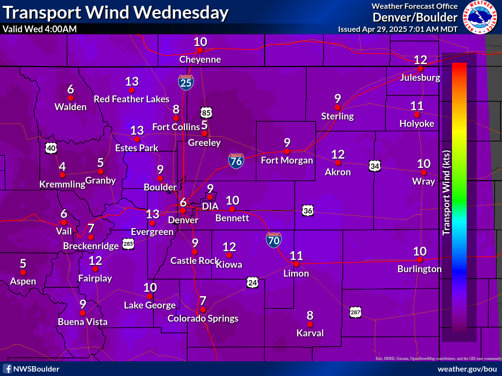
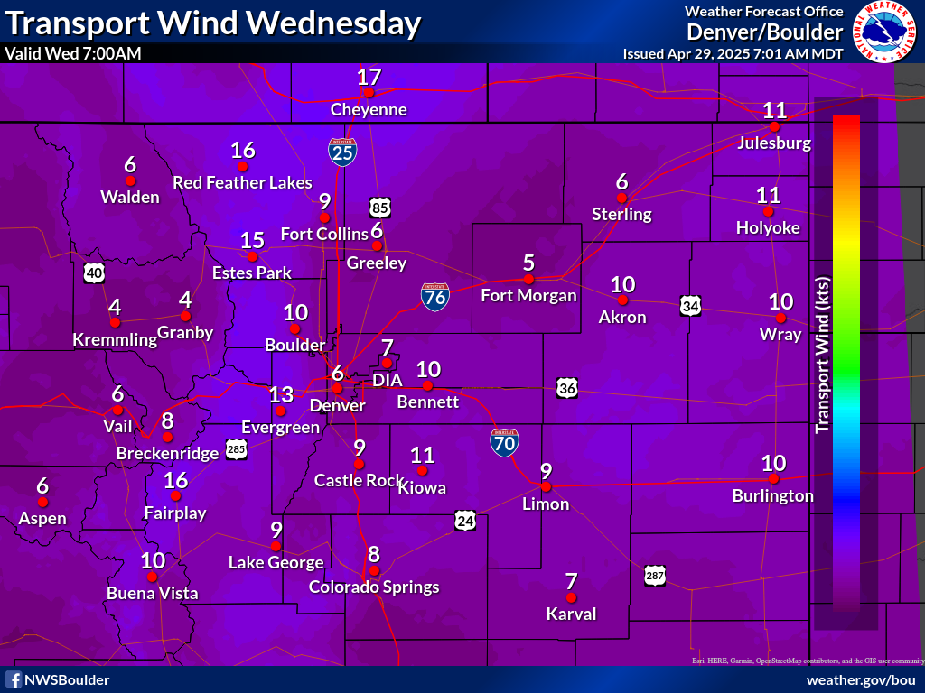
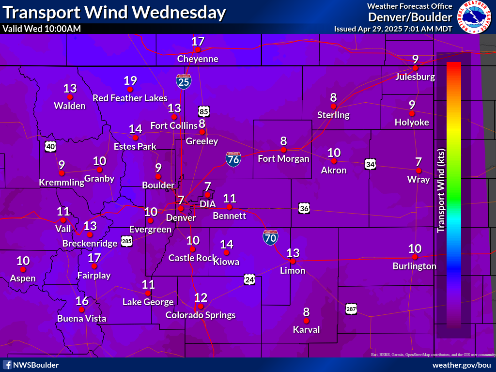
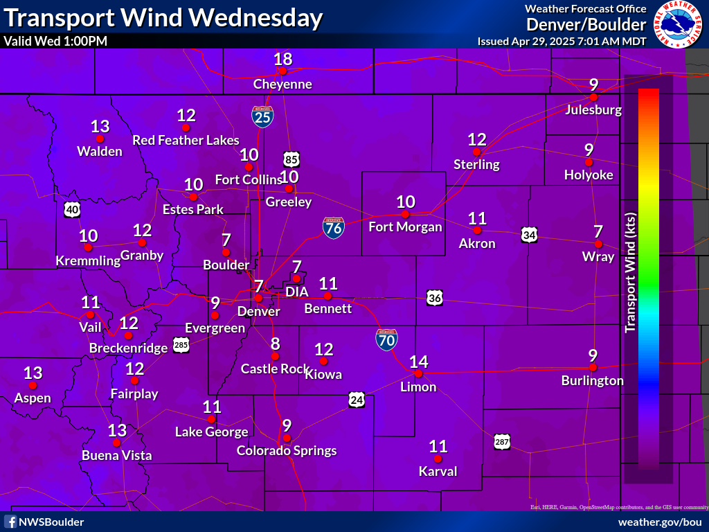
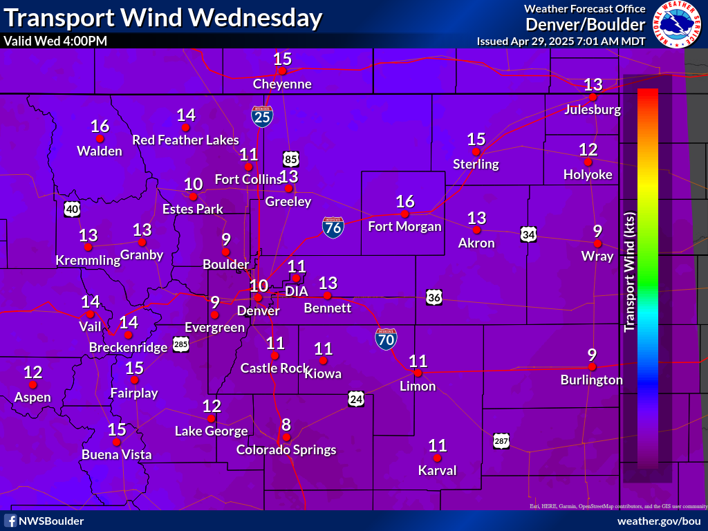
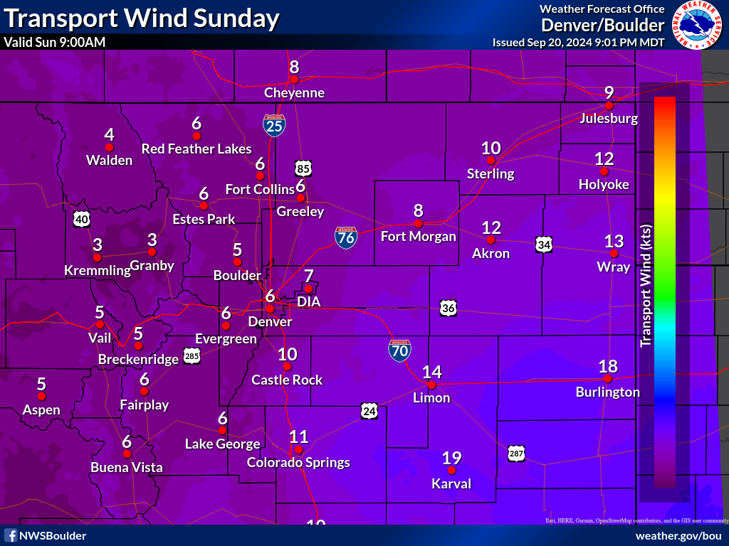
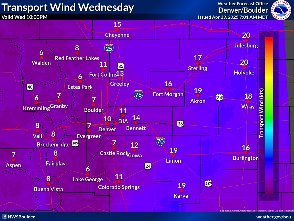
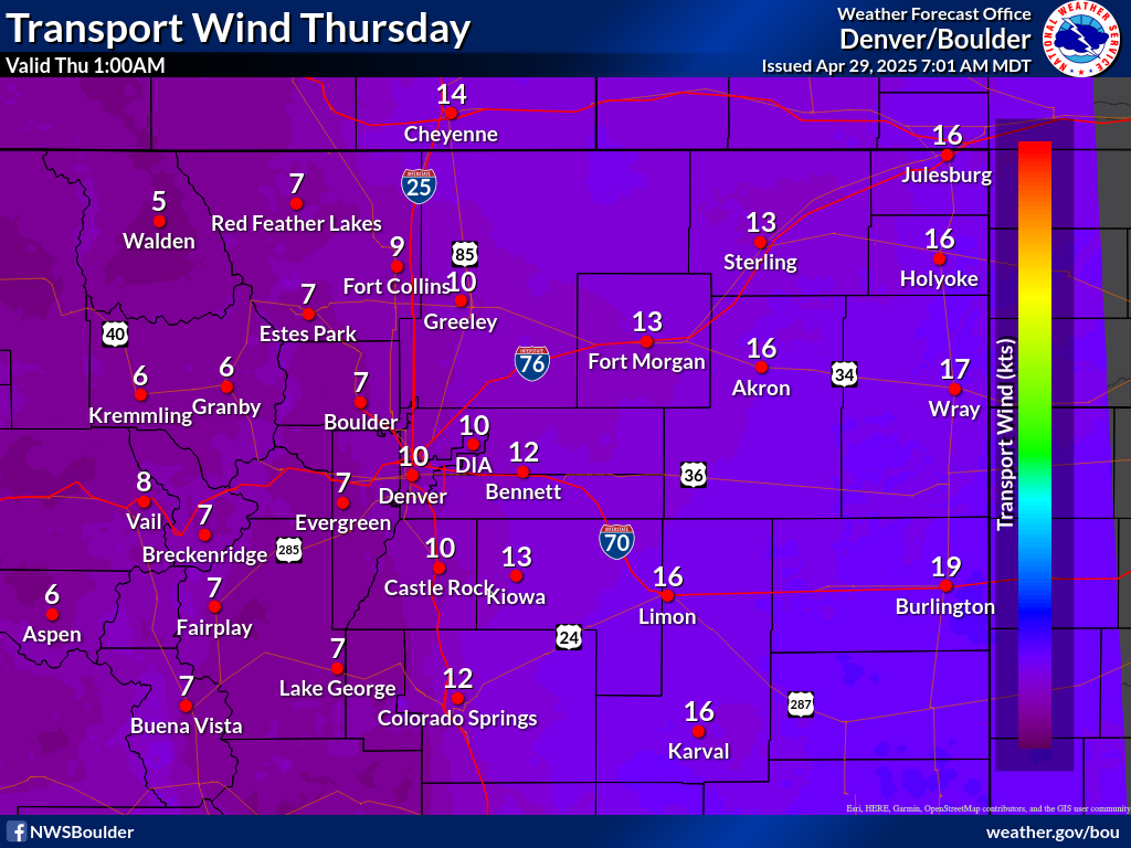
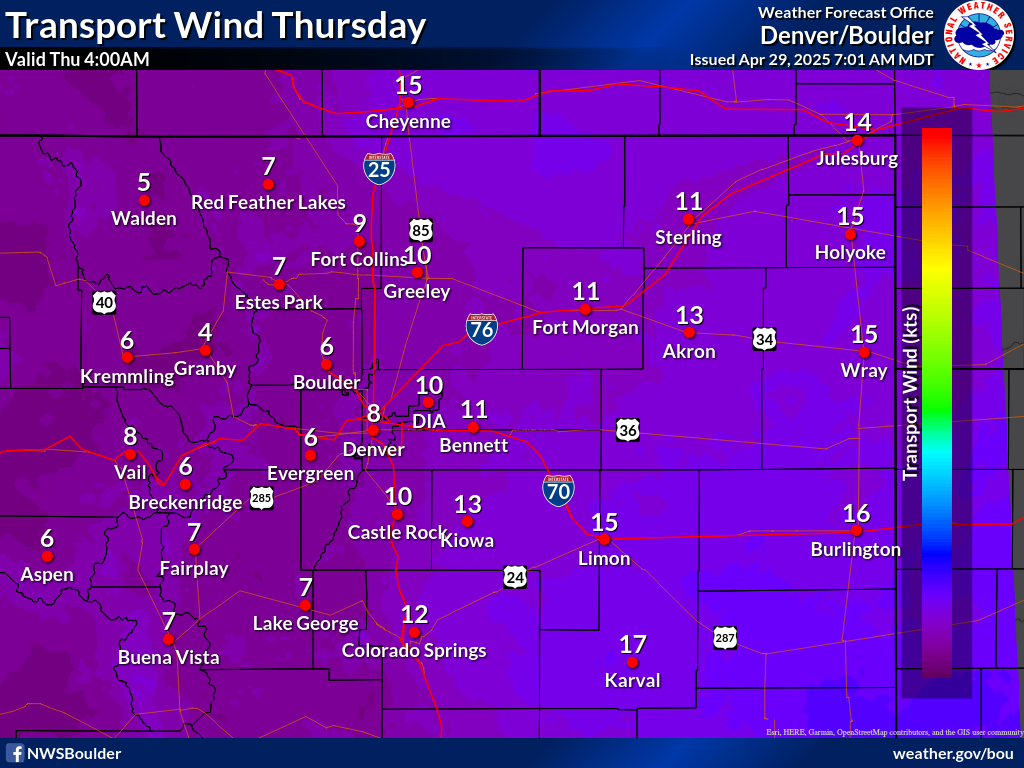
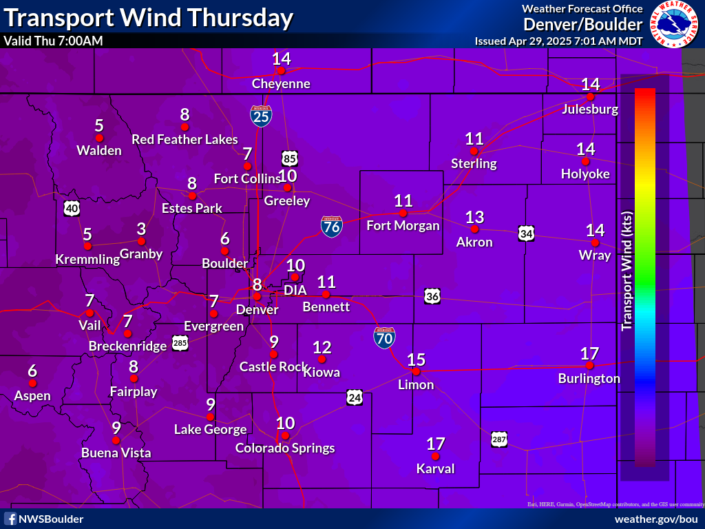
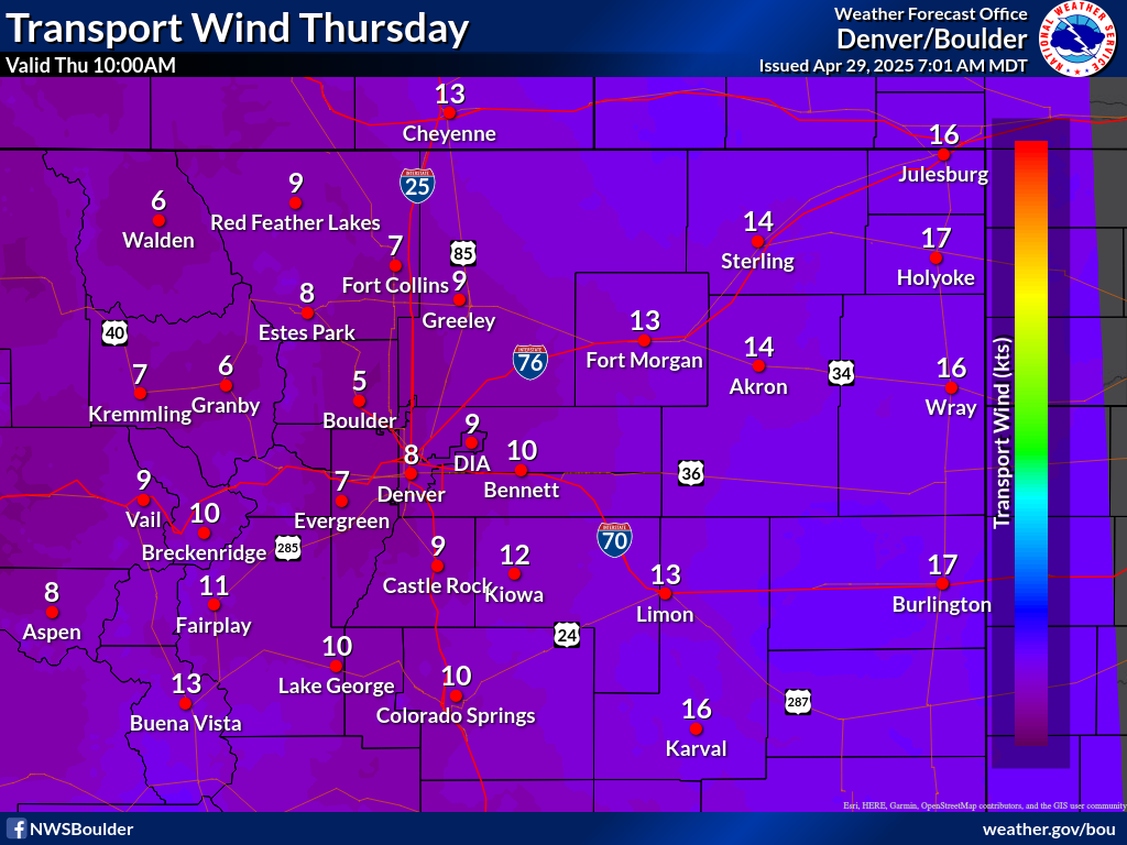
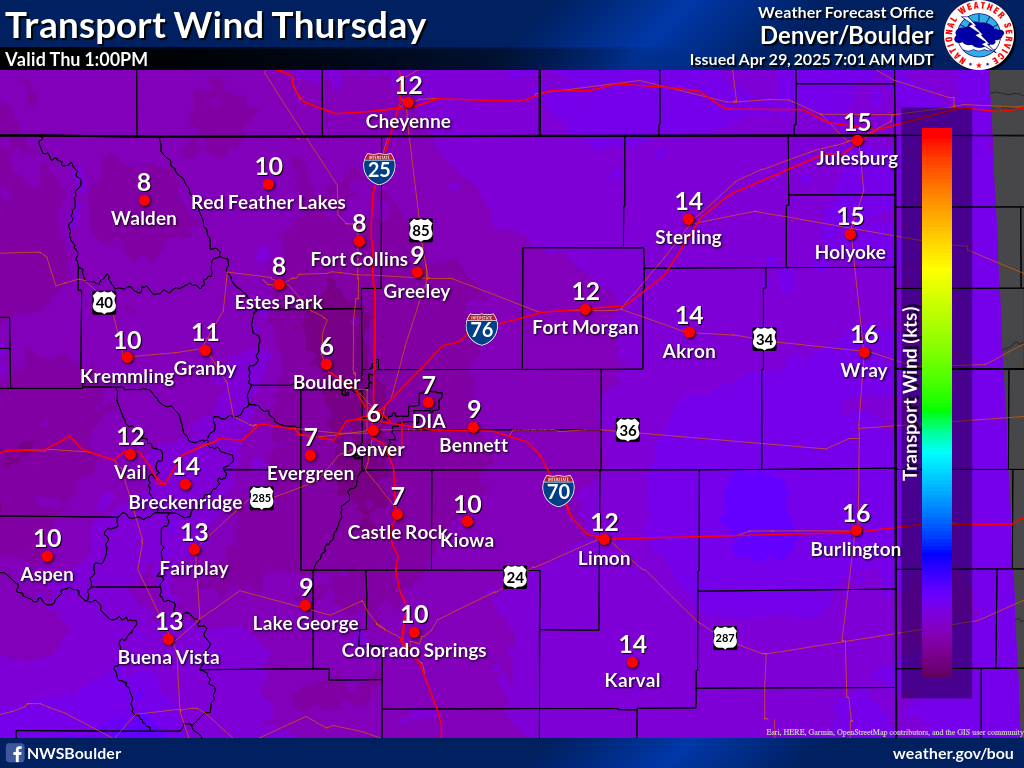
Ventilation Rate = Transport Wind (kts) x Mixing Height (ft)


MAPPED SMOKE MANAGEMENT GRAPHICS


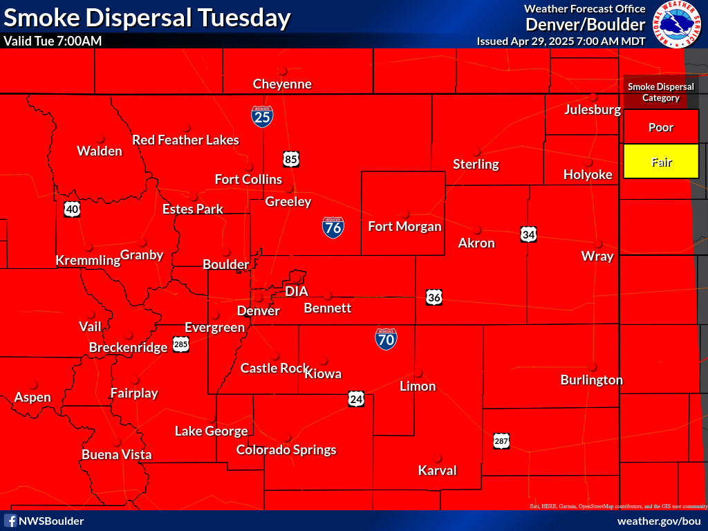
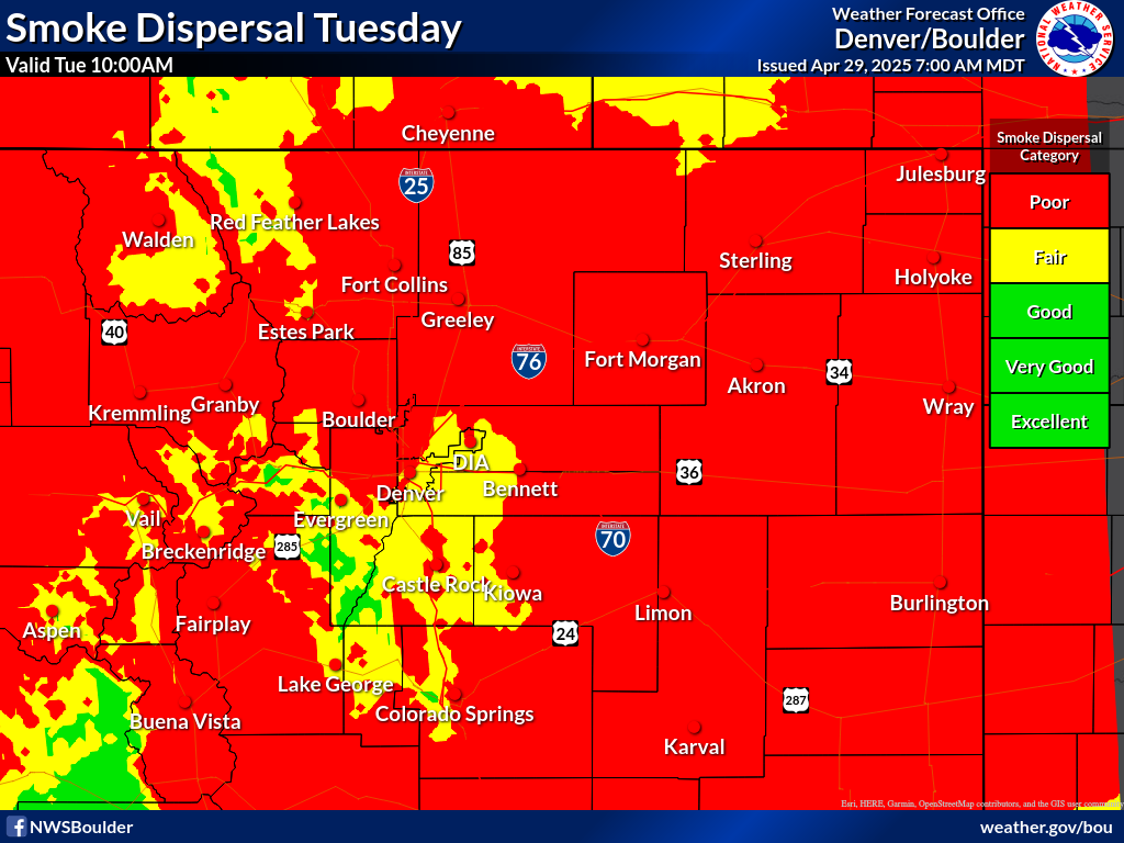
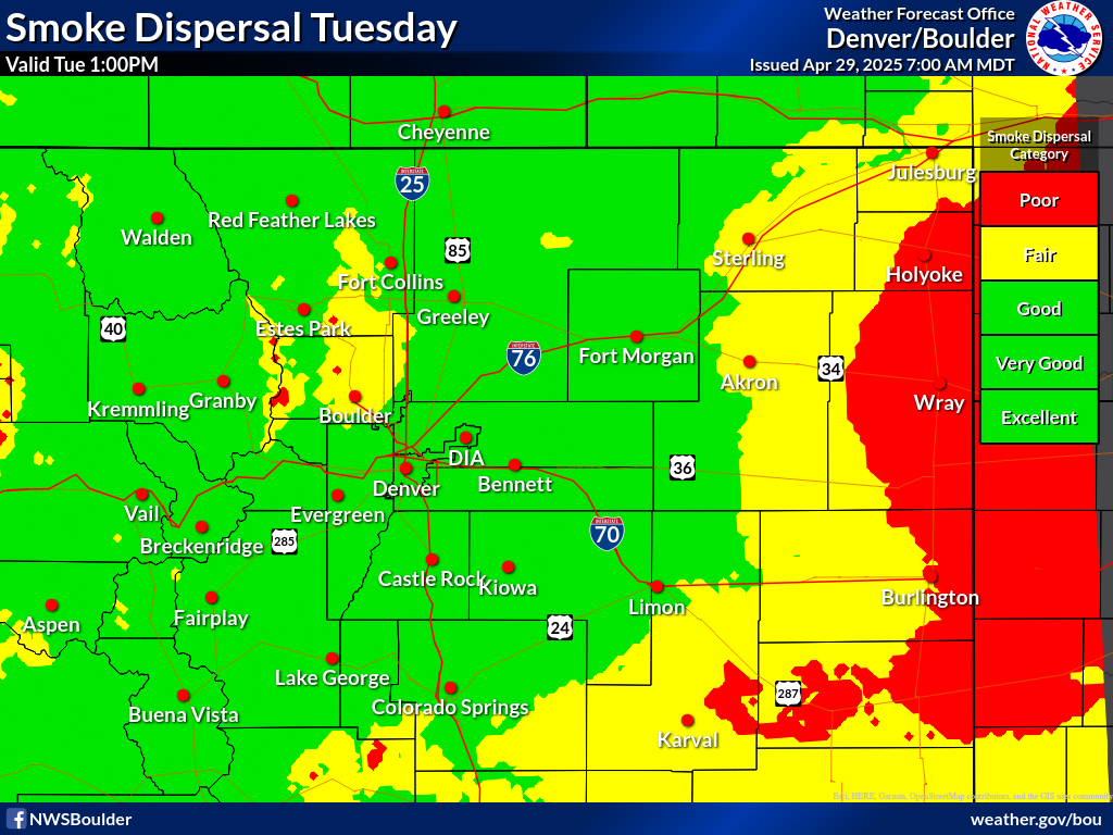
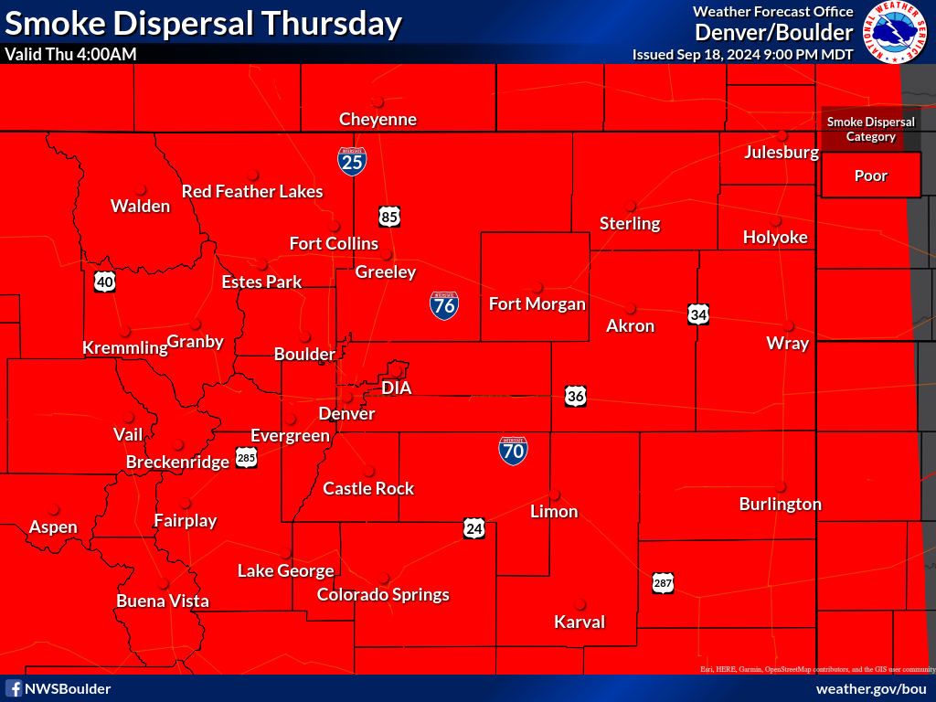
Smoke Dispersion / Vent Rate Forecast
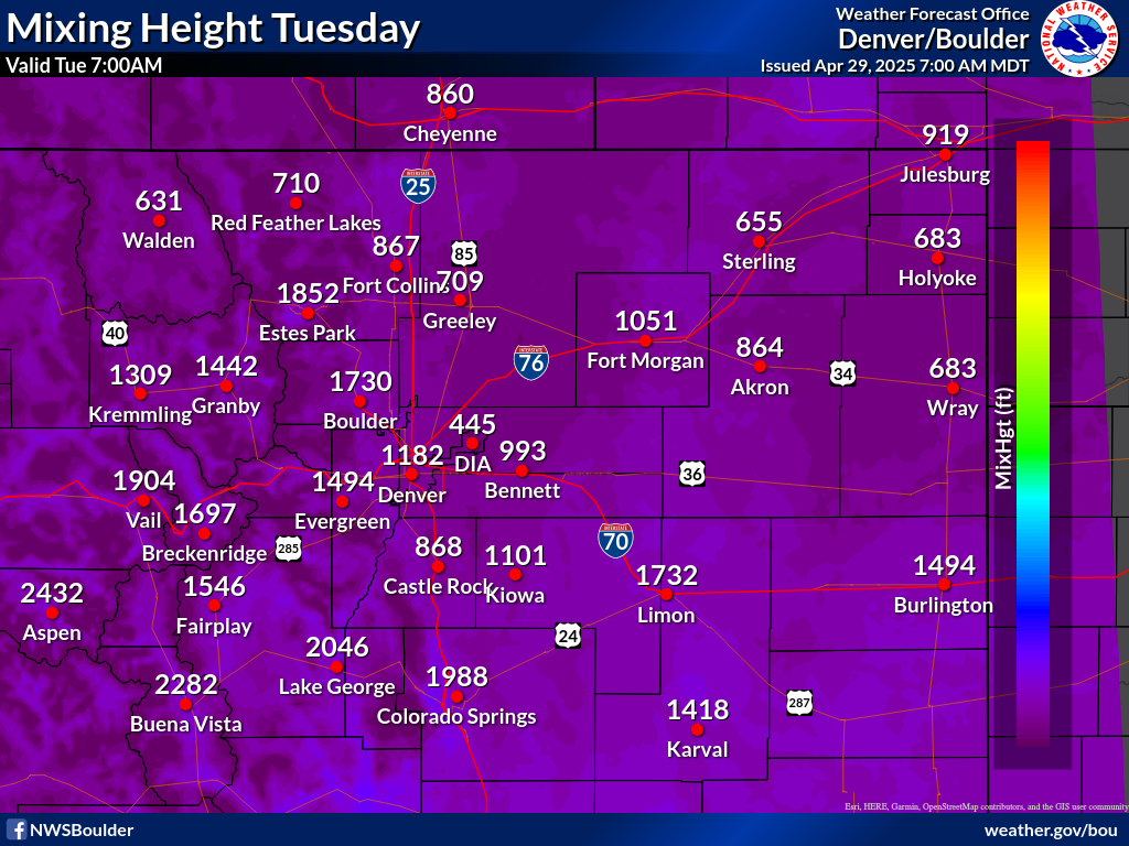
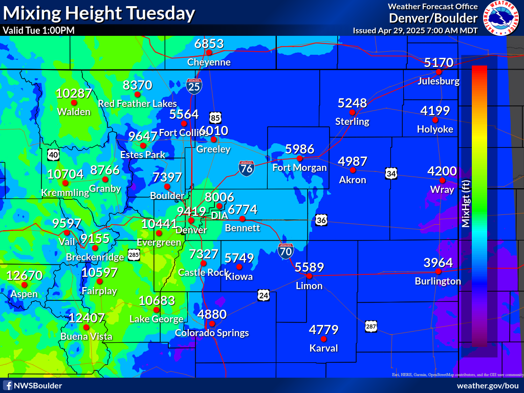
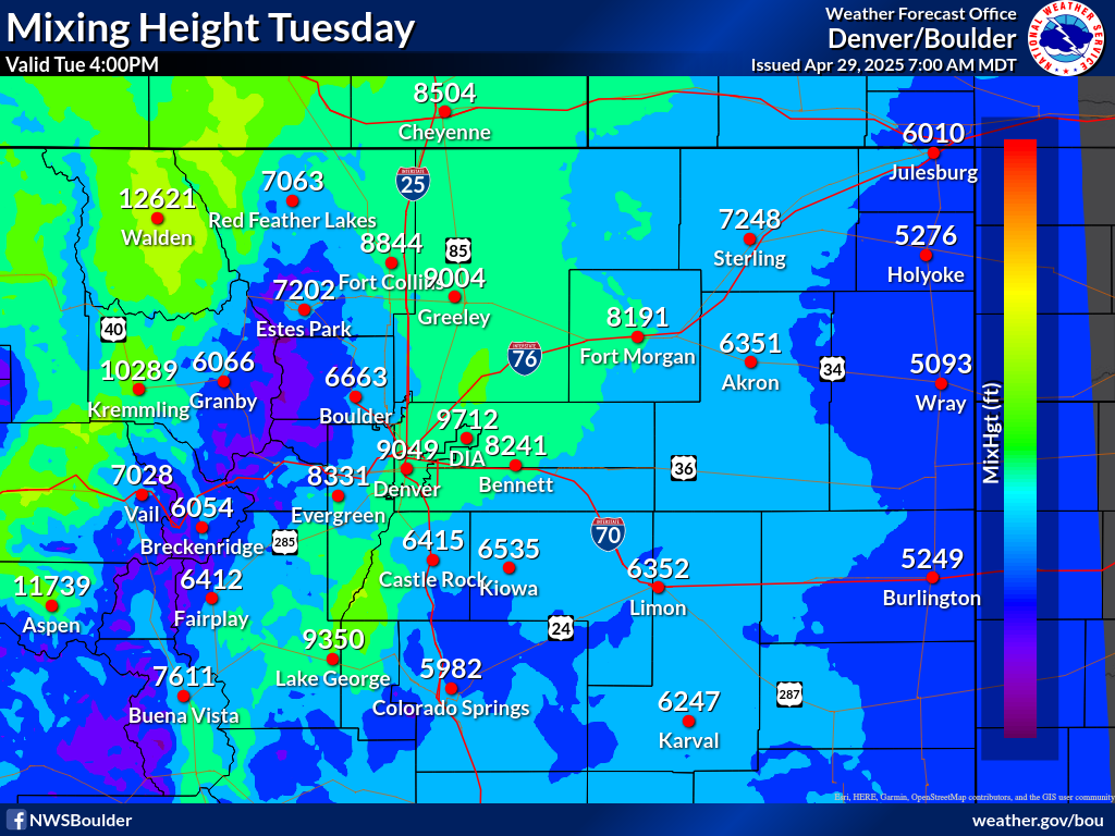
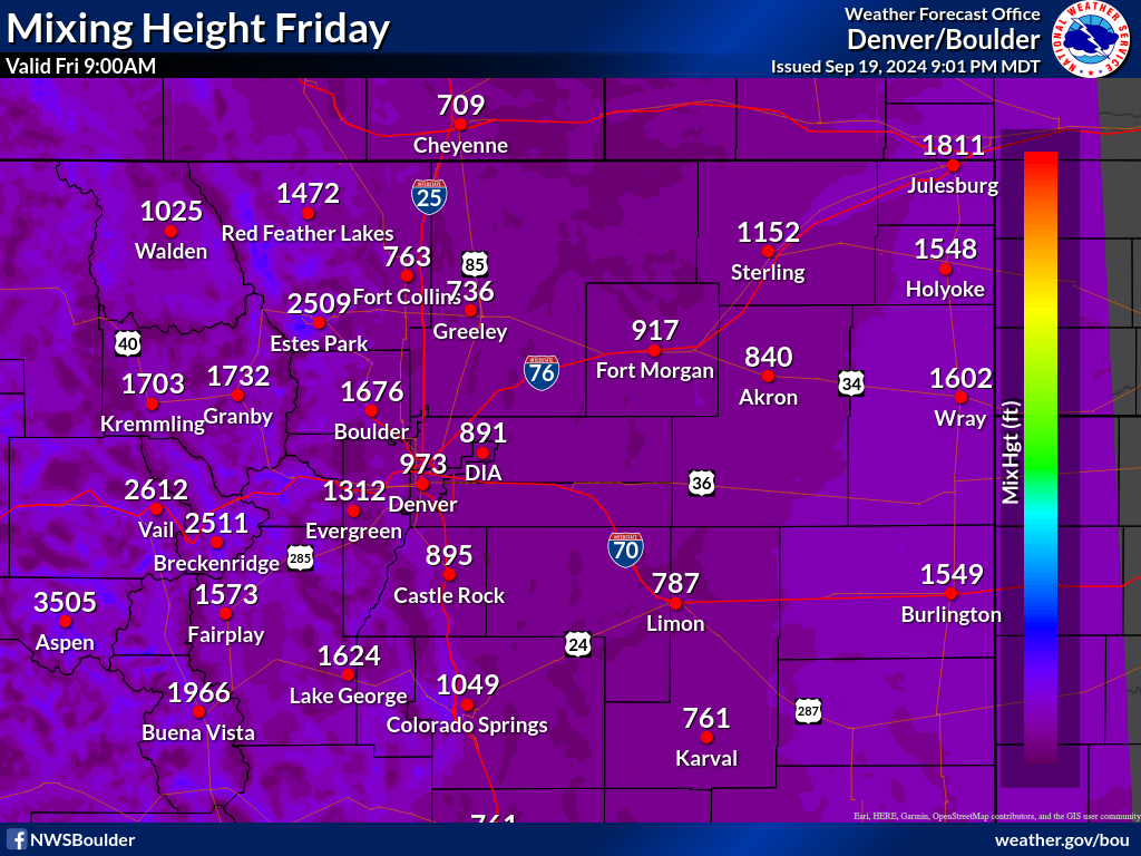
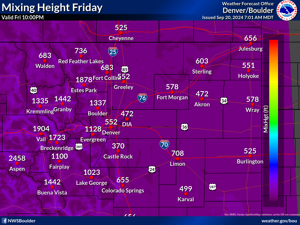
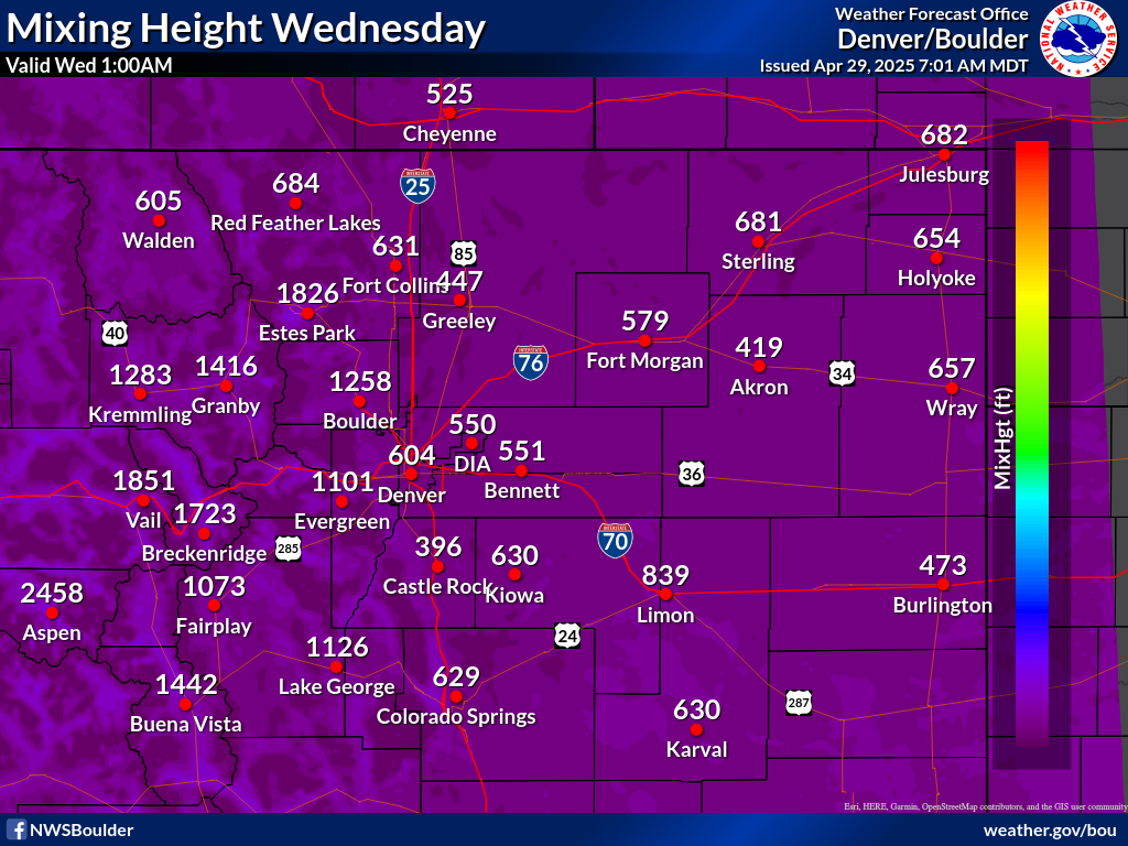
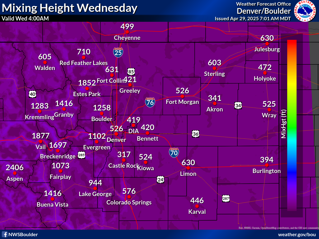
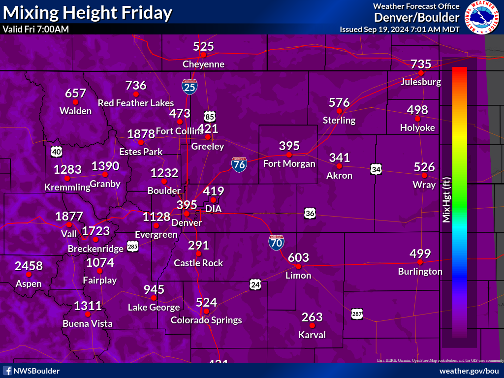
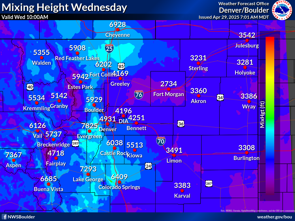
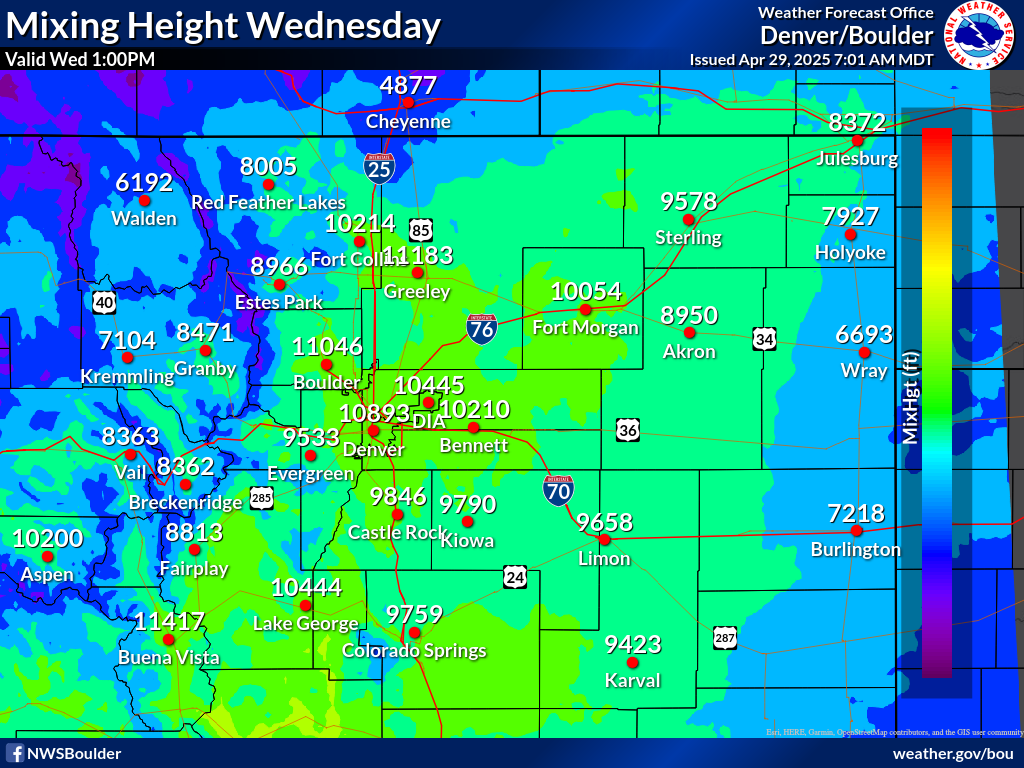
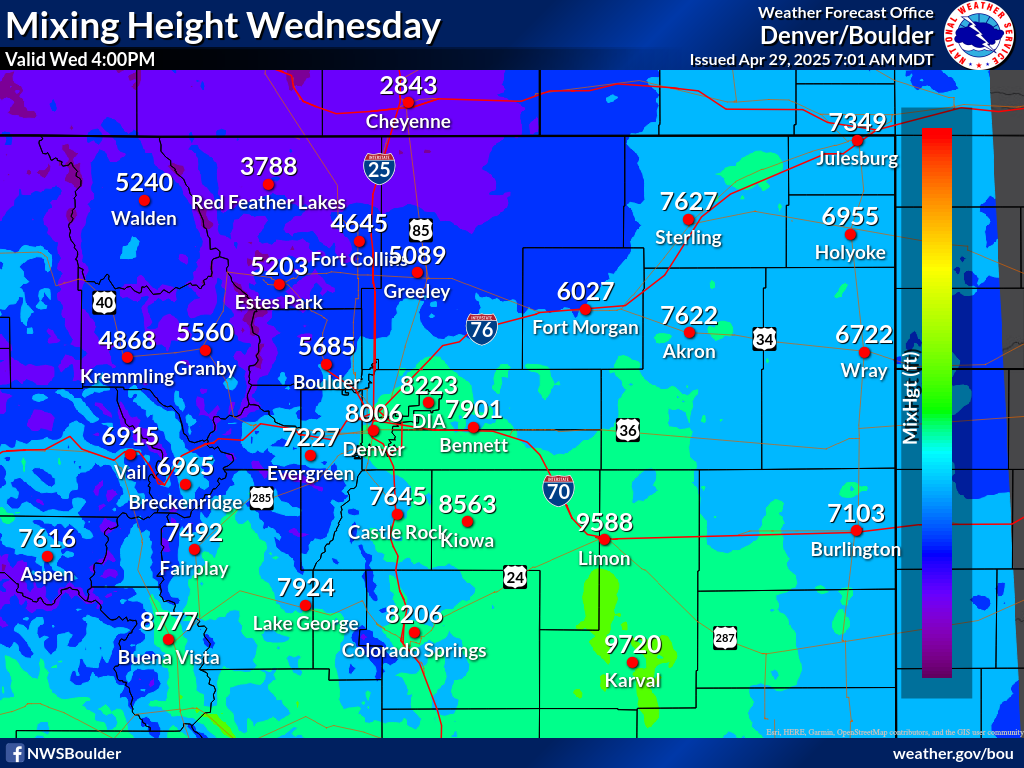
Mixing Height Forecast
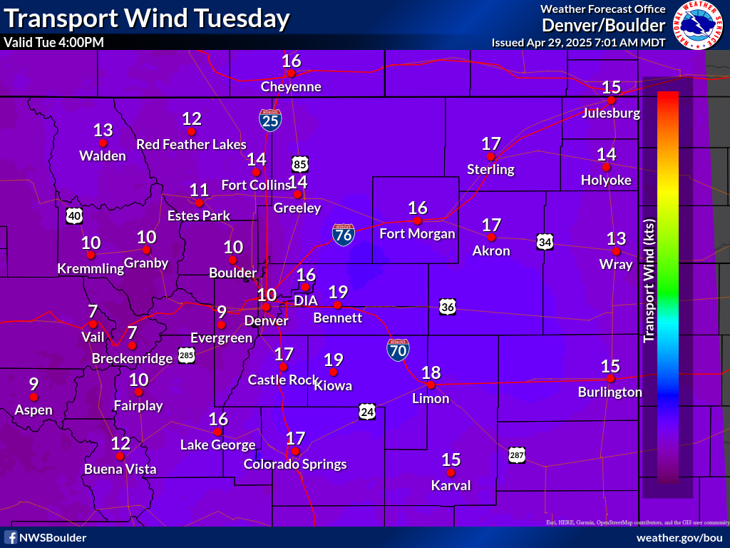
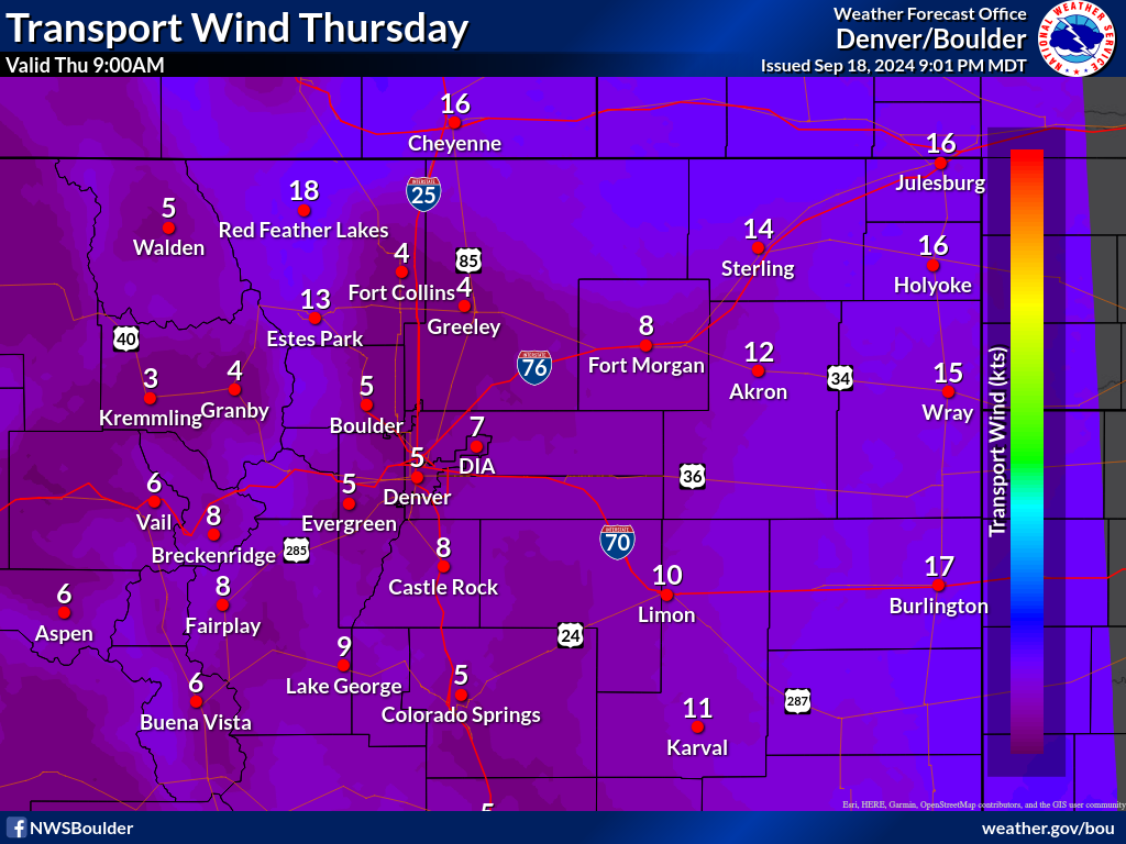
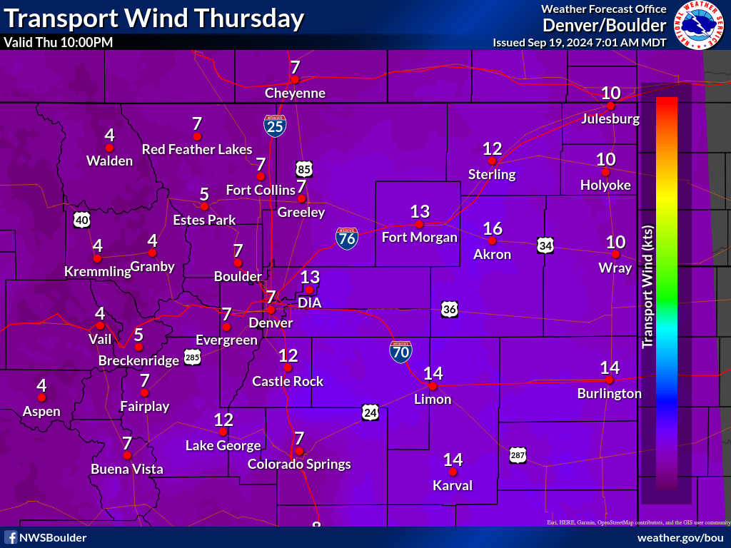
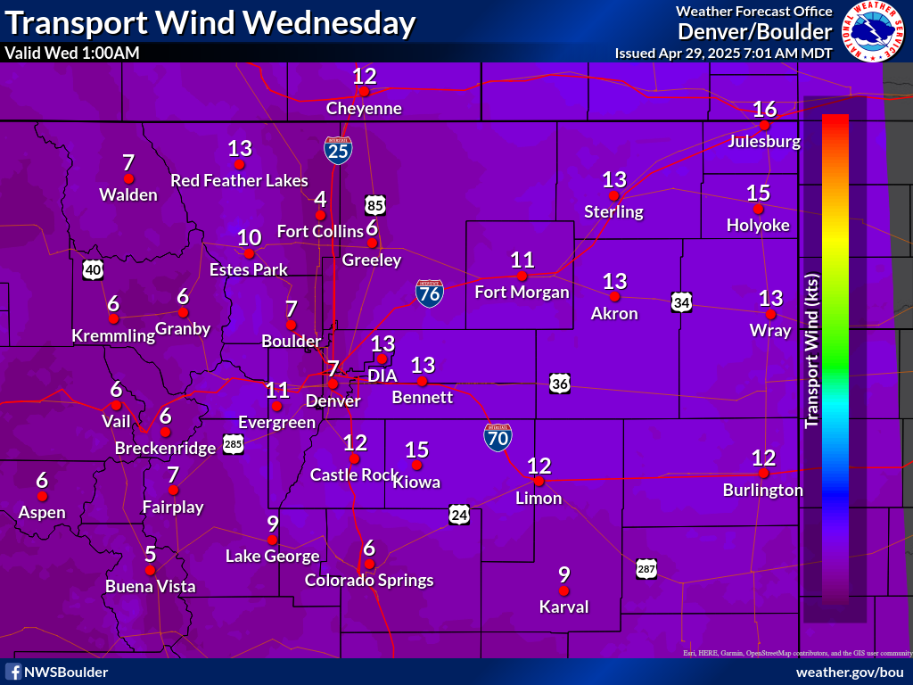
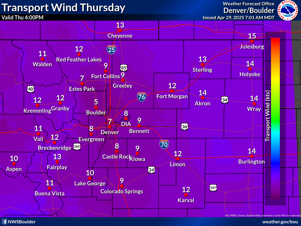
Transport Wind Forecast
 
****Request A Spot, Click Here****


Smoke Dispersion Forecast
Valid Times of these graphics change throughout the day and are displayed at the top of each graphic.
 First 3 Hours
3-6 Hours
Click to enlarge
Click to enlarge


6-9 Hours
9-12 Hours
Click to enlarge
Click to enlarge
 12-15 Hours
15-18 Hours
Click to enlarge
18-21 Hours
21-24 Hours
Click to enlarge
Click to enlarge
24-27 Hours
27-30 Hours
Click to enlarge
Click to enlarge
30-33 Hours
36-39 Hours
Click to enlarge
39-42 Hours
42-45 Hours
Click to enlarge
Click to enlarge

TOP

Mixing Height Forecast
Valid Times of these graphics change throughout the day and are displayed at the top of each graphic.
First 3 Hours
3-6 Hours
Click to enlarge
Click to enlarge


6-9 Hours
9-12 Hours
Click to enlarge
Click to enlarge
12-15 Hours
15-18 Hours
Click to enlarge
18-21 Hours
21-24 Hours
Click to enlarge
Click to enlarge
24-27 Hours
27-30 Hours
Click to enlarge
Click to enlarge
30-33 Hours
33-36 Hours
Click to enlarge
 
36-39 Hours
Click to enlarge
 

TOP

Transport Wind Forecast
Valid Times of these graphics change throughout the day and are displayed at the top of each graphic.
First 3 Hours
3-6 Hours
Click to enlarge
Click to enlarge


6-9 Hours
9-12 Hours
Click to enlarge
Click to enlarge
12-15 Hours
15-18 Hours
Click to enlarge
 
18-21 Hours
21-24 Hours
Click to enlarge
Click to enlarge
24-27 Hours
27-30 Hours
Click to enlarge
Click to enlarge
30-33 Hours
33-36 Hours
Click to enlarge
36-39 Hours
39-42 Hours
Click to enlarge
Click to enlarge
42-45 Hours
45-48 Hours
Click to enlarge
Click to enlarge
48-51 Hours
51-54 Hours
Click to enlarge
Click to enlarge
54-57 Hours
57-60 Hours
Click to enlarge
Click to enlarge
60-63 Hours
63-66 Hours
Click to enlarge
Click to enlarge

TOP

Additional Smoke Dispersion Forecasts and Resources