
Hurricane Isaias is expected to make landfall along the U.S. northern Gulf Coast late Friday or early Saturday. A life-threatening storm surge is expected along the coast with damaging wind gusts extending well inland. Areas of heavy rainfall are forecast throughout much of the Southeast U.S. The remnants of Rachel will bring gusty winds and heavy rainfall to the Southwest U.S. this weekend. Read More >
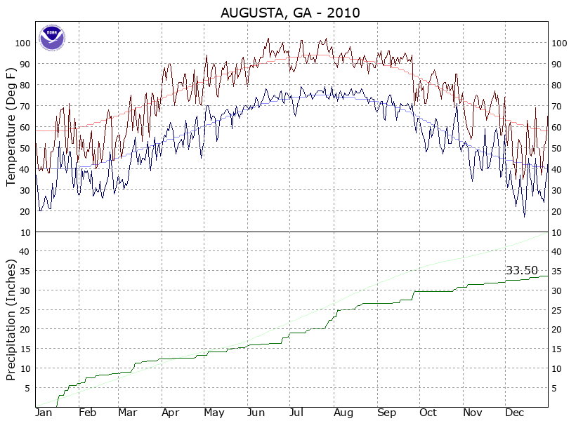
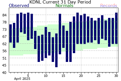
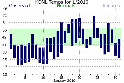
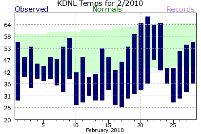
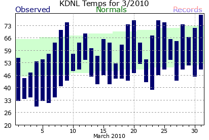
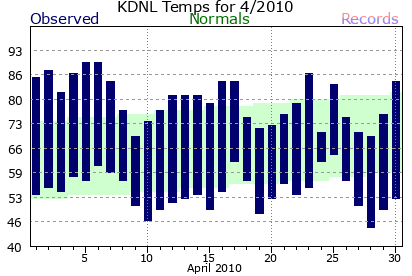
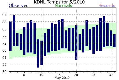
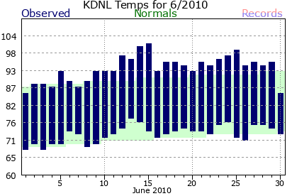
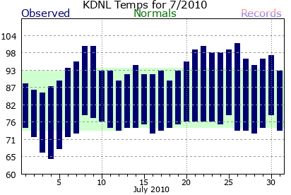
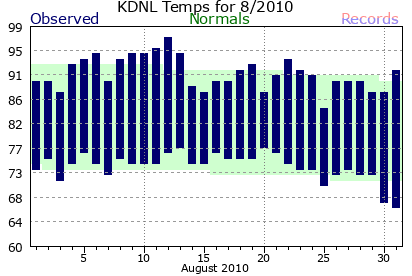
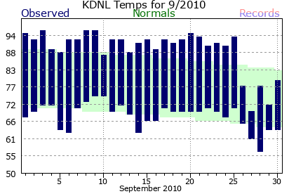
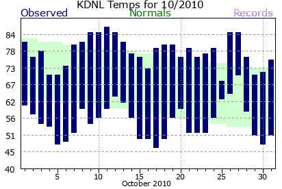
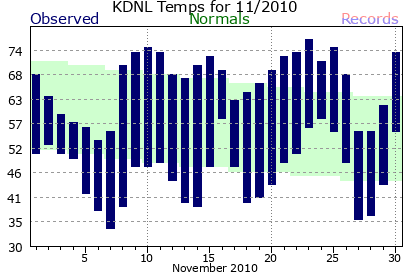
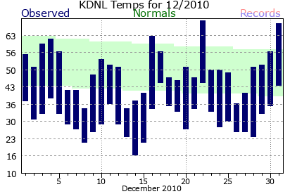
2010 Augusta Daniel Field Climate PlotsClimate data on this page is PRELIMINARY (unofficial). CERTIFIED (official) climate data is available from the National Climatic Data Center (NCDC).
|



 Radar
Radar Current Weather
 Rivers & Lakes
 Satellite
 Forecast Maps
 Hour by Hour Forecast
 Tropical Weather
 Graphical Hazards
 Climate Plots
 Weather Briefing
 Regional Observations
 Fire Weather
 Forecaster's Discussion
 Skywarn
 Drought
 Text Bulletins
 Follow us on X
 Follow us on Facebook
 Follow us on YouTube
 CAE RSS Feed