July 10, 2006Richland, Ashland County F1 Tornado |
|---|
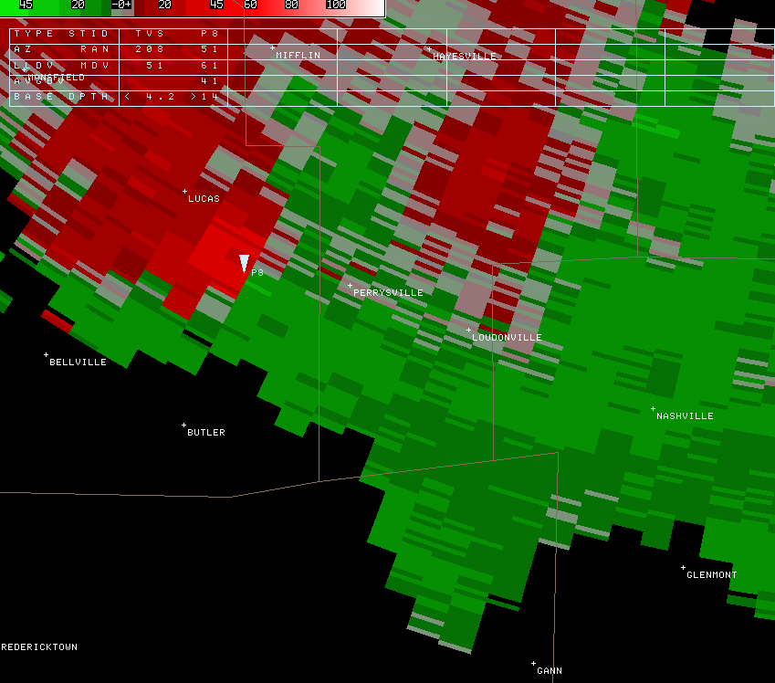
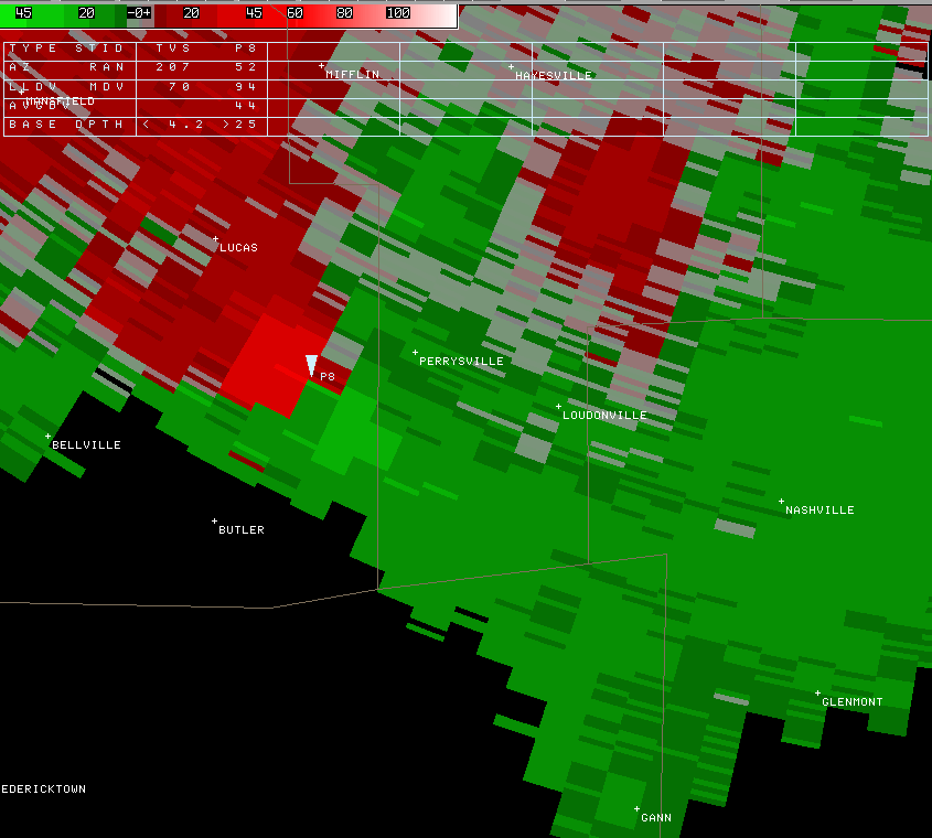
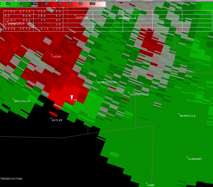
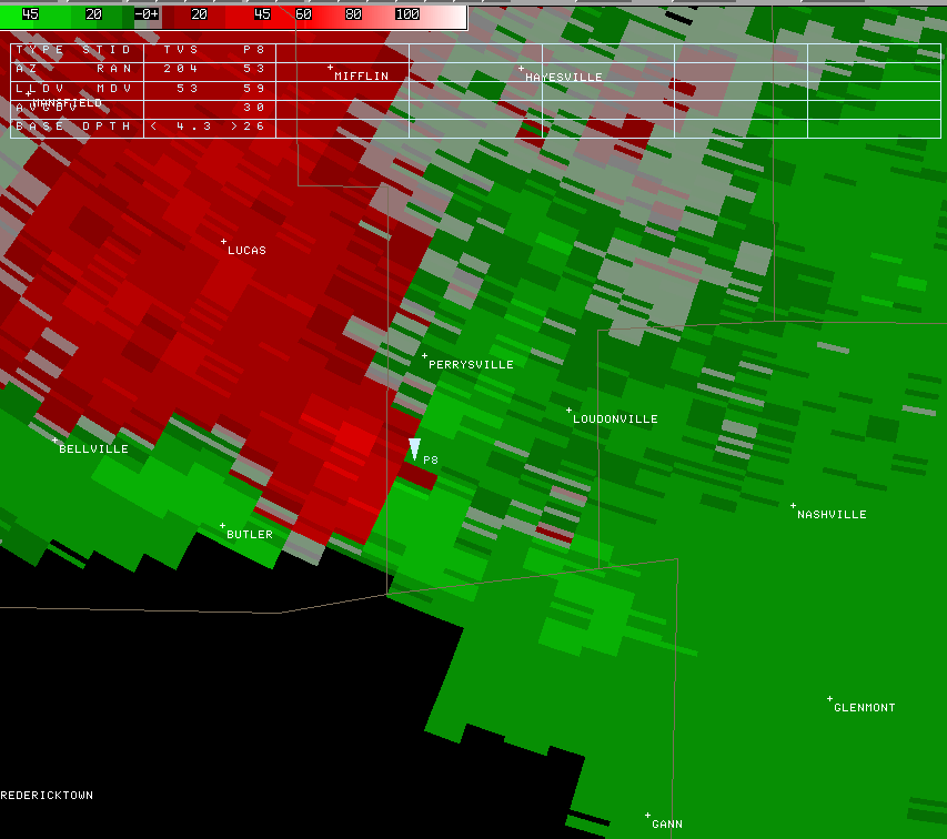
| By analyzing wind velocity, the radar determines where rotation is occurring in the storm. The approximate location of the tornado is indicated by the tornado icon in the following images. This is where the wind moves in opposite directions, both towards the radar (green) and away from the radar (red) across a short distance, and at a relatively high speed (rotation). This phenomenon indicated by radar is known as gate-to-gate shear. Here, the radar indicates the rotation as it moves southeast from Richland into Ashland County where the tornado dissipated. Just click on the images below to view a larger, clearer image. |
|---|